
LaGrangewx
-
Posts
399 -
Joined
-
Last visited
Content Type
Profiles
Blogs
Forums
American Weather
Media Demo
Store
Gallery
Posts posted by LaGrangewx
-
-
This winter would've been exceptional if the Christmas thaw never wiped out the December storm in southern and central Vermont.
-
 1
1
-
-
44 minutes ago, powderfreak said:
Yeah it’s weird, the mountain has been skiing like a much larger snow depth. It really hasn’t felt like a sub-par winter to me... the lower elevations are definitely seemingly closer to normal (if not near normal).
BTV airport is right around normal, JSpin has to be near normal and I feel like it’s been pretty close to normal here. Central/Southern VT solidly above normal snow. VT has seemed pretty good this year looking at the stats.
The 3,000ft and above level has been solidly below normal snow but with good snow down lower the skiing has been excellent. Many have remarked about how the backcountry has been in play for so long, even low elevation stuff.
Most locals seem to think this has been a good winter for skiing after December. You never get 6 weeks without a rain event and just pow on pow.
Definitely agree. The meat of the ski season has been very good all over for average snowfall at a lot of places. I think New Hampshire into maine is probably a bit behind vermont in terms of near average snowfall and snow depths.
-
This season seems to be a bit more below average for northern New England than I realized. I think the 2 big storms in my area and a relatively good year in certain areas of southern Vermont made me think northern areas were closer to average. Also the really nice stretch of cold weather, with no thaws, great skiing, and substantial snow pack throughout most of the northeast from mid January till mid February seemed to mask the rest of the subpar winter except the December storm. Hopefully March delivers a few big coastal storms to the northern areas and keeps the season going late and strong.
-
1
-
-
5 hours ago, jculligan said:
Balmy start to the day. After we spiked to 40F last evening, it eventually dropped back down to 30F overnight but it's already back up to 36F as of 7am. The snow developed a crust layer with the overnight re-freeze, but should go through a true "corn cycle" (in skier terms) once the sun hits it for a couple hours this morning. As I mentioned last night, I think the overnight re-freeze was critical for good spring ski conditions today. I'm planning to lap the Cog to get some alpine views in low risk terrain today.
Tonight's event looks good for a quick 2-3" in my area, but I think areas below 1500' will struggle with the warm boundary layer. The models have a pocket of >0C 850 temps north of the Whites, so I have a feeling Phin's poor luck with downsloping recently will continue.
Tomorrow evening's arctic front looks fun. There's a good signal for squalls, though the RGEM is focusing more on southern NH. We've had a dearth of WINDEX events this winter, but this could be a good one. The combination of wind and cold to follow looks to be among the worst we've seen all season, but thankfully this is a quick in-and-out.
Snow pack at Hermit lake has finally reached~50” as it’s been around 45” for weeks now. They’ve been tracking the plot for almost 4 seasons now and surprisingly every season has achieved an 80+” pack there that peaks usually mid to late March but sometimes even early April. 17-18 hit around 80”. 18-19 hit 100”. It surprised me that even last season 19-20, which seemed below average to mediocre at best hit about 90” in early April. So there’s a good amount of ground still to make up there over the next few weeks to reach the levels of the last few years and models are looking pretty dry For the first half of March. Have You toured up there recently?
-
9 minutes ago, ORH_wxman said:
If there was one spot I had to pick to place an observer where we don't have one in the east, it would probably be Kibby Mountain Maine. They probably get walloped with upslope and likely benefit from a lot of the coastal storms. They are nestled in basically a horseshoe-shaped area of very high elevation with a lot of flat topography off to their W and NW. The snow up there is legendary for snow mobilers who bother to make the trek as dryslot often mentions.
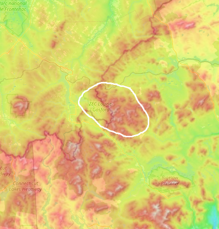
Yes That area and the border crossing in New Hampshire. There are actually 2 spots that report depth sometimes. One at Second Connecticut Lake and the other is right above it. They seem to report considerably more on average than the 1st Connecticut lake so I can’t imagine what the crest at the border crossing would have. Uploaded an example I came across. They also reported last week and had more than the rest of that area.

-
1 hour ago, J.Spin said:
Great additions of all those snowy eastern North America spots. Those MI and NY sites have always seemed to be tops for relatively low elevation areas due to that lake influence. If it weren’t for elevation, it would basically be no contest on the annual snowfall for those sites sitting downwind of those moisture sources. Some of those sites actually could be in contention for the highest i annual snowfall on the entire continent for those elevations, simply because it’s hard to get to quite those levels on the west coast right down near sea level. If those sites are getting up to 1,000’ or more in elevation though, it might not quite cut it vs. spots like Alyeska. While they report an average of 213” a season there at their base elevation of 250’, that quickly rises to 530” at mid-mountain. If there are any of those sites off the lakes that are really snowy down near sea level though, it would seem like they could be in contention.
I always check on the Chic Chocs as well to see what the latest averages are that they’re reporting, and I continue to see numbers in the range of 240”, 275”, and even close to 300”, but I’ve just never seen anything yet that has them really pushing well past that 300” mark.
I’ve even checked out Newfoundland and Greenland to see if anything has yet popped up to really suggest numbers pushing past that 300” barrier, but I tend to find numbers in the 150” to 250” range. Part of the issue is that as you head farther north, snow preservation becomes fantastic, but being on the eastern side of a continent in the northern hemisphere, you’re moving into a much drier climate. And with the cold temperatures, bodies of water are frozen much of the winter and can’t contribute to snowfall like they otherwise would.
As we know, the Northern Greens have sort of a stacked setup in many aspects of acquiring snow in that they’ve got some decent elevation, decent latitude, ~4,000’ of relief from the lowlands off to the northwest, the shape of the range is in the form of a 250-mile long N-S spine that’s somewhat perpendicular to prevailing winds, they’re downwind of the Great Lakes to get moisture from that source, they’re close enough to the coast to get in on most coastal storms to some degree, etc., etc.
There probably are some spots in eastern North America that average more annual snowfall than the high elevations of the Northern Greens, but I just haven’t found anything consistent enough yet to really make the case. It’s likely one of those situations where there’s just no one in those places observing it year after year, while we’ve got the resorts here that are doing it in a fairly public way, constantly. Obviously there are many folks that take issue with the numbers that come out of places like Jay Peak, since they’re a business, and getting snow is certainly in their best interest. That issue of trustworthiness comes up frequently here in the thread, but the ridiculous snowfall they seem get there was only reinforced, yet again, when we were there in the backcountry skiing in 20” of champagne on Sunday.
That’s sort of the same thing going on with those sites downwind of the lakes though – there may be sites that are getting more overall frozen winter moisture (such as Mt. Washington in NH), but in the end, the highest snowfall “numbers” might end up coming out of places that get a solid amount of moisture and capitalize on it with snow that has the dendritic structure for incredible loft. We know the Northern Greens often do that extremely well, and that could be a “secret sauce” component among all those factors contributing to the snowfall that I listed above that pushes the numbers over the top.
I think you’re spot on with several points such as the farther north generally the less precipitation. It’s also possible that there aren’t quality observations like your own coming out of areas like the chic chocs especially at the higher elevations to truly measure every inch that falls each season. Requires Some dedication To measure accurately and frequently in a snowy place like that. Lastly I did read through your report of Big jay. I have never been up there but you mentioned the snow was already around 40” deep at 2000’. We discussed The Nohrsc mapping a month or so ago and it has had that whole Jay area at 20-30” for the past month or so which just can’t be right at higher elevations. I have Recently noticed with Nohrsc that it seems to heavily weigh real on the ground observations more than anything when regarding the shading on the map. A cocorahs reporter had 36” depth in the southern adk a couple days ago and Nohrsc updated its map to show a 30-40” zone in that area.
-
14 minutes ago, bch2014 said:
Another great snow spot east of the Rockies is Houghton, MI.
Averages 202” which impressive for a low elevation spot (though it’s influenced by the lake).went to school out in the midwest and there are a few fairly active posters in the lake effect thread there. One is in Calumet/Larium area which is just north of houghton on the keweenaw but also on the spine of the peninsula at 1200'. They seem to average 250+". Their is also a woman on the Tug Hill in Redfield who has very accurate data and a long term average (25 years) of 290". She seems to be in the perfect spot latitudinally for lake effect but only around 1300'. A couple miles east gets to almost 2000' on the tug hill which I would guess has to average 300" or a bit more based on her data. The tug hill seems to get the ridiculous 5-10' lake effect events and probably the only spot for storms of that magnitude outside of the Western Mountains, but the Keweenaw has better snow preservation and depths with more frequent snows as well. Those 2 areas are no doubt the snowiest places under 3000' east of the rockies
-
 1
1
-
-
21 minutes ago, PhineasC said:
Hmm, interesting data point. There was a storm earlier in the season (the October snow I think) where the west part of the town did quite a bit better than here. It's definitely noticeable if you are dealing with a cold front pushing west with the precip. I don't seem to do too well in those setups as the precip seems to race through but the cold front gets hung up. I will say just anecdotally when I drive down towards Jefferson the upslope seems to slacken from here, but I haven't done any really scientific observations. I know Alex has also observed that Jefferson is a bit of a hole for upslope but this other observer is further east.
There are definitely some dud scenarios here but I feel like I have a really good combo of being able to do a little of everything here: synoptic, upslope, and retention. Fewer ways to get skunked than other places and the snow season is about as long as it can be in NNE.
My snow depth is still near the top of the rankings across the area (outside the ski peaks) even though there hasn't been a storm over 2" since Feb 2.
Yea I was going to ask if you’d driven through there or observed much. It would be interesting to drive west during an upslope event and see if there is any noticeable differences. That observer only reported for Like 2 or 3 years and they were on the west side of Randolph still a ways from Jefferson. I know on the meso models like the 3km NAM and wrf they always paint a narrow strip of enhanced snow during west or northwest flow I believe from the presidentials that connects diagonally to the Pilot/piny range where Mt Cabot is. I wonder if that intersects rt 2 somewhere. I bet you’ve probably seen that depiction on the models it’s always there. The Models also always show the sharp cutoff to basically nothing a lot of the time as you continue west towards Jefferson and Whitefield which you mentioned are noticeable snow holes from observation. The white mountains are interesting to me because they’re not a spine like the greens where it’s pretty obvious where the upslope occurs. There has to be some real micro climate differences in your area.
-
1
-
-
4 hours ago, alex said:
I’m down in the Berkshires. Skied Jiminy Peak today - skiing is a bit of a stretch, as it is more of an ice skating experience than skiing. Absolutely awful. Talked to a ski patrol guy - “it’s just New England skiing.” Hmm, no, it isn’t lol. Never in 5 years have I seen conditions this bad in Bretton Woods.
I did some night skiing up at catamount last Friday after they got some snow and it was all completely skied off by then. I had skied just a week earlier up at Pico and the conditions were incredible there. Jiminy, catamount area to me is glorified southern New England type skiing and the conditions can change drastically just as you go up into vermont from my experience. Back in Mid-December I skied Magic after the 3 foot storm they got and stopped at Jiminy to night ski a bit on the way home. The difference in conditions were incredible. 2-3 feet of ungroomed powder all day at Magic to Machine groomed not even great packed powder conditions at Jiminy even tho they reported 15”-18”. They definitely cater to the crowds they get a lot of young families and vacationers there not a ton of locals I think. Still a fun place tho and not too far from me.
-
2 hours ago, PhineasC said:
I don’t get the 7-10 in a day or two upslope stuff that NVT can get. After the mid Jan storm I racked up over a foot of upslope after the storm passed, over the course of a week. So a good setup can produce. Usually I get 1-3” refreshers with good regularity. There are definitely several synoptic setups where Randolph can stack up to any place in NNE. My totals kept up with the Northern Greens ski peaks in the mid-Jan storm for example. Just one winter here but my read is that I am in the game for basically everything from any direction but due south. I get downsloped from that direction. I lag behind a little in upslope (although I am fairly similar in totals to Alex most times) but have an edge over NVT with many synoptic setups and possibly retention (at the 1500 and below level). Obviously the ski peaks at 3000+ are a different beast).
I’m not very familiar with your area but I have looked in the past at a bunch of the data on xmacis. There used to be another reporter down the road from your area a few years back. They were located around the Bowman inn and Jefferson notch snowmobile rentals area I believe. I think that area was discussed in here before and people thought it would be very snowy as the mountains converge around there. Elevation there is still around 1500-1600 and it seems to be the crest of rt-2. Anyways the data was a bit spotty and definitely not as good as the reporter in your neighborhood but they seemed to always measure For the bigger storms. I noticed a trend that, that location always reported more backside snow during the storms than your reporter did. Maybe they do a bit better a few miles west there with upslope snow than you but the retention at your spot is better I bet.
One example of an upslope storm was January 2010. I believe Burlington area got a lot with that also. The 4.0wsw Randolph reporter had over 30” with almost 40 on the ground, and the one 1.4ne had around 20” with about 30 on the ground. -
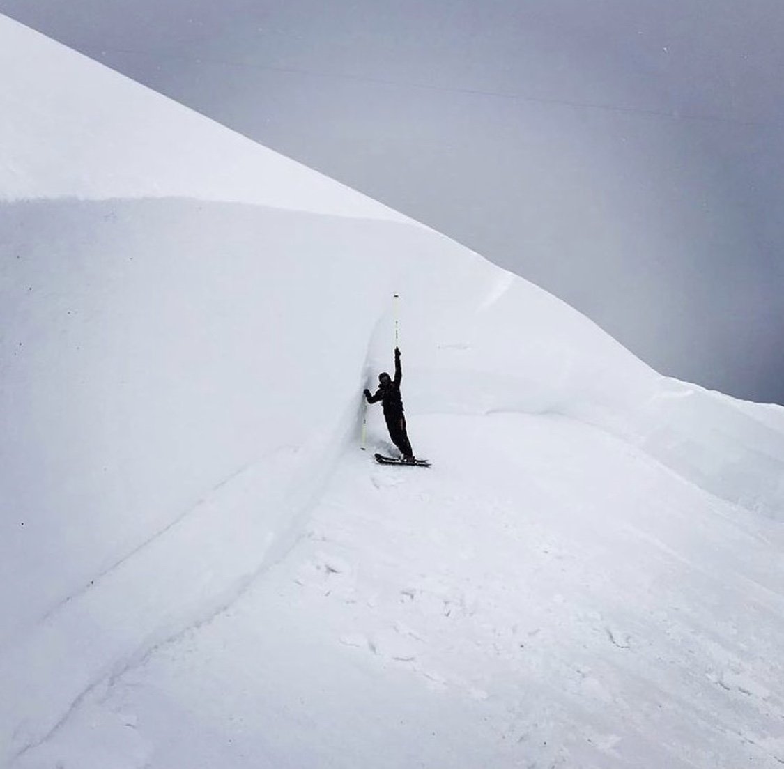
Skiing Pico today. Awesome out there. Untracked powder from Tuesday is almost boot deep up top in spots And the base is deep. Soft bumps all over.
-
2
-
-
Just saw on Instagram. Triggered by Snowmass ski patrol.
-
40 minutes ago, PhineasC said:
Looks like the Hermit Lake Snowplot at 3500' or so... uh, I mean "Gorham"... pulled in 14.6" for top honors in Coos.
There is a report from downtown Lancaster with 13.0." That's gotta be a mistake. The other observers nearby had 6.0 and 3.4 which better aligns with what I saw there yesterday.
I assume Mt. Washington and Pinkham Notch had more than 5.2 and 6.6 inches. I'm sure measuring there is challenging in any case.
I saw Wildcat said they got 17”. Also looking at NOHRSC Randolph has a 34” snow depth which is only behind Hermit lake in all of NH. The 34” is basically double anything else in NH including the Pittsburg area. Pretty wild.
-
Just saw on Twitter. 3" of liquid equivalent at Ellenburg Ny. The farther north town in the state of NY. They have been up-sloping off the Northeast wind all day. All the mesos had been showing that area getting crushed today but ~3ft+ is insane. Has to be pretty rare that NYC area and that area get crushed by the same storm. https://twitter.com/NickPBassill/status/1356827452933369857?s=20
-
3
-
-
13 hours ago, alex said:
Nice! As always these setups don’t work for us until the wind shifts. 2” with some pretty serious downsloping. But no complaints, the upslope will come!
Was just looking at the AMC reports. The highland center had a report of 8" new around 11 am this morning. Thats a pretty crazy difference in just a few miles. I guess in a setup like this the snow made it just to the notch but not really past it. Pretty awesome microclimates in that area.
-
5 minutes ago, Lava Rock said:
Anyone know what the totals are up to by NW NJ and just over the border into PA? There's been a band sitting there all day.
Around 30+ in That Pocono area
-
That band about to hit Sugarloaf area looks insane. They reported 6-8 a few hours ago. Just checked actually they said 10 as of 5 minutes ago before this crazy heavy batch looks to move in
-
Family said another ~7” from last evening till this morning in Poughkeepsie side of Lagrange. So around 22-24” but that’s With adding 3 separate measurements.
-
1
-
-
6 minutes ago, PhineasC said:
I assume Wildcat is getting nuked in this setup. Just what they need to get on track.
Sunday River too
-
Somehow there’s a weenie band in Binghamton

-
Family estimated 16-18” around 6pm in Red Oaks. Not official measurements but a lot regardless.
-
2
-
-
Sounds awesome. Gotta get some pics in here
-
2 minutes ago, nesussxwx said:
25" down. Should be an all-timer for NWNJ, might surpass 1996, hope that band doesn't move.
Yea all timer there for sure. Orange County is going to clean up tonight too it seems
-
Eastern Catskills getting crushed rn
NNE Cold Season Thread 2020-2021
in New England
Posted
It’s interesting that Killington is up to like 180” on the season which is very good for them heading into March but sugarbush is only at 130”. They must’ve missed a lot of the upslope Stowe and Jay got but too far north for the synoptic storms that cutoff around Killington this year. Killington was due for a good winter they hadn’t hit their claimed average in several years.