

Frog Town
-
Posts
970 -
Joined
-
Last visited
Content Type
Profiles
Blogs
Forums
American Weather
Media Demo
Store
Gallery
Posts posted by Frog Town
-
-
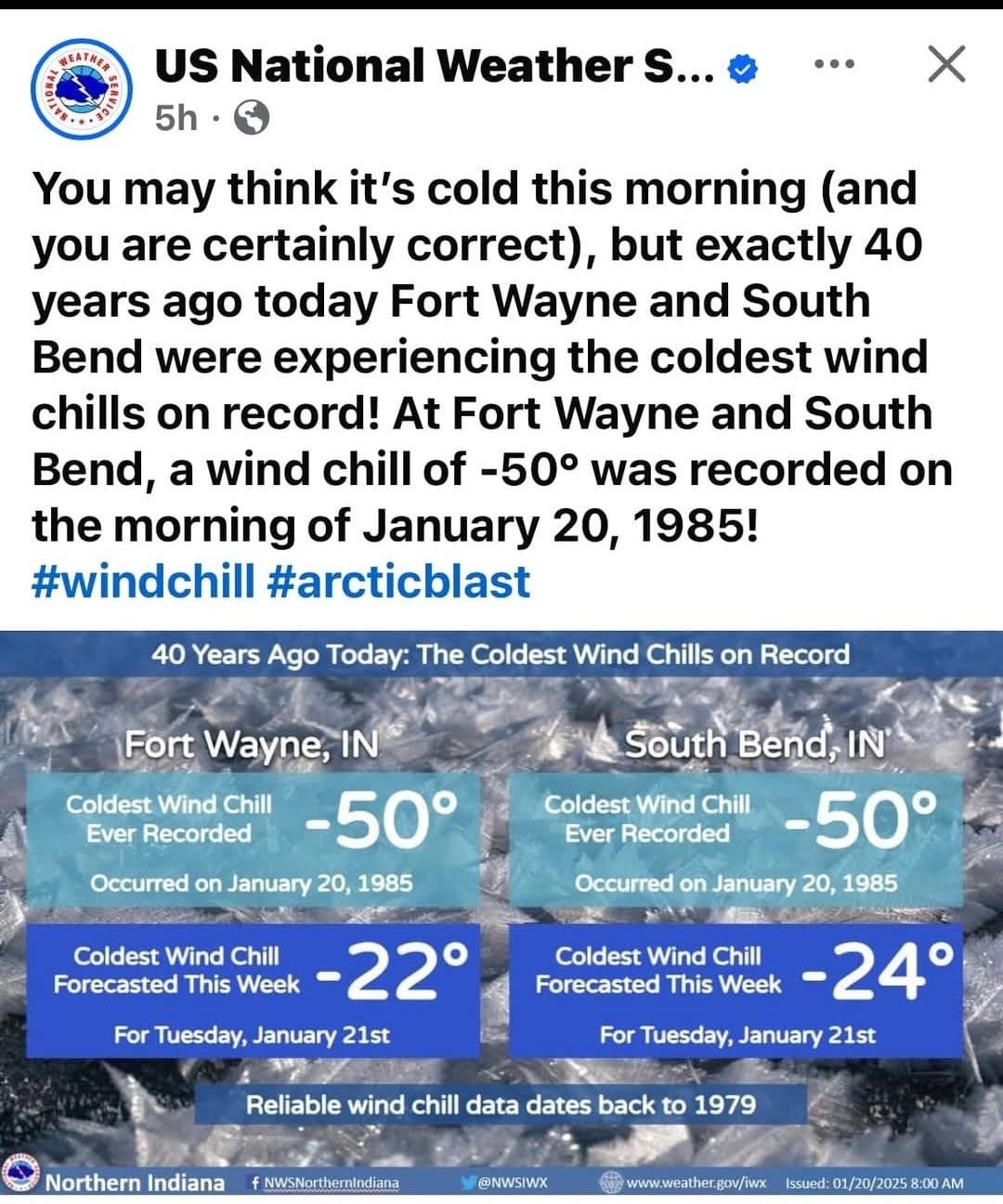
On 5/30/2025 at 2:39 PM, Chinook said:
Off topic question here. I have an older laptop that works great. The front face of the laptop does not snap in place at all anymore. The screws are in normally. When I've tried to get the front face to snap in place, it goes back to the situation you see in this picture. I am wondering if there's some sort of fix for this.

Battery expansion. Need a new battery, fellow Toledo'n
-
I have a feeling that the system next week 3/5 and 3/6 is going to surprise a lot of people on the cold snowy side The following week we torch.
-
At this point I say bring it.
-
 1
1
-
 1
1
-
-
4 hours ago, michsnowfreak said:
It was march 1 1900
Thank you! I thought you might know.
-
Some historian can correct me if I'm wrong but our biggest snow storm in recorded history for NW OH was in early March some time in the early 1900's after a very similar winter to what we currently in. It was something like 20"+. Not that I want that crap in March only to watch it melt away in a few days.
-
None of this even comes close to verifying so I wouldn't feel too ripped off.
-
 2
2
-
-
While I'd love a north trend with this, the TPV will keep it south.
-
1
-
-
This will be the one that explodes and surprises everyone. It's kind of fun going into it not knowing what to expect. Definitely interesting watching the local TV Mets riding the line of that "not sure exactly what to expect" look.
-
5 hours ago, Powerball said:
I have to imagine that DTW, IWX and GRR issue watches for portions of their CWA this morning.
Certainly enough of a consensus in model guidance to support it at this stage...
Duration and uncertainty give pause. Maybe this afternoon if trends continue. Seems more like a long duration WAA.
-
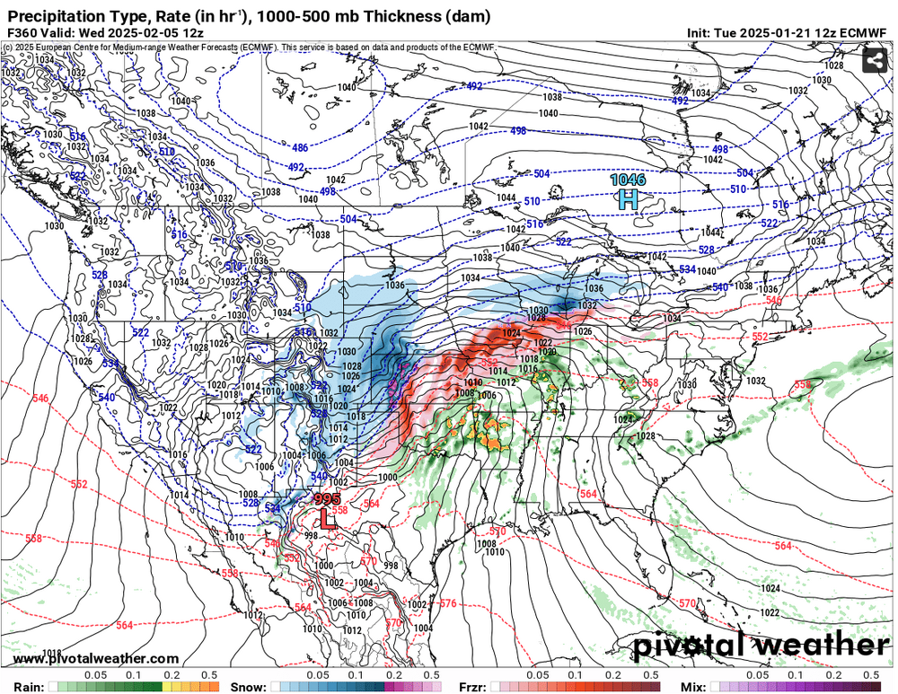
Once thing is clear; this thing has a ton of moisture.
-
I just like that we have these two big hitters analyzing this stuff. That means it's legit.
-
1
-
-
Amazing how different all the models are within 36 hours of this event. Throwing darts really. Did DOGE get to the model suits??
-
 3
3
-
3
-
-
Detroit crew reeling this one back in. Like the good ole' 2010's

-
2
-
-
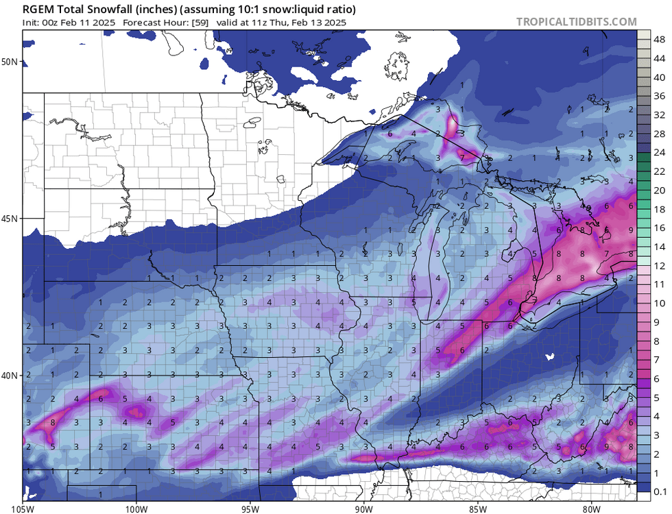
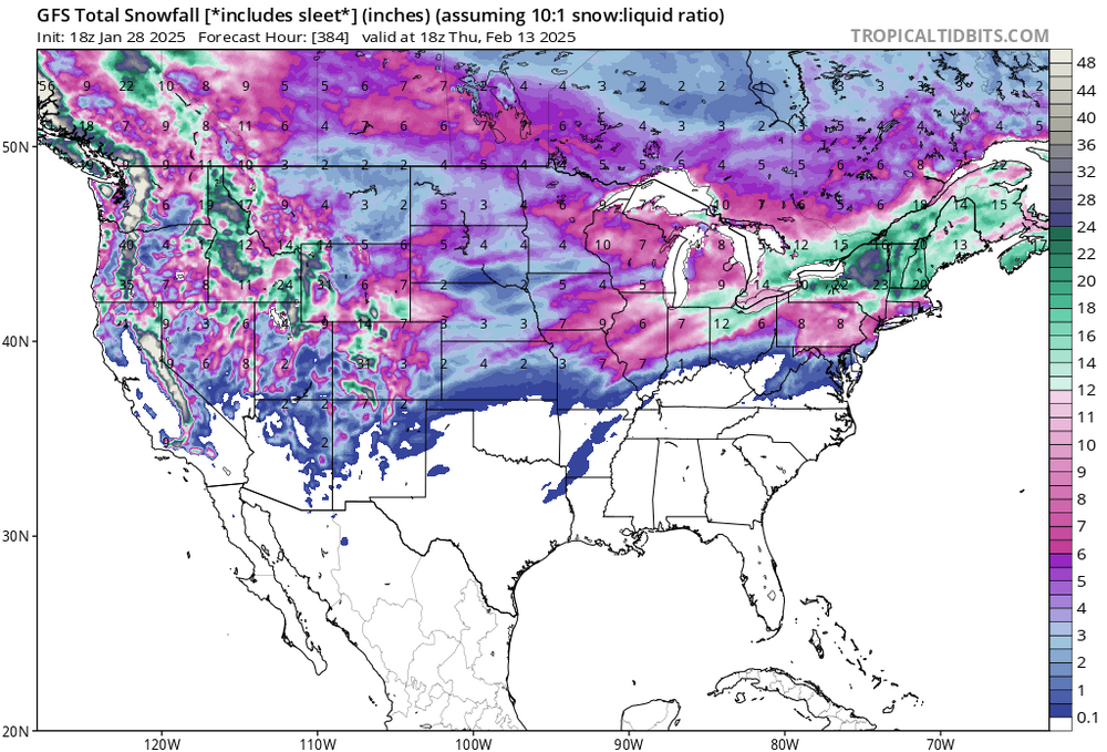
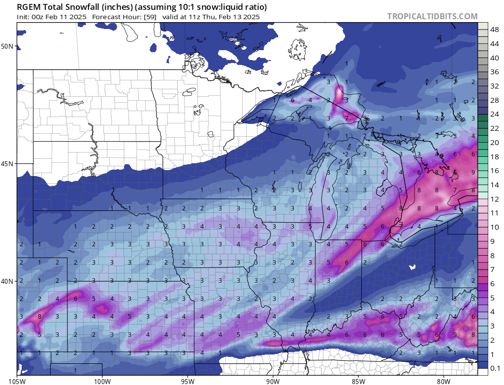
Our two Hi-RES(At least the ones I have access two, NAM/RGEM) models are at both end of the spectrums. Nice.
-
What I trust is seasonal trends, which have been flatter/weaker/se. Haven't had an amped system yet this season, at least with Arctic air in place.
-
Craziness! Even if 25-50% of that verified would be epic.
-
1
-
-
20 hours ago, Frog Town said:
Hasn't just about every storm this season trended SE this season about 3-5 days out. I feel like the TPV will push the pattern slightly SE, albeit not to the extent as the previous storms.
Not that I'm pulling for my backyard, it's just hard to ignore seasonal trends.
-
Hasn't just about every storm this season trended SE this season about 3-5 days out. I feel like the TPV will push the pattern slightly SE, albeit not to the extent as the previous storms.
Not that I'm pulling for my backyard, it's just hard to ignore seasonal trends.
-
Impossible with the positioning of the TPV. Little too much of a good thing..
36 minutes ago, DocATL said:
The NW trend has been mythical this year.-
1
-
-
This is so spot on...If only
-
1
-
-
Week of 2/3-2/7 looks like our next legitimate threat with cold pressing again but a bit more west and not as strong. We shall see...
-
Yeah, I don't think this cold pattern is changing anytime soon. Maybe a relaxing of the pattern, which is what we all want for better snow chances, but not a big a warm up. Thinking mid to end of February for that. But even then I bet it's a slow warm up with a lot of ice chances.
-
1
-
-
1 hour ago, A-L-E-K said:
counterpoint: riding it
Factoring in the SE trend this winter, it should be a Florida special.
-
5
-
1
-
-
1 minute ago, sbnwx85 said:
Could always be worse…
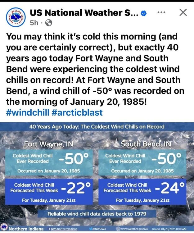
Assuming this takes into account the change in the wind chill scale.
-
1
-


Late June 2025 Heat Wave
in Lakes/Ohio Valley
Posted
I know you're a stats guy but this is consistent with what's happened the past few years with this set-up. End's cooler vs. warmer.