Eskimo Joe
-
Posts
24,043 -
Joined
-
Last visited
Content Type
Profiles
Blogs
Forums
American Weather
Media Demo
Store
Gallery
Everything posted by Eskimo Joe
-
Couple of the hurricane models trying to nude the 2nd US landfall further east and now as a Cat 1/2 hurricane.
-
Storm surge M4.8ft Naples, FL. Appears to be a record.
-
I'll go with 90mph sustained, gust to 110-120mph.
-
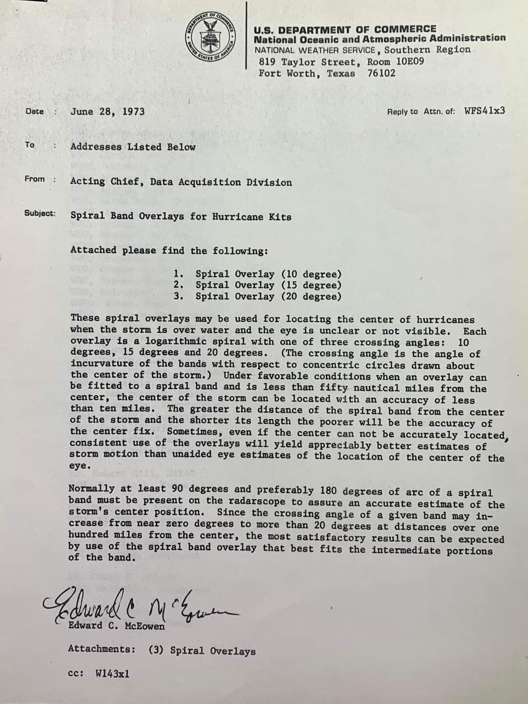
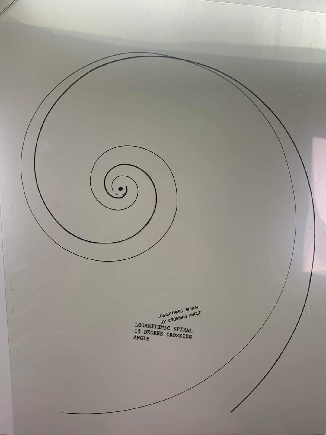
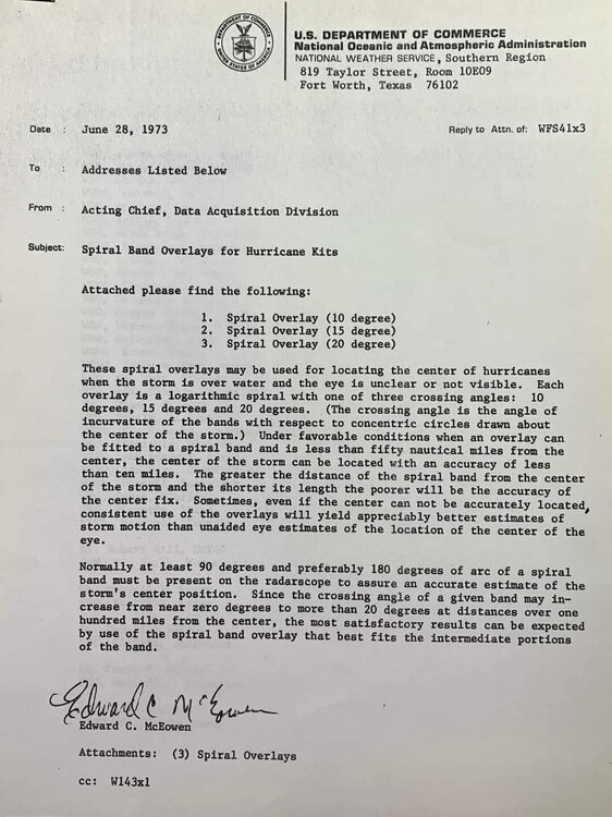
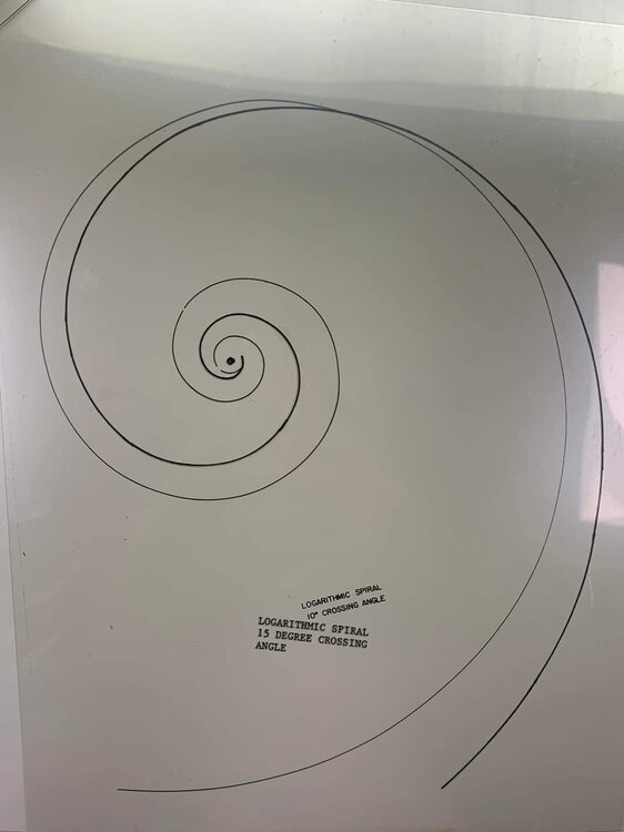
We have such an array of tools to analyze tropical cyclone these days. Here's how things were done in 1973.
-
-
The latest NHC discussion (#24 for future archival) is absolutely worth reading. Eric Blake talks about the worth of the hurricane hunters and Tampa Bay doppler radar. Wish I could post it but I'm mobile.
-
Sarasota ASOS reported a wind gust to 53kt.
-
165mph
-
144kt flight level wind on the latest vortex data message
-
Yes it would
-
Looks like latest recon may have found cat 5 winds in Ian.
-
ProTip: turn the smoothing off. You'll see the finer features better.
-
Watch the sun rise on Ian here: https://weather.msfc.nasa.gov/cgi-bin/basicLooper.pl?category=goeseastabimesoscale1®ex=00p64um&title=GOES-East ABI Mesoscale 1 - 0.64 um - Band 2&time_drop=show
-
Wow does Ian make a run at Cat 5?
-
Gulf storm gonna gulf storm.
-
Morning visible satellite should be a stunner. Ian sure is living up to the 'I' storm reputation so far.
-
Pre gaming for an epic winter.
-
Looking like the 2nd landfall is becoming a real possibility.
-
Unless that's contaminated, looks like Ian is trying for Cat4