Sciascia
-
Posts
541 -
Joined
-
Last visited
Content Type
Profiles
Blogs
Forums
American Weather
Media Demo
Store
Gallery
Everything posted by Sciascia
-
After a couple solid hours, light snow currently in Poplar Grove.
-
Flakes aren’t large (yet), but definitely the heaviest of the event so far.
-
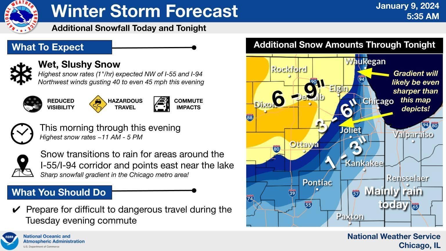
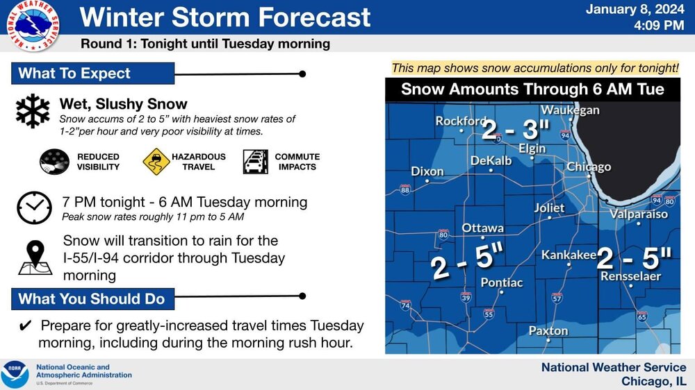
It’s been snowing, but nothing too major. Still seeing some patches of sidewalk. Hoping that 1-5pm period is the high point that it’s advertised to be.
-
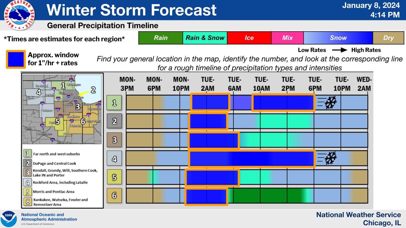
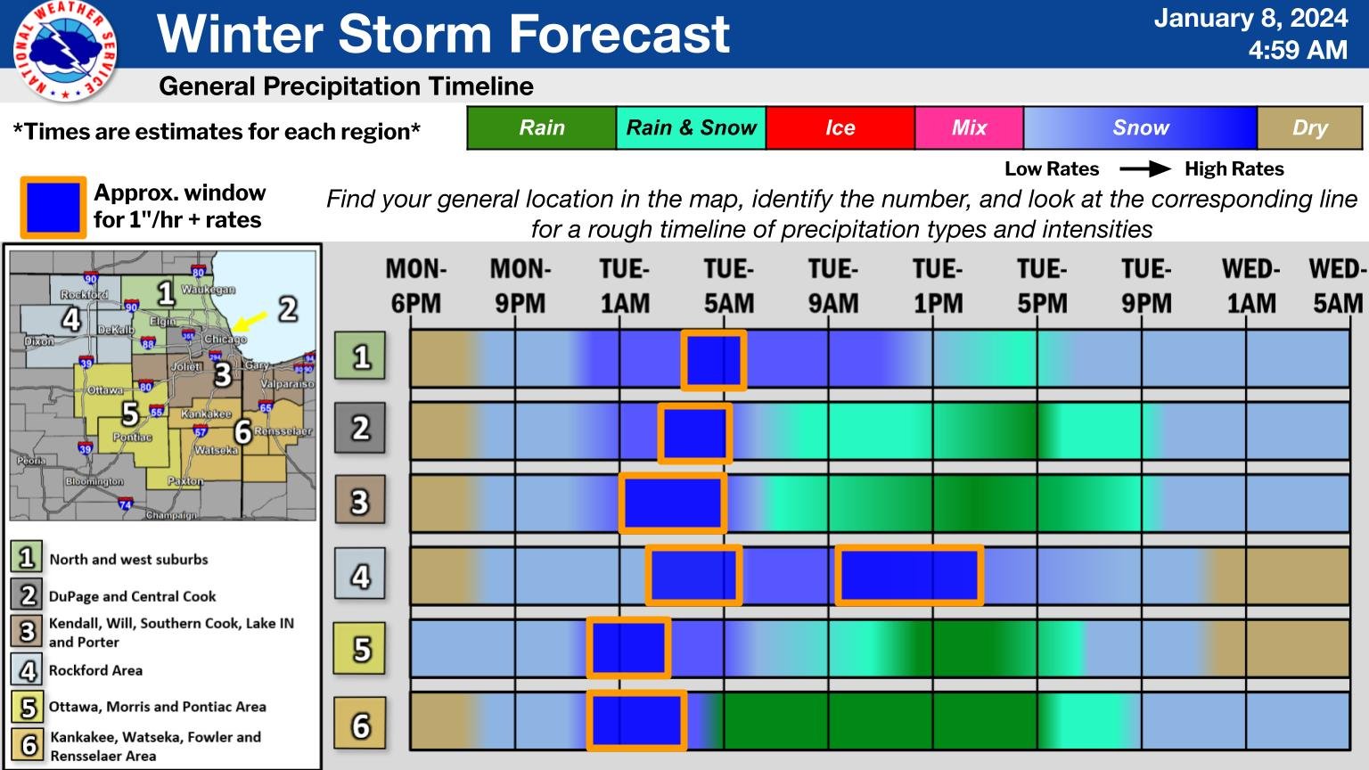
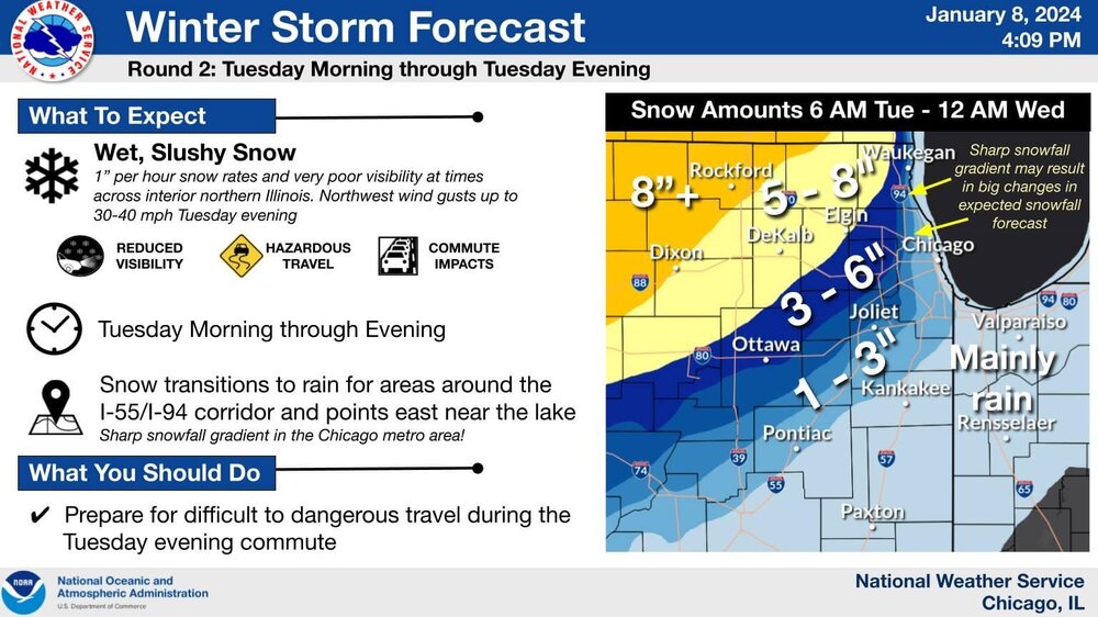
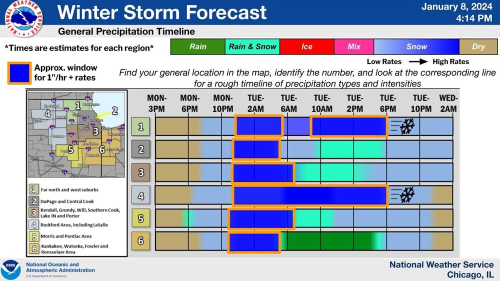
Most recent LOT thinking:

-
Deck is nice & covered. Was selfishly looking for a touch more before the main event arrives, but beggars can’t be choosers.
-
That dry zone looks fairly large. Hopefully it fills in as it continues to move.
-
So that’s why my P&C went from 5-9 to 2-4 for daytime tomorrow with the removal of the heavy snow terminology.
-
LOT’s recent graphics. The solid gold bordered snow block from midnight to 6pm tomorrow for Rockford area has me excited as a snow enthusiast. It also has me slightly concerned as the snow removal guy for both my house & my in-laws next door. P&C from LOT has the wide range of 7-15 potential inches.
-
I enjoy the little 12”+ splotches near the 7s, 8s, and 9s.
-
Even accounting for compaction, this snowfall’s gonna be a workout to shovel if it all pans out.
-
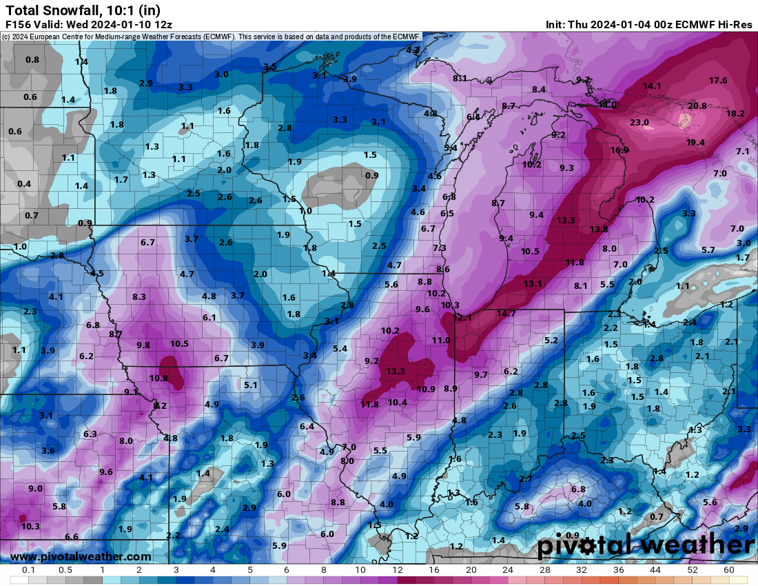
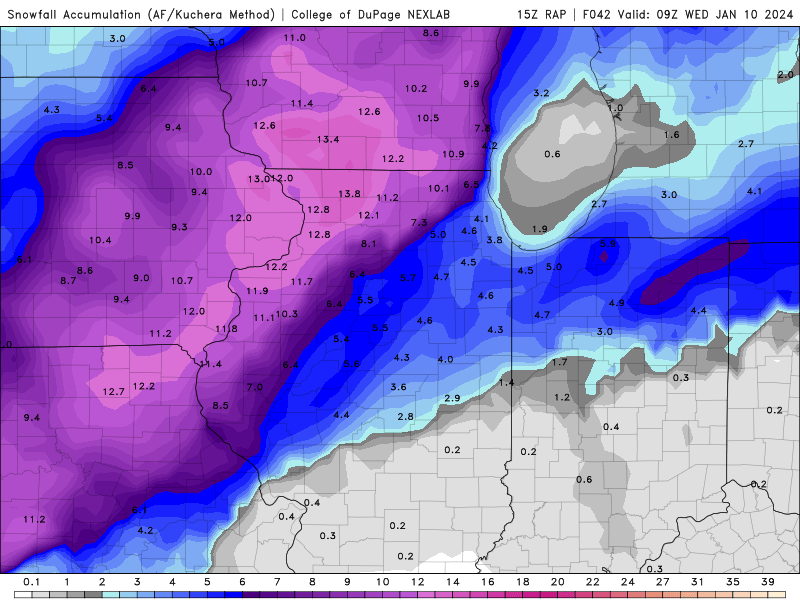
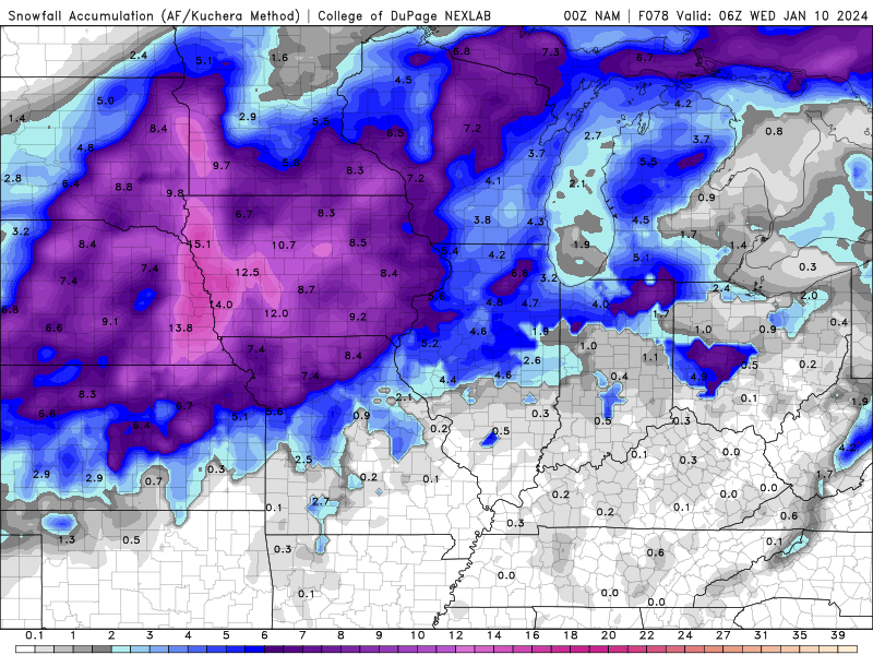
15z RAP Is more moisture showing up or are ratios getting better? Don’t recall snow going near or over a foot on Kuchera maps for IL previously.
-
Quadrant #4 represent! If this were to pan out (or even potentially change for the “worse,” it’s a tough decision on whether or not I should go to work tomorrow afternoon.

-
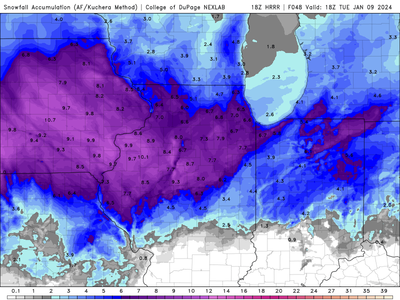
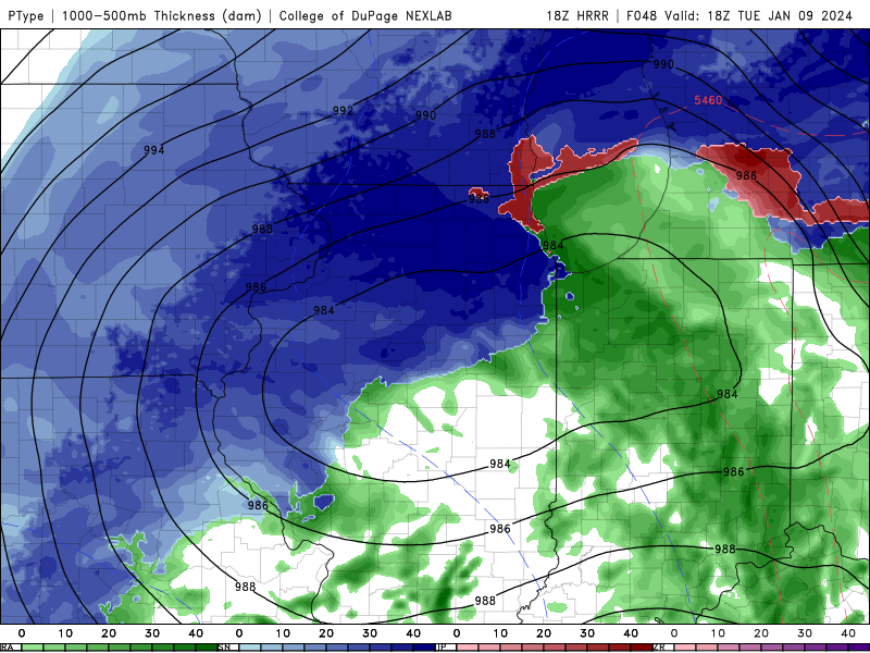
18z HRRR Kuchera snow map and precip plot at the end of the run (Noon Tuesday):
-
Euro has officially put me in bullseye territory in the upper 1/3rd of Boone County, IL. Which means it’ll shift somewhere in the next 24hrs.
-
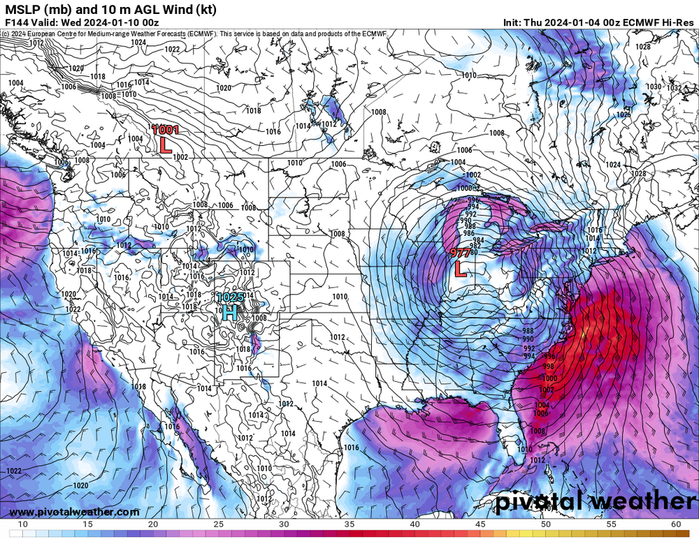
This storm is close enough to be on the HRRR. You’ll see the low placement at 48hrs in the lower left vs. the new 00z NAM
-
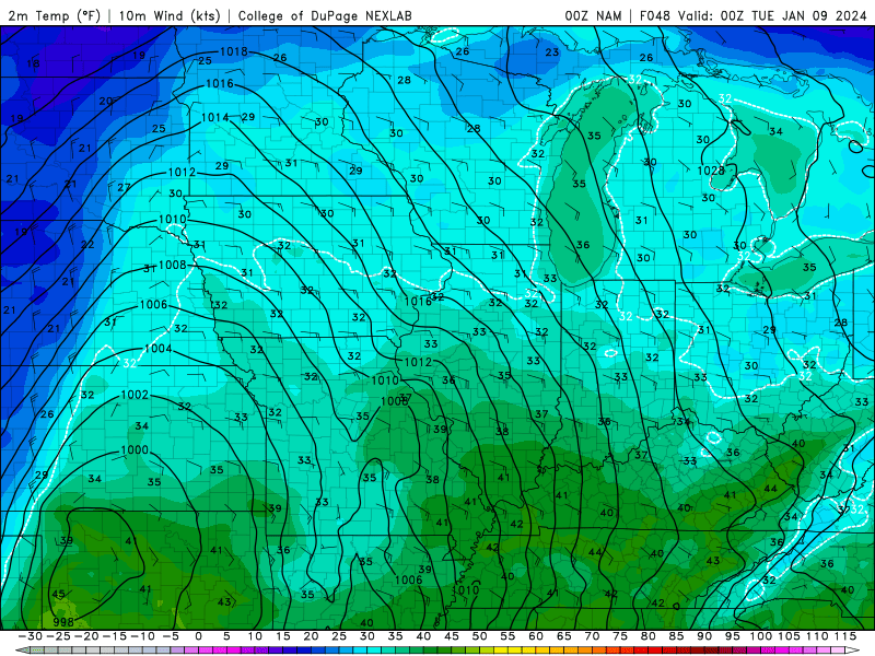
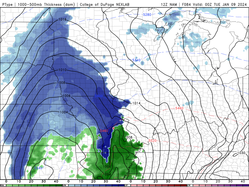
00z NAM: Snow output in N IL weirdly spotty with 6 in Kane & DeKalb county but only 3-4 north of that. The low tracked through the middle of lower Wisconsin.
-
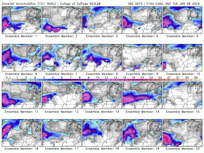
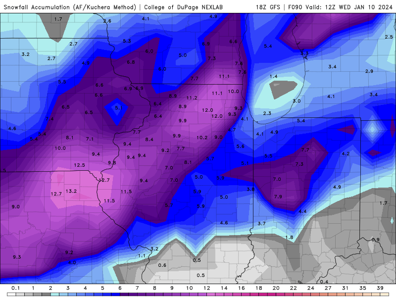
Showing the snow band shifts over the last 13 GFS runs.
-
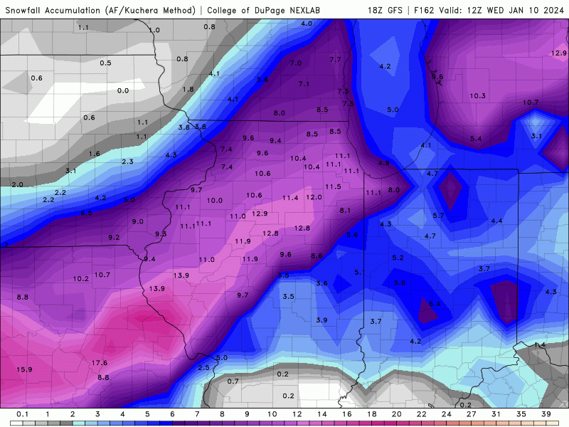
Kuchera map for 18z GFS
-
Just imagine if the NAM pulls a coup on the way north track.
-
If Rockford has a magnet, this is about as far NW as it can go in terms of getting the most snow.
-
Winter 2023/24 Medium/Long Range Discussion
Sciascia replied to Chicago Storm's topic in Lakes/Ohio Valley
After looking at the 6z GFS, that’s back to back runs of 30+ inches at ORD in the next 8 days. If the 12z does the same, that’s “officially” a streak. Let’s go for it! -
Winter 2023/24 Medium/Long Range Discussion
Sciascia replied to Chicago Storm's topic in Lakes/Ohio Valley
Fox Chicago’s Mike Caplan mentioned in a livestream today that a special mission was conducted to retrieve data from the storm before it makes landfall. Also, that data is supposed to begin appearing in the 00z model suite. -
Here’s the final frame of the 12z NAM:
-
-