Sciascia
-
Posts
542 -
Joined
-
Last visited
Content Type
Profiles
Blogs
Forums
American Weather
Media Demo
Store
Gallery
Everything posted by Sciascia
-
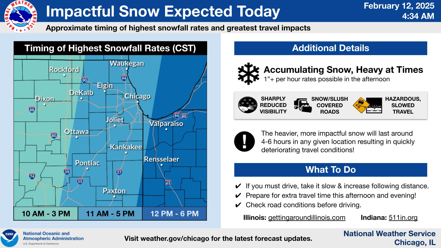
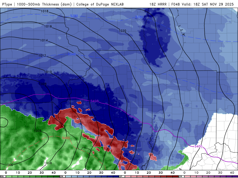
Nov 28-30th Post Turkey Day Winter Storm
Sciascia replied to Chicago Storm's topic in Lakes/Ohio Valley
Operational NAM cooking up another weenie run, especially for E IA/NW IL/SW WI. Hi-res NAM still high but a couple inches lesser. -
Nov 28-30th Post Turkey Day Winter Storm
Sciascia replied to Chicago Storm's topic in Lakes/Ohio Valley
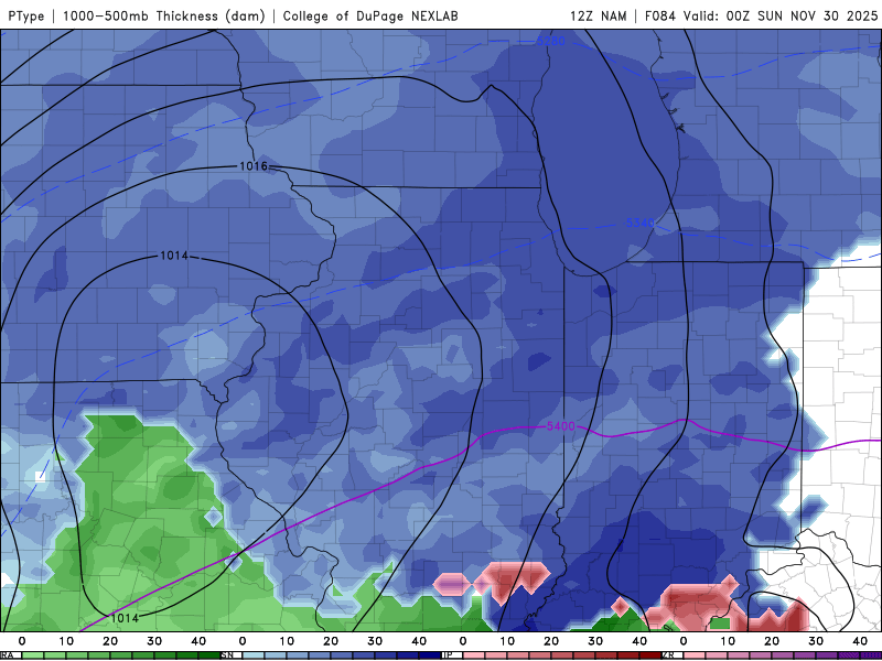
Let’s behold it together (thru noon Saturday)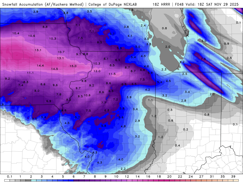
-
Nov 28-30th Post Turkey Day Winter Storm
Sciascia replied to Chicago Storm's topic in Lakes/Ohio Valley
You don’t say…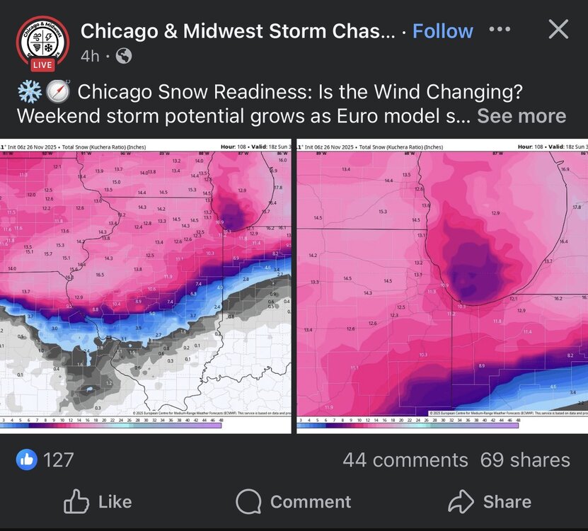
-
Nov 28-30th Post Turkey Day Winter Storm
Sciascia replied to Chicago Storm's topic in Lakes/Ohio Valley
84hr NAM (lol) but sharing as it’s reaching range. Run ends when snow is continuing to fall.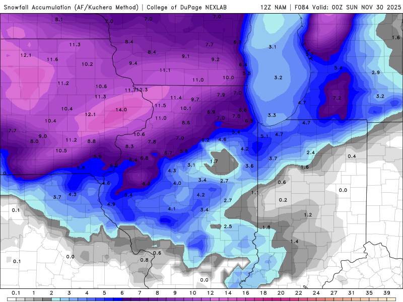
-
Nov 28-30th Post Turkey Day Winter Storm
Sciascia replied to Chicago Storm's topic in Lakes/Ohio Valley
I’ve been sidelined from work since November 6th dealing with a lower back injury. Things are looking good that I’ll be cleared tomorrow to go back to work on 12/1. So, of course, a potential winter storm may dump a foot right before I go back & my 20 year old Explorer is immediately put to the test. -
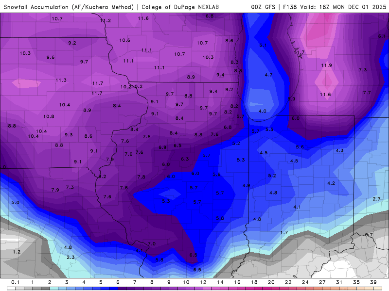
Nov 28-30th Post Turkey Day Winter Storm
Sciascia replied to Chicago Storm's topic in Lakes/Ohio Valley
-
11/8-11/10 First Snow and Lake Effect Event
Sciascia replied to Geoboy645's topic in Lakes/Ohio Valley
Flakes in Poplar Grove. I won’t be in on the lake effect fun, but the first snow of the season is always enjoyable. -
Looks like the lull period will include the Bears game, which is a shame.
-
A trained spotter measured 4.5 inches in Capron, IL (super close to me) at 8:13am. I’m going to guess that easily jumped over 5, maybe even 6 if they can chime in again later. If it hit 6 inches, that would be the top event of the season.
-
I am around 23 miles northeast of RFD, and 10 or so miles away from the IL/WI border. RFD, as of a little over an hour ago, picked up 3.1 inches from the snow band.
-
Appreciated. It was 80 degrees here around 3pm Friday. To go from that to this in about 40 hours is that late 90s/early 00s climate I remember growing up with.
-
Confirmed.
- 469 replies
-
- 14
-

-

-
I’m going to be on the road at 10pm Friday. That orange blob inching closer to the cheddar curtain hopefully stays back.
-
Feels like it’s been 2-3 straight winter seasons of them overall. Storm on models for multiple days, showing 6+ as late as 24hrs before the event, and then only ends up being a 1-2 inch pixie duster.
-
Me, jumping on the forum for the first time in 4 hours looking for happy IL peeps: (Looking like a good one for Michigan)
-
The boom/bust potential being legit at both ends for the NE-IL area makes me not envy any of those mets.
-
10:1 map
-
GFS painting 5-6” at the cheddar curtain on the 10:1 maps.
-
10:17pm update:
-
I’m in the minority in Illinois but I’ve enjoyed the event so far from northern Boone county. 8:30-10am and currently are the heaviest it’s been, but the dry slot is creeping up. I don’t measure, so nothing official; but based solely on what I had to walk in with my dogs, seems like there’s more on the ground than what’s reported in Rockford.
-
Much like it was on the models, snow began in Poplar Grove around 8am.
-
-
-
When your parents popped into your room, you had to minimize that GFS page so fast!