Sciascia
-
Posts
542 -
Joined
-
Last visited
Content Type
Profiles
Blogs
Forums
American Weather
Media Demo
Store
Gallery
Everything posted by Sciascia
-
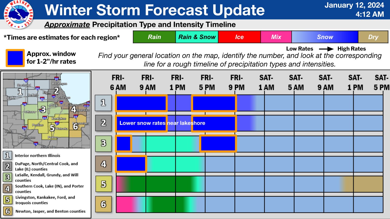
Pfft, easy. Free, untimed field goal kick because our fair catch was interfered with. Then we recover the onside kick, and throw a touchdown to tie it. 0z NAM (standard model) precip & snow swath south of 18z.
-
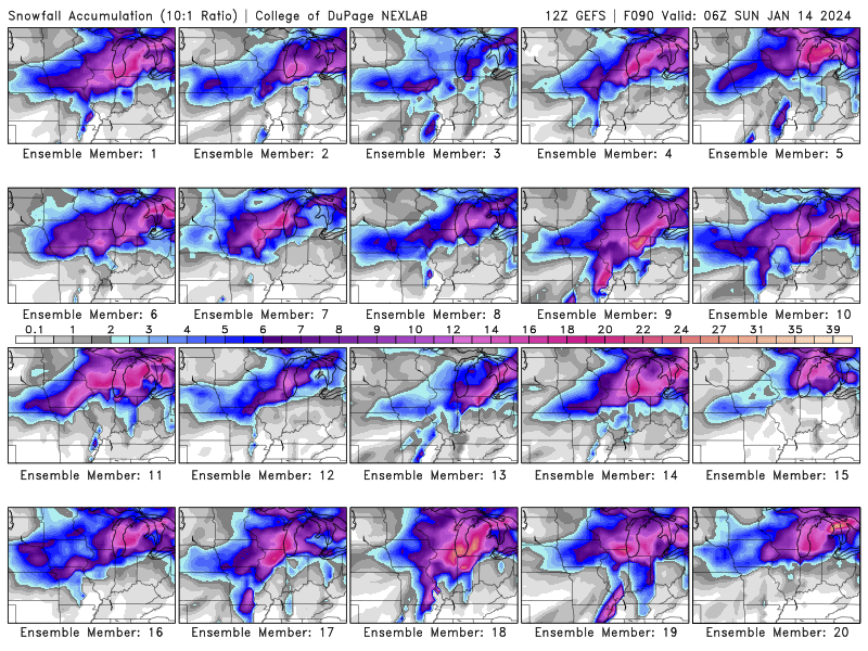
Cruelty helps me cope with the pain of watching them let that loss beat them 10 straight (soon to be 11) weeks in a row. Anywho, here’s the Euro’s snow band placement over the last 24 hours.
-
And as we’ve seen this football season, Chicago can’t stop a Hail Mary from being successful.
-
2024 Short/Medium Range Severe Weather Discussion
Sciascia replied to Chicago Storm's topic in Lakes/Ohio Valley
These increases in potential storm severity and potential tornado chances always make me nervous now that I live out in the middle of nowhere. I felt invincible living in Chicago based on the old “tall buildings” myth; but out here? Nerves are real having had a tornado touch down as close as 3 miles away last year. -
Heavy snow wording in the P&C in late March happens rare enough to be enjoyable, even though the idea of shoveling is less so.
-
Snowing pretty good here in Woodstock. It feels like forever since we’ve seen snow falling.
-
Hanging onto snow here. It had looked like another dry swing was coming through, but it’s been refilling with snow.
-
RAP as well.
-
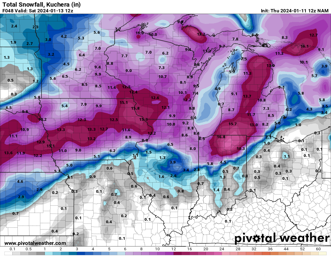
Newest HRRR has another 5.5 - 6 inches or so for the Rockford/Boone County area thru 3am Saturday. ORD 2 inches.
-
Dry slot filling in. The longest drought in the history of…today’s storm is over. Let us continue jumping around like a bunch of delirious 10-year-olds. (That’s a Pat Hughes World Series winning radio call reference for those not in the know.)
-
Officially in dry slot. A shame seeing as NWS Chicago’s belief was that this was a prime time for 1in/hr in the Rockford area until 11am or so. Hope it fills in in relatively short order.
-
I’ve somehow forgotten: Was that big dry spot forecast on models?
-
I have the power to un-crunch & separate.
-
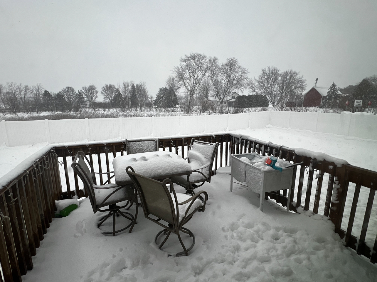
P&C total snow forecast is 2-4” overnight, 4-8” tomorrow, and 3-5” tomorrow night. If all of that verifies + the arctic air that follows, I’m pretty sure my husky will never come inside again.
-
EURO is telling the dreamers to dream.

-
First day?
-
The changes these storms make late in the modeling game is unfortunate. Hopefully the NW cheddar curtain areas have a chance for double digits. Don’t think I’ve had that since I moved out here from Chicago in early 2020.
-
You forgot option #3: Non Hi-res NAM:

-
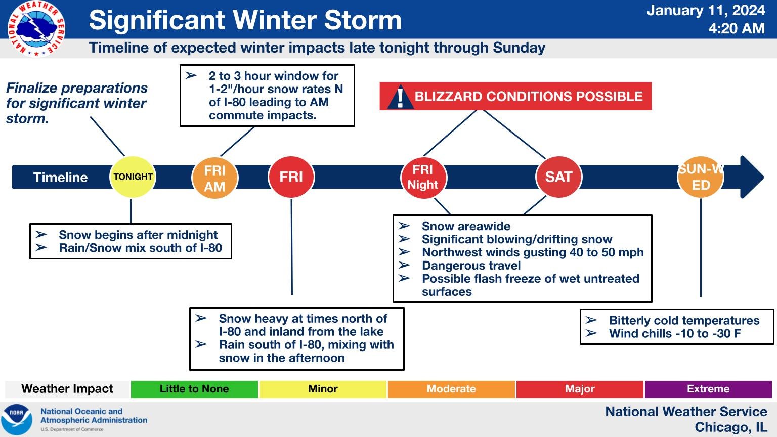
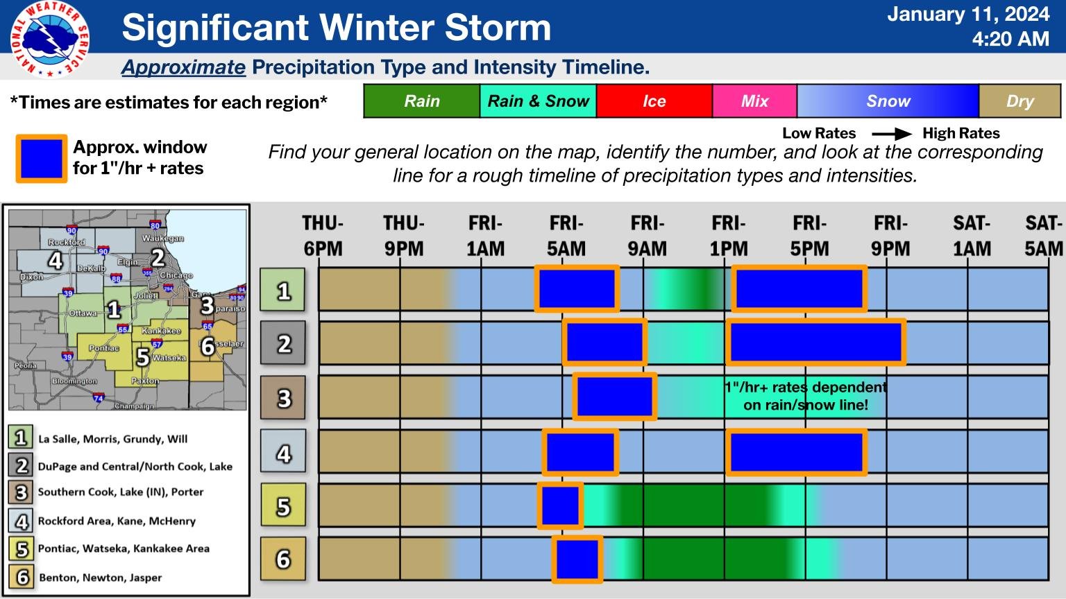
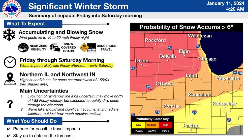
4:20am LOT graphics:


-
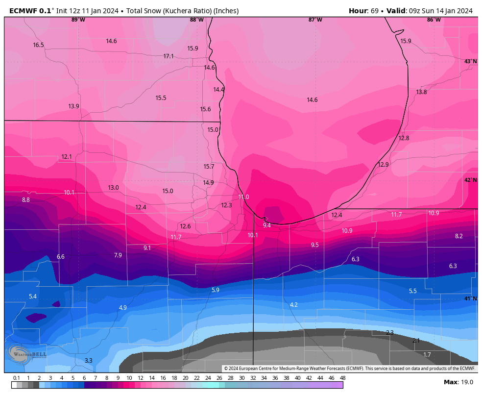
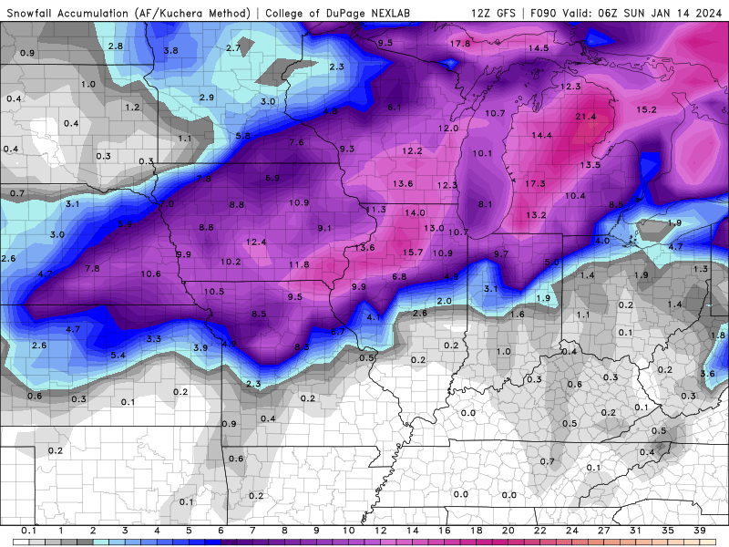
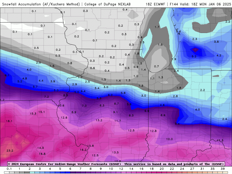
06z EURO QPF map. In Januarys gone by, 2+ inches of precip at ORD in early January would be setting records. Sadly not the case anymore. Granted, it would still be like 16-17 inches of snow if it verifies. But wouldn’t break top 3 snowstorms.
-
Now I know. And knowing is half the battle.
-
Captain Obvious-level statement: Part of the “bad luck” with the ratios is the timing of it being yet another daylight storm. If this would strike overnight, we could probably actually use 10:1 maps.