

StormchaserChuck!
-
Posts
2,273 -
Joined
-
Last visited
Content Type
Profiles
Blogs
Forums
American Weather
Media Demo
Store
Gallery
Posts posted by StormchaserChuck!
-
-
10/8-9, both have a chance
-
Anyway, how different we are this year.
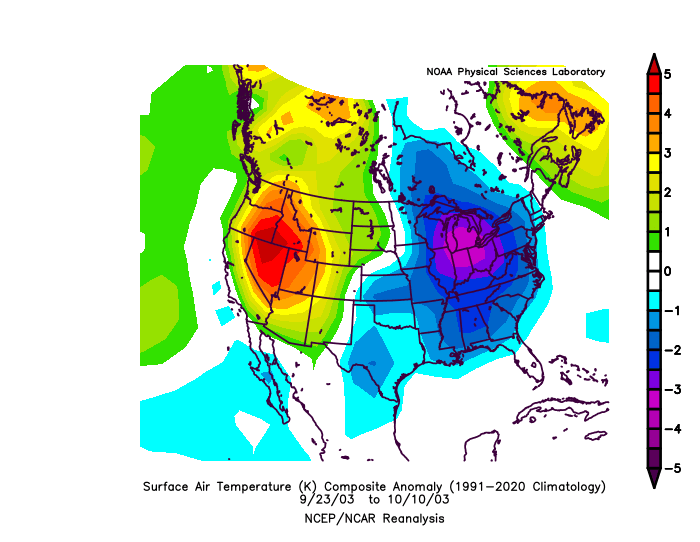
You have to go back to 2003.
(Another point, with my last post, it's data after 1986, 14 analogs, and the satellite -0- average is 1948-2020. so it's impressive that all the maps are normal to below everywhere, because of the skew)
-
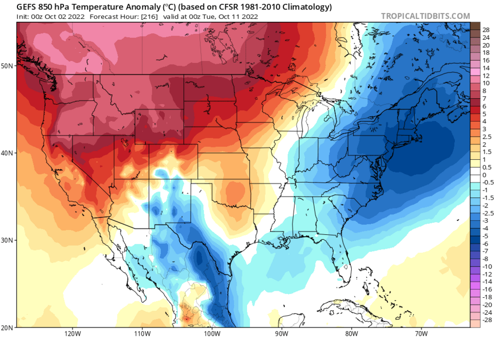
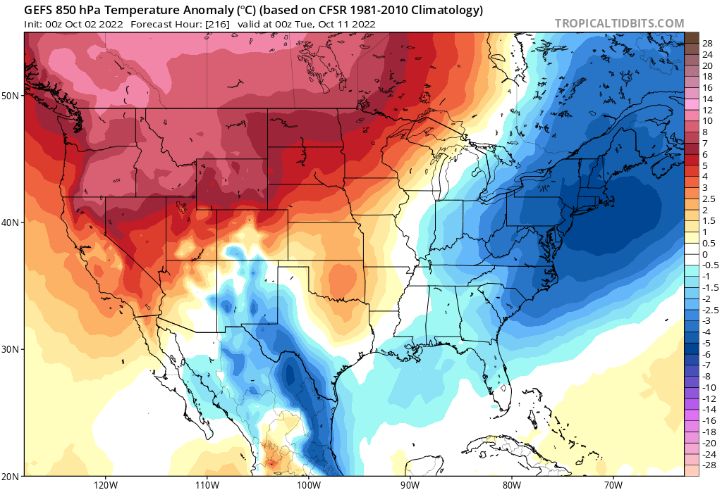
Anyway, check out this +PNA signal after we have an anomalous trough/ridge over the EC Sept23-Oct10

(whole earth is cold actually.. ^14 years since 1986, 1948-2020 maps are warmer/2nd half )
+PNA December too (mountains SE have biggest snowstorms in Dec)
if we can -EPO October, like I think we will

-
 2
2
-
 1
1
-
-
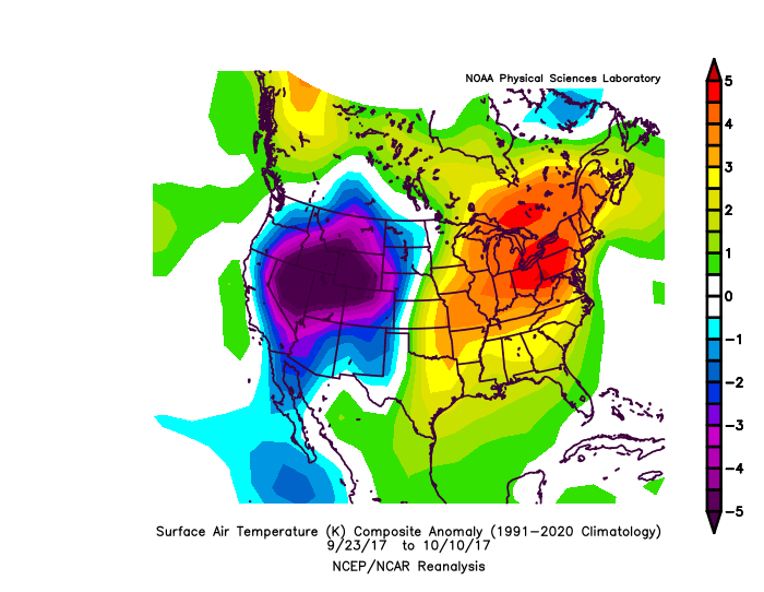
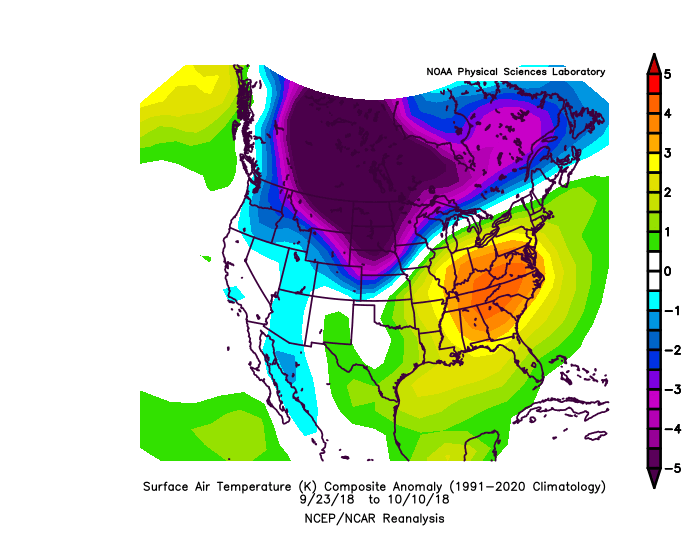
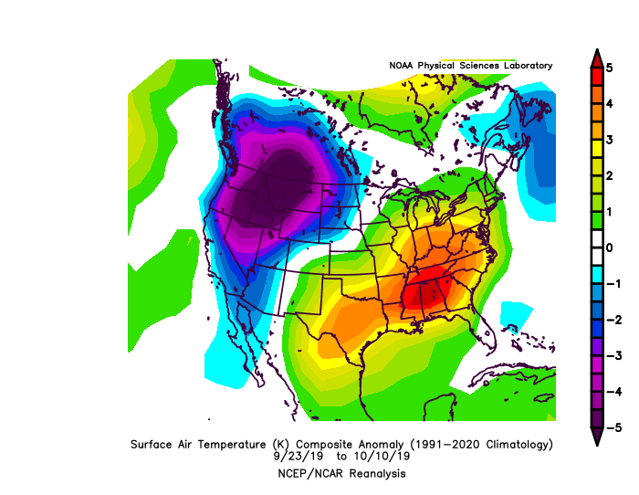
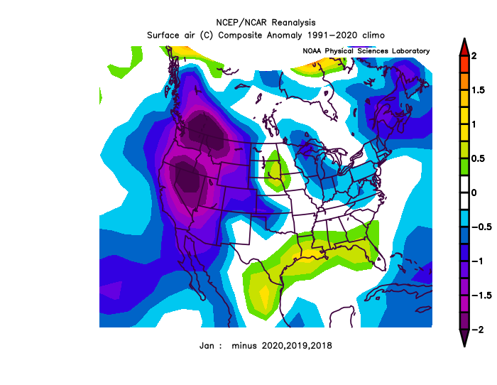
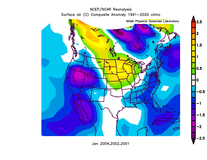
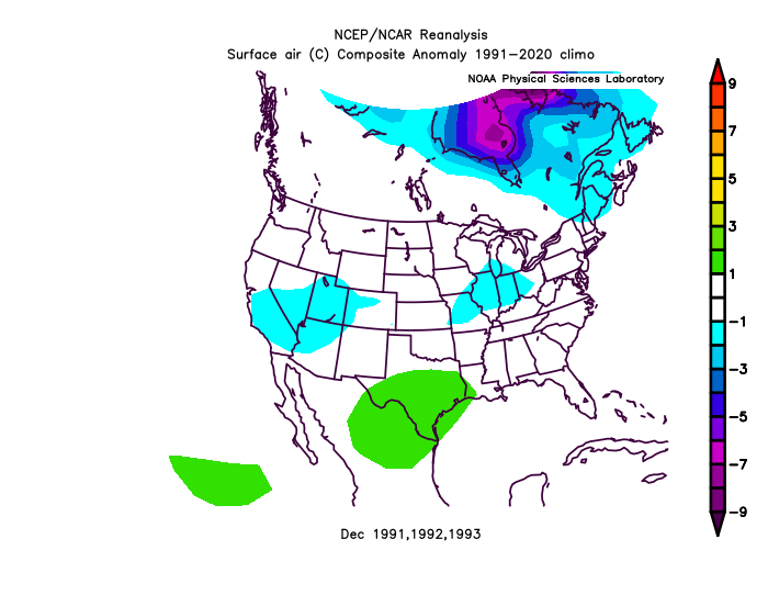
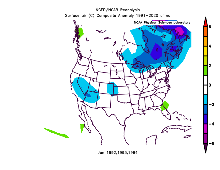
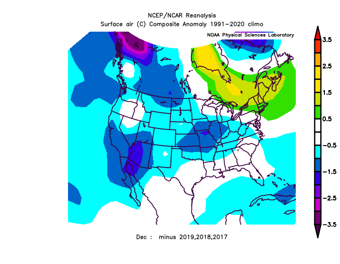
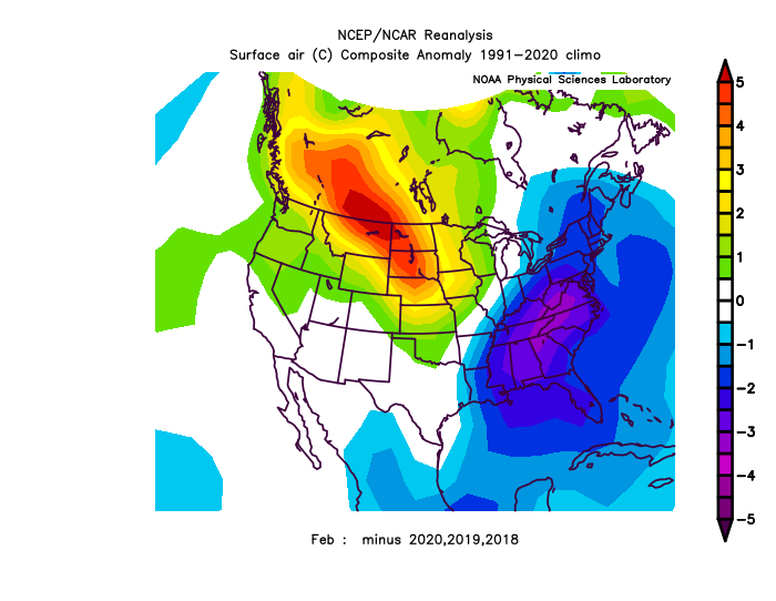
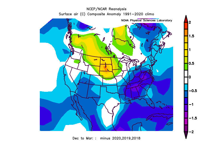
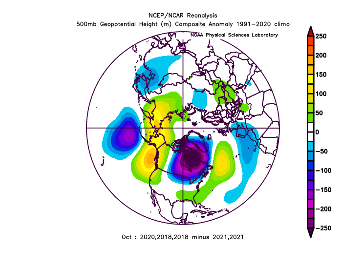
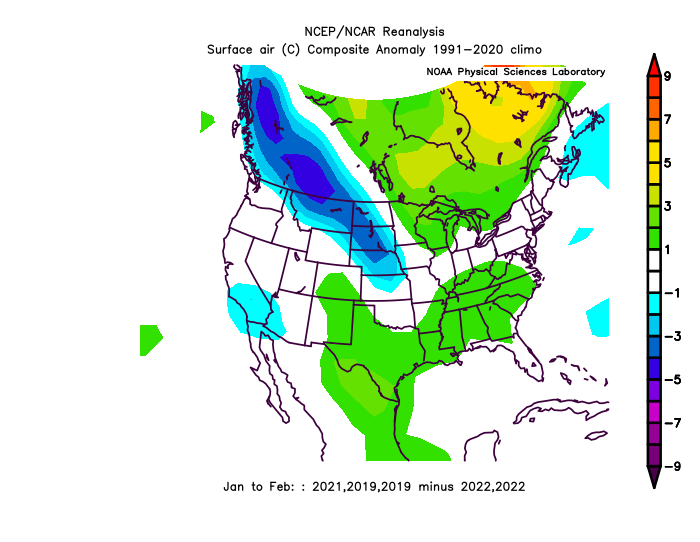
EC trough/well below average this year is the first time since 2003. 2017,2018,2019 were good opposite matches (3/4 since 1986), and I was surprised that Boston only had 2" of snow in 2018-19. Check out this composite.
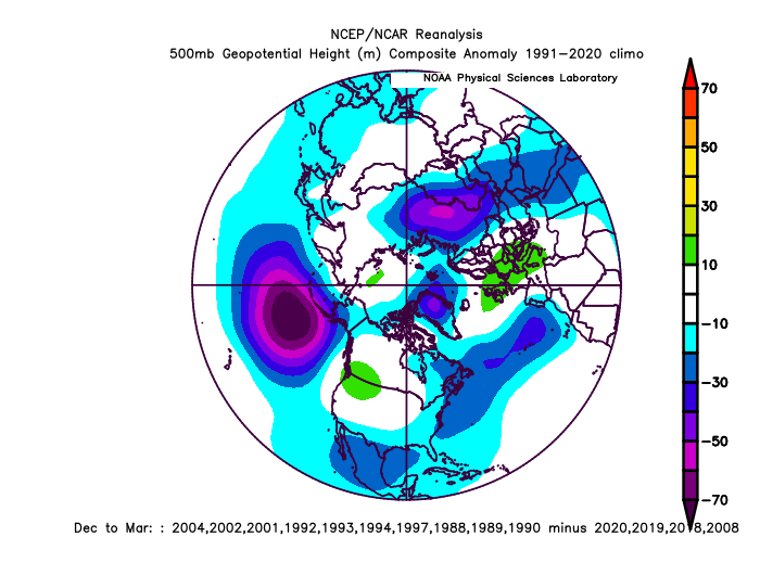
I at least think it will be a +PNA December. (I'm referring to Sept 23-Oct 10. below average/EC trough 9/23-10/10)
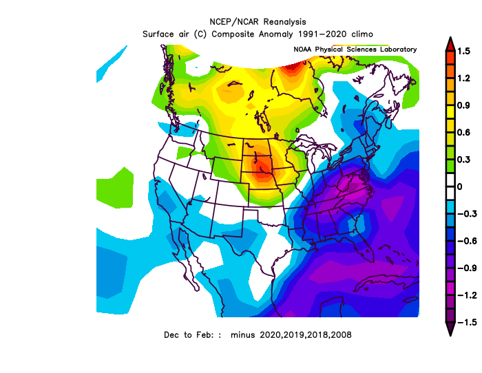
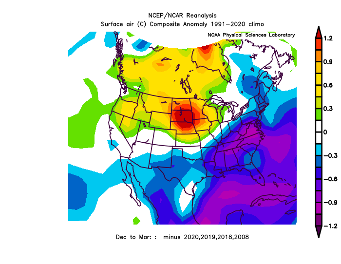
All of the roll forward years are average to cold, too.


Mostly EC Trough since April.. confirms what I think, that real cold is at our doorstep, normal progression stuff..
-
14 hours ago, WinterWxLuvr said:
I need more colorful maps.
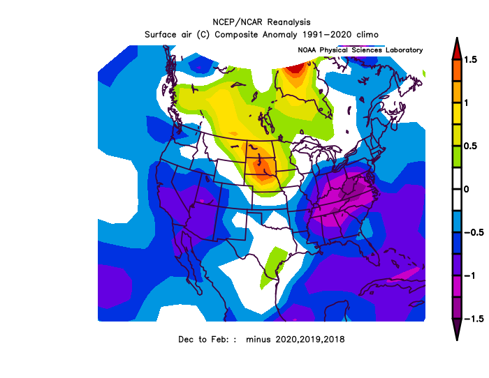
At least I acknowledge that you saw the post. I thought it was interesting that there is really no way above average in the mix, and it's a pretty diverse/random dataset. Seems to be a strong consensus for average to slightly below average Winter temps following EC trough/significantly below average Sept 23-Oct 10 (what I thought when I was thinking in it- outside). It has been a drier La Nina STJ though. I wouldn't be surprised if we have near average snowfall.
-
2
-
-
-
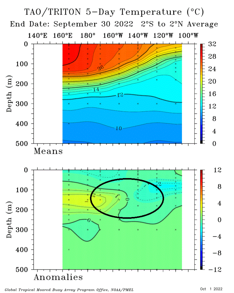
ENSO is nothing to sneeze at.
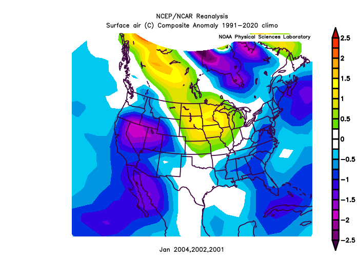
This is after anomalously below average/East coast trough Sept 23 - Oct 10. Last time it happened was 2003. 14 analogs since 1986: 70>dm +PNA. 4 months. quite a signal. last Winter I had 20 analogs for 2 months giving a +70-100dm PNA/NAO signal, it verified with strong gravity-pull, I saw.

-
Really strong trough building in the east, everything that develops will have to stay way south.
-
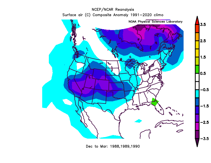
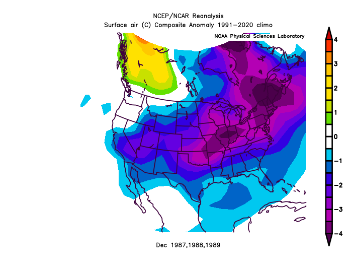
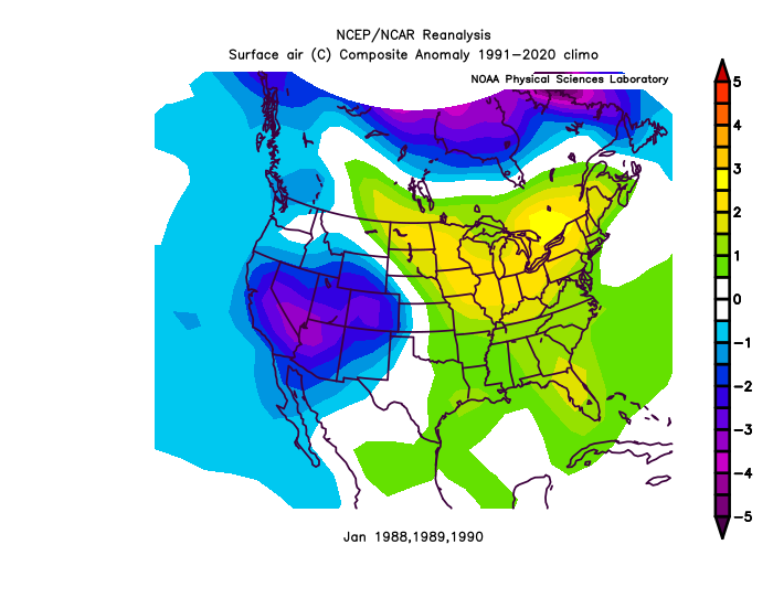
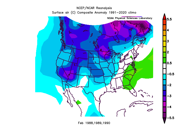
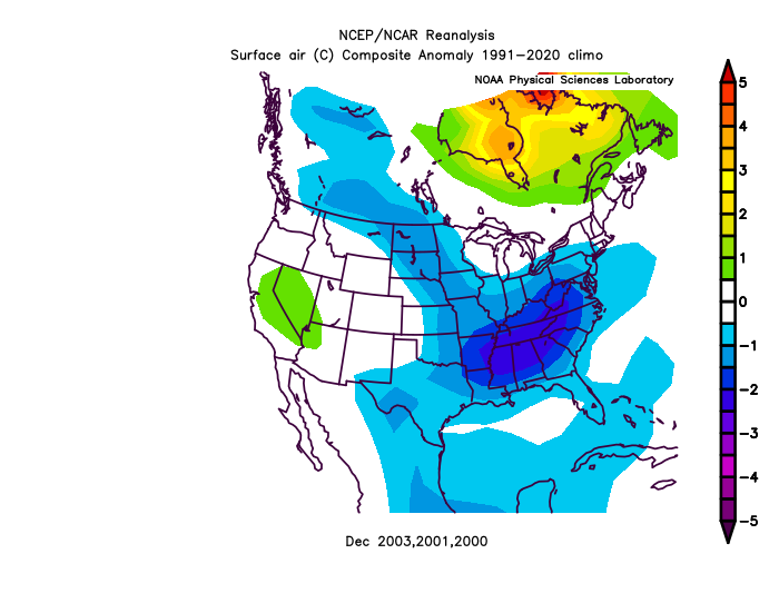
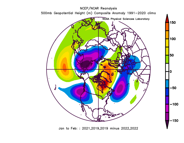
Another cluster of years for those that care:

-
1
-
-
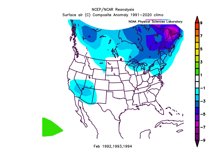
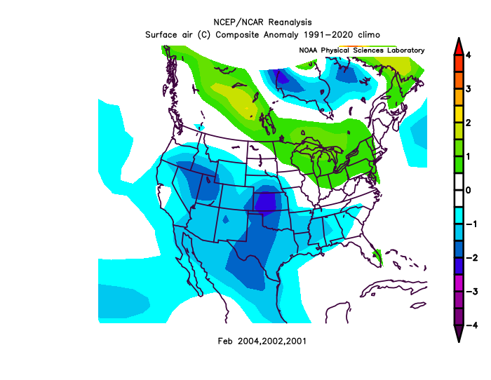
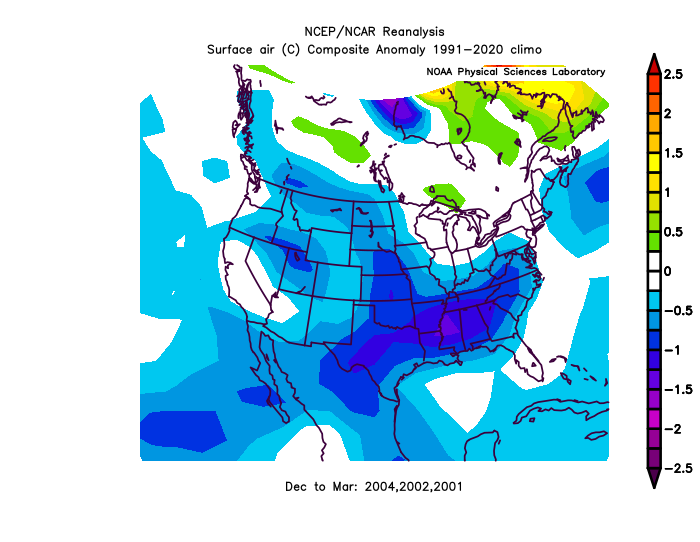
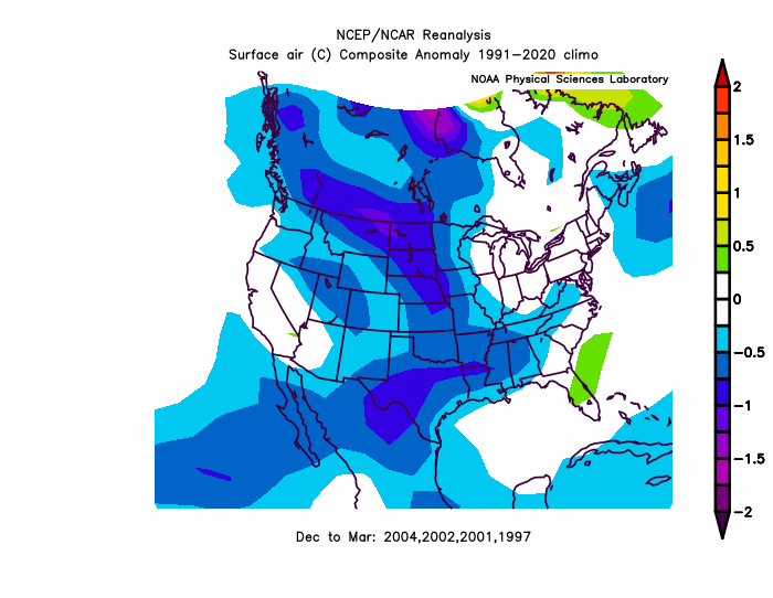
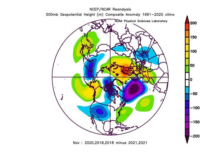
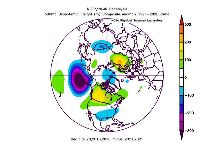
Below average/EC trough: Sept 23 - Oct 10 is the theme. We haven't seen anything close to what is going to happen since 2003. This year stands out. Follow the images. many. all with the same starting theme. Above and below average years. (It tends to happens in clusters:)


-
1
-
-
Below average/EC trough: Sept 23 - Oct 10 is the theme. We haven't seen anything close to what is going to happen since 2003. Follow the images. many. all with the same starting theme. Above and below average years. (It happens in clusters:)


-
1
-
1
-
-
DCA -2.0
NYC -2.5
BOS -3.0
ORD -3.0
ATL -1.0
IAH -0.5
DEN -0.5
PHX +2.5
SEA +0.5
-
On 9/21/2022 at 8:22 PM, MN Transplant said:
Want some depressing stuff? Here are the temps from around 1900 vs around 2000. Departures from current norms. Yeah, we can still pull off a Dec. 2000, or Feb. 2007 or 2015, but woof.

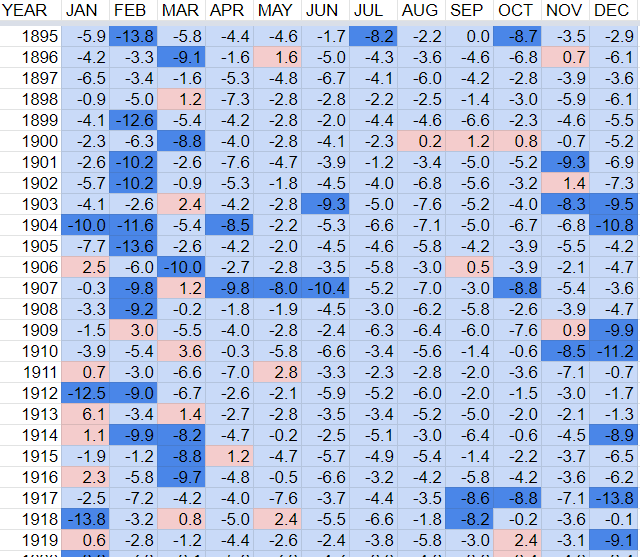
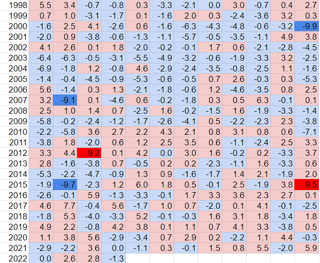
2015 warm+9.5, El Nino... 2007-9.1cold La Nina... 2000-9.9cold La Nina 3/5 latest extremes have been warm-El Nino, cold-La Nina. That seems to me to be more "typical".
I think it's typical for La Nina to be cold phase, and El Nino warm phase.
-
1
-
-
2 hours ago, Windspeed said:
That beast trough is so strong it may very well capture and phase Fiona into New Foundland, perhaps even Nova Scotia. Good take is that though Fiona may get intense, it may miss Bermuda cleanly to the west.
SE ridge-Texas ridge has been trending stronger, may/will probably trend stronger in the medium term.
-
1
-
-
-EPO still coming
.thumb.gif.bfaf54ad9998d0929944a5ba60902bef.gif)
-
-
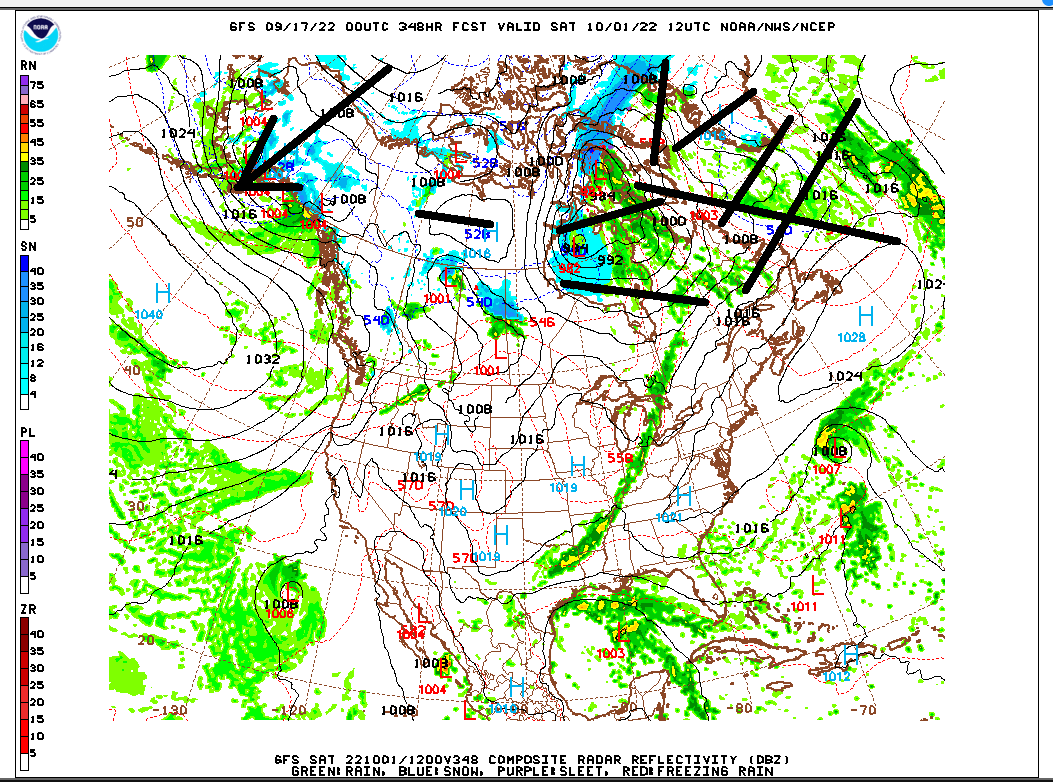
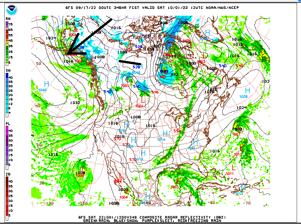
Looks like a beast on the GFS
-
-
-
-EPO Oct's since 2015
300dm+PNA

-
-EPO October guaranteed

-
-
O-k
-
1
-
-
.gif.1d72baaf792f800324ae226e9af2222e.gif)
.gif.eb58ab6281d4eae64d84bd9ac071bf44.gif)


Winter 2022-2023 Conjecture
in New England
Posted
17-18 or 18-19, the point is, we are going in the opposite direction.