

StormchaserChuck!
-
Posts
2,273 -
Joined
-
Last visited
Content Type
Profiles
Blogs
Forums
American Weather
Media Demo
Store
Gallery
Posts posted by StormchaserChuck!
-
-
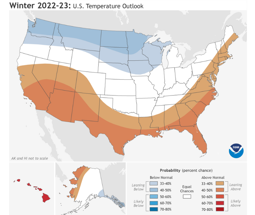
This is one heck of a +EPO coming up for late week/weekend.. you know I love +EPO's. temps to overperform warmer.
-
 1
1
-
-
On 10/22/2022 at 10:43 PM, midatlanticweather said:
18-19 was similar to this Fall. I'd take the opposite of this, despite La Nina. at least Dec. Jan and Feb could match forecast.
-
watch out for this over the NW
-
1
-
-
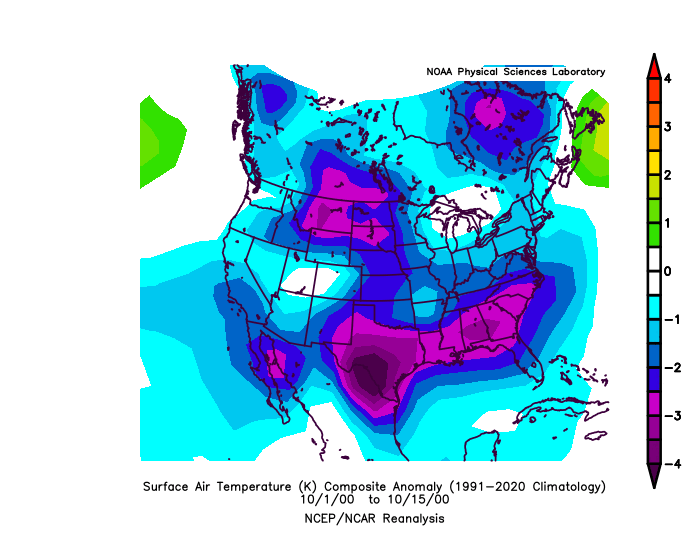
10-15 is a good analog.
-
1
-
-
4 minutes ago, 40/70 Benchmark said:
Cosgrove is all in on a -AO/NAO.
If we have -NAO, it will be -PNA
+NAO is +PNA/-EPO -
6 minutes ago, 40/70 Benchmark said:
I remember the pattern during the fall of 2006 was awesome, then you came out with your infamous "warmest winter on record" thread, and sure enough, it went to shit.
Yeah, I've been serious the whole time.
-
This one was warmer though.
-
Never done a 4th year La Nina. 3rd year Nina's are colder and snowier, for uncoincidental reasons.
-
1 hour ago, psuhoffman said:
Some of the same forcing mechanisms that are conducive for HL blocking now become hostile and have a very different response come winter. I think there can be instances where a cold pattern in the fall, if driven by specific global factors that remain positive influences in winter can be a good thing. But I worry that some of the tropical forcing helping now would be detrimental come winter.
We ware shifting pattern in the Southern Hemisphere too to colder.
-
Actually, this kind of -NAO in October heavily correlates with a +NAO Winter. a few things remind me of 2018.
-
Believe it or not, after +PNA Dec, we have more of a High pressure correlation in the north Pacific ocean for Jan and Feb
-
I hate that Hadley Cell expansion as a long term pattern.
-
21 hours ago, Eskimo Joe said:
Been some top tier moon rises / sets past couple of days.
Yeah, I noticed that too. In like 2 years or something, the best moon the last few days.
-
La Nina redeveloping in subsurface
.thumb.gif.3533ff7699a44d6263d04dd2a8efd8d2.gif)
-
Had frost yesterday on the roofs and cars. It was pretty.
-
-
Thank you. I would be interested to see if a La Nina/+QBO doesn't strengthen the 10mb vortex, giving higher chances of +NAO. The last 3 La Nina/+QBO's have been -NAO's so there might be a "put" in the mix.
-
Pretty nice -PNA/+NAO developing here on models, could warm up a bit more than forecasted.

-
1
-
-
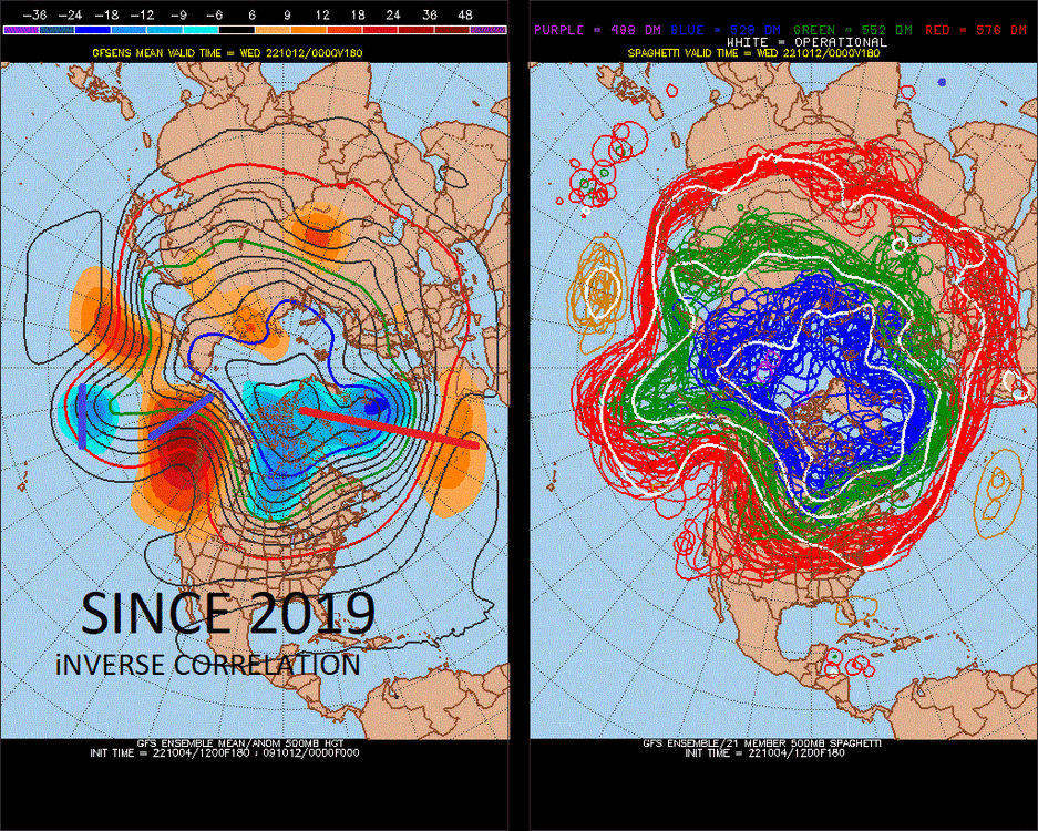
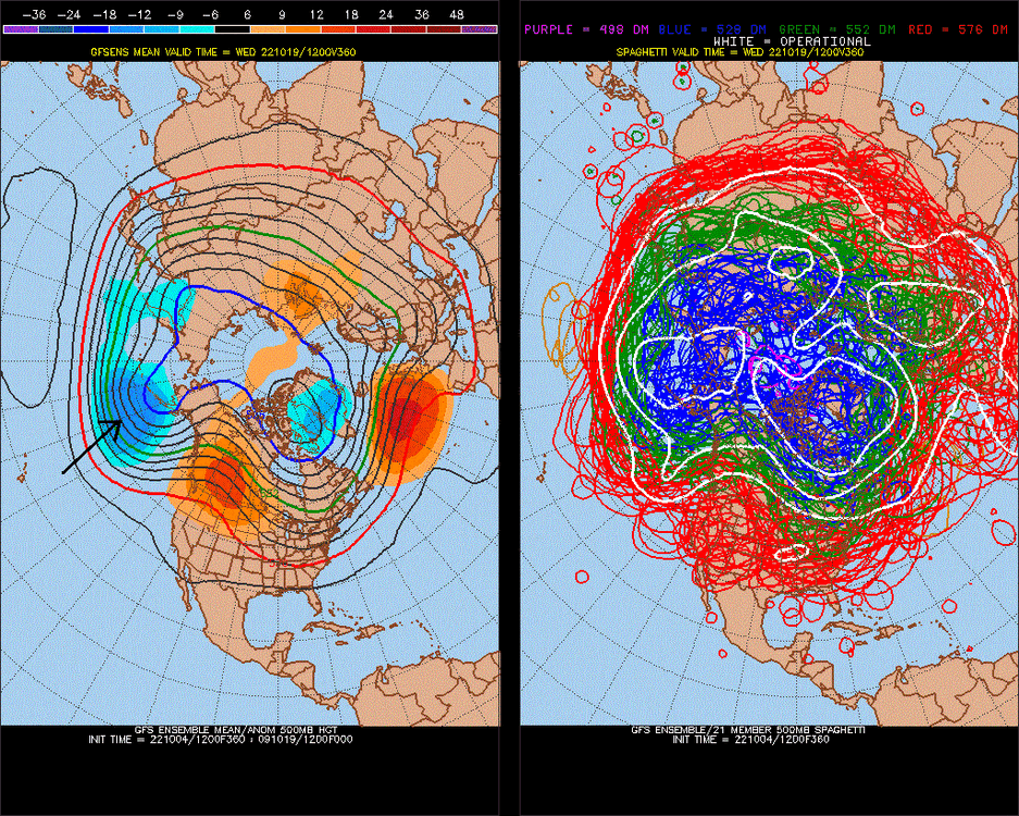
NAO has been inversely correlating with the Pacific, at like -0.70 (highest on record), so this increases the chances for +PNA -EPO this Winter.
.In "0 time"
3 good posts
-
1
-
-
Nailed it last year.. 12-4 since inception in 2005. [0.54 SD of DJFM NAO (0.00 is -0.54 to +0.54, 50% chance)] 12-4 is the base state verification, which is + this year.
NAO forecast is about +0.40 here, -0.14 to +0.94 50% chance DJFM.
-
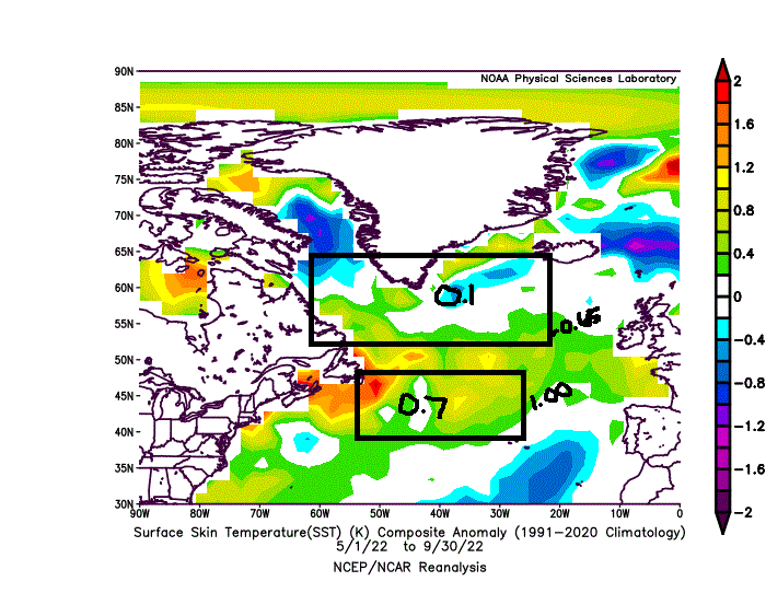
A mix of 00-01, 99-00 could be a good match, what do you think?

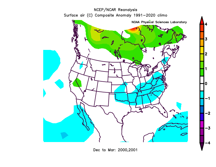
This is the last "La Nina "cold phase"", as the 2nd half of that Super Nino was very cold.
I think the story will be, +PNA Dec, -PNA Jan, -PNA Feb.
We were also coming up on a Solar Max, which we are in between this and low the solar la nina 07-08, 08-09, "solar ascending moderate now" (there's your fix)not sure it has much relevance.. but we are right in between 99/00-00/01 and 07/08-08/09 for enso and solar
-
5 hours ago, SnowenOutThere said:
Some hints of winter showing up on very long range GFS, tis the season I suppose
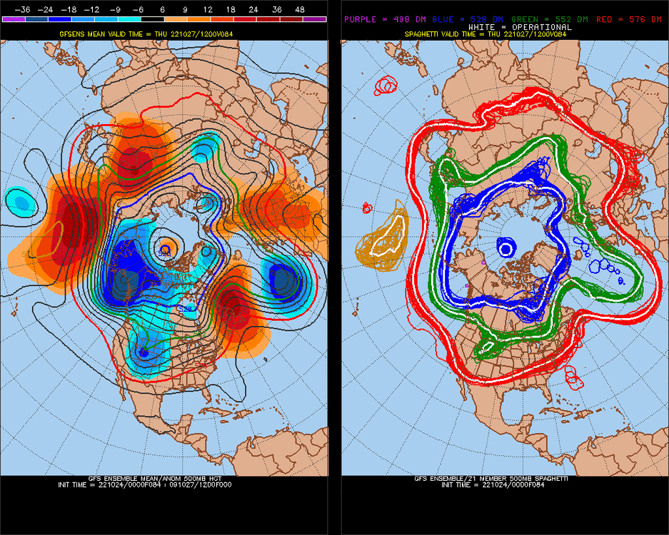
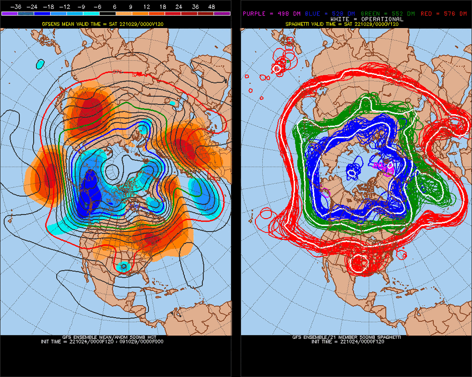
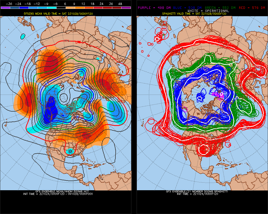
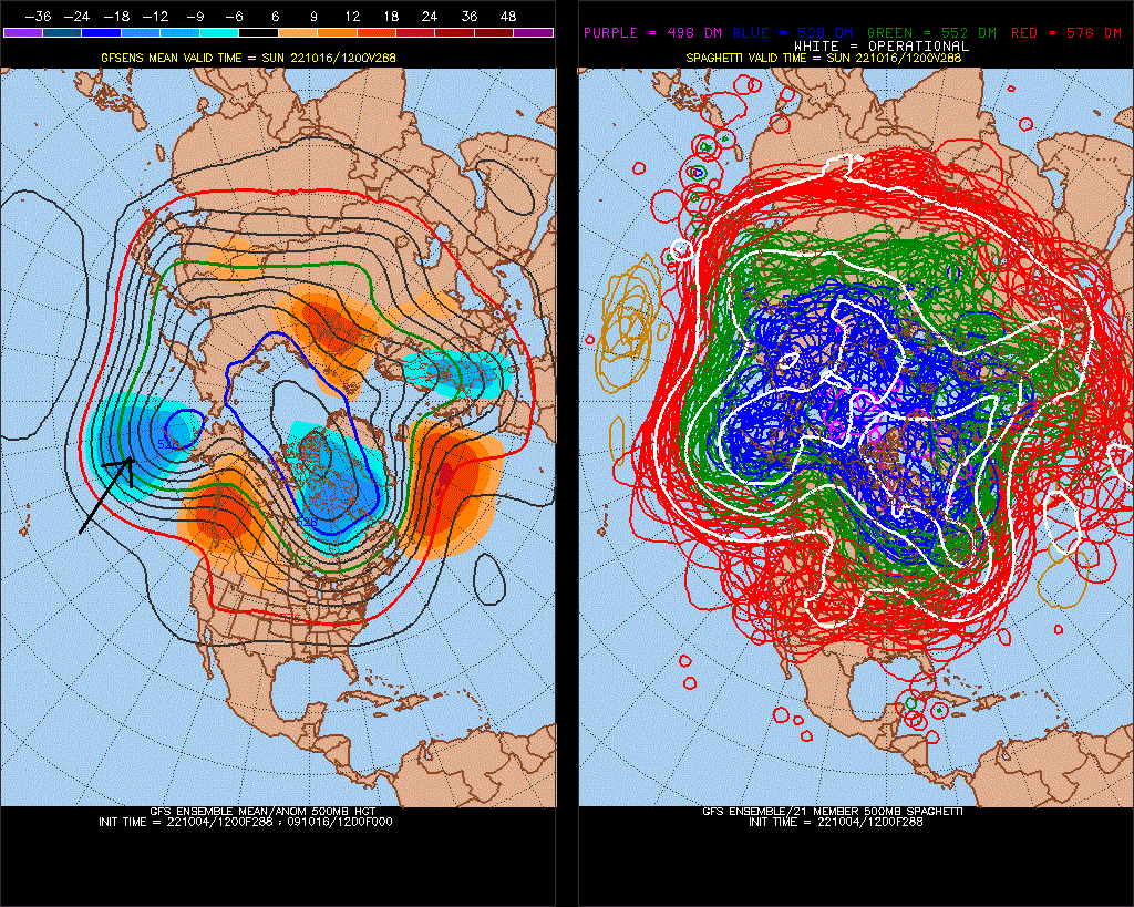
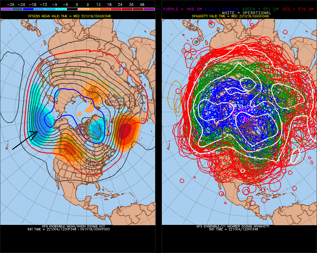
Actually, there's 2 rounds of +PNA coming up in the LR, which being in mid-October, bodes well for the Winter. Unless we revert back to pattern of last 7-10 years.


I keep getting 00-01 feelings when thinking about the Winter, and believe it or not the last time it was below average in Late Sept/early-mid October was 2003,2001,2000 *2000 was La Nina
-
4
-
 1
1
-
-
STJ has been very dry though, stronger La Nina-like. I've noticed this (precip) has stayed consistent with surface ENSO obs
-
7 minutes ago, 40/70 Benchmark said:
 21SEP2022     19.7-1.0     24.1-0.8     25.8-0.9     27.7-1.0
 28SEP2022     19.0-1.7     23.9-1.0     25.8-0.8     27.6-1.1
The new weekly number is up a tick again.....this event actually has somewhat of an eastward lean now.
subsurface is actually net + , I found a 0.90 vs 0.75 correlation subsurface vs Nino 3.4/MEI 0.80. December will be +PNA, so expect further subsurface warming.


.gif.bb8d43b80a24b3239886cd2c6afbcd7d.gif)


Fall 2022 Medium-Long Range Discussion
in Mid Atlantic
Posted
Forecast is low 60s for highs next Thurs-Fri and the weekend, I say we hit at least 70.