

StormchaserChuck!
-
Posts
2,273 -
Joined
-
Last visited
Content Type
Profiles
Blogs
Forums
American Weather
Media Demo
Store
Gallery
Posts posted by StormchaserChuck!
-
-
4" of rain is pretty impressive. I keep thinking, if it slowed down, we have a real nice cold shot coming 1-2 days later.. at least for inlandPSU and company lol
-
 1
1
-
-
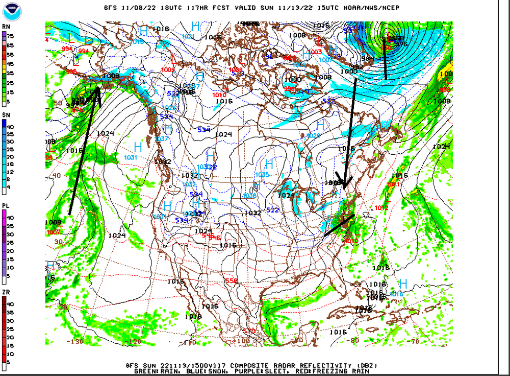
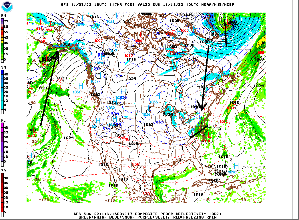
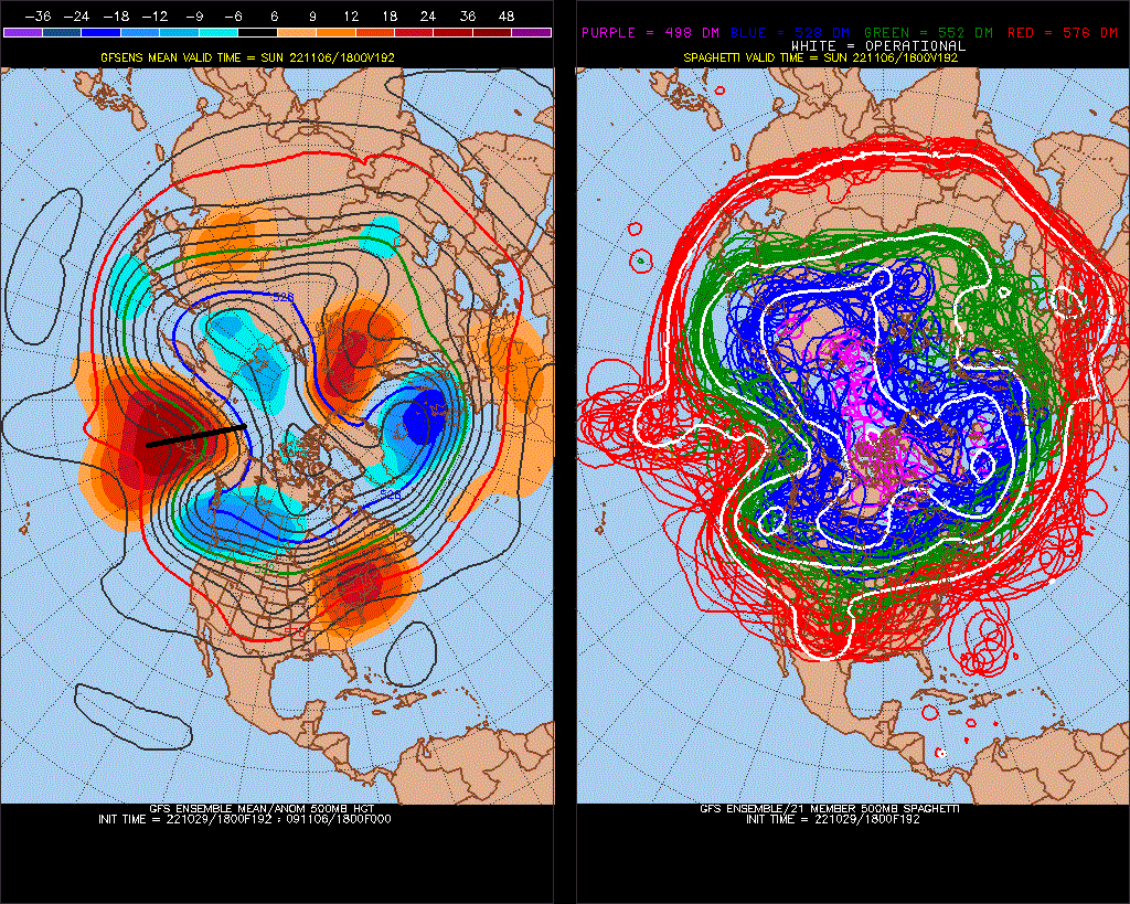
Nov 16-18 Snow threat..
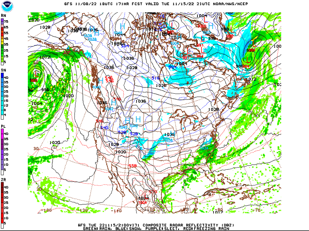

pattern is securely cold early.. lag pieces off of strong storm/Nichole rarely work out, but it shows the solidity of the cold..
(I made a thread for the Nov 16-18 snow threat but it was deleted)
-
1
-
-
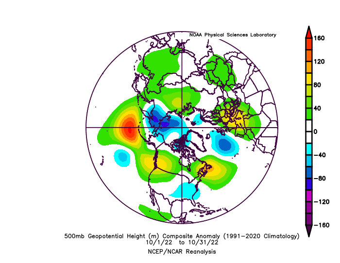
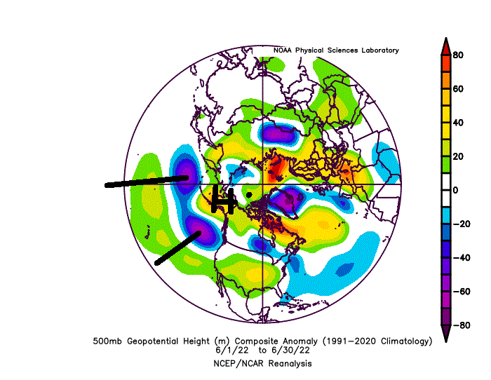
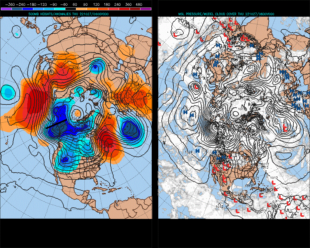
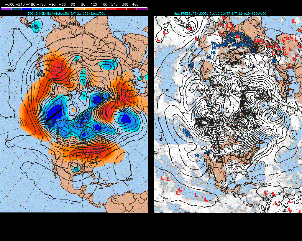
It wasn't even a very warm 500mb pattern, in the first week of Nov. It also broke against the global pattern trend from Apr-Oct and back now in the present. The pattern was more like a warm front.
-
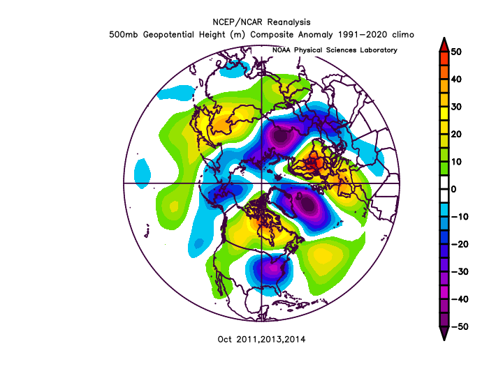
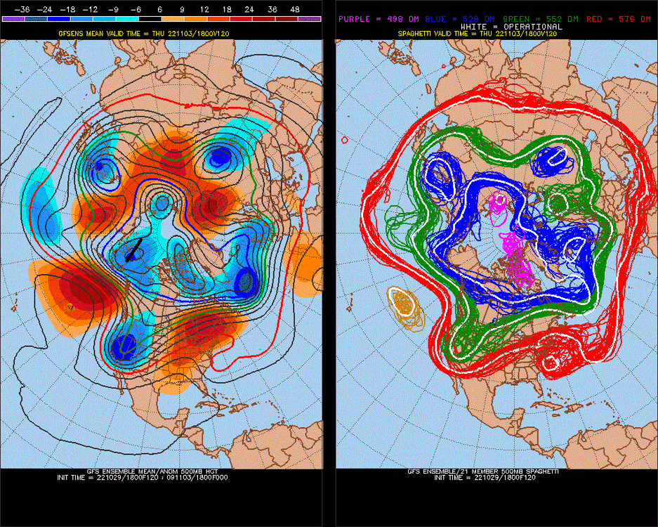
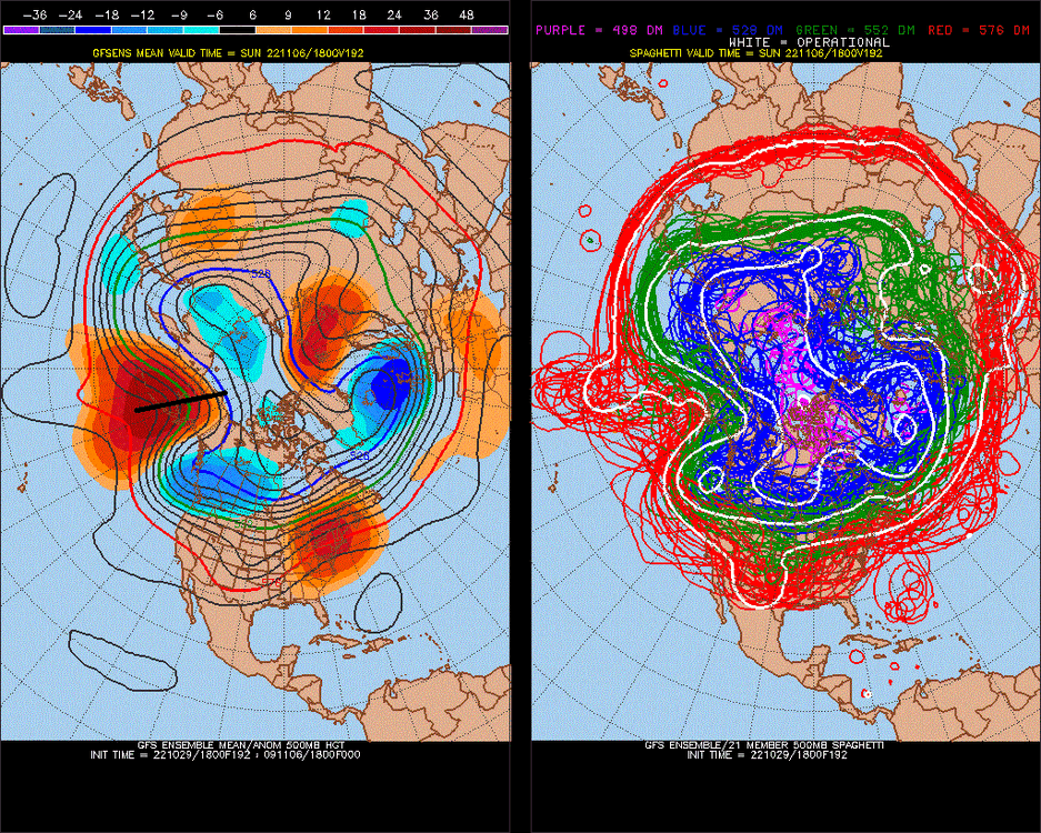
Oct 500mb matches were 2011,2014,2015, minus 2009..
-
1
-
-
2 hours ago, bluewave said:
The top 6 strongest EPO blocking Novembers were 2019, 2018, 2014,2013,1996, and 1978. Quite a bit of variability between those winters. The recent examples of 19-20 and 18-19 were the opposite of 14-15 and 13-14. Similar to the spread between the 96-97 and 78-79 winter. So just looking at the November EPO wasn’t much help.
13-14 and 14-15 were pretty good October 500mb pattern matches. (minus 09-10 means that it's slightly a La Nina pattern)
October +matches since 2000:
-
11 hours ago, donsutherland1 said:
Many parts of the northeastern U.S. saw their warmest first week of November on record. A sample of records is below.
Leaves are still on all the trees, despite below average October.. I think we beat last years record.
-
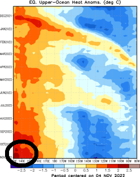
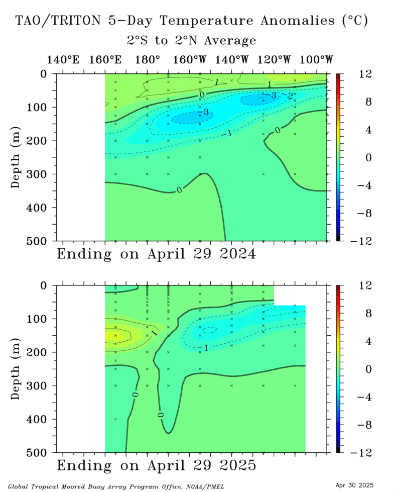
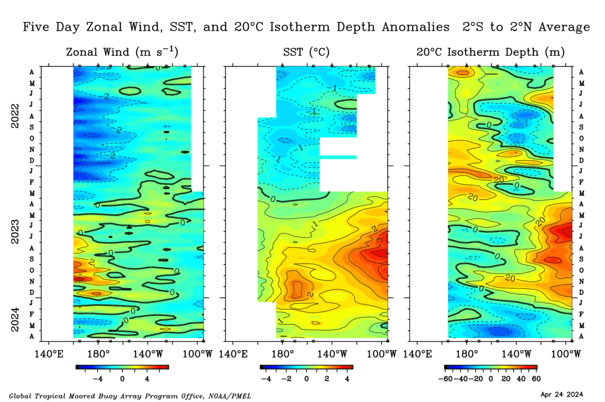
3rd time we hit +4c bubble probably coming up in western subsurface... I think this actually increased chances for 4th year La Nina, as the +wave will happen before ENSO turns about in March. This is what happened last year (I found no +correlation between Xwest-Yeast -1 year). My analogs were showing ~+1.0c mean in Nino 3.4 for the year, and it kept feeding back with record -PDO, long term -PNA, -PNA/-PDO continuum. If we depress all of the warm energy this Winter, it's anyone's guess what happens next year, although my analogs earlier in this thread showed a +1.0-1.5c mean average for next year's ENSO (cold pool extending down South America (+SOI*). Solar Min has been 2010.. solar min, 2011 on.. we might be over the peak ascending where it favored La Nina 2-3:1 over El Nino.
-
1000:1 activity on this board for storm vs no storm
-
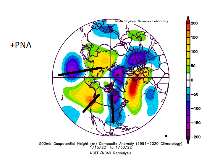
How do you guys like my analog for this upcoming Dec, minus -NAO (+PNA/La Nina)
-
2
-
 1
1
-
-
Again, I think this spells a big +PNA upcoming for December.
I say this over and over and over, and over over. Subsurface >>>> at N. Hemisphere pattern. It's like 0.90vs0.75.
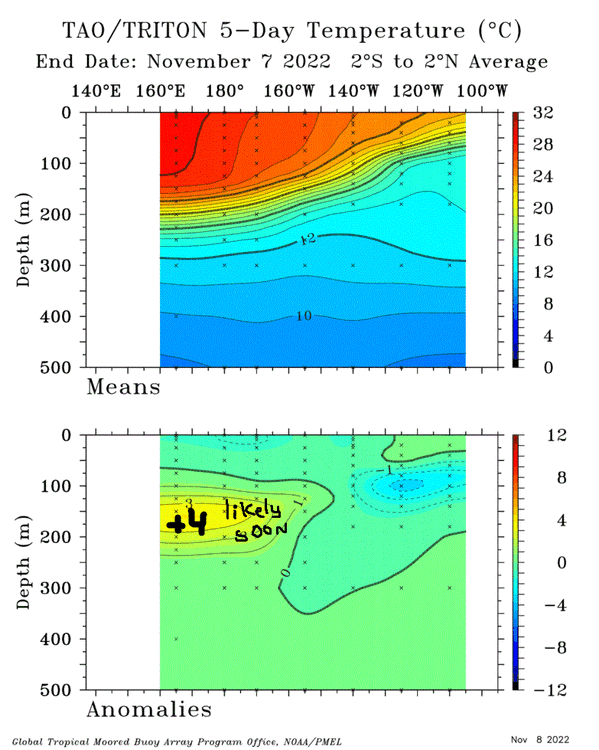
+4c is +7f
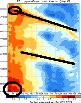
Let's see the warm water hit the central subsurface in mid-late Jan last year (+30-45 days)(MJO-theory)
Also in June
It's like 21/24 since theorized-in practice, and this is even against Mod La Nina(+PNA). The 3 that missed were something close by, like the NAO theory you already posted.
-
2 hours ago, stormtracker said:
Barely. My work(board of elections) is a bit busy today for some reason.
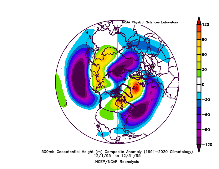
boo hoo we have '95 coming up as a good analog for Dec, possibly. +NAO looks weak on models holding, so it will be interesting.. Biggest difference between this year and '95 is the NAO.
-
1
-
-
On 11/3/2022 at 7:36 PM, raindancewx said:

How interesting! I have been wondering this as there are months in the Spring where a -NAO rises to a 0.4 to 0.5 +correlation in the Rockies and West. It always looks like the Pacific is doing something/driving here, but when you take this into consideration is better see what the primary factors are... again, -PNA/+EPO occurring now in the Pacific is fake. It's been like this every single time since April. No signs of La Nina in the N. Hemisphere Pacific, when you look closer into it.
-
This is what I have been saying the whole time. This is the pattern.
That we have a +NAO is better for snow right now. Fortunately, the NAO is more forecasted to be positive than negative for the Winter. The 10mb PV (+QBO) may negate this as a good factor though.
-
1
-
-
Carving out a real nice -EPO here.. NAO correlation is gone temporarily
.thumb.gif.dd466b74f3ef69d04b3564e5d8279d4e.gif)
-
EPO-NAO adjacent.

Correlation still continues... strong
-
Now EPO-not variation. changers will change. haters will hate.
-
North Atlantic low pressure for the foreseeable future


-
DCA +5 NYC +5 BOS +5 ORD +3.5 ATL+5 IAH +5 DEN +2 PHX +3 SEA +1
-
One day all these simple correlations will be blown out
-
Dead pattern anomalies time, EPO is kind of a spike back to normal, in that
+EPO flux
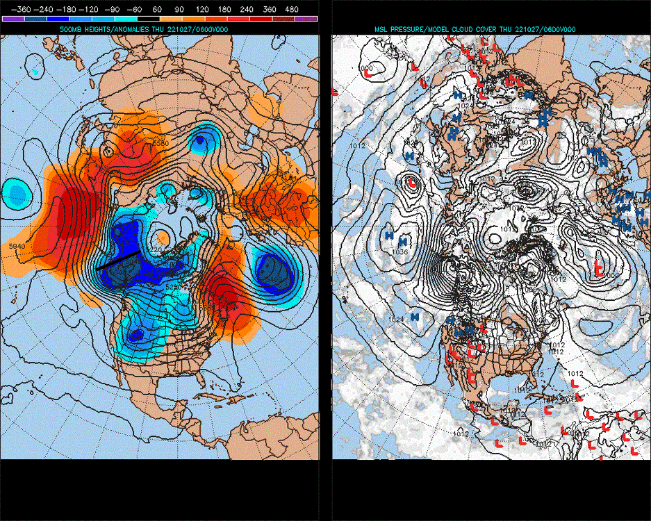
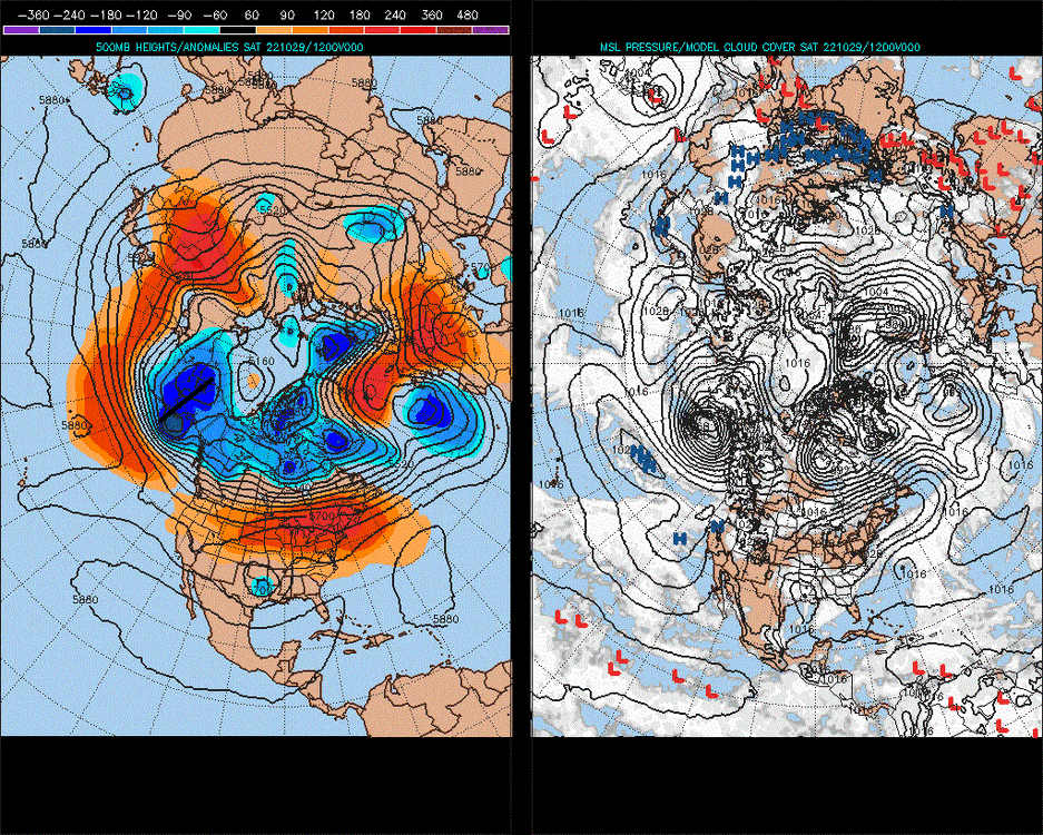
Reverses
EPO pattern anomaly variation
(4 model runs have shown this now.)
-
-
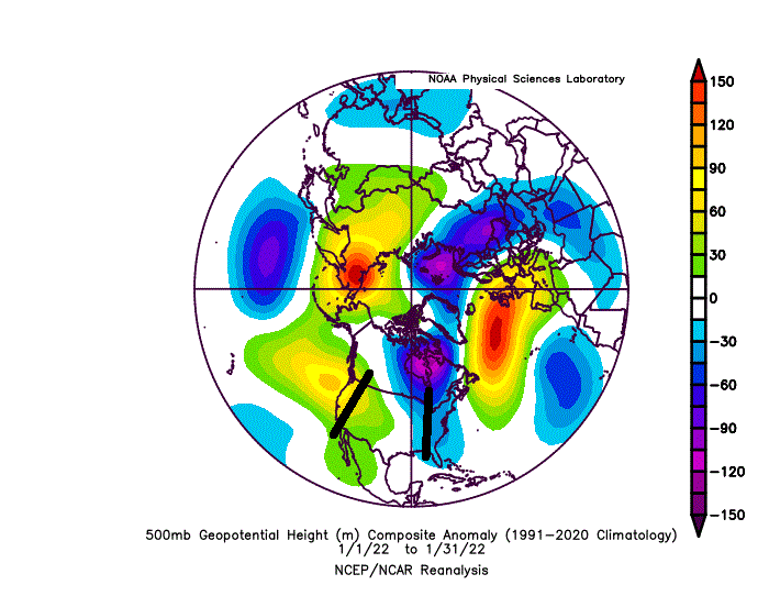
If the mods let me do a 3 post.. pattern not breaking. +PNA Dec means +NAO, probably (or we'll do 18/30 days +NAO kind of thing). -PNA Jan and -PNA Feb still holding. Higher chance for -NAO these months, but not high variation variable. NAO, can one of these days bloster to +900dm anomaly, although maybe not in our lifetimes.
-
Here comes your +PNA December
-
2
-
-
ENSO is nothing to sneeze at.
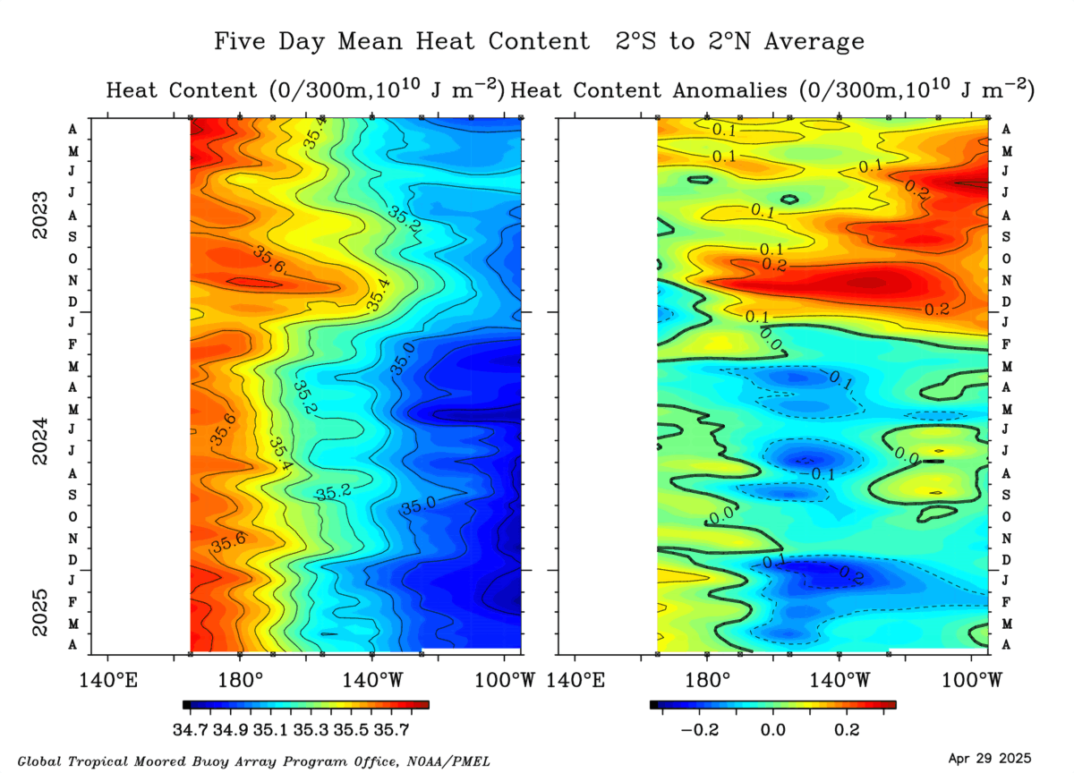
Some really warm water under the western subsurface redeveloping


.gif.c3e30a318953597b513f5d8c168a6b75.gif)

.gif.21919ef9565a55b79248215dd89b72b4.gif)
2021-2022 ENSO
in Weather Forecasting and Discussion
Posted
I mean the last 2 strong -PNA's have had other factors as #1 drivers.
(^Maybe that's why I keep getting +NAO/+PNA for Dec)