

HillsdaleMIWeather
-
Posts
3,836 -
Joined
-
Last visited
Content Type
Profiles
Blogs
Forums
American Weather
Media Demo
Store
Gallery
Everything posted by HillsdaleMIWeather
-
It's slightly more juiced too, so makes up for the little shift a bit
-
Lets see what the 18Z GFS does in a few mins lmao
-
-
EPS is north of operational
-
18Z NAM starts in about 30 mins so we'll see if it's still going south
-
Euro is southeast but only very very slightly so, also the high in Canada is weaker which could maybe have it go back northwest a little in future runs?
-
GFS ensembles are honestly all over the place lol
-
.thumb.png.f73b1fd7f986cebd07da5b848907276e.png)
-
If the GEM And Euro end up being the north solutions after days of being the south one it's gonna be hilarious
-
.thumb.png.e377f948bb104825cbcde72cdd48e42b.png)
-
-
Looking like the NAM isn't really south, just a different orientation, even gets more snow into Illinois
-
The GEFS however only shifted like 25 miles compared to the massive operational run. Guess we'll see at 12Z
-
-
06Z Euro is a touch north with the overrunning snow but maybe like 20 miles south with the main storm. But also way more wet.
-
Running rn, will post when it's done
-
Ensembles look almost the same as 0Z
-
06Z GFS ensembles don't have as massive a difference as the operational
-
06Z GFS is shockingly different than the 0Z run
-
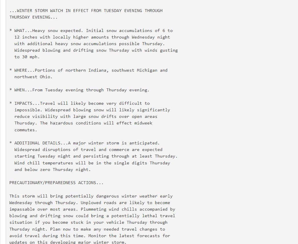
Blizzard Watches were killed off during the first round of hazard simplification, now they go from Winter Storm Watch to Blizzard Warning
-
IWX with a very scary worded watch

-
GRR winter storm watch issued, calling for 8-12 for now, DTX with a similar watch calling for 8-14 meanwhile the 06Z NAM is even more juiced
-
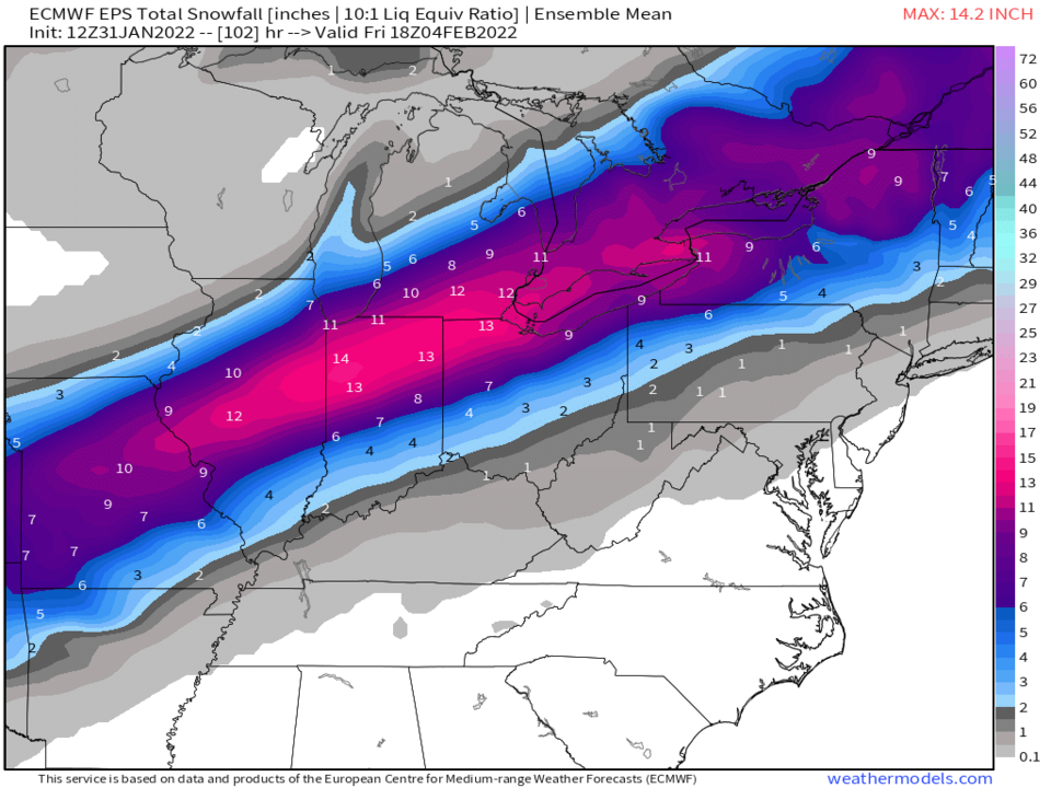
We're starting to get into the run to run noise for exact totals phase, gonna be interesting to see the ensembles though
-
Wetter than the 18Z run but not as crazy as the 12Z run
-
.thumb.png.2707aa39565d78c646085ec5cb1ceebe.png)


.png.b82df627118eb9649293d76217da5bcb.png)
.png.946c341c6b2b0e75be2a0f860093534b.png)

.png.d0386cecfbd0da68bdbcc014fa51c08d.png)