

WeatherHawk
-
Posts
718 -
Joined
-
Last visited
Content Type
Profiles
Blogs
Forums
American Weather
Media Demo
Store
Gallery
Posts posted by WeatherHawk
-
-
12 hours ago, mackerel_sky said:
Is this winter toast, in your opinion?
not toast...maybe a bagel or a doughnut...as we 'dough'...'know' how it will go from here
") But glad we cashed in December Mack
But glad we cashed in December Mack
-
Same here...bring in some snow or let's roll with an early spring...I've got so much yard work and still working on a 96' F350 and a 70 Ford 5000 tractor. IMO, we'll pick up about 2 from the coming event...higher elevations above 4000' will get more
-
 1
1
-
-
5 hours ago, Cheeznado said:
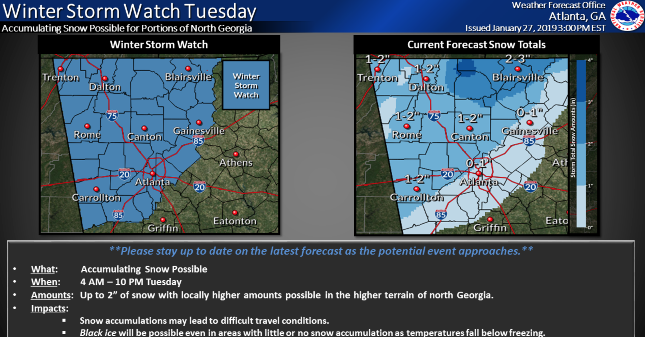
This NWS map seems reasonable. 15Z SREF and 12Z EPS are .5-1" for Atlanta. New NAM a bit over 1.

Nice to see some winter weather in my ol' TAG stomping grounds
-
On 1/21/2019 at 3:23 PM, Blue_Ridge_Escarpment said:
Can’t forget the ice first. Tomorrow night and Wednesday morning just east of the blue ridge
IMO we may see more IP/ZR with this one...I am not buying the change over to rain at 8am...also look likes some cold next week coming in Tuesday and Wednesday with another blast of cold
-
1
-
-
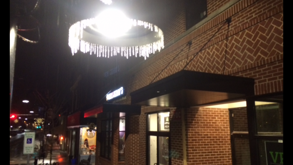
strong winds and light snow here on Rittle Knob...gonna be cold tonight folks...down to 3, with strong winds...can hear the wind rolling down the mountain
-
Tyler: Surprised that section was open...we used to park at Beacon Heights and cross country ski on the parkway...but don't tell the Rangers
-
2 minutes ago, tramadoc said:
If it happens, I will pay respect to you. LOL
.Liking hour 252 on the 18z for our area, but we hope it happens for our Eastern folks
-
2
-
-
Fine and light snow up here for the past few hours...elevated surfaces/metal, etcetera with a light dusting...but it's nice to watch and feel the flakes on your face.
-
Just now, TheVille said:
All freezing rain in statesville. Maybe a little sleet mixing in.
That's gonna be the story with this one...lots and lots of ZR...hope folks are prepared for power outages
-
Downtown Boone about an hour ago.
-
1
-
-
9 hours ago, Cheers for Western Ears said:
Care to post pics? Not seeing anything at my current location but I am quite a bit lower in elevation than you.
9 hours ago, Cheers for Western Ears said:Care to post pics? Not seeing anything at my current location but I am quite a bit lower in elevation than you.
-
1
-
 2
2
-
-
24 atm, thick dusting of snow overnight...IMO this is gonna be an icy mess, hopefully more sleet than ZR, be safe everyone and remember to get your milk and bread
-
2
-
-
29 and light snow falling here between Meat Camp and Todd
-
2
-
-
29 and light snow falling here between Meat Camp and Todd
-
10 hours ago, griteater said:
The EPS looks straight wretched in the mid & extended range with the Alaska/Gulf of Alaska/West Coast trough trifecta. That's about as bad as it gets out west.

In contrast, the GEFS develops a nice pattern in its extended range.

The GEPS is somewhere in between the 2, but closer to the GEFS
The MJO on the RMM plots has made steady progress the last 2 days and has finally reached the beginning of phase 6.

The dynamical model RMM plots bring the MJO into phase 7 in the next 5 days, then have varying long term MJO solutions. Given the current MJO amplitude, we should expect the MJO to continue on thru phases 6-7-8-1 over time, with the specifics around the timing to be determined.
The filtered VP portion of the MJO shows that the enhanced convection associated with the MJO has moved from the Maritime Continent out into the western Pacific over the past week (blues and purple).


Loop of those images shown here: http://www.atmos.albany.edu/student/ventrice/real_time/maps/mjo/global_analyses.html
The week 2 GFS forecast of MJO filtered VP shows the suppressed convection moving east and centered over the Maritime Continent, with the enhanced convection extending from the central & eastern Pacific to Africa. That's where we want to be from a tropical forcing standpoint to begin to see improving western ridging / eastern troughing solutions in the models.

The official SSWarming wind reversal is occurring today. The extent to which it propagates down into the troposphere to affect our weather remains to be seen. It this one does propagate downward, it looks like it's going to take some time - at least a few weeks.
I think there is good reason to remain optimistic about wintry weather returning in the 2nd half of Jan into Feb, but until we see good ensemble runs showing consistently, it's all speculation.
I did find it kind of funny that the very last image of yesterday's Euro Weeklies for Feb 9-14 was the best image of the run, as if the model is just wanting to tease us


Thanks for this info, we appreciate it, and I agree with you...last half of January into Feb, will be most favorable. A local up here in Boone, told me that Ol' Man Winter is out sharpening his axe!
-
1
-
-
2 minutes ago, WeatherHawk said:
Merry Christmas ladies and gentlemen...old snow laying around and lots of ice yesterday morning and a few flurries...wish you all the best for an awesome new year!
Off topic...but had a good time today in Blowing Rock with my girls. Sad, my wife had to be at the ER working

-
6
-
-
2 hours ago, Sw NC weather said:
Merry Christmas guys. Hope everyone’s had a blessed day.
On a side note both GFS throw us some New Year’s Day snow!
Merry Christmas ladies and gentlemen...old snow laying around and lots of ice yesterday morning and a few flurries...wish you all the best for an awesome new year!
-
1
-
-
1 hour ago, SENC said:
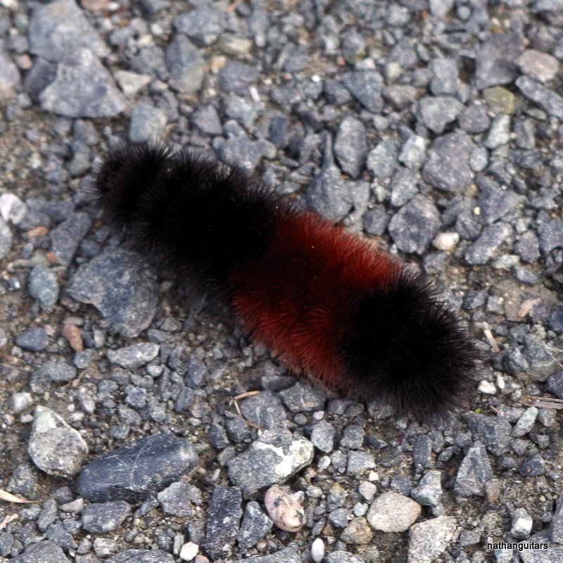
examples.. On the "extremes".. What have you got @LithiaWx??
Cold as a Witches...… T**Ts ,, First picture
Or.. Secondly..
second Warm winter.. And Bikinis
")


All I have observed up here have been solid black to little or no brown, like the first photo.
-
1
-
-
On 12/23/2018 at 1:00 PM, SENC said:
….
"Drawing on my fine command of language, I said nothing." Mark Twain
-
 3
3
-
-
1 hour ago, AsheCounty48 said:
Well it's kinda boring in Boone tbh. I dont believe its actually below freezing yet so no snow on the roads.
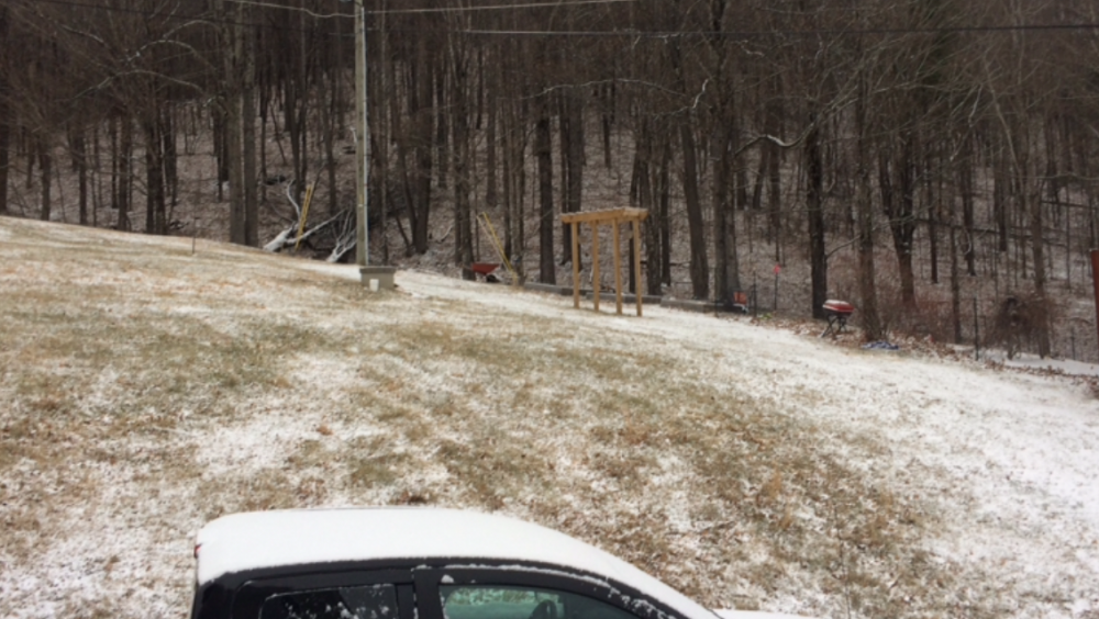
We are at just a bit above 3600' and it's snowing and everything is covered ATM...Our dirt road is covered as well. Not sure how it is going down the hill in Boone.
-
About 2" here on the grass and elevated places and about 1" on the dirt road here and the snow is falling good...
-
Wind is ripping here in Todd...and lots of snow, but not much accumulation ATM...it's blustery
-
On 12/18/2018 at 11:20 PM, The Alchemist said:
Off topic again... but wanted to thank you guys, Just home now from Bristol speedway, and a grand time was had by all, my daughter was terrorizing everyone in the Christmas village with her deft wheelchair antics!!! Also, Funnel cakes and hot chocolate were involved, would have been worth it at twice the price!!! Interesting though, we've got more fallen snow on the ground here in Saluda than anywhere along the way up there...
Love this post...our main goal in this life is to help people...because we never know when the 'shoe' will switch. I hope that this AMWX site will contribute to our society, where we can help each other via forecasting, communication, and genuine care for each other, no matter what's happening IMBY
-
1
-
-
15 hours ago, Met1985 said:
Interesting. No wind here at all. A pretty cold morning also with a current temp of 28 degrees.
Yeah, we're about 100 miles NE of you and those winds were ripping last night when I made that post. It's clear and cold here tonight with some icy patches freezing from the melting.
-
1
-


Post Arctic front snow Tuesday, Jan 29
in Southeastern States
Posted
Should someone start an obs. thread?...or not?