

Metasequoia
-
Posts
660 -
Joined
-
Last visited
Content Type
Profiles
Blogs
Forums
American Weather
Media Demo
Store
Gallery
Posts posted by Metasequoia
-
-
About 4 inches in Battery Park City. Best snow of the season. Finally a snow with temps below freezing.
-
 5
5
-
-
Sidewalks in Battery Park City are starting to get covered. Some sidestreets are getting slushy. Whatever grass we have is covered... maybe a couple inches.
-
1
-
-
32 minutes ago, BxEngine said:
Its definitely amusing seeing some ppl who whined about it being too far north yesterday and “no one lives up north” now celebrating, gotta admit.
And if this storm trends northward overnight and shafts the metro, they'll be rejoicing... and good for them.
Importantly though, the vast majority of us would rather have a storm that buries everyone.
-
I think a large portion of this subforum will jackpot on this storm...didn't think this yesterday even. Poor NE forum folks are taking baths while making toast.
-
1
-
 1
1
-
-
1 minute ago, MJO812 said:
Gfs is south
Not sure what ratios make sense at this point.
-
1
-
-
Just now, SnowGoose69 said:
When you consider the fact the SREF is too far NW like 90% of the time thats scary
Scary good, yeah?
-
2
-
-
1 minute ago, HVSnowLover said:
Seems they expect it to bump back north a little tomorrow and the gradient to be around I287 as opposed to the models pulling it down to I80 today. Unfortunately they may be right
I think they are waiting to see what the 0Z model runs show.
-
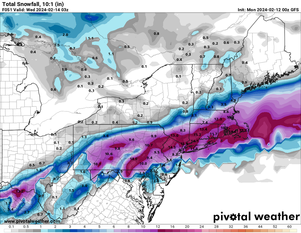
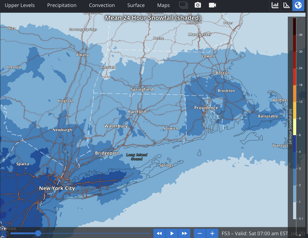
3 minutes ago, Northof78 said:
Thats not QPF, that's accumulation of snow map
It's the resulting depth of water if accumulated snow is melted. That's a lot of snow... if it actually did accumulate. Am I wrong?
-
1
-
-
5 minutes ago, mitchnick said:
Fyp. 18z Ggem.
.gif.7e7649367d020a89f63cf88ed121a992.gif)
That's an inch plus of qpf for NYC metro, LI, and north. That would add up.
-
1
-
-
At this point, cityfolk and LI peeps should hopefully have their expectations in check. Could the modest south trend continue and make Tuesday fun (not that fun though)? Sure. It could go the other way too. I don't think either direction is likely at this point.
-
1
-
-
TWT has always been about grabbing eyeballs, as one would expect from a company, for good or bad. Less so about their actual forecasts.
-
2
-
-
2 minutes ago, LibertyBell said:
omg just now on the air they said it is passing right over the benchmark and will be a big snowstorm for the I-95 corridor. Despite whatever their maps show this is what they have been saying for days now with their mouths.
Weird... Their forecast for NYC is 1 to 3 inches.
-
What percent of this forum lives in the City or on Long Island? I think it must be a significant majority. So, that's why the focus is on the City and the coast... Also, I suspect most people in the City rarely leave the boroughs, so the north isn't on their minds. I never go north of the UWS...born in Schenectady though.
Plus many people in this forum predominantly pay attention to their backyard (northern folks) or front stoop (MJO). Many Cityfolk want northern folk to get crushed by snow, but care more about the City. Seems reasonable to me. At least the north doesn't get screwed over so much by latitude, warm water, and concrete... take the win even of this forum doesn't focus on it as much.
Also, I agree, people in this forum should consider moving 20 miles north instead of to SNE. Makes more sense.
-
1
-
 1
1
-
-
7 minutes ago, MJO812 said:
In Nam we trust
It's shifted north for each of the last four runs. Only room for a couple more ticks north until it's mood flakes for the City.
-
1
-
-
We haven't been NAMed yet...
-
Will be interesting to see what the 12Z Euro EPS looks like. I suspect this might bring people back from the ledges... for good or bad.
-
7 minutes ago, MJO812 said:
It's amazing how this north trend happens all the time after people ( yes myself also ) gets excited about model runs over 120 hours showing good stuff.
Seems like now would have been a good time to start tracking. A few days out, still lots of variability amongst models, but general agreement on some basics such as timing, duration, etc.
-
2 hours ago, MJO812 said:


-
-
12 minutes ago, SnowGoose69 said:
I said my main concern for sure is 700mb is not that cold and system is fast so it really needs to be dynamically induced or you'd probably be less snowy than even the Op GFS snow maps depicted
Remind me, you like to see 700mb at least at -10?
-
1
-
-
The biggest red flag (for those in the city and south) is that the freezing line is north of the city for most of the models.
-
Differences between 6Z and 12Z GFS runs aren't that much and could be model noise four days out. Bigger change is at 500 mb which doesn't look worse to my untrained eyes.
-
2
-
-
7 minutes ago, nycsnow said:
Gfs following suite not even 2 inches for nyc area
Any mets want to weigh-in on what weather models should be used to forecast inverted troughs 24 hours before start time?
-
Refresher snow & obs between ~midnight and Noon Sat Feb 17 2024
in New York City Metro
Posted