Rd9108
-
Posts
3,862 -
Joined
-
Last visited
Content Type
Profiles
Blogs
Forums
American Weather
Media Demo
Store
Gallery
Everything posted by Rd9108
-
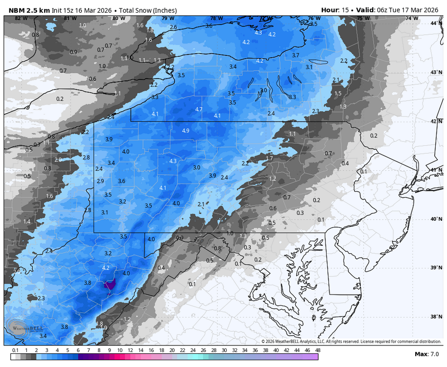
And still somehow got a 7 inch snow storm as well
-
Did you guys get any accumulation? Im in Florida its 80 here....
-

Pittsburgh/Western PA WINTER ‘25/‘26
Rd9108 replied to Burghblizz's topic in Upstate New York/Pennsylvania
Not great boys. Just upgraded to Enhanced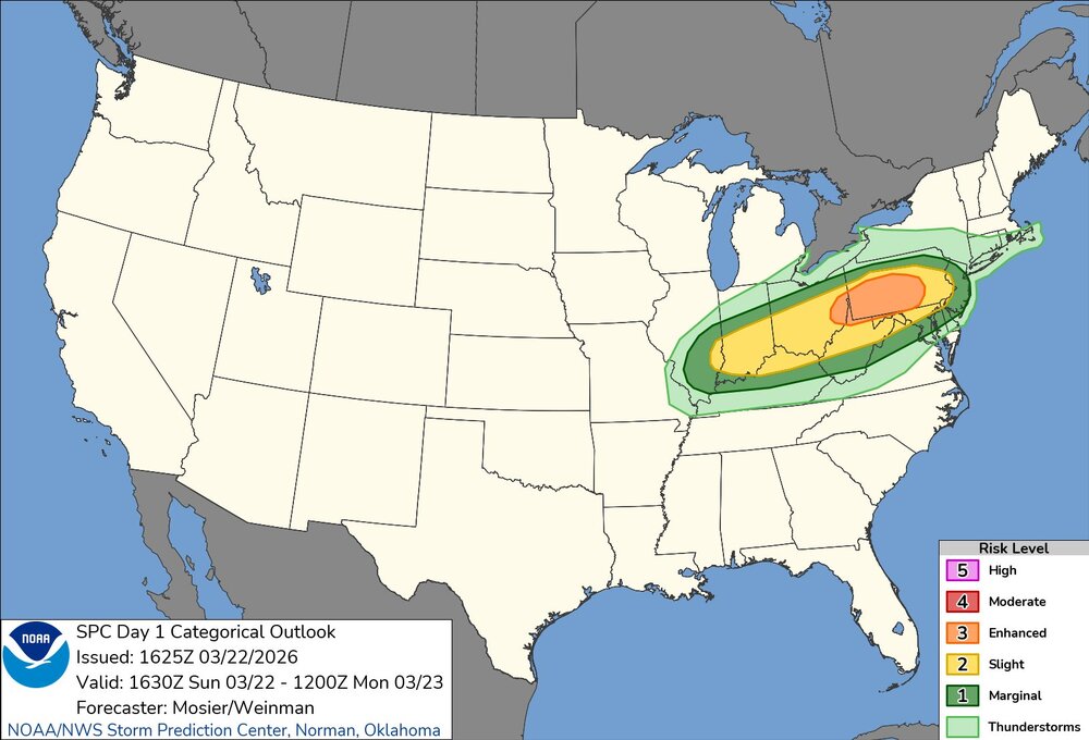
-
Pittsburgh/Western PA WINTER ‘25/‘26
Rd9108 replied to Burghblizz's topic in Upstate New York/Pennsylvania
Appears we have a chance at hail tomorrow with a strong signal for developing supercells. -
Pittsburgh/Western PA WINTER ‘25/‘26
Rd9108 replied to Burghblizz's topic in Upstate New York/Pennsylvania
Just in time for opening day!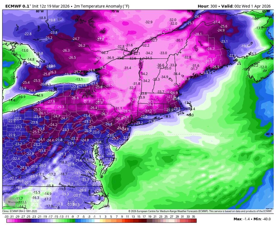
-
Pittsburgh/Western PA WINTER ‘25/‘26
Rd9108 replied to Burghblizz's topic in Upstate New York/Pennsylvania
Drove through a squall earlier on 279 and it was a white out. -
Pittsburgh/Western PA WINTER ‘25/‘26
Rd9108 replied to Burghblizz's topic in Upstate New York/Pennsylvania
It wasnt even that much snow to shovel. Just straight ice -
Pittsburgh/Western PA WINTER ‘25/‘26
Rd9108 replied to Burghblizz's topic in Upstate New York/Pennsylvania
Would be pretty wild to get warning criteria out of a set up like this. Kind of reminds me of the fronts a few years ago in December that overperform. -
Pittsburgh/Western PA WINTER ‘25/‘26
Rd9108 replied to Burghblizz's topic in Upstate New York/Pennsylvania
We might hit warning criteria at this rate. -
Pittsburgh/Western PA WINTER ‘25/‘26
Rd9108 replied to Burghblizz's topic in Upstate New York/Pennsylvania
Funny how it doesnt take long before the pavement and roads cave. It was just like 80 a week ago. -
Pittsburgh/Western PA WINTER ‘25/‘26
Rd9108 replied to Burghblizz's topic in Upstate New York/Pennsylvania
Nws mentioned up to 1.5 inches per hour rates. Shaping up to a be surprise event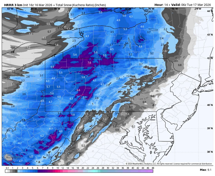
-
Pittsburgh/Western PA WINTER ‘25/‘26
Rd9108 replied to Burghblizz's topic in Upstate New York/Pennsylvania
It will be nice to see snowfall again. If its gonna be cold might as well snow -
Pittsburgh/Western PA WINTER ‘25/‘26
Rd9108 replied to Burghblizz's topic in Upstate New York/Pennsylvania
Looks like we might get a repeat of what the east coast dealt with last week with their frontal snow. I think it was mostly in the 2-3 range. -
Pittsburgh/Western PA WINTER ‘25/‘26
Rd9108 replied to Burghblizz's topic in Upstate New York/Pennsylvania
This is the third time this year my power has gown out. Im getting sick of this. -
Pittsburgh/Western PA WINTER ‘25/‘26
Rd9108 replied to Burghblizz's topic in Upstate New York/Pennsylvania
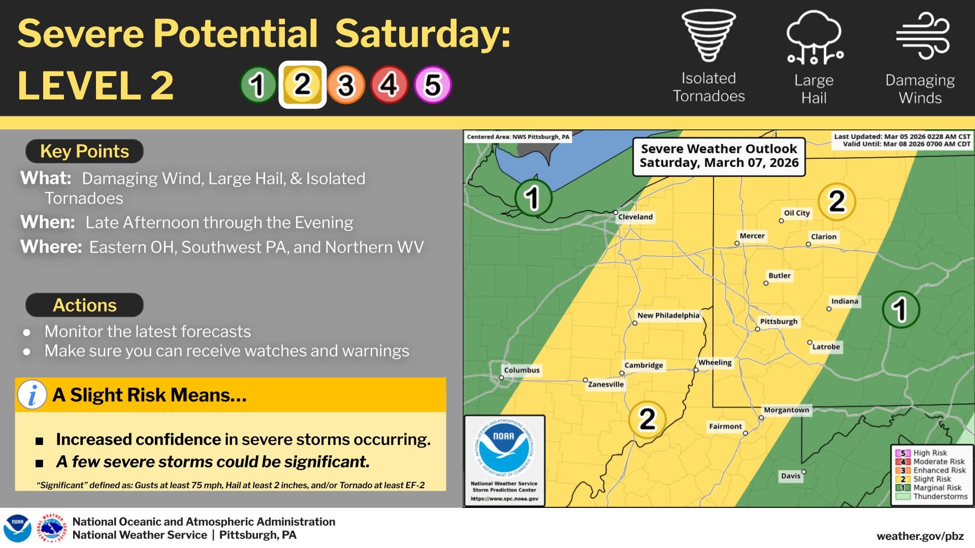
Another day of level 2 severe tomorrow
-
Pittsburgh/Western PA WINTER ‘25/‘26
Rd9108 replied to Burghblizz's topic in Upstate New York/Pennsylvania
Im golfing tomorrow so im definitely on team spring but it definitely looks like we will see a return to possibly more seasonable/wintry weather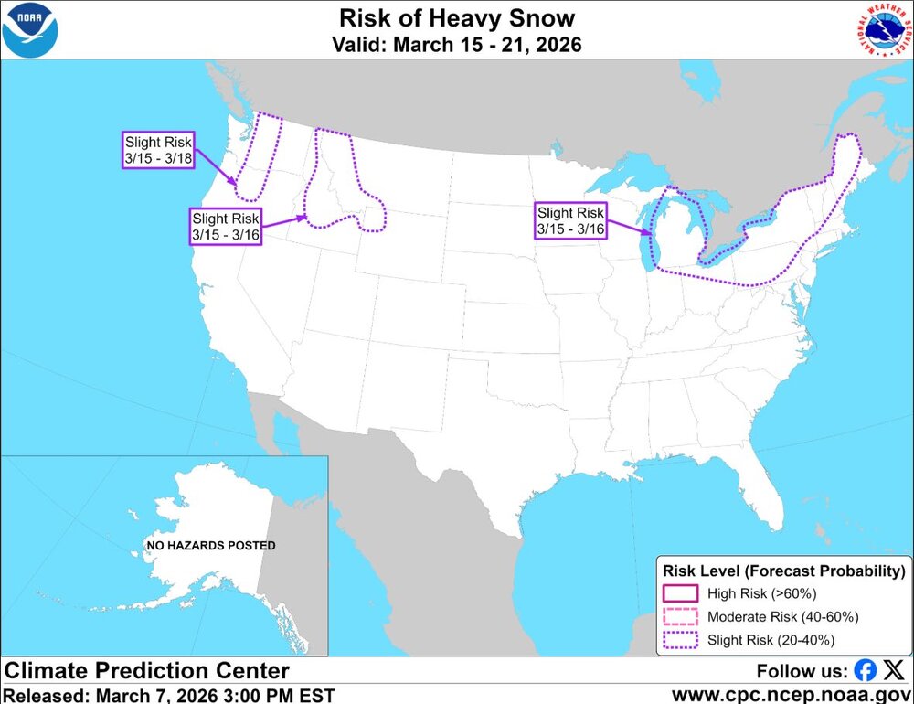
-
Pittsburgh/Western PA WINTER ‘25/‘26
Rd9108 replied to Burghblizz's topic in Upstate New York/Pennsylvania
the potential is there and thats all it is.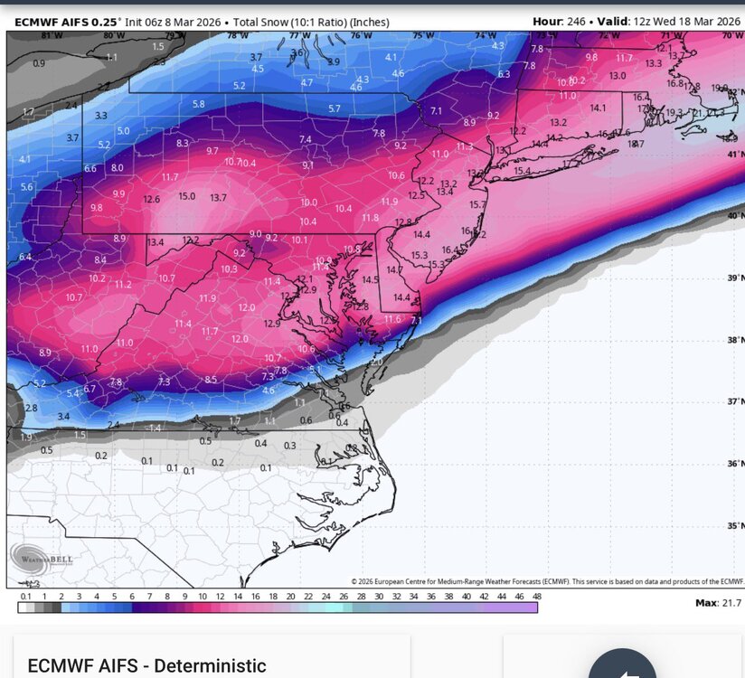
-
Pittsburgh/Western PA WINTER ‘25/‘26
Rd9108 replied to Burghblizz's topic in Upstate New York/Pennsylvania

-
Pittsburgh/Western PA WINTER ‘25/‘26
Rd9108 replied to Burghblizz's topic in Upstate New York/Pennsylvania
Its hot and sunny out -
Pittsburgh/Western PA WINTER ‘25/‘26
Rd9108 replied to Burghblizz's topic in Upstate New York/Pennsylvania
Im going down to Florida March 23rd so as long as its warm there idc what it is here. I agree though once we get to the end of March Im over snow. Although ill cheer on a heavy thump if it happens -
Pittsburgh/Western PA WINTER ‘25/‘26
Rd9108 replied to Burghblizz's topic in Upstate New York/Pennsylvania
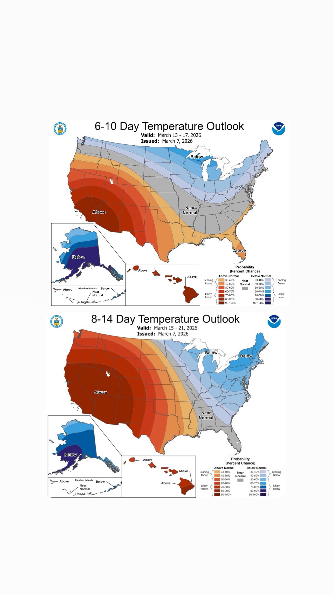
Euro is showing some impressive temps for March. See if this signal continues into next week. Still 10 days away. -
Pittsburgh/Western PA WINTER ‘25/‘26
Rd9108 replied to Burghblizz's topic in Upstate New York/Pennsylvania
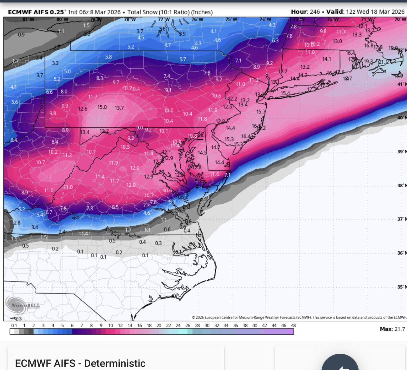
Btw who remembers this storm. Happened in mid March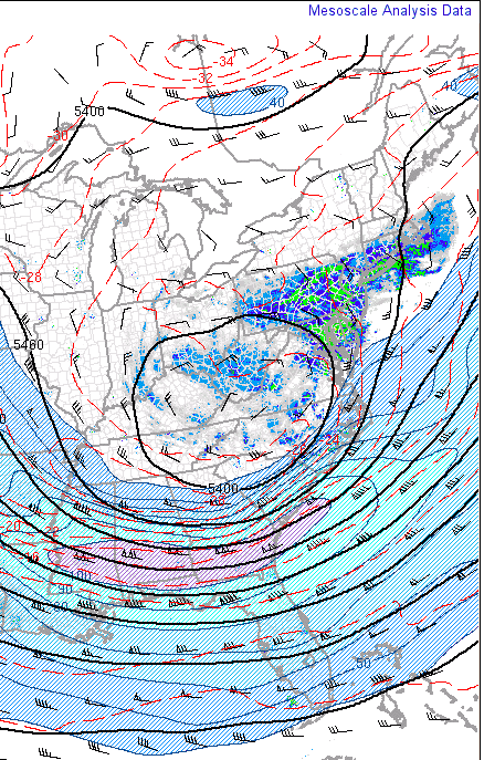
-
Pittsburgh/Western PA WINTER ‘25/‘26
Rd9108 replied to Burghblizz's topic in Upstate New York/Pennsylvania
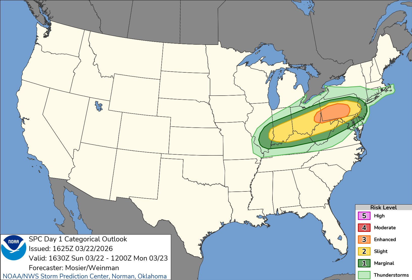
Before we deal with winter weather again possibly we have some severe weather to deal with.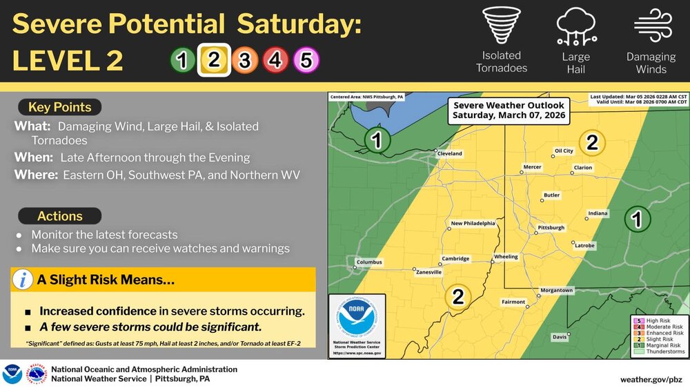
-
Pittsburgh/Western PA WINTER ‘25/‘26
Rd9108 replied to Burghblizz's topic in Upstate New York/Pennsylvania
It can still snow in May here. I get that ot doesnt stick around though. -
Pittsburgh/Western PA WINTER ‘25/‘26
Rd9108 replied to Burghblizz's topic in Upstate New York/Pennsylvania
We shouldn't be taking model runs that are 10 days out seriously. EPS shows cold weather returning and the GEFS isnt nearly as torchy as the OP