

Local Yokel Wx
-
Posts
735 -
Joined
-
Last visited
Content Type
Profiles
Blogs
Forums
American Weather
Media Demo
Store
Gallery
Posts posted by Local Yokel Wx
-
-
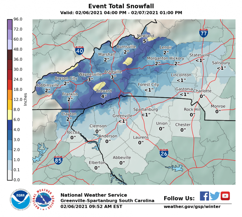
GSP inching down ever so slightly from the 3am call map. This is the 10am update.
-
1 hour ago, Maggie Ace said:
24 for my morning low with heavy frost. Good luck folks! Hopefully this quick hitting storm brings everyone that has been missing out enough snow to cover your yards. Cataloochee may get that 100 inch base overnight!
Even though those newer guns were installed years ago, it still amazes me how fast they can go from zero to a skiable base (12 - 18") in under 24 hours. Tammy told me one season they had a 500k energy bill in just one month! That was before their guns and lines were upgraded.
-
 2
2
-
-
10 hours ago, franklin NCwx said:
Over 100 a year ago. Highlands had around 125 one year.
Highlands broke their annual rainfall record this past year at 136.50", only 3.45" shy of the state record at Mt Mitchell in 2018 (139.94").
2018 - 125.46"
2019 - 111.78"
2020 - 136.50"Some folks have high snow totals, we have high/extreme rain totals.
-
5
-
 1
1
-
-
As with most events we talk a lot about populated areas (because its where we live) but who wants to throw down where you think the highest totals will be (factor in backend NW flow snow)?
I'm liking the southern end of the Great Balsams but also could see Mt LeConte push past everyone with their last minute light accumulations Sunday morning.
-
3
-
-
1 hour ago, Maggie Ace said:
Black ice on the driveway made for an interesting walk with down the hill with the Lab this morning. Looks like a couple of inches fell overnight above 4500 ft.
Cat is reporting 2" overnight into this morning.
-
2
-
-
Got my inch I was hoping for, ended up with a storm total of 1.75" and although its still snowing, its so wind whipped and small in size i doubt we add much more.
Cat has a running storm total of 6"
- 2" Sun PM - Mon AM
- 4" Mon PM - Tues AM
- Still light - moderate snow up there, maybe another 0.5 - 1" before its all said and done.
-
1
-
10 minutes ago, Sw NC weather said:
Looks to be 2” or so with fine flakes still coming down at a good clip.
Very nice SW NC Weather! Where about in Franklin? valley floor, further west along the divide?
-
1
-
-
Half inch just outside of Waynesville (8pm). This on top of the dusting this morning that melted.
Was thinking an inch or two was possible but now I'm just hoping for an inch.
-
2
-
-
We picked up a dusting this morning in Waynesville near town. Still think 1 - 2" is likely by tomorrow morning for central Haywood.
Next week's cold on the models already has me making plans for backup heat and double checking my seals in the crawlspace and exterior.
-
4
-
-
6 minutes ago, Phelps said:
4-5 inches of snow then .25”(?) of rain, and now it’s in the teens. Things are crunchy up here this morning.
If we’re going to get to Ray’s 5-10 it better start snowing harder soon
")
It's coming. WV imagery is showing the pivot occurring now.
With such high ratios, cold temps, and no problem with ground temps, it'll collect quickly.
-
1
-
1
-
-
1.5" at Camp Daniel Boone at 4pm when we left the Art Loeb/Cold Mountain Trailhead.
A half inch at the house here outside of Waynesville.
-
7
-
-
Gonna make a run into the Shining Rock Wilderness this afternoon to catch the early round snow.
-
4
-
-
1" here just off Racoon Rd in Waynesville (looking at the Mtn Research Station).
-
4
-
-
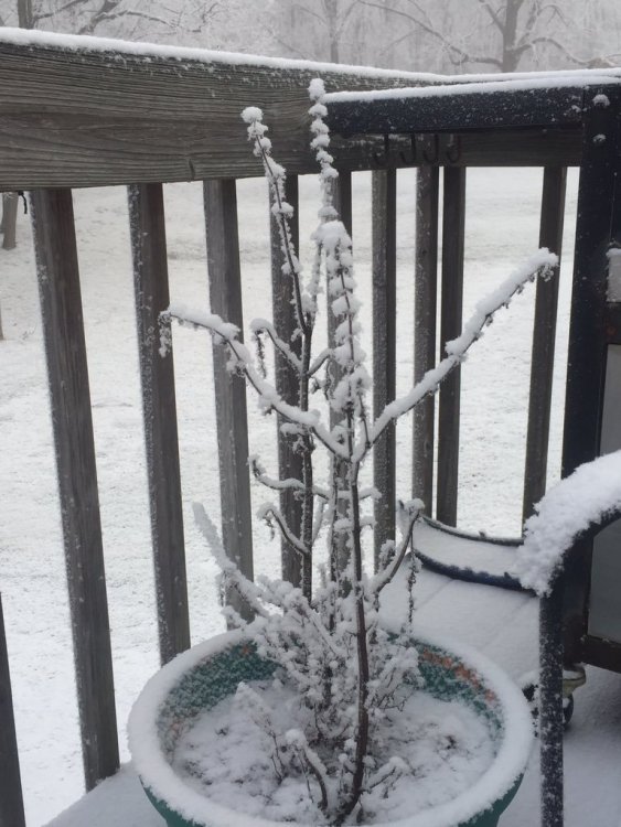
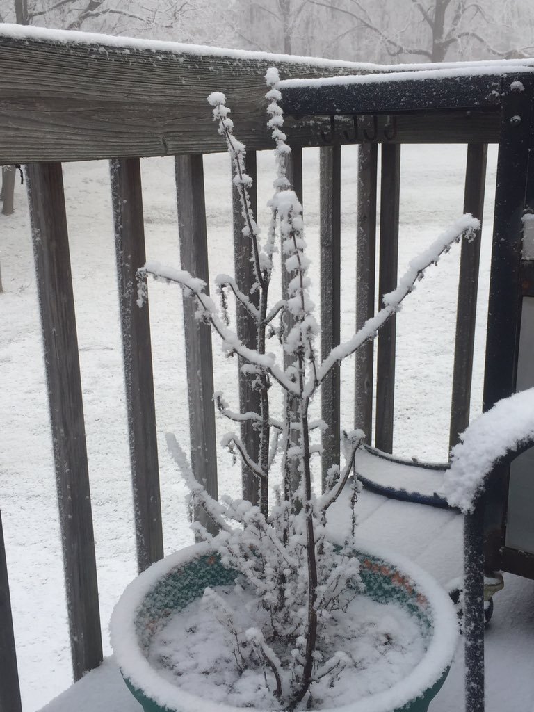
Nice snow globe action this morning in Waynesville, not sticking but pretty. Only trace amounts grass, deck, and cars
@WxKnurd, my buddy up Chad Crawford sent me some pics. Solid dusting up to a half inch he said (around 9:45am).
-
2
-
-
Wx Twitter this morning has been fun to follow. Someone out of Canton inside the city limits posted this pic.
@Met1985, this is likely the evergreen plant providing just enough moisture to create a heavy diamond dust or light snow event for this person's yard (Evan Fisher's theory and I think it sticks). Diamond dust was falling in downtown Asheville as well.
-
4
-
-
21 minutes ago, Met1985 said:
and how warm was the hemlock branch sir
We need a full accounting and from here out, all "ground temp" debates move to tree limb (type) temp debates
-
 4
4
-
-
1" in Cashiers as of 1:25pm
-
2
-
-
1.25" atop Pressley Creek in Jackson Co up just below Cullowhee Mtn (3400') at 1:15pm
-
3
-
-
Trace snow amounts at my house in Waynesville. Nice puffy flakes.
Moderate sleet was coming down around 815am around HCC into Canton
-
2
-
-
A round up from here, social media, and NWS...
Below Mt Lynn Lowry/Eaglenest Ridge? - 6"
Maggie Valley - 4.5"
Balsam - 4"
Yellow Mtn - 4"
Lake Toxaway - 4"
Waynesville - 2.5"
Highlands - 2"
Brevard - 2"
Cullowhee Mtn - 2"
Scotts Creek - 2"
Sapphire Valley - 2"
Tuckasegee - 1.5"
WCU & Whittier - 0.5"
Franklin - Dusting-
5
-
-
Sipping on coffee and ignoring the news. Moderate rates and fat flakes.
This is perfect.
.thumb.jpg.3399693bb5a744a905fece43cb87449b.jpg)
-
6
-
-
11 minutes ago, franklin NCwx said:
Lol...try living in the southern mtns. 100 inches a year seems the norm now
The past three years have been extremely wet. North of 110" for Highlands each year 2018 - 2020
-
3
-
-
2" down here in Waynesville, less than a tenth of a mile from the Mountain Research station
-
1
-
-
2 minutes ago, BretWx said:
A lot of places still sitting in the low 30s. 31 at the house.
Posting a lot today. Let me know when to shut up

As long as the boss doesn't notice your not working, no issue here.

-
2
-

.jpg.aba7152079bfaff87074ddc762b01330.jpg)
2020/2021 Fall/Winter Mountain thread
in Southeastern States
Posted
Much better spot than the last few rounds.
I forget, what is your elevation and how far south down 276 are you (no need to be specific, landmarks are fine)?