

dilly84
-
Posts
4,041 -
Joined
-
Last visited
Content Type
Profiles
Blogs
Forums
American Weather
Media Demo
Store
Gallery
Posts posted by dilly84
-
-
NAM is still a snoozefest.
-
After seeing the 18z NAM(yes I know it's 18z), I agree that it may be time to stick a fork in this piece of crap.
-
 1
1
-
-
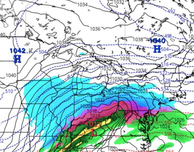
I mean, if the kuchera map is accurate, I'll take it.

-
1
-
-
Just now, HighTechEE said:
18z GFS & NAM just a bit east of 00Z for Ohio peeps!
Assume you meant 6z. Weaker system overall, but a tad more snow for ohio. These 12z runs will be interesting today I have a feeling.
-
GFS looks a bit further south and east. Bit weaker, but think we have to have it a tad weaker to get better snows here.
-
1 hour ago, Steve said:
Not saying this will happen… but there is still hope..
What's swc?
-
Not even on the NAM or any short range models yet and half the group sounds like Grinches. Lord.
-
2
-
-
I personally like where I'm sitting. Outside of the ICON, 12z runs all gave me at least 5" of snow, which I'd gladly take 2 days before Christmas.
-
 1
1
-
-
52 minutes ago, NEOH said:
Long shot unfortunately. If today's 12z runs stay well west we are likely done.
Definitely not done. Even the worst model still gives me 5" of snow. Except the ICON it's been bad from the beginning. That said I wouldn't trust any single run until tomorrow night.
-
15 minutes ago, NEOH said:
Tough model trends for those of us in Ohio. Everyone's favorite met LC thinks this goes south and east...

There are two influencing factors that most of the numerical forecast models are missing. That would be the strong Baffin Island ridging and the energy-laden subtropical jet stream. The lower latitude feature is a boundary that a developing low pressure could realign with. And the Rex signature that is drifting westward from the mouth of the Davis Strait blocks the "into Quebec" route that predictive guidance is suggesting. Plain and simple, it makes sense to go with the scheme that shows a farther south and east track.
Well let's hope he's right.
-
Come on guys, let's be optimistic. We are due a whopper.
-
1
-
1
-
-
8 hours ago, buckeye said:
3 week scheduled maintenance bump
Steve didn't make a new one this year and is MIA. Must've had enough lol. At any rate, 2 systems showing up for the 22nd and 24th. Still way out but nice to dream.
-
On 2/20/2022 at 2:34 PM, buckeye said:
if a 1011 low in south central KY with a fresh 1040 banana high sprawled out north of us can still warm tongue us, we might as well give up.
It's ohio. It can be 15° and warm tongue us. This one is gonna hopefully end up being mostly sleet instead if freezing rain, but I have a feeling we're gonna see significant zr.
-
28 minutes ago, CoachLB said:
Fair chance for at least a glaze for me.
There's one model showing an inch for me and 2 others showing half inch.
-
Starting to wonder if I don't need to worry about freezing rain here. Many models showing some significant zr.
-
11 hours ago, chuckster2012 said:
Nope. Another stinking Lakes cutter.. Zzzzzzzzz.....
Still have nearly a week. 5 days of models. Gfs moved a good ways se from the 0z run last night.
-
I'd say excluding the off chance the storm next week shifts se significantly, or a clipper, stick a fork in this winter, it's done.
-
1 hour ago, vespasian70 said:
It's not too bad. We got about 3 or 4 inches of sleet with a couple of inches of snow on top. Probably will stick around longer than snow.

And if we get a robust clipper or two over the next week or so then we have at shot at matching this storm's totals for us. lol
That's good then my snow and sleet call was really close for even you guys.
-
1 hour ago, buckeye said:
Nice pics. I'll be kind and not bump those first few posts from you and pondo yesterday morning
So now it's time for the post tracking blues made worse by an extended that has nothing but cold and dry for the next 10 days. I hear JB says winter dies in 3 weeks. If he's saying it, it's probably a good bet since he never forecasts winter's end this early. I'm ok with that, AS LONG AS WE GO ABOVE NORMAL TEMPS. CAD in late Feb into spring is miserable.
It was really bad for newark, which is right below me. I got lucky. For many, what was supposed to be a good snow, wasn't. I, however, cant complain. I probably got 8 or 9" from it
-
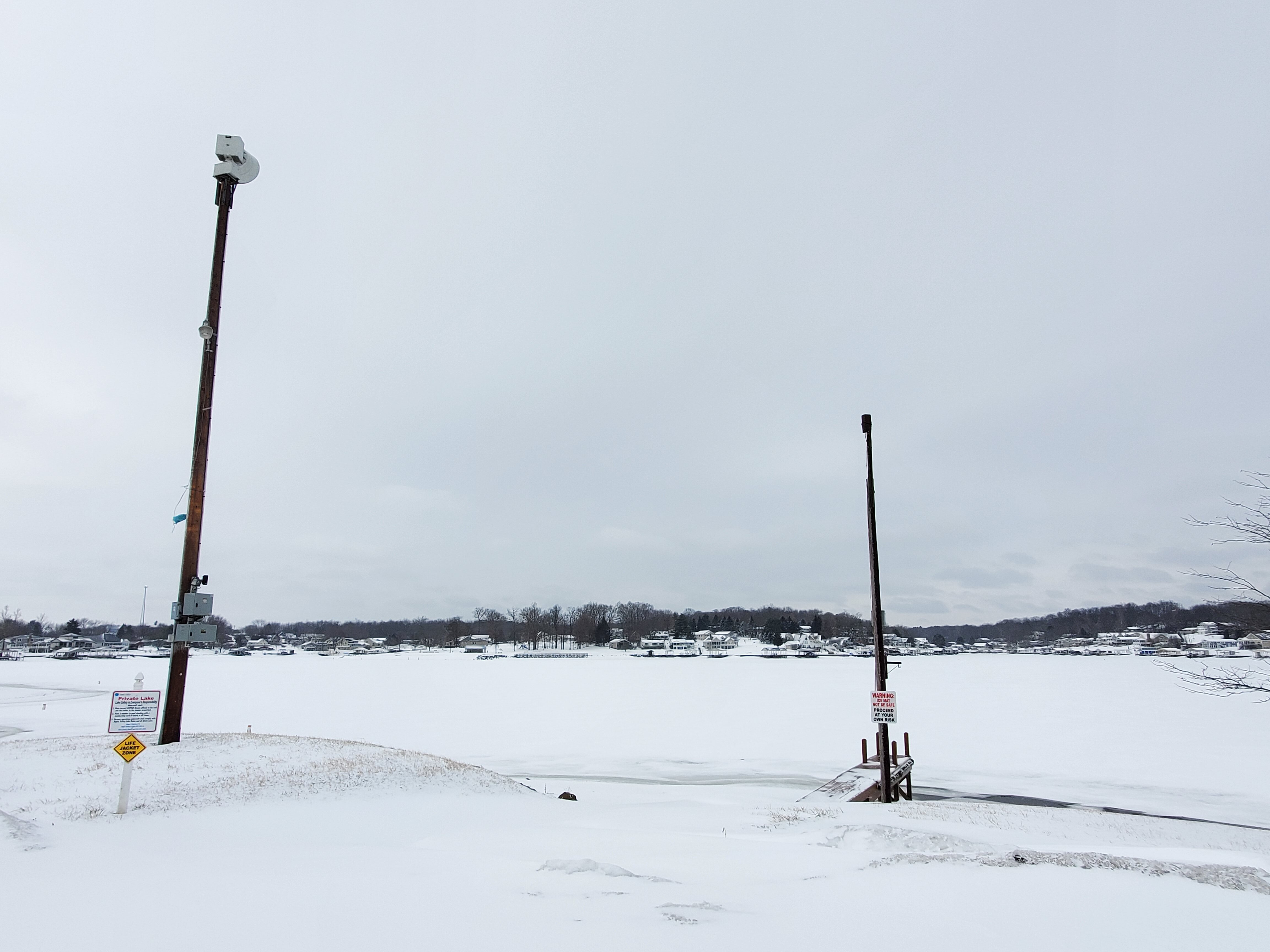
Apple Valley Lake frozen over and snow covered
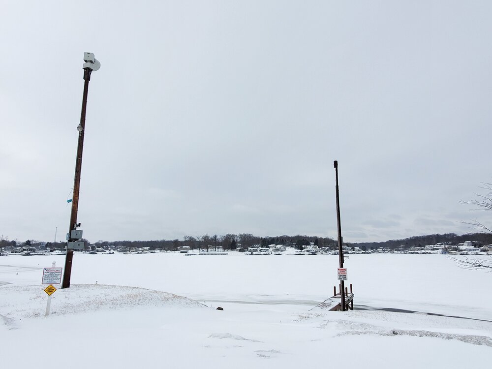
-
6
-
-
I'll take some pics and post later.
-
20 minutes ago, hawkeye_wx said:
The map is using spotter reports up through 9:45am EST. Perhaps it'll be more accurate later once all the snow is finished and all reports are in.
Yea I'm in howard, ohio knox county. It's hard to measure cause if blowing but we definitely got between 8-10"
-
27 minutes ago, hawkeye_wx said:

Can confirm this isn't accurate. Definitely got more than that in knox county. Have between 8 - 12" depending where you measure.
-
1
-
-
3 minutes ago, pondo1000 said:
Haven’t measured but looks like 6-7ish here. Fun tracking this one with all of you. Enjoy!
Looking like another 2 or 3 before all is said and done with these bands moving through


Let’s talk weather!
in Lakes/Ohio Valley
Posted
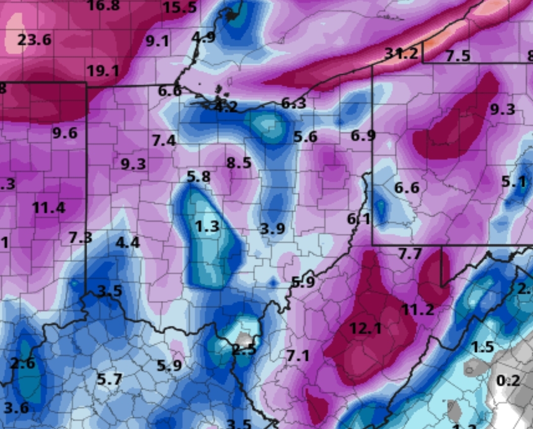
Pretty big differences with amounts in the nam, gfs and rgem. Gfs using the kuchera map would give me a pretty hefty storm since it lollipops me lol.