
audioguy3107
-
Posts
928 -
Joined
-
Last visited
Content Type
Profiles
Blogs
Forums
American Weather
Media Demo
Store
Gallery
Everything posted by audioguy3107
-
-
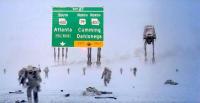
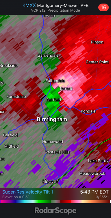
Looks like a Tornado Warning may be needed ASAP for the Birmingham cell near Fultondale very soon.
-
December 8-10, 2018 Winter Storm
audioguy3107 replied to Orangeburgwx's topic in Southeastern States
Storm Prediction Center’s website Mesoscale pages -
Southeast Sanitarium - A Place to Vent
audioguy3107 replied to Jonathan's topic in Southeastern States
Oh yeah.....that was the sky has to heal guy. Looks like he may get a good storm so I bet he's happy. -
Southeast Sanitarium - A Place to Vent
audioguy3107 replied to Jonathan's topic in Southeastern States
Did you get scolded for not "brining anything to the table"? -
December 8-10, 2018 Winter Storm
audioguy3107 replied to Orangeburgwx's topic in Southeastern States
Fairly surprised at the FFC graphic....haven't really chimed in on this storm since it looked to leave us totally out of the game, at least Atlanta proper around the perimeter. The new EURO continues support for freezing rain in the typical CAD areas from Gwinnett/Hall county and points north and east. I'd still like to see what the NAM says by tomorrow afternoon for our area, that should give us a better idea of what the potential is, but if we get a stout NE wind per usual, we usually get down to 31/32 around here. If by some chance the CAD encroaches earlier for the bulk of the precipitation, then NE Georgia up through GSP is going to be in for one serious ice storm. -
Still can't get over the HRRR.......has the secondary band pivot right over the Atlanta metro and has us in the snow until close to 11 AM on Saturday morning.....just incredible if it pans out this way.
-
The HRRR still has it snowing in the Atlanta metro until late tomorrow morning, unreal.......is this even possible around here? Amazing

