Snowman.
-
Posts
928 -
Joined
-
Last visited
Content Type
Profiles
Blogs
Forums
American Weather
Media Demo
Store
Gallery
Everything posted by Snowman.
-
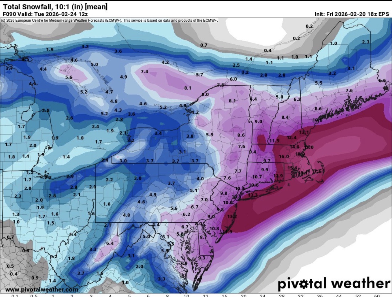
18z EPS

-
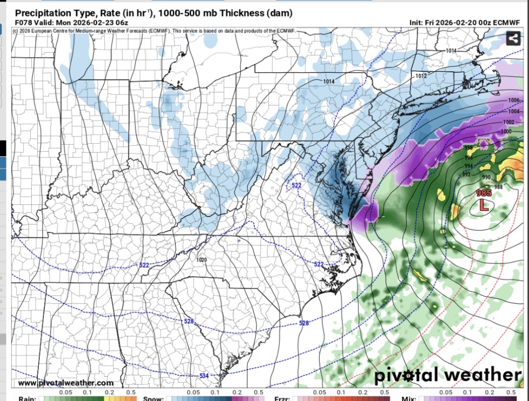
Feb 22nd/23rd "There's no way..." Storm Thread
Snowman. replied to Maestrobjwa's topic in Mid Atlantic
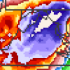
That IVT band is serious.. for whoever gets under it
-
Feb 22nd/23rd "There's no way..." Storm Thread
Snowman. replied to Maestrobjwa's topic in Mid Atlantic
Euro Ai looks better wetter at 12z sunday -
Feb 22nd/23rd "There's no way..." Storm Thread
Snowman. replied to Maestrobjwa's topic in Mid Atlantic
00z GEFS went west cluster hugs the coast more -
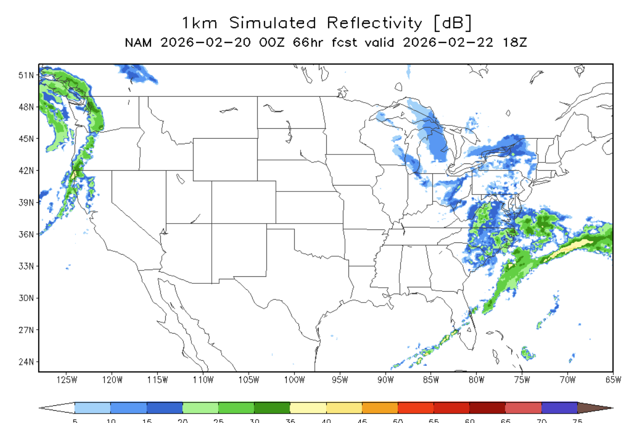
Feb 22nd/23rd "There's no way..." Storm Thread
Snowman. replied to Maestrobjwa's topic in Mid Atlantic
0Z NAM is definitely better surface wise than 18z
-
Feb 22nd/23rd "There's no way..." Storm Thread
Snowman. replied to Maestrobjwa's topic in Mid Atlantic
GFS about to score a coup? -
Feb 22nd/23rd "There's no way..." Storm Thread
Snowman. replied to Maestrobjwa's topic in Mid Atlantic
Looks better forsure -
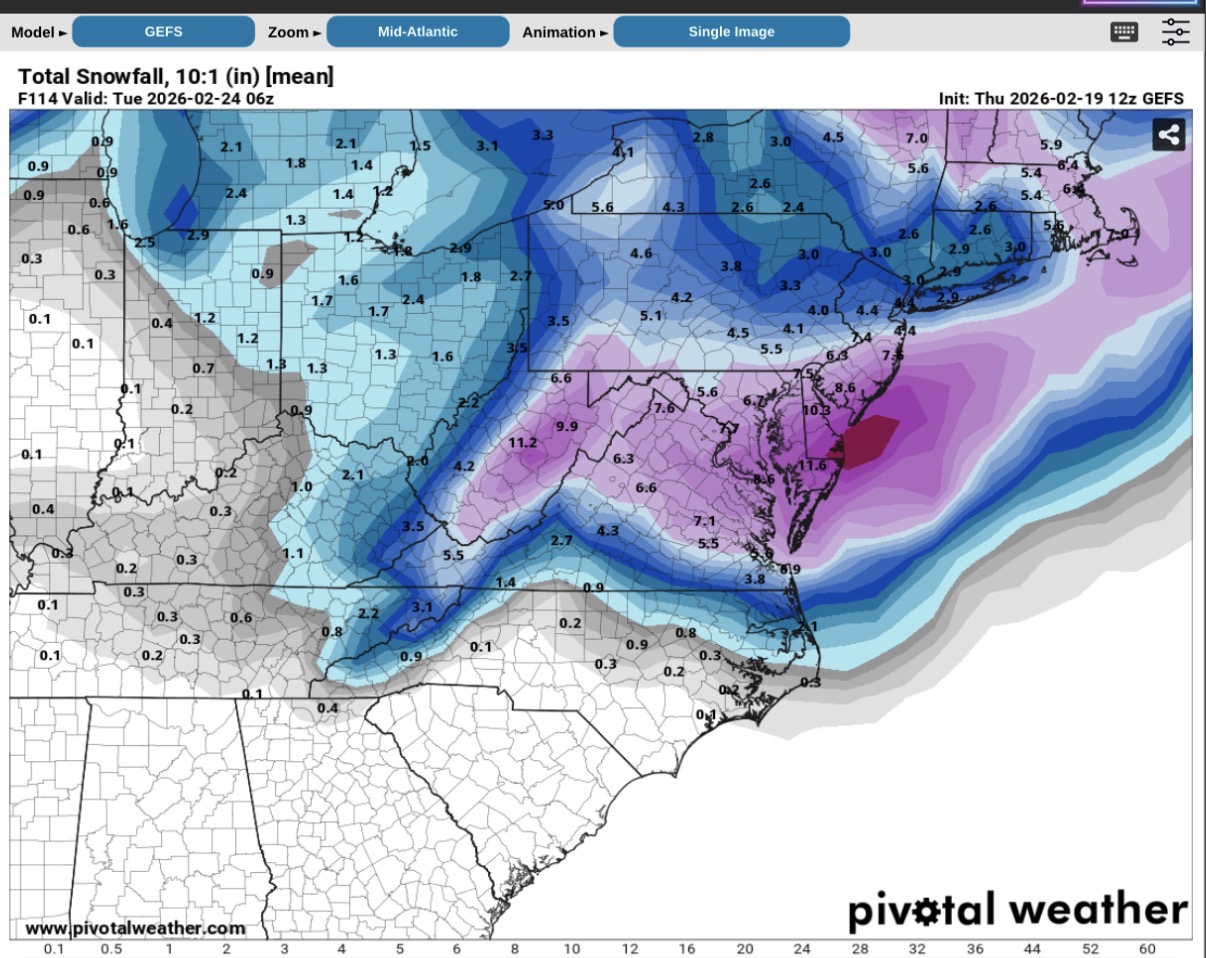
Feb 22nd/23rd "There's no way..." Storm Thread
Snowman. replied to Maestrobjwa's topic in Mid Atlantic
GEFS snow mean FWIW
-
Feb 22nd/23rd "There's no way..." Storm Thread
Snowman. replied to Maestrobjwa's topic in Mid Atlantic
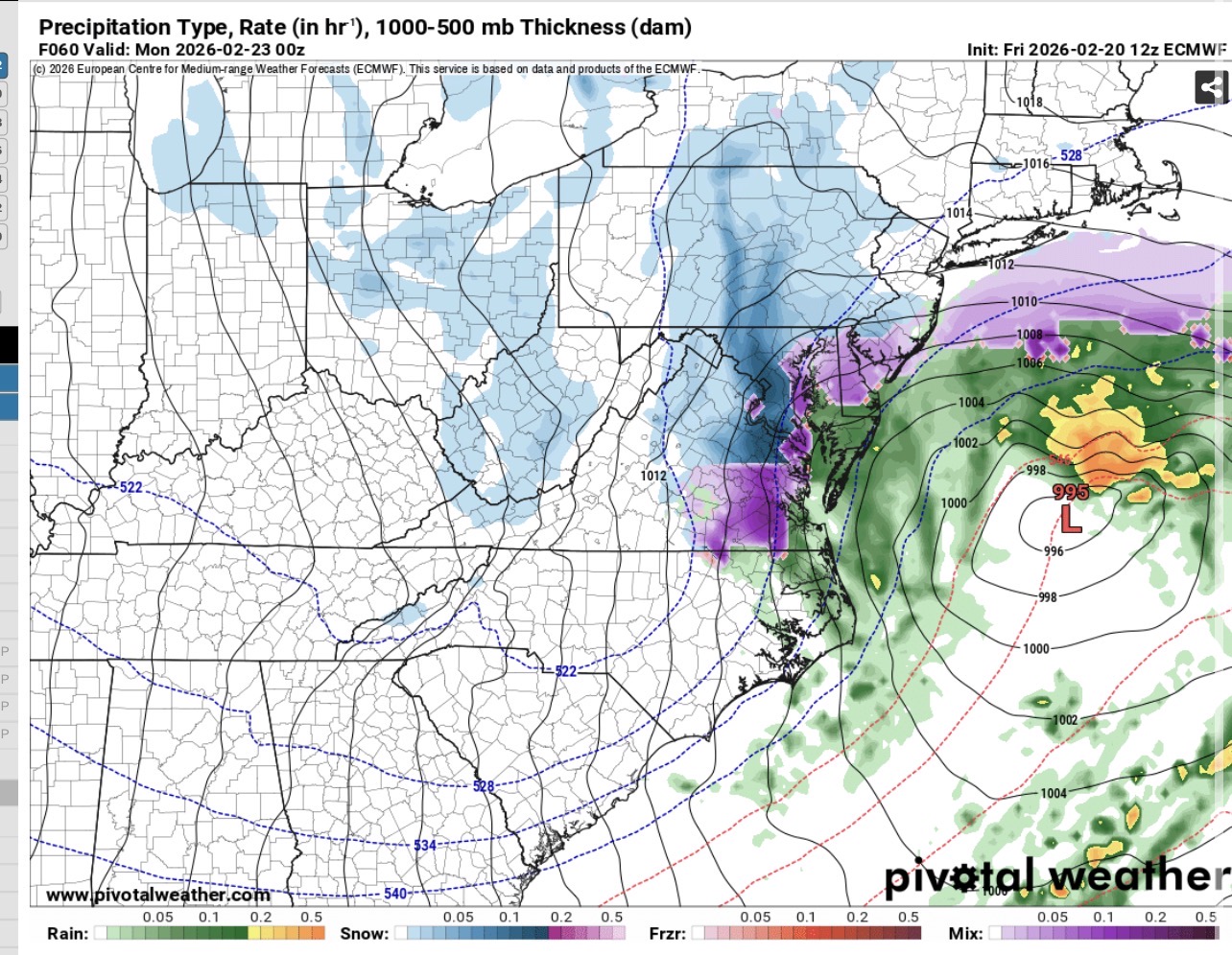
0z AI GFS improved from 18z -
0z AIGFS juiced up from 18z more QPF all around and primary doesn't go as far north.. temps are iffy though.
-
The Euro has been pretty poor this winter.. it's very interesting to see such a continuing disparity between it and the AI.
-
Holy crap UKMET is a nuke.
-
CMC is about to be a bomb. Temps iffy at 18z Sunday
-
CMC crushes NC again like they need more snow.
-
Euro AI is still a decent little event for Wednesday night. Around 0.3 QPF area wide more south. For whoever’s got the Weatherbell snow map.
-
UKMET looks good
-
The Jan 31 Potential: Stormtracker Failure or 'Tracker Trouncing
Snowman. replied to stormtracker's topic in Mid Atlantic
The GGEM was the first model to start picking up on the mixing issues with this past weekends storm. I’m most interested in its 00z run to see if it’s in the GFS camp. -
Give me that 969 right off kitty hawk.
-
Big dendrites all snow in Sterling still holding on for now.
-
Under yellows = heavy snow
-
Not hearing the pings as much for now in Sterling VA. The snow is trying to hold on.
-
Snow and sleet mix near Sterling VA. Hearing the pings. Full sleet changeover almost imminent.
-
Pouring heavy snow still. North of Sterling VA.
-
Heavy snow under the yellow. North of Sterling VA. 14 degrees