paulythegun
-
Posts
976 -
Joined
-
Last visited
Content Type
Profiles
Blogs
Forums
American Weather
Media Demo
Store
Gallery
Everything posted by paulythegun
-
This is a picture perfect overrunning precip profile. Would love to be tickled by some of that dark blue on the next run. The red on the Greenland coast is "rage"
-
this post made me laugh so hard
-
Also the euro issue with the 18 hour dry slot (freezing drizzle slot) while people 50 miles north get pummelled
-
Lol. rain now possibly?
-
Putting this in banter (because it's stupid) but we are about to witness the Most Important UKMET Run of All Time
-
558 FXUS61 KLWX 202014 AFDLWX Area Forecast Discussion National Weather Service Baltimore MD/Washington DC 314 PM EST Tue Jan 20 2026 .WHAT HAS CHANGED... Confidence is continuing to increase for a significant winter storm for the region Saturday into Sunday. Additionally, snow accumulations increase for upslope snow showers in the Alleghenies Wednesday night. && .KEY MESSAGES... - 1) Significant winter storm expected across the Mid- Atlantic states late Saturday through Sunday bringing widespread snow. Arctic high pressure will build into the area Friday afternoon into Saturday morning providing the source for very cold temperatures this weekend into early next week. - 2) Accumulating snow is likely along the Alleghenies Wednesday night through Thursday morning. && .DISCUSSION... KEY MESSAGE 1...Significant winter storm expected across the Mid-Atlantic states late Saturday through Sunday bringing widespread snow. Arctic high pressure will build into the area Friday afternoon into Saturday morning providing the source for very cold temperatures this weekend into early next week. Broad upper troughing will remain established across the Great Lks into the northern Mid-Atlantic through at least early next week. Southern stream energy is expected to interact with very cold air to the north to produce moderate to heavy snow across the area this weekend. Looking at most recent model data, the 12Z GFS and 12Z NAM remain the furthest south and weakest solutions as it leaves more energy cut off while the 12Z EC and Canadian models show more energy getting absorbed into the northern stream. The 12Z EPS and AIFS are more consistent with their deterministic runs while the GFES shows a very different solution to its deterministic run. Will continue to highlight a significant winter storm affecting the area this weekend in our Hazardous Weather Outlook.
-
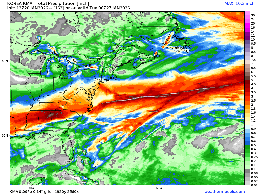
12z Korean with WELL OVER 1" of QPF regionwide

-

-
Another note on ICON: In the wake of that catastrophic icing all across the deep/mid-south, they'd have no power PLUS temps in the single digits. BAD!

-
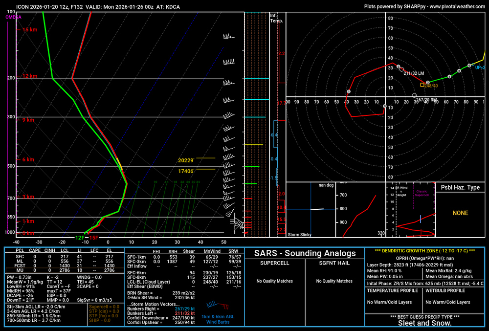
for illustrative purposes, here a sounding for DCA Monday 00z showing that warm(er) nose up at 700 producing a mix of sleet/snow (or at least lower ratio snow)
-
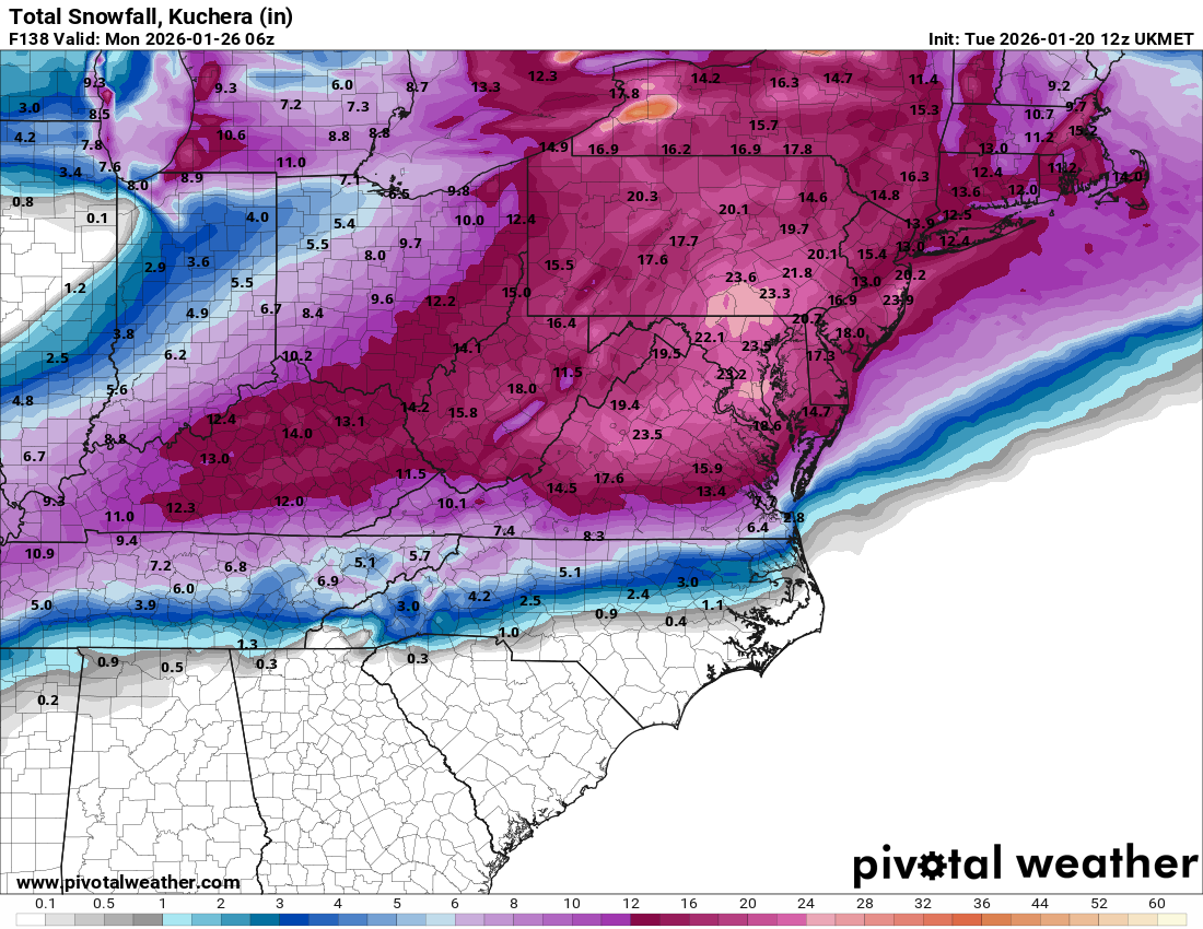
Massive differences between ICON (slower ejection and further south) and UKMET (northern stream interaction, faster ejection)
-
-
Mulch is one of the coldest substances on earth, second only to the metal frame of a ski lift
-
Trinidad, DC. 34/29. Wet SN-. Accumulation limited to grassy cartops
-
Sent from my SM-S938U using Tapatalk

-
PAIN
-
TAKE COVER (Virga)
-

-
Two big time coldenings on EPS

-
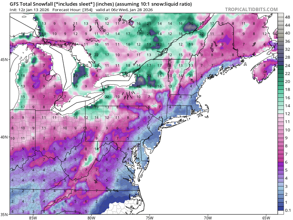
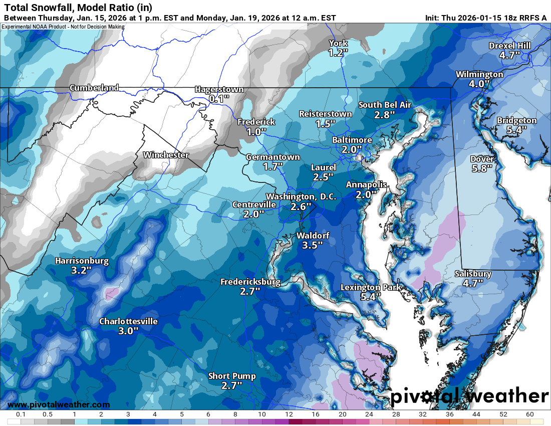
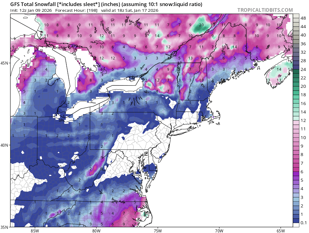
The GFS "Includes Sleet" snowmap is about to be EPIC. Will add to this post when it loads. UPDATE: it was NOT epic.