paulythegun
-
Posts
976 -
Joined
-
Last visited
Content Type
Profiles
Blogs
Forums
American Weather
Media Demo
Store
Gallery
Everything posted by paulythegun
-

Feb 22nd/23rd "There's no way..." Storm Thread
paulythegun replied to Maestrobjwa's topic in Mid Atlantic
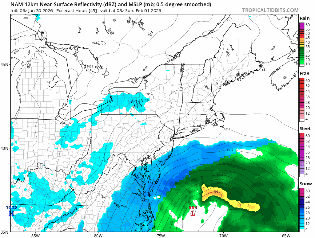
it's a relatively mature mid-latitude low. vertically stacking a low like that tightens the precip field for a variety of reasons when compared to what we usually see (a coastal surface low with a trailing 500mb low and trough) we usually don't see that occur at our latitude. it's something we'd be more attuned to if we lived in the northeast though. -
Feb 22nd/23rd "There's no way..." Storm Thread
paulythegun replied to Maestrobjwa's topic in Mid Atlantic
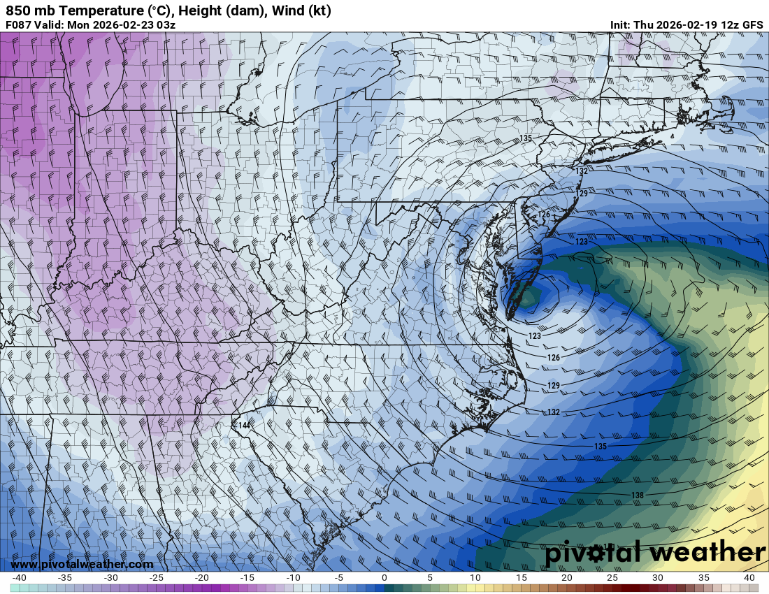
ha yep look at that warm air wrapping into it on the 850mb panel
-
Feb 22nd/23rd "There's no way..." Storm Thread
paulythegun replied to Maestrobjwa's topic in Mid Atlantic
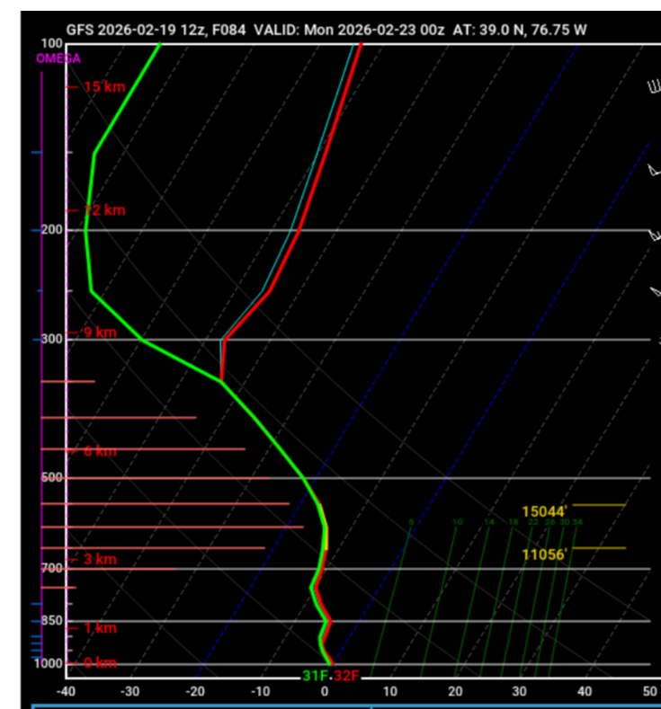
i don't think i've ever seen the pink horizontal lines on the left almost touch the temp/dew point lines
-
Feb 22nd/23rd "There's no way..." Storm Thread
paulythegun replied to Maestrobjwa's topic in Mid Atlantic
The money shot: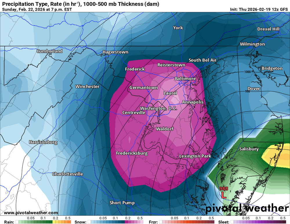
-

-
*borat voice* IT ABOUT TO MAKE LIQUID EXPLOSION!
-
Simple setup
-
For this, I recommend the Nutty Professor remake, along with the Klumps sequels
-
12z RFFS (pronounced Arfs!) model. Used 10 to 1 to distort the snow upward
-
Look at these two friends getting together at the last minute
-
This site is now offering WeatherNext 2 for free. It's not totally functional yet (you can only get MSLP, 6 hour precip, and 2m temps) but still worth keeping an eye on: https://aguacerowx.com/app
-
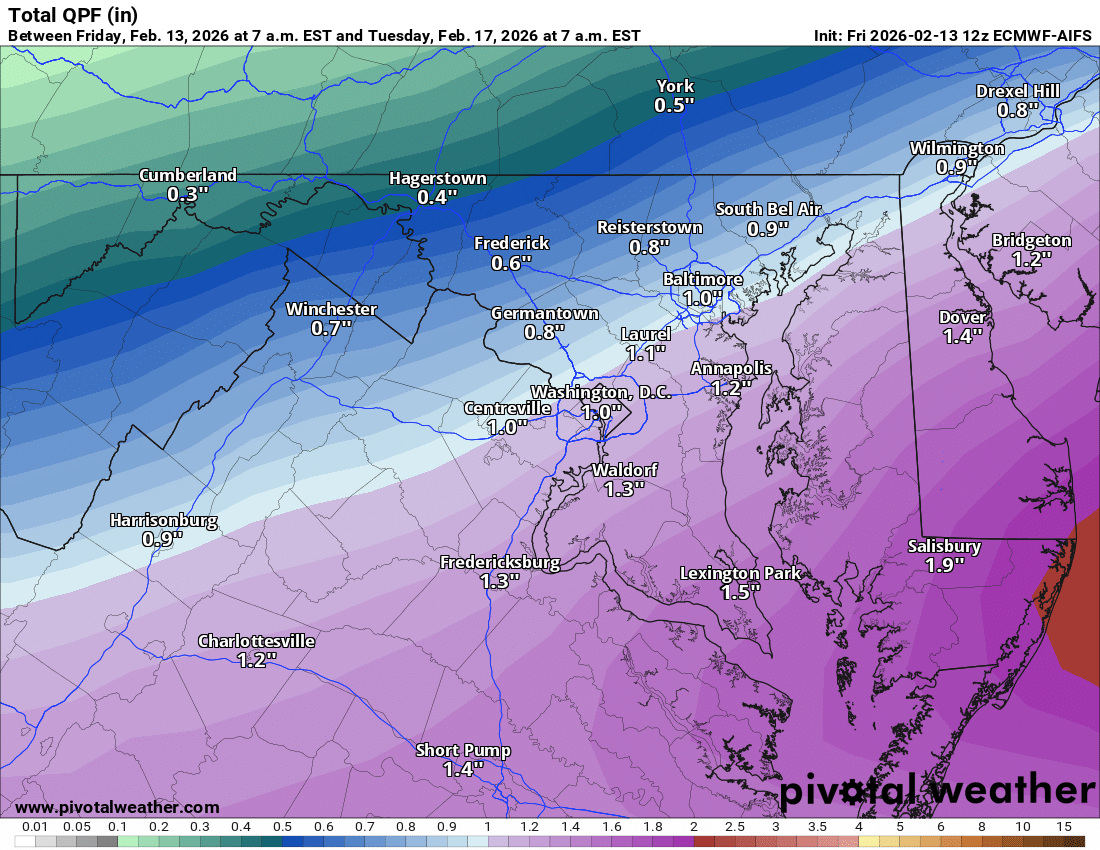
I don't think anyone posted this yet - the 12z ECMWF AI QPF map is kinda wild.....

-
And the system won't be occluded for another 2-3 days
-
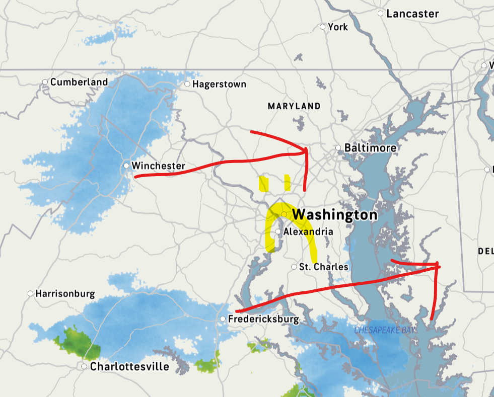
Mid-Atlantic cold air when moisture finally approaches
-
All of the models are too warm with their surface temps for this weekend..and here's why: Their snow cover estimates are too aggressive with melting. They're assuming typical snow density and compaction. They can't handle the slow pace of north facing snowcrete melt-off. Please hit the hot dog emoji
-
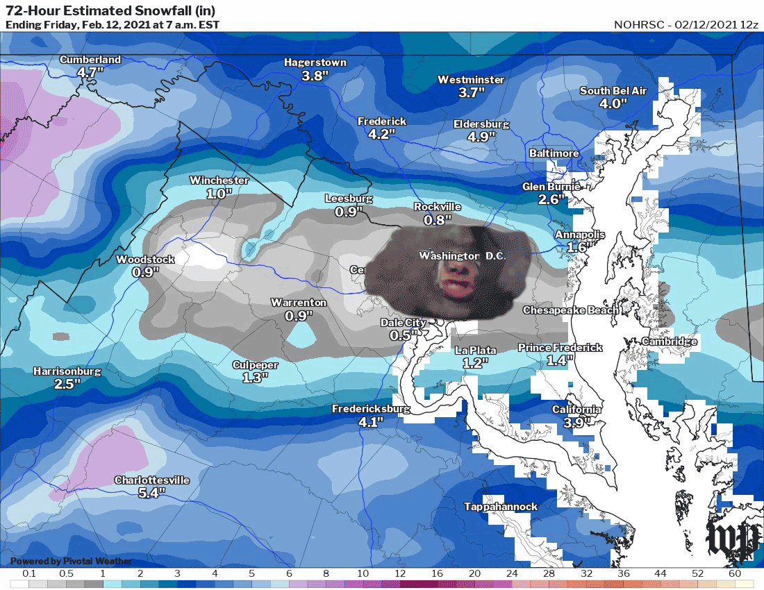
There was a massive sewage spill about a month ago just NW of DC. One of the largest (unintentional) spills in U.S. history. But right now, all of that sewage is sitting frozen (or under ice) in the canal area. An amped system would finally flush it out into our waterways where it will settle and create algae blooms along with an enormous stench throughout the spring and summer. Lets get this sewage moving. Amp this thing up! Unleash the sewage blob!
-

-
I just mistook water dripping off my roof for flurries. They should probably issue a Special Weather Statement on that
-
every storm for the rest of the winter

-
Sublimation is our friend
-
The Jan 31 Potential: Stormtracker Failure or 'Tracker Trouncing
paulythegun replied to stormtracker's topic in Mid Atlantic
*sniffs glue* Here it comes!!!! -
It's 4 degrees at a station near me north of Capitol Hill but Virginia's DCA station, which is the official station for the city of DC, is at 15F
-
The Jan 31 Potential: Stormtracker Failure or 'Tracker Trouncing
paulythegun replied to stormtracker's topic in Mid Atlantic
15z SREF still with 4 members out of 27(?) with over 10" of snow for DCA. Max is 26.3". Good times. The SREF is definitely sniffing out the north trend that I'm imagining on the radar. -
The Jan 31 Potential: Stormtracker Failure or 'Tracker Trouncing
paulythegun replied to stormtracker's topic in Mid Atlantic
yeah....sadly.
-
It's 8 inches of compressed snow and sleet (harder than concrete) plus a week of record cold. a generational weather event in a municipality that doesn't control its own budget. public transit is barely functional (bus lanes are blocked by mountains of ice) so people are understaffed. Plus it's dangerously cold out. i'm not sure what people are expecting. wednesday and thursday, i had to walk 2 miles to work with my dog on my back in a backpack because there was no one to watch him. great exercise though!