Jump to content

Buffalo Bumble

Members
  • Posts

    1,613
  • Joined

  • Last visited

Everything posted by Buffalo Bumble

  1. Amazing pics from you guys in eastern NY. Another day of frequent snow squalls here. That's probably what amazes me most about this...I remember other snowfalls in May, it's not that uncommon. But the sun comes out, snow melts quickly, and we jump back to spring. This is legitimately locked in winter for 2+ days. No quick melt, no warming breeze. Just...winter.
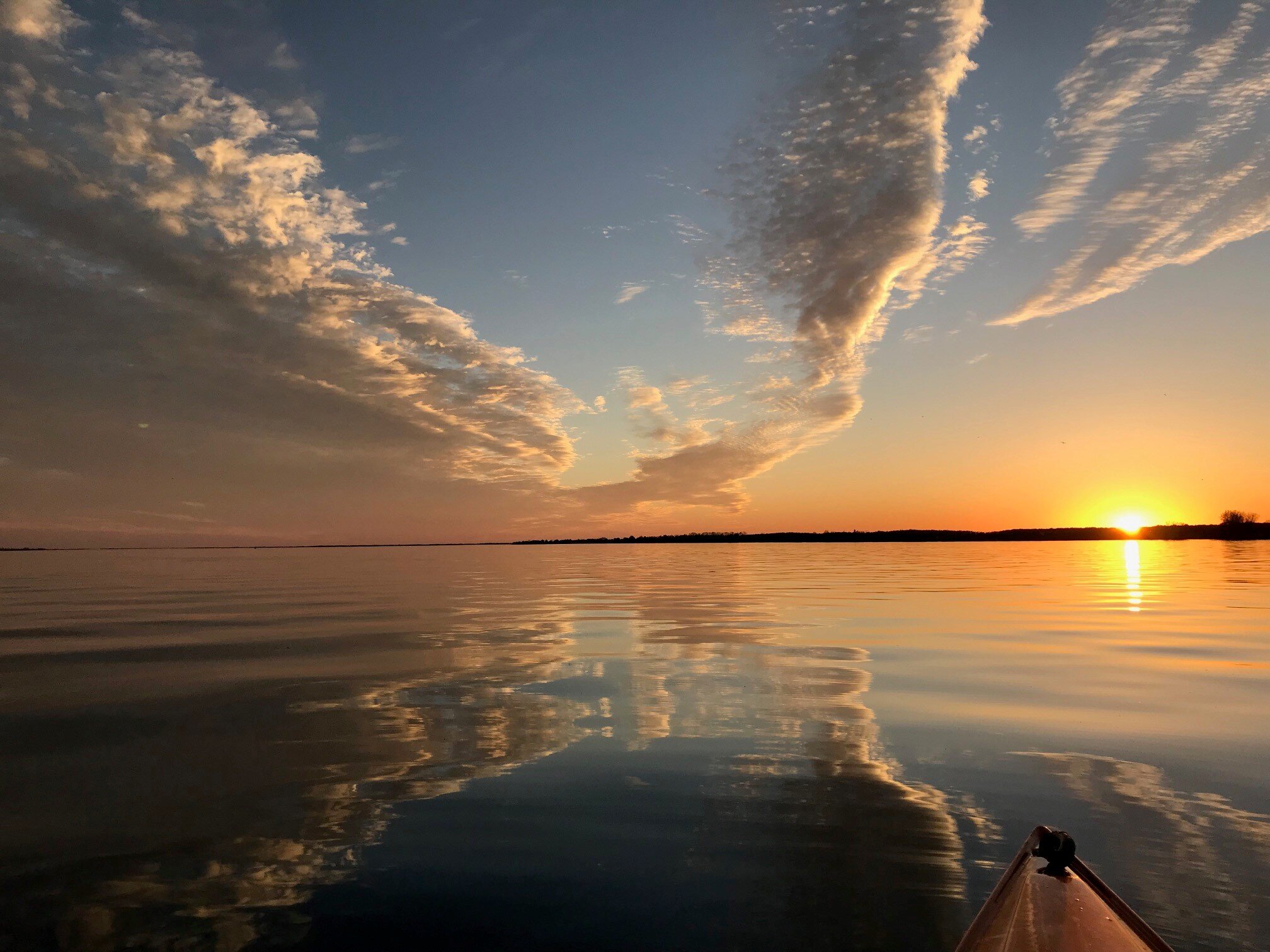
  2. Great shot!! Clear here too, if wind drops temps should really nosedive.
  3. I'm certainly no climate scientist and haven't read too much on this, but...I bet you would find that average temps here from about mid-March through May are much cooler than the rest of the NH at similar latitude for what seems like 2 obvious reasons - 1) frozen Hudson Bay and residual snow cover in eastern Canada extending down to 45 deg latitude; and 2) massive bodies of water (Great Lakes) immediately upstream ranging in temps from freezing to 50 degrees. Combine that with building heat domes in the southwest US pushing up into the Rockies with a propensity for air coming off the Rockies to bend southeast, and you have a perfect recipe for a mean trough over the upper GL's/northeast US. Seems like from Washington D.C. points west are immune from our seasonal spring lag/extended winter as they mild and green up on que in early April.
  4. I feel like this current NH snow cover image is a good indication of why our springs more often than not are horrible (cold, wet, cloudy, snowy). Snow cover persists towards the 45th parallel right over our heads, whereas the rest of the NH is snow free up to the 60th parallel. Perfect recipe for our spring "perma-troughs", and certainly a clear pathway for polar air to slide into our region with accompanying fat fluffy snowflakes. And during the middle of the day 6 weeks from the freaking summer solstice no less.
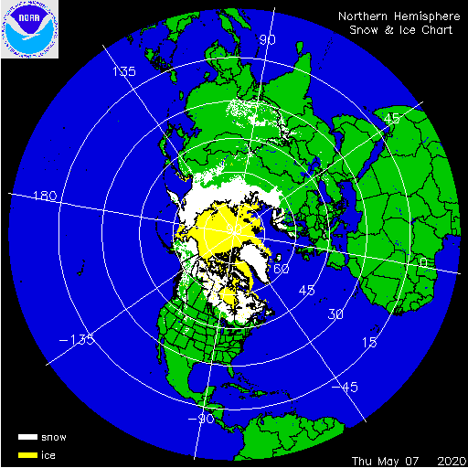
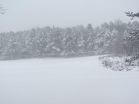
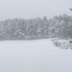
  5. I made a post in mid-April about being rather amazed to see "real" snow falling in the middle of the day (big flakes, sticking easily...like look out the window and it could be January). Fast forward to May 8 at 1115 am and same exact thing! Gentle mid-winter snow parachuting down. Unreal.
  6. Surprising “nice pulse” here for last hour or so. Sun poked out, no wind, and still mild with a touch of humidity in the air. Funny to see people flooding into the neighborhood to walk or run. These last few weeks have trained us to get out and soak up the nice weather while it lasts I’ll give this current storm credit for transporting some warmth and humidity to the area, which has restarted spring leaf out here. Lots of trees popping leaves now, and the understory is really greening up.
  7. I'm actually cautiously optimistic about the forecast after tomorrow. Temps still representative of somewhere in central Canada, but hopefully plenty of sun.
  8. Sneaking in a nice day here in WNY between the gyre swirling to the east and the next system racing towards us from the west. Sun and low 50’s feels like mid-summer after yesterday’s rawness. Looks like a good chance to get into some rare southerly flow on Wednesday that would send our temps above normal for the first time in about 16 days.
  9. Picture perfect day here at BUF - low 60’s and full sun. Way overdue for this. Now for the bad...spring climo at BUF is atrocious compared to other “B’s” at the same general latitude. Look at Baltimore, Bismarck, Billings, and Bend for the next 7-10 days. So many 70’s-80’s with lots of sun. Compare that to Buffalo...near constant 50’s with frequent rain and clouds. Frozen Hudson Bay, lingering snow pack in Ontario, cold Great Lakes...= semi-perm trough in upstate NY from Mar - end of May. Am I missing something?
  10. Super bad stretch of weather for sure. This is no consolation, but just to put into context how awful this is emerging from the winter months (when I think we all want negative departures), to "spring" (when we beg for mild), check out this stat for BUF...Dec, Jan, Feb, and Mar had NO stretches of 4 straight days of negative departures. There were only 2 stretches of negative departures for 3 straight days, both in Dec. We're currently working on NINE straight days of negative departures, with 2 of those coming in at -15. Maybe we cap it at 11 with a "mild" Saturday...?
  11. I honestly didn't think legitimate lake effect snow was possible at the end of April, during the day. But the band coming off Huron and extending through the Niagara Frontier right now is legitimate. About an inch down here in the last 30 minutes. Wife and I were talking that if not for covid situation, we would do an "emergency" 1-2 week vacation down south to escape this nonsense. Step one to likely moving to a warmer climate. I love the snow in winter, but "springs" around here are getting tough to take.
  12. Great snowy day here. Frequent squalls and gusty winds. Looking at long range, I’m concerned that Lake Erie will be freezing in the next 7 days, effectively cutting off the lake enhancement.
  13. I know, right...April is the new March. It just pounded snow here for about 15 minutes. Having a hard time remembering another April with such frequent snow (especially after mid-month). Granted, it's not adding up too much here, but it's been incredibly persistent.
  14. Glad you said it! We’re stuck in a rut where for the last 2 weeks our return interval on nice days is about 1 in every 8. That looks to continue in the extended. So get out and enjoy today!
  15. Maybe not...Seems like all the bitter cold that was bottled up in the arctic all winter was finally dislodged a week or 2 ago. I’m guessing it won’t be far away over the next month to further dampen spring and even bring more snow chances. Shoot...the 12Z GFS has a wound up bomb moving north from Chesapeake Bay at 10 days, elevation crusher if that happened. Fantasy land, but shows the atmosphere wants to stay cold/troffy here.
  16. Whoa! Don’t really like saying this in mid April, but...congrats!!
  17. Really is nuts, bordering on absurd, that here we are 24 hours after a mid-April evening snowfall...watching the snow pound down. I know April snow isn’t that rare, but to settle in like this for what will be about 3 days is goofy. Come to think of it...like Rich pointed out, the bookends of this cold season are fascinating. First 15 days of Nov are way below normal with constant snow cover at BUF. Winter can’t muster one good sustained pattern, cold departures are erased after 2 days. Mid April arrives...and we get back to back to back days of snow, temps dropping below freezing during max heating, and currier and Ives scenery with snow plastered on the evergreens as the sun sets (at 8pm). Just, odd...
  18. Pounding snow here for going on 30 minutes. Accumulating nicely
  19. Weird vibe outside now. March was so nice with no snow, grass has been greening for a while, buds popping...now there’s a fresh 1-2” OTG. Feels like we hit hyperspeed thru the rest of spring, skipped summer and fall, and landed in winter.
  20. Wonder if there’s any correlation between cold April’s here and the following summer. Looks like we should build up a pretty solid negative departure over the next couple weeks.
  21. Seems we’re getting the pattern now that was entirely absent when we want it, from late Novie thru mid March. Temps consistently 10-20 deg below normal with frequent short waves rolling thru over 2 weeks. Entirely predictable that it comes now in April.
  22. Fortunately the wind hasn’t been too bad here so far. Was bracing for much worse with the “once in 20-30 year storm event” talk from BUF. 65 mph in Fredonia is impressive though.
  23. In the last 5 minutes we've had a period of sun, clouds, hail, sleet, and snow, topped off with a little drizzle. Fired up atmosphere.
  24. Surprised to see heavy snow here currently. Didn’t see mention of it in the forecast for this morning. Sticking on the grass and rooftops.
×
×
  • Create New...