

mappy
-
Posts
45,137 -
Joined
Content Type
Profiles
Blogs
Forums
American Weather
Media Demo
Store
Gallery
Posts posted by mappy
-
-
7 minutes ago, Kmlwx said:
Almost looks D-word-ish. But then again...it's the HRRR
SPC all but said the word derecho in their outlook. I wouldn't rule it out, at least a long lived squall dropping south out of the PA/Ohio area.
Pitt WFO is doing a special sounding today.
-
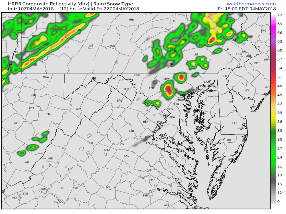
from the SPC outlook
   the air mass will remain favorably unstable/buoyant to support
   damaging-wind-producing thunderstorms riding the frontal
   baroclinic/instability gradient, potentially all the way to the
   Chesapeake Bay region.
can any one guess what that could mean?
")
-
 2
2
-
-
2 minutes ago, Eskimo Joe said:
Our HM really likes tomorrow per his Twitter account.
widespread wind damage, tornado stuff seems better further north.
-
1
-
-
Day 1 and 2
.png.8338e615d103c701ed78a3e534fd5dd1.png)
.png.9994949bed21deae0362cd5fc387880f.png)
-
1
-
-
Looks like mine -- chicken wire around the whole thing to keep the deer/rabbits out.
Super pumped about my new space. 10x10 area out in the yard. We have used the spot as a burn pit too for brush and the like, so the soil should be really awesome. Tilled it all up, laid down the weed paper, then cut out the holes for the plants. Planted: 2 cucumber plants, 2 types of tomatoes, 2 bell peppers (green and orange), zucchini, sugar baby watermelon and spaghetti squash.
Really looking forward to taking care of this baby this year. I've wanted a nice garden space since we moved in, but just hadn't found the time to make it happen. It was my number one thing to tackle this spring and I think it turned out great.
")

-
5
-
-
sounding for my backyard at 21z per the NAM. Small CAP in place, but plenty of CAPE to work with. LI is pretty low too.

-
7 hours ago, high risk said:
The 00Z NAM3 likes 00z Wednesday, with really volatile environment progged for our area.
06z NAM still advertising the same. Nice line dropping south out of PA 21z-00z
-
Had some penny sized hail last night when the PA complex moved south into MD. Another storm overnight around 4am
-
Overcast this morning after some overnight storms came through.
-
i missed out yesterday both to the north and south. but had some really good views of the storms in PA as they went by. Enhanced for me tomorrow.
-
isolated stuff today maybe?
-
moved about 60 concrete cylinders that are 1x0.5 from around our pool area to hardscape a garden space out in the yard a couple weekends ago (the nice 80 degree Saturday). Going to use it as a brush pile/burn pit during off growing season. Trimmed trees for spring and burned it all last weekend. Going to till it all up this weekend. Need to put a fence around to keep the deer/rabbits out and all plants go in Mothers Day weekend.
I am so excited to finally have a real hardscaped plot in the yard for a garden. I've been planting things in random places where I can find space, or in containers on the deck.
-
1
-
-
Got a pop up from amazon saying I won money for Apple products then got redirected to another site.
-
4 minutes ago, Rjay said:
Lol
3:57 to be exact.
-
1 minute ago, cmasty1978 said:
that's that fire ass year 2002 web monetization strategy
oh. im back at 4pm.
-
started getting pop ups last night. i can handle the large banner ads at the top and bottom of pages, but legit pop ups in the middle of my page is super annoying.
-
-
With two Hs in place, and a weak ULL that won't amount to much, a direct east coast hit from Maria just isn't in the cards.
-
20 minutes ago, Mountain_Patch said:
except the westward flow into florida right now. That confuses me why people are so confident on this turn.
You can wish it all you want, but without a stronger WAR to keep Maria west... it follows the weakness and goes OTS.
-
7
-
-
It's an eye. End of discussion.
-
7
-
-
16 minutes ago, das said:
Lots of them look like this. Likely not contamination system wide.
http://water.weather.gov/ahps2/hydrograph.php?wfo=sju&gage=comp4
Map of all sites. Hover over site for quick view:
Thanks, Das!
-
2 minutes ago, eyewall said:
Wow just wow at this river gage. 42ft and rising (flood begins at 10ft). The old record as 25ft.
http://water.weather.gov/ahps2/hydrograph.php?wfo=sju&gage=ciap4contamination, maybe? I saw another that was showing some 80 feet at peak...
-
2 minutes ago, medville said:
BULLETIN
Tropical Storm Jose Advisory Number  61
NWS National Hurricane Center Miami FL       AL122017
1100 AM EDT Wed Sep 20 2017

...AIR FORCE HURRICANE HUNTERS INDICATE THAT JOSE IS A STRONG
TROPICAL STORM...
...DANGEROUS SURF AND RIP CURRENTS EXPECTED TO CONTINUE FOR SEVERAL
MORE DAYS ALONG MUCH OF THE EAST COAST OF THE UNITED STATES...


SUMMARY OF 1100 AM EDT...1500 UTC...INFORMATION
-----------------------------------------------
LOCATION...39.0N 70.0W
ABOUT 150 MI...245 KM S OF NANTUCKET MASSACHUSETTS
MAXIMUM SUSTAINED WINDS...70 MPH...110 KM/H
PRESENT MOVEMENT...NE OR 35 DEGREES AT 8 MPH...13 KM/H
MINIMUM CENTRAL PRESSURE...976 MB...28.82 INCHES
Hi, we have a Jose thread. This thread is for Maria. Thanks!
-
10 minutes ago, clskinsfan said:
Just looking at this loop it appears she was definitely weakening as she made landfall.

ERC tends to do that
4 minutes ago, Baroclinic Zone said:Clickbait BS.
trash it yo


2018 Mid-Atlantic General Severe Discussion
in Mid Atlantic
Posted
Lets do this.