

das
-
Posts
2,154 -
Joined
-
Last visited
Content Type
Profiles
Blogs
Forums
American Weather
Media Demo
Store
Gallery
Posts posted by das
-
-
49 minutes ago, Mrs.J said:
No storms close to me but just got a big thunder clap out of no where. Sun is back lighting the clouds to my East and the colors are vibrant. Getting more thunder.
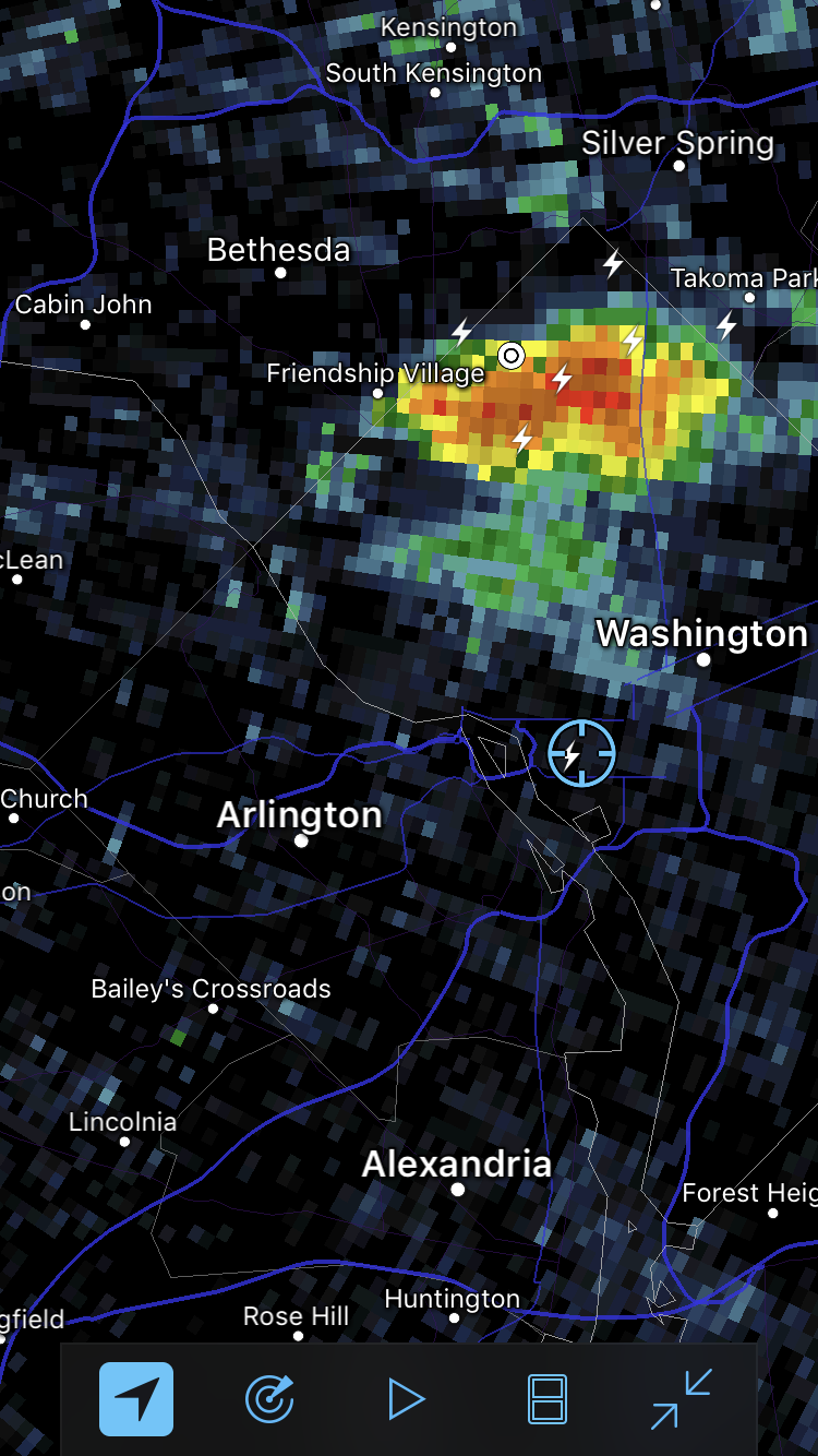
These storms have indeed had strikes far from the rain column. I snapped this image right after a strike hit my building at work this afternoon. What would be considered the classic storm core was 8 miles to the north and we were in full sun.

-
 4
4
-
-
Dime sized hail

-
Hi, all. I'll be meeting with NOAA tomorrow in Boulder and might have a little time to ask some informal questions outside of the topic of my meetings. Let me know if you have questions and I'll see what I can do to get answers and post anything appropriate here.
Topics areas would be NCEI, a bunch of the ESRL (PSD, GSD, GMD, CSD, etc...) capabilities and the SWPC.
Meetings start at 8:30am MST.
-
1
-
-
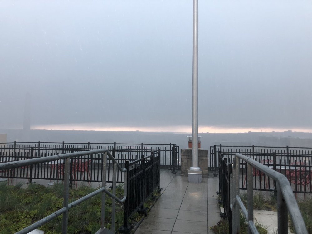
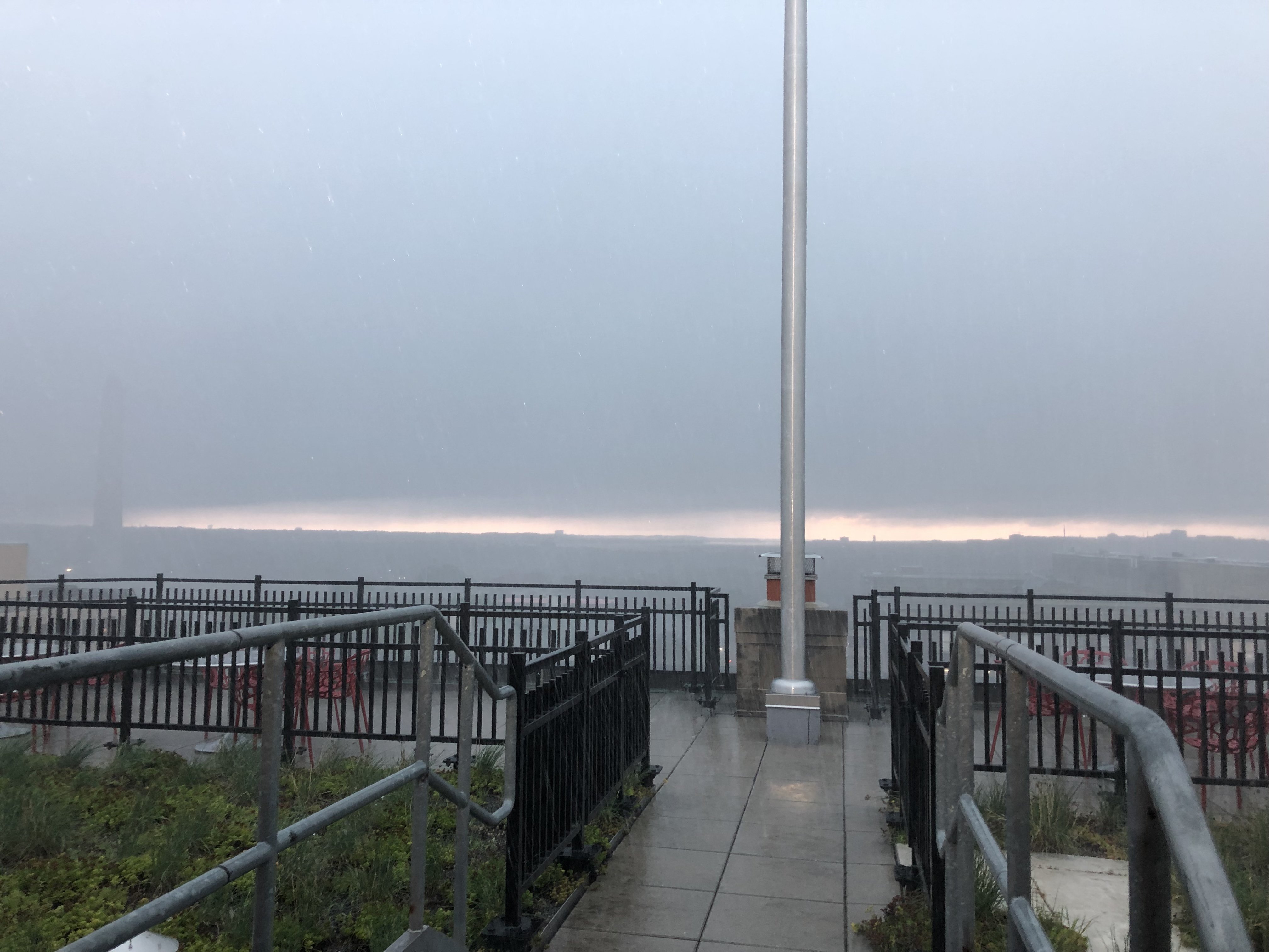
Cool pic right as I arrived at work just west of the WH. This is looking south just as the torrential rain started. You can see the obscured Washington Monument on the left.
-
6
-
-
2 minutes ago, MN Transplant said:
Wall of water
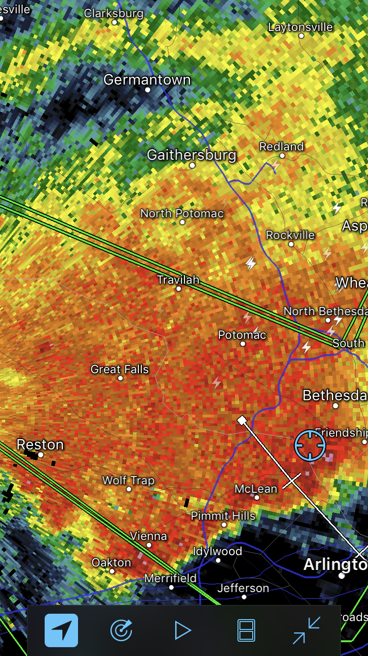
I have matched the speed of the wall the entire way from Clarksburg to almost to DC. It has been like being in a car wash the entire way. Surfs up!

-
 1
1
-
-
23 minutes ago, C.A.P.E. said:
57 and sunny here in Vermont. Perfect.
It still looks like less than a tenth of an inch has fallen over the past 8 days at home lol. Cant wait to return my scorched brown yard.

I drove down from my place up there last night. The rapid change in air mass in northeast Pennsylvania was like driving into a jar of Vaseline at speed.
-
1
-
1
-
-
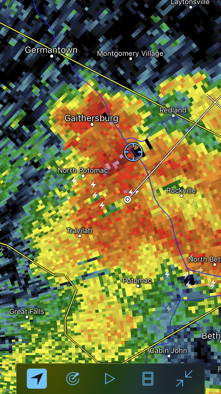
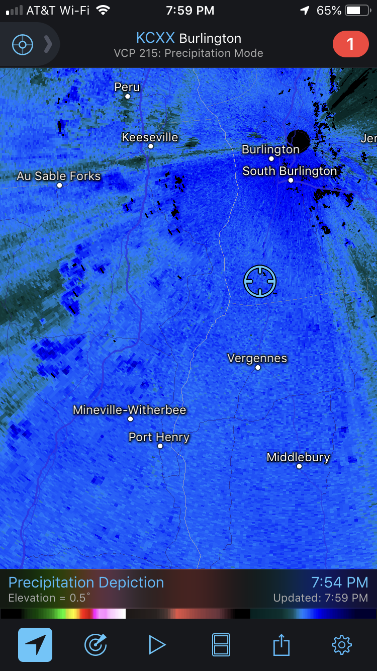
1.57 inches of rain in 14 minutes under 60dBZ returns in Clarksburg before I had to hop in the car to head to work. And still dumping…
(edited to fit the return rate)
-
2
-
-
On 5/14/2019 at 9:31 AM, mappy said:
hi! I did not. Life got in the way

Completely understand. Thanks for all you’ve done for the board previously, btw...
-
@mappy Hi there. Did you do a map this year?
-
1 hour ago, powderfreak said:
A good season to move into the BTV area/Champlain Valley... 102.5" at BTV to date, which is +24.7 above normal to date.
From Maryland to a 100+ inch winter probably feels like a pretty solid increase for sure. I loved when I first moved to BTV from ALB...you can tell the northern latitude difference.
It’s been fun. I’ll miss the big whopper coastals that nail Parrs Ridge in central MD but really like the constant snowfall and snowcover here.
-
I have to say, I’ve really enjoyed my first winter (largely) in Vermont.
My place right now:

-
2
-
-
68°F at work yesterday in downtown DC to teleworking here in VT and this:

-
1
-
-
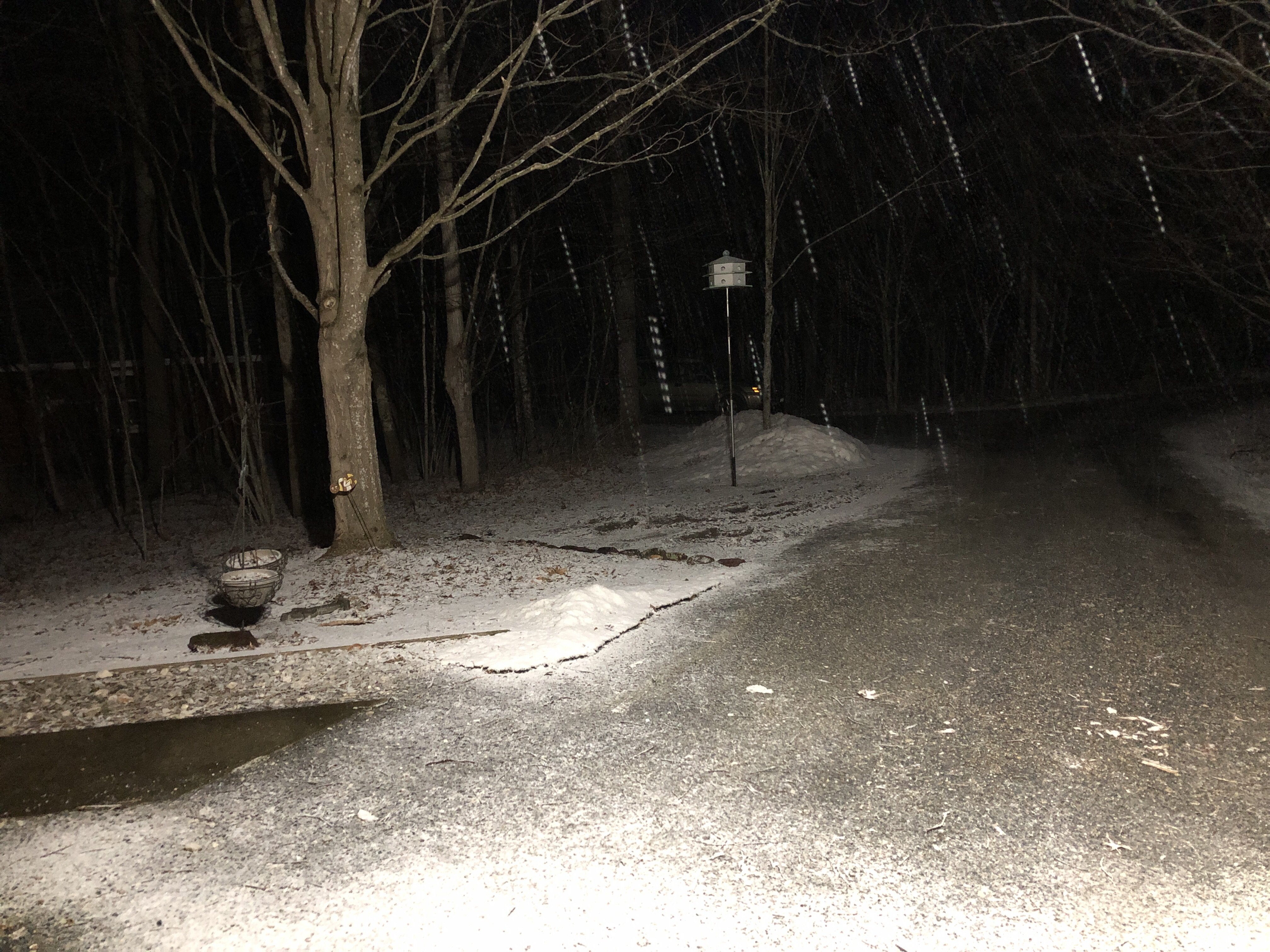
1.1" of snow this morning in Charlotte, VT, south of Burlington. Snow continues to fall but 2m temps are up to 35.1F so the snow is melting off of the trees and roads.
Edited to add, I'm at 285' here in the Champlain Valley, btw.
-
B. Grade is based on actual outcomes (fair number of events, actual total snowfall, good distribution throughout the season and decent snowcover longevity). If I weight the actuals with expectations as we entered the season, it would be a perception-biased C-.
10 year mean for MBY went from 34.34" to 34.42"
10 year median for MBY went from 22.5" to 28.8"
There's very little chance both median and mean numbers don't take a big hit next year as the 87.0" from 2009/10 roll off the 10 year rolling averages next year. C'mon moderate El Nino + blocking............
Totals subject to change after the upcoming Sunday night snowshowers and midweek 1993 March superstorm redux. And the whopper on the 30th as well. :^P
-
1
-
-
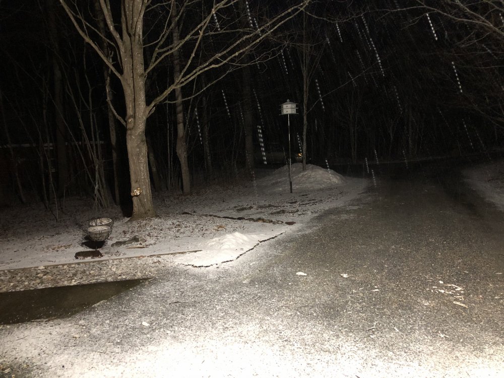
35.1" in Clarksburg at casa de das so far.
-
State of the snowpack in Clarksburg:
I am not so sure that it is going to survive until next week’s big blizzard…
-
1
-
-
2 hours ago, psuhoffman said:
Thanks, excellent stuff... Question. Are they working on a way to turn the MVP into a predictive tool?
Reanalysis is a part of the program so, yes. Next steps are to: "determine why some MJO events produce a response over North America while others do not. Preliminary results suggest that the convective anomaly near Hawaii might play an important role. This convection may be associated with anti-cyclonic wave breaking from the extratropics. Therefore, further research is required to determine whether the convection is driving the circulation or vice versa". So, still in the research domain but, there is very little meteorological research being done just for the sake of research anymore. The vast majority of it is focused on expressly enhancing predictive capabilities and mitigating impacts.
-
 1
1
-
-
On 3/9/2019 at 10:55 PM, psuhoffman said:
Warning signs are always easier to see in hindsight. There are always going to be some factors that could throw a wrench in things. There are so many variables and they are never going to be 100 percent perfect. There were some legit "warning signs" which I will get into below but It's hard to say how easy it would have been back in the fall to see that they would indeed interfere so heavily with the nino signal.
IMO the nino didn't so much as fail as it was offset and muted by other influences. We did have a weak nino. The ONI peaked at +.9 in OND and the DJF number was +.8. It actually wasn't far off from the top analogs I picked out back in the fall. 2002/3 had a winter ONI of .9. 1978 was .7, 2015 was only .6 and 1964 was 1.1. 2009/10 was always low on my analog list because it was a much stronger Enso peaking around 1.6.
And there were "hints" of a nino pattern from time to time, even when the MJO went into god awful phases again in January we still had a major arctic outbreak and some snow events. So in the end the real pattern ended up a blend of the nino forcing and the mjo forcing.
Regarding the MJO, it does seem there is some truth to what JB was saying about the warm pool east of Australia. Others have also said that could be what caused the persistently +SOI and convection near the Maritime Continent. Problem is that wasn't really easy to see from back in the fall. That warm pool didnt ramp up until winter and wasn't on any of the guidance.
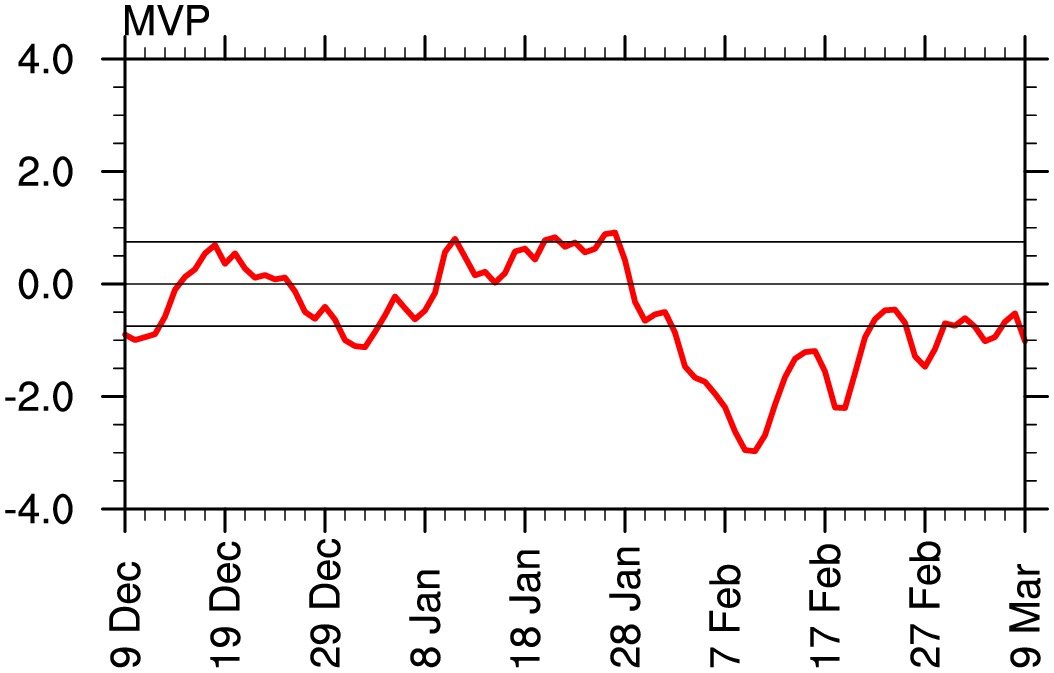
Some of the experimental work to assess the impact of MJO on tangible North American weather is yielding interesting results. For example, typically, Phase 8 of the MJO is typically cold in the east DJF but, when the experimental Multivariate PNA (MVP) is negative, it actually trends warm. MVP is assessing OLR as a decent proxy for tropical convection in the MJO domains as well as streamwaves at 850 and 200 hPA in near real time . If you look at the MVP plot for the last 90 days, you can see it has indeed been negative during the time period we expected the best outcomes according to the ENSO and MJO forecasts.

If y'all want to dig into MVP a bit, here's some decent reading.
Peer-reviewed, evidenced-based paper:
White paper inject for NWS staff:
https://www.nws.noaa.gov/ost/climate/STIP/37CDPW/37cdpw-cschreck.pdf
Easy-to-digest slide deck from the researchers:
https://slideplayer.com/slide/13103907/
Link to real-time Multivariate PNA outputs:
https://ncics.org/portfolio/monitor/mjo/extratropics/
BTW, click around that site if you are interested in tropical forcing outputs. There's an absolute treasure trove of MJO & tropical forcing data there.
-
1
-
4
-
-
36 minutes ago, yoda said:
I think Ji would be okay with this map

The ground is so muddy that Parr's Ridge sank into one, massive sinkhole.
-
4 hours ago, Ji said:
Wow....just a terrible stretch

Just a crappy, crappy Atlantic this year.
-
@Ka60, what was our total? Looks over an inch.
-
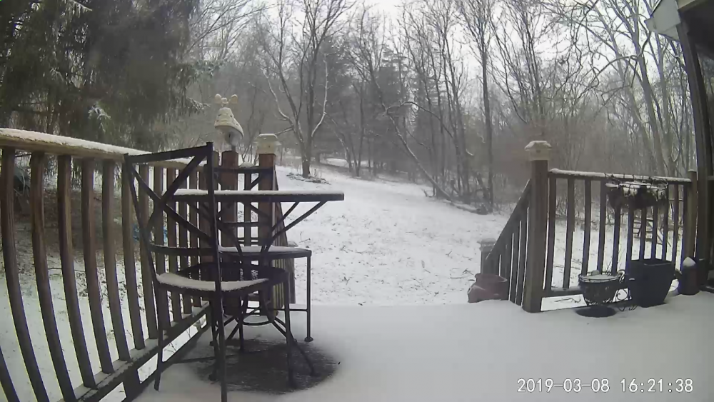
0.5” in Clarksburg. Roommate just measured for me. 32.6°F/32°F. Sidewalks have caved. Roads in the process.

-
2
-
-
4 minutes ago, AdamHLG said:
It is legitimately snowing outside in Frederick enough so that the autopilot on my Tesla will not engage due lack of camera visibility. I actually need to drive back to Baltimore county the old-fashioned way and use my steering wheel.
Sent from my Pixel 3 XL using Tapatalk
First world problems.
-
4
-
-
40 minutes ago, psuhoffman said:
Would you say Montpelier is the best “larger town” for big snows and not being in a shadow effect up there?
Yes. At 7,500 people, it's the smallest state capital but in the top 10 or so in population here in Vermont. Other larger "cities" are in the shadows to the east and west. Looking at population stats can be misleading here in Vermont. My little town, Charlotte, has 3,500 people but the "downtown" is 5 or 6 buildings, 2 of which are businesses and a relatively large agricultural area. Vergennes, 15 miles south, has less people but is a thriving town with 50-75+ businesses, restaurants, churches, etc... arranged in a classic Vermont layout with a central town square. So, it is much more "town/city" like. Montpillier is the exact same way. The town center is pretty large and picturesque. But there are more people in the outlying areas. Imagine, if you will, maybe Frederick MD. But, take away 1/2 of the businesses and replace them with a State Capital building, a federal building, some court houses and a bunch of state government buildings. That look more New England style (brick, stone, columns, etc...) than ugly Bauhaus structures. And craft breweries and outdoors/ski shops every 3rd storefront... And, cool people that are more about you as a person than what you do or who you know or what you have.
-
1
-


Where are some good places to live near DC to maximize snow potential?
in Mid Atlantic
Posted
Clarksburg has been a good happy medium between the benefits of elevation and distance from the UHI of DC vs. commute times. For me, anyways.
If you like big, synoptic storms, Clarksburg and the rest of Parr's ridge running NE through MD is not bad. For example, there have been two storms in Clarksburg just in the last decade that have exceeded the largest storm in Indiana history (26" in St. Josephs County in 2011) with that number increasing to 4 in places 10-20 miles NE up Parr's ridge. Those places NE tend to put you away from reasonable commute times to DC. For Clarksburg context, In the last decade, there were those two 26"+ storms (33.6" and 28.0") but the numbers for significant but not-as-large storms increase to 3 storms of 20+", 5 storms of 15+" and 7 storms of 12+" in the last decade. Not bad for what is effectively the south. Also, for context regarding commute times; if I leave my house at 6am, I get to work a block west of the White House in 40-42 minutes. If I leave at 6:15am, it can take 1.5 hours. If I leave at 6:30am, it can take two hours. Big incentive to get out the door in the morning. That's for like 35 of the 52 weeks of the year. The others, (summer, holiday weeks, etc...) are much more reasonable.