

das
-
Posts
2,154 -
Joined
-
Last visited
Content Type
Profiles
Blogs
Forums
American Weather
Media Demo
Store
Gallery
Posts posted by das
-
-
27 minutes ago, HIPPYVALLEY said:
I’m still under 15” for the season.

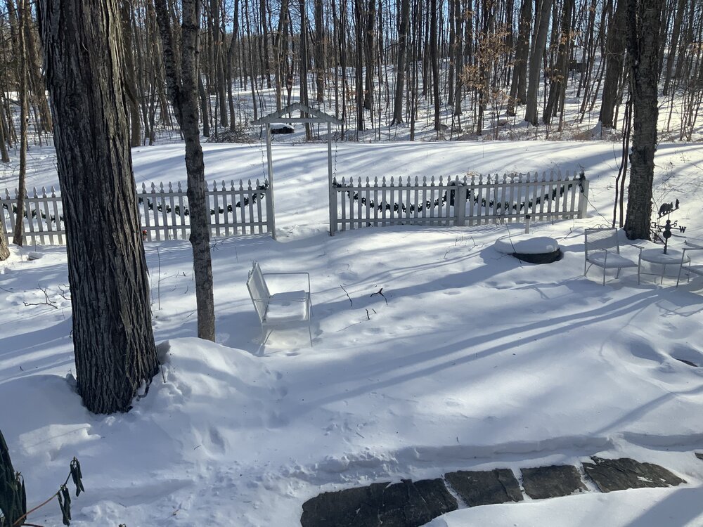
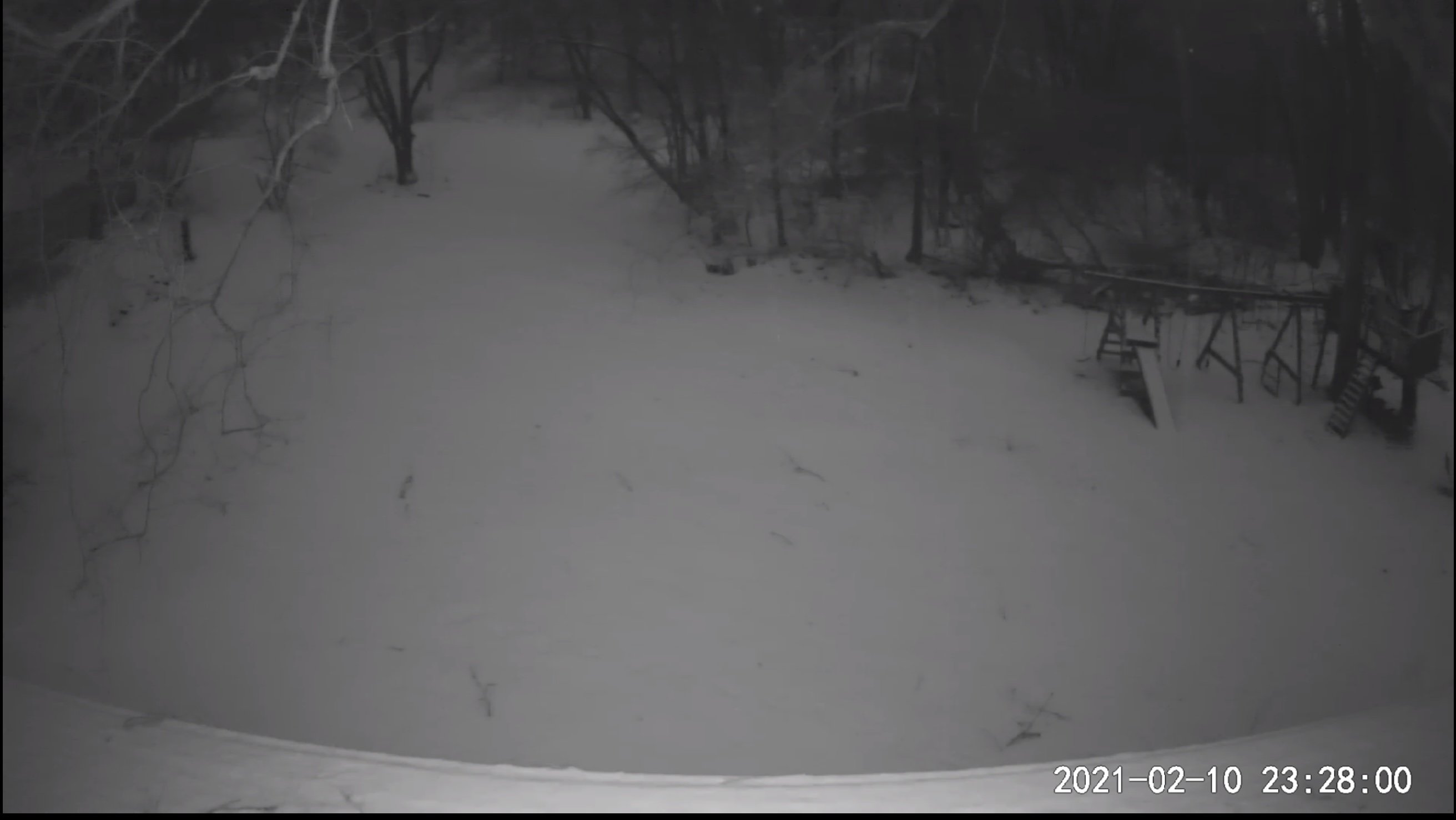
I’m at a whopping 22.4” for the season but, at least, it’s looked like this since the middle of December. (taken just now out my front door). I do miss the big coastals from MD but I love the constant cold and snowpack.
-
 3
3
-
-
7 hours ago, dmcginvt said:
Stowe VT, 0 inches, we were the cold high that made it happen. IT was cold. You are welcome. temp has actually gone up from 1F to 4F tonight
The cold was indeed legit. Here in the Champlain Valley, we were a tad below (horizontal advection) ground blizzard criteria with 6 hours of steady north winds of 16-21mph with gusts between 24-31mph for the duration. There was only two hourly obs of snowfall for the entire storm (some lake-enhanced diamond dust) and the high was 1°F with a low of -8°F. I’m about 18mi south of Burlington. There were some vertical advection components to the storm here with numerous 100m snow devils, likely terrain and lake-enhanced induced since I am just southeast of the lake.
-
1
-
-
1 hour ago, powderfreak said:
We are getting smoked pretty good.
Was powder, now paste.

Was the same in the valley. 2 hours, 2.5”, 3/8mi visibility.
-
5 minutes ago, PhineasC said:
Gonna need major upslope fluff support for 15” I think.
How was it down in MD? I think the house in Clarksburg got to 4.5" before the flip.
-
2 minutes ago, PhineasC said:
25 here. Hopefully I can hold out. Usually I do in events like this.
Just passed 6" here in the valley with the ULL starting to channel some convergence. Looks like the flow continues to waiver just east and west of south which is really helping to mitigate any shadowing. 29ºF and steady for the last 4 hours here at 300' with visibilities ranging between 1/2mi and 3/4mi as the waves move on through. Just have to make it to ~4pm after which any risk of mixing goes away.
-
2
-
-
2 hours ago, PhineasC said:
A week out? No way. This will look wildly different by Friday.
Hush, you. Remember, guidance picks up the big ones early.
-
2.8” was the final all the way out here on the west coast of New England. Was sitting at a paltry (and expected) 1.4” when the wraparound picked up some moisture off of the lakes and dropped another 1.4” over 2.5 hours late afternoon.
-
3
-
-
14 hours ago, PhineasC said:
Definitely trying to keep last winter in perspective. It was not until the mid-January storm that things really got going here.
Hoping the New Years cutter doesn't wipe out the fragile pack we all have built.
I’ll just have piles after the rain down here in the valley. It’s been a miserable year so far, for sure.
-
And, something more weather related: look at these mesovorticies in the eye wall, two hours after “landfall”. Incredible.
-
3
-
-
Now that the storm is ashore, a slightly banter-ish comment: that WebCam in Grand Isle deserves the storm chaser of the year award. It’s getting sandblasted from the backside now that the water has receded.
-
14
-
 4
4
-
 1
1
-
-
It's snowing all the way down to 300' here in the Champlain Valley. Woo!
-
29 minutes ago, Typhoon Tip said:
Day's a dud for records .. ?
This is like that day in mid July that has a shot at 100 and it's in the forecast, ...but the this pall at 20K feet seems to emerge in just enough to keep in 97.2 ... Only today we shy records by decimals because of this ... which seems like it shows up just for that purpose lol...
Like my old mentor used to say: “never ever ever predict a record and you’ll have a fine career”.
-
17 hours ago, dryslot said:
Lets see how he enjoys May-June with the black flies and the the no seeums when he comes up, They don't care what blood type you are or what part of the country your from, They bite equally without preference, ha ha.
omg. OMG. O. M. G. The black flies are horrific. Never have I ever been in a place where I can't outrun a freakin' fly. They draft behind your head, ala NASCAR, and then make you go yelping down the path at top speed flailing your arms about like an absolute lunatic when they bore a hole in your neck. OMG. And the bite itches and hurts for hours. The idyllic Vermont scenes on the Hallmark Channel never prepared me for this BS.
-
3
-
-
31F / 21F here in the Champlain Valley. Snow started 30 minutes ago. 1/2mi visibility. Mostly individual dendrites with some conglomerated groups.
-
6 minutes ago, George001 said:
Yeah, that’s not a good run at all. It went way east with the low which I did not expect it to do, I’ll give it another run but I’m starting to think I’m going to bust. That’s too bad, the models looked good as they were last night, I don’t know why they shifted 50 miles east but they did, and that destroys my entire forecast. It’s still close but what a terrible performance by the models making that big of a shift this close in.
This has nothing to do with model performance. It’s not called modelology. If your forecast is based on model read outs rather than an understanding of cloud physics, fluid dynamics and numerical weather prediction comprehension, it’s not a forecast at all.
-
3
-
2
-
-
3 hours ago, MegaMike said:
No. Public websites keep snowfall calculations simple because 1) scripting Cobb's/Dube's algorithm is too computationally expensive 2) in the end, it doesn't matter which algorithm you utilize for forecasts or 3) they can't write the script.
Besides what I wrote above regarding positive snow depth, 10:1 ratios is easier to compute:
a) If they use a precipitation type algorithm (csnowsfc is boolean wrt snow-> 1==snow, 0==not snow): snowfall = csnowsfc*LWE*10. For snowfall, precipitation type algorithms perform well... Diagnosing mixed precipitation type is problematic though. Here's an article that provides results using "observed" data: https://journals.ametsoc.org/view/journals/apme/55/8/jamc-d-16-0044.1.xm. Go to Table 1.
b) If they use microphysics scheme output (SR is continuous -> from 1==all frozen precipitation to 0==no frozen precipitation): SR*LWE*10. You occasionally.......
Nice post. And great link to the Reeves paper.
For those of you interested in helping numerical weather prediction to iterate to better outcomes by aligning this this math and code with observed data, do your citizen science part and use mPING to submit your real-time obs. These next couple of dynamic storms will be a great opportunity to gather good data on the morphology of precipitation types.
-
1
-
-
1 hour ago, powderfreak said:
“We don’t live at 500mb” seems to come to mind too. I always hear about it’s H5 scores.
Maybe the NWP scoring analysts all live in Bolivia.
-
1
-
-
23 minutes ago, Typhoon Tip said:
Lol -
I don't know what those are called in all honestly. You know ? those tiny little 'dandruff' sized balls of white that bounce on the hood of a car. It'd need to do that for 20 days to get an inch worth, but they're real. They're about the size of a single 'grit' ... I dunno.
It's like the pixie dust Will was mentioning above, only it gets balled up - balled pixie dust maybe
I always just call it styrofoam.
-
2 minutes ago, jayyy said:
ACTUAL SN+ out there. Beautiful.
40-44dBZ SN radar returns are legit.
-
1
-
-
32 minutes ago, Ka60 said:
It is so amazing. perhaps 2"/hr This is incredible.
I forgot to have the roommate turn on the back yard lights so I’ll have to live vicariously thru your reports. <>edited to add: 31.8°F/32°F there at the house in Clarksburg>>
-
33°F/32°F in Clarksburg with SN. Dirty snow is white again, new snow on all elevated surfaces.
Man, the radar sure looks juiced to the WSW entering WV along the low level jet. It will be interesting to see where the heaviest snow sets up running west-east in MD.
-
2
-
-
Oops, posted obs in the other (wrong) thread. Just passed 2" here in NW VT. Looks like the 1-3" will be more like 2-4" up here. 16F/15F, calm wind.
-
4 hours ago, Ginx snewx said:
I saw that. Looks good for 4 to 8

Looking like good guidance for here in NW VT. Just passed 2" at 11am here. 16F/15F, calm wind.
-
1
-
-
1 hour ago, powderfreak said:
That NWS met now has 11.4” Storm total in Milton and only 1” last hour lol.
I think we are around 6.5” here in Stowe Village. Steady snow still going.
It was pretty vigorous. I just passed 7" here in Charlotte and 3.5" of it came in 1h45m from 3:45pm to 5:30pm. The convergence was definitely greater 20mi to the north in Milton so it's likely a legit measurement as they were under it for like 3 hours and they started with 4 or or so already while I only had a measly 2.5" when it started. Steady snow still going here. It's going to be a nice 24 hours upcoming as waves of moisture continue to wrap around the GOM low.
-
1
-


OBS/DISCO - The Historic James Blizzard of 2022
in New England
Posted
I don’t know why but the snow blower stripe on the tree trunk cracks me up.