

das
-
Posts
2,233 -
Joined
-
Last visited
Content Type
Profiles
Blogs
Forums
American Weather
Media Demo
Store
Gallery
Posts posted by das
-
-
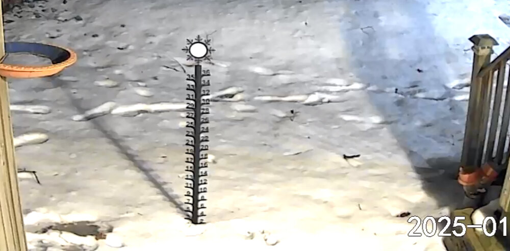
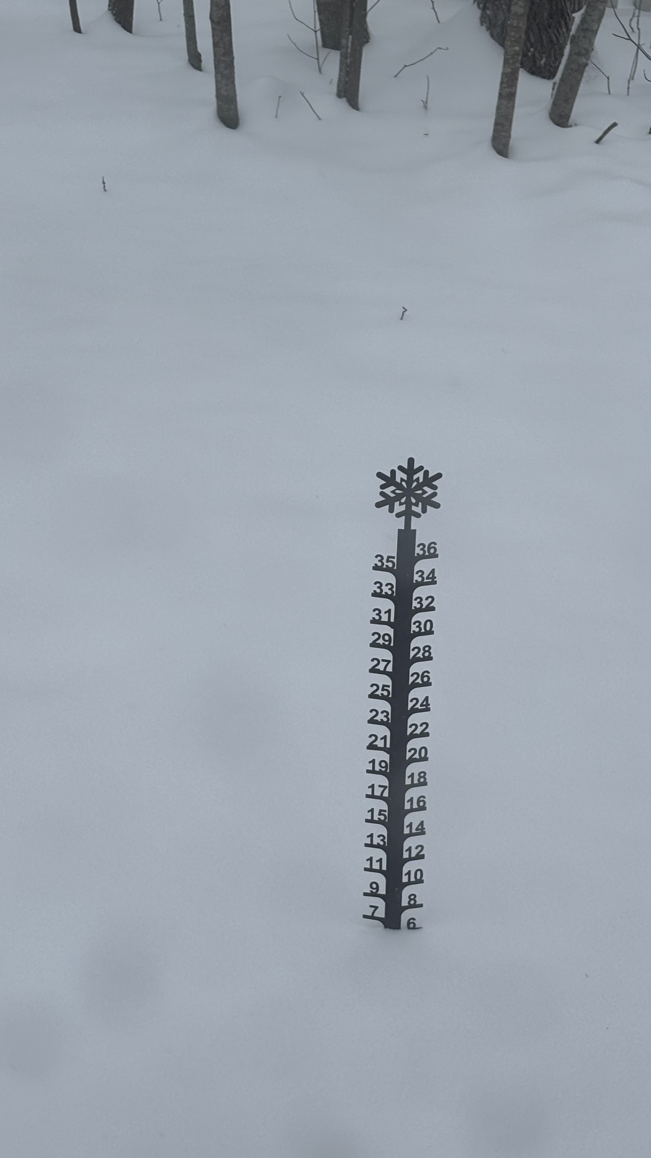
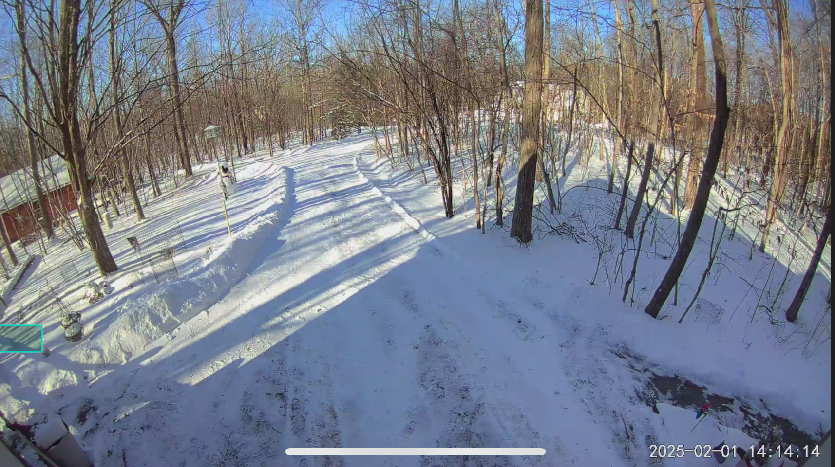
Dews and temps are down 2° to 28.1°F / 25°F on NW13G25 here in Charlotte. Light snow continues. Total so far is 6.3”.
-
 1
1
-
-
12 minutes ago, BrianW said:
65 here and feels like a summer morning out there with some dews and full sun. Great day to cut the lawn.
I came home from 70°F Morocco on Wednesday to this:
…and find snow piles still in the yard. And now this today.
Not unhappy.
-
3
-
-
Looks like we are in the very narrow jackpot zone here in Charlotte. Just passed 6.1” at 9am. 10 miles to the north they have about 3 inches and I have heard that 20 miles to the south was wet snow and rain with very little accumulation. Winds have been light and from the north the entire event. The forcing/boundary has just started to sag south and winds are getting gusty and response. That will bring in some dry air for sure. 30.1°F / 27°F
-
3
-
-
12.7” was the total here in the Champlain Valley. We had two hours of IP from noon to 2pm then flipped back to SN as soon as the 850’s crashed. I can hear the wind up in the treetops here in my sheltered location.
Just under 22” OTG.
-
3
-
-
17 minutes ago, osfan24 said:
The good runs?
Eat a lot of chili and drink a bunch of cheap beer.
-
 4
4
-
-
36 minutes ago, mitchnick said:
.thumb.png.eae9f93ce948d379ec7f01b1d099744e.png)
Crawling. Nice.
-
52 minutes ago, Prismshine Productions said:
How you feeling about our spots in the valley? 4-8, inch of sleet, then glaze?
Experimental - Leave feedbackWhat's this?Location Low-End
AmountExpected
AmountHigh-End
AmountChance of Seeing More Than 0.1" 1" 2" 4" 6" 8" 12" 18" Brattleboro, VT 3" 8" 12" 98% 97% 95% 87% 72% 51% 12% 0% I'd guess late morning transition to IP as the warm nose moves in between 925 and 850mb. The warm nose will drop a bit flipping us to ZR before we flip back to SN as the cold comes crashing back in. Latest trend has IP lasting quite a few hours so your 1" estimate is not bad. ZR will be maybe 0.05 to 0.10". 2m temps should stay below freezing the whole time.
-
1 hour ago, Ralph Wiggum said:
@Scraff SBI was reading high so ran out to stock the fridge. If all else fails, the cellar is loaded with stouts and imperial stouts. And if the storm falls apart, well, I won't remember it anyway
Fiddlehead, eh? My recent favorite. The brewery is 3 miles from my house here in VT. I know where I am stopping on the way home tonight!
-
1
-
 1
1
-
-
1 hour ago, stormtracker said:
Anybody have important plans Thursday?
I'll be in DC / Clarksburg for the week. Oiling up my snow shovel and making ridiculously tall snow piles that'll last until June.
-
7
-
1
-
 1
1
-
-
5.7” in Charlotte, VT.
-
I am happy to report that 100% of the precip from this storm up here in Clarksburg has been snow. That said, it was for around 10 minutes hours ago...
Edited to add: Oops, spoke too soon. Now we are getting some sprinkles. 35ºF / 21ºF
-
2.5” was the total up here. We were right on the north edge. Another 20 miles up the valley just got a dusting.

Too lazy to get a good pic so a floodlight cam pic it is. 9°F at 2pm with a forecast low of -7°F for tonight. Perfect post storm weather in my book.
-
4
-
-
19 minutes ago, powderfreak said:
8.5”-9” for Mansfield.
High Road Plot had 4.5” at 9:30am and then added another 4” in 5 hours through 2:30pm.
The differences have been wild this year from Champlain Valley to Greens.
The low level wind from the (dry) north has been so very persistent for the last 30+ days. You have to go up to the mid levels to get any appreciable moisture coming from any of the westerly directions. Even the moisture coming off of the Great Lakes when the wind is westerly is scrubbed out by upslope on the west side of the Adirondacks (and subsequent downsloping here in the Valley) with the only real moisture making it to y'all at the mids... Again and again...
-
1
-
-
1.1" in Charlotte, VT. For the umpteenth time this year, synoptic moisture comes in less than modeled/forecasted here in NNE. When in drought, predict drought...
-
1
-
-
Up here in NNE, the battle on the front lines will be fun to watch. These are the forecasted high temps, starting with today's high temp and thru to next Tuesday:
13ºF, 28ºF, 21ºF, 36ºF, 14ºF, 28ºF, 37ºF, 18ºF
-
1
-
-
43 minutes ago, mreaves said:
@dasshould be able to confirm. I think he lives in Charlotte.
@ineedsnow @dendrite Indeed it was. 2.1" in 4 hours as the band wavered over a couple of times.
-
1
-
 1
1
-
-
1.1" so far here in Clarksburg. Meh. Two, maybe three bands of wraparound about to start moving through. Don't think I'll pull off 0.9" to get to 66% of the low end of the forecast. Yes, I am being pedantic.
-
19 minutes ago, DarkSharkWX said:
whats ur elevation?
574'. I am in a little NE-facing hollow at the top of Parr's Ridge that peaks at 700' around 1,000m to the NNE and rises to 650' in all other directions. So, my "climatology" is more like 630' for this area. Probably more info than you wanted but the microclimate dynamics here are interesting and I've had a long time here to see them in action.
-
1
-
-
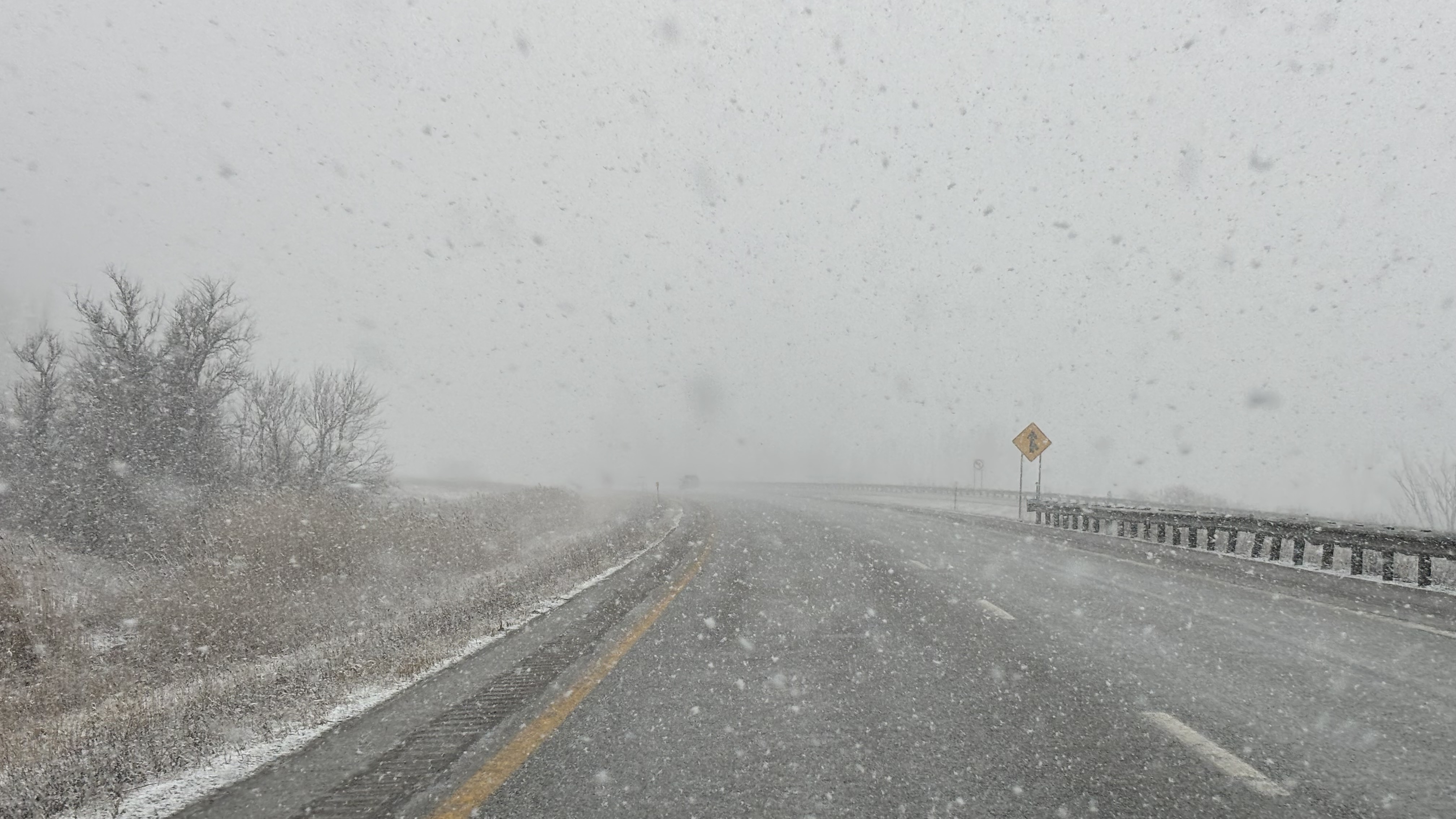
First flakes mixing in here in Clarksburg. Temp down to 33ºF.
-
3
-
-
20 minutes ago, DarkSharkWX said:
you didnt get all snow earlier? im 5-10 miles south of you and i was all snow for a bit, although its very light drizzle now flakes come back immediately once theres some precip heading in
Nope. Working here at the house (PTT for the loss? Win?) with windows on three sides. Not one flake.
-
Still rain and 35ºF here in Clarksburg. Nary a flake.
-
Rain started around an hour ago here in Clarksburg with the temp of 34°. Rain picking up in intensity and it is now 37°F.
-
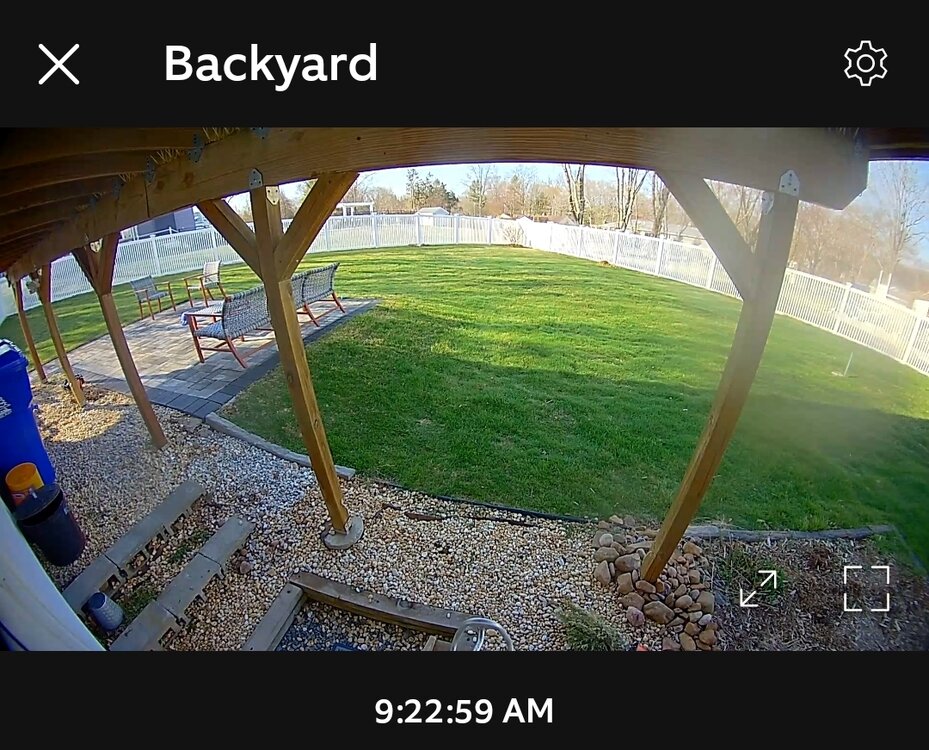
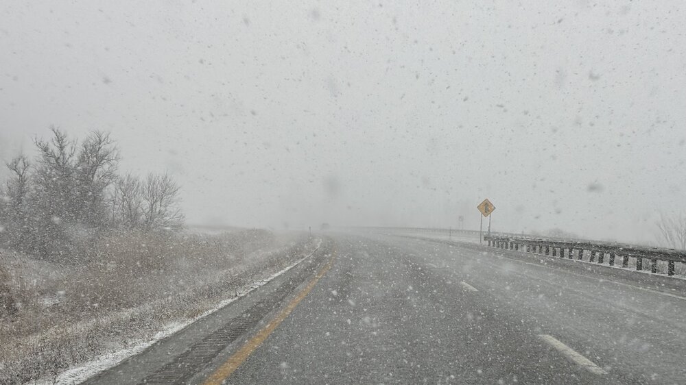
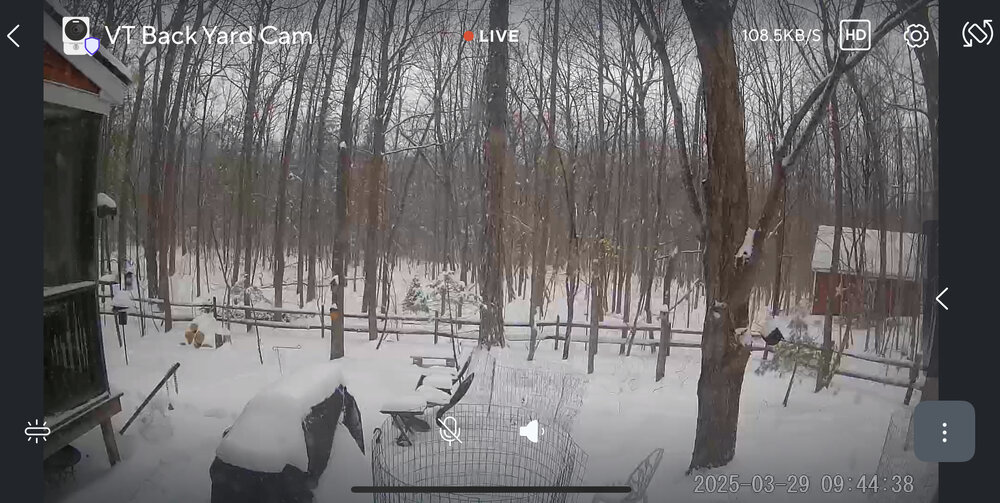
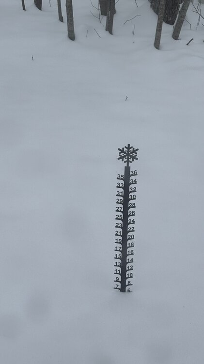
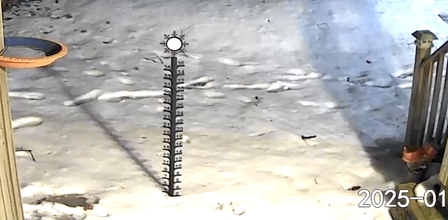
Aaaaaaand, my backyard weather sensors crapped the bed so I am flying blind for the storm. I guess I could find a thermometer to stick outside and check manually but, um, no. It says it's 62.9ºF / 43ºF with a wind of 0mph from the NULL. No amount of fiddling with it / changing batteries / shaking it is helping. Grrrrr..... At lease I can count on the good, old analog stuff:
-
7
-
1
-
 3
3
-
-
2 minutes ago, MillvilleWx said:
Light snow in Edgewater area. Man, what an awesome winter this has been for the lowlands and surrounds.
It's funny to hear this over and over again. We have 8.5" in Clarksburg, less than the 33rd percentile for the area yet everyone thinks it's been a cold, snowy winter because of the days and days of snowcover. This is my favorite. I like big snows but I like deep winter cold with extended snowcover even more.
-
6
-

.png.6192d9b30468f71cd263baf1280c3255.png)
Napril 2025 Obs/Discussion!
in New England
Posted
0.7” on the day here in the Champlain Valley with snow showers on and off all day.
Nice midwinter day…