

das
-
Posts
2,154 -
Joined
-
Last visited
Content Type
Profiles
Blogs
Forums
American Weather
Media Demo
Store
Gallery
Posts posted by das
-
-
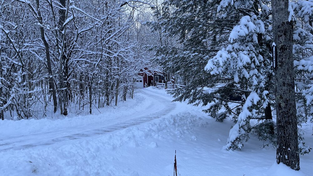
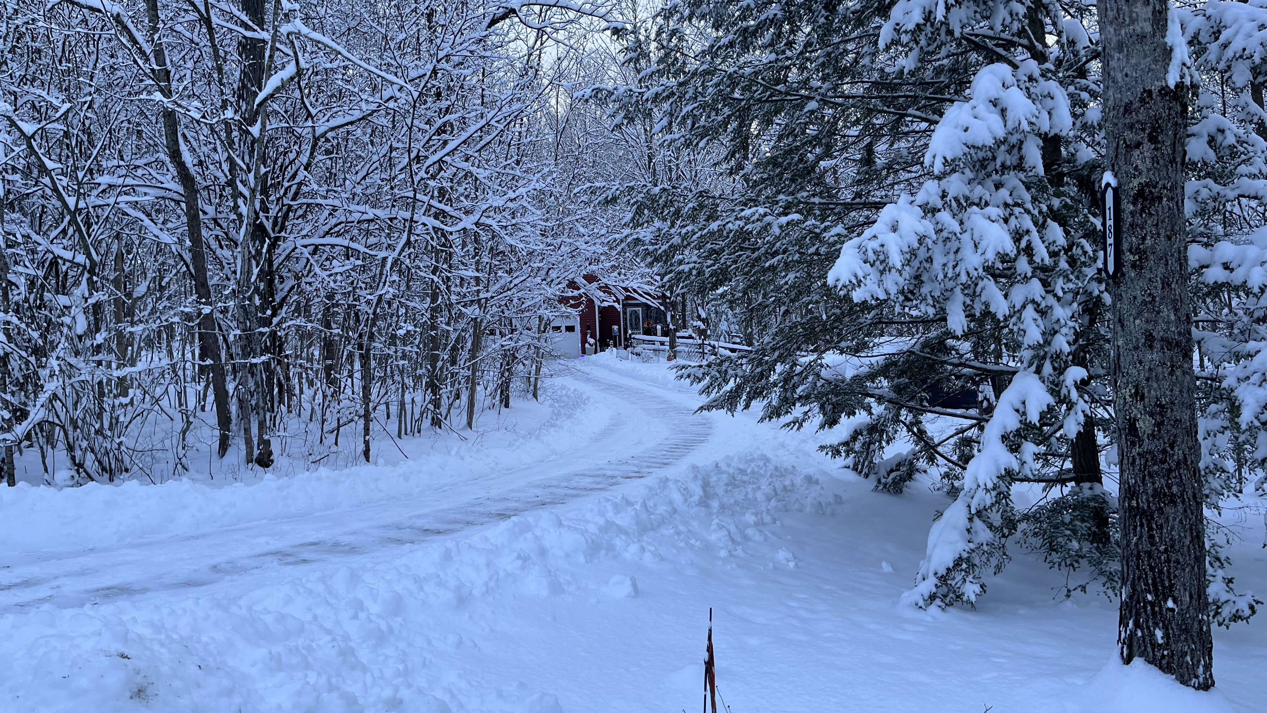
Picking up again. 23.8°F
-
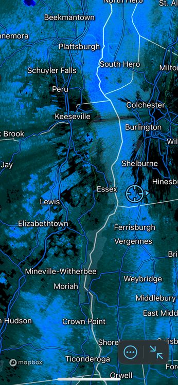
8” was the total here in Charlotte, VT. Only had 2.1” from the WAA snows overnight but the UL trough and embedded shortwave really delivered today. Nice. One more vorticity lobe should pivot thru later and, coupled with blocked flow, should squeeze out another 1/2” before midnight.

-
 9
9
-
-
1.4” up here 18 miles south of Burlington, VT in the valley. It took 3.5 hours to measure an inch. I’ll be happy with 3” by morning so far removed from the low/forcing. Then we’ll see what we can get with the UL trough moving thru late morning.
Temp up a degree in the last 4 hours to 22.8°F on NNW winds of 3mph. It’s been 100% perfectly formed six-sided dendrites the entire time. It’s been a long time since I’ve seen that. Not a single plate, needle or conglomerated bunch.
Have fun down south there with the frontogenic forcing pivoting in and east tonight! See y’all in the morning.
-
1
-
-
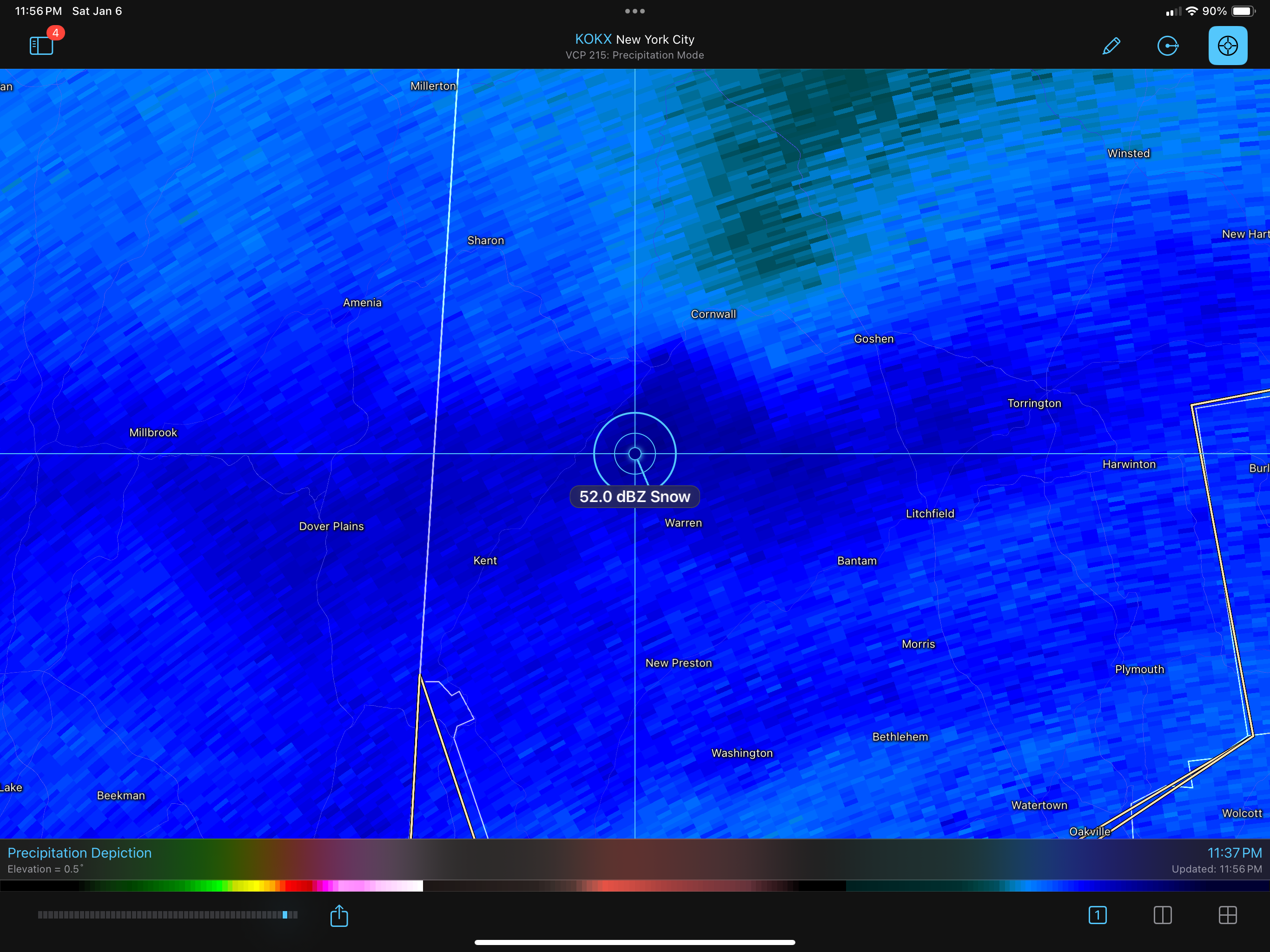
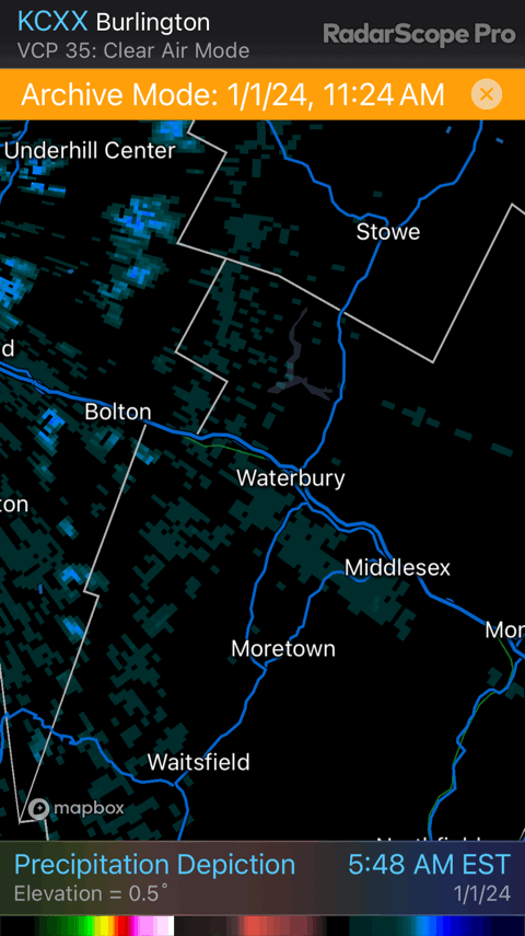
Just putting this here for posterity since I can save big loops here:

-
1
-
-
21.9ºF / 19ºF here in Charlotte, VT
High of 23.1ºF
Light snow continues.
-
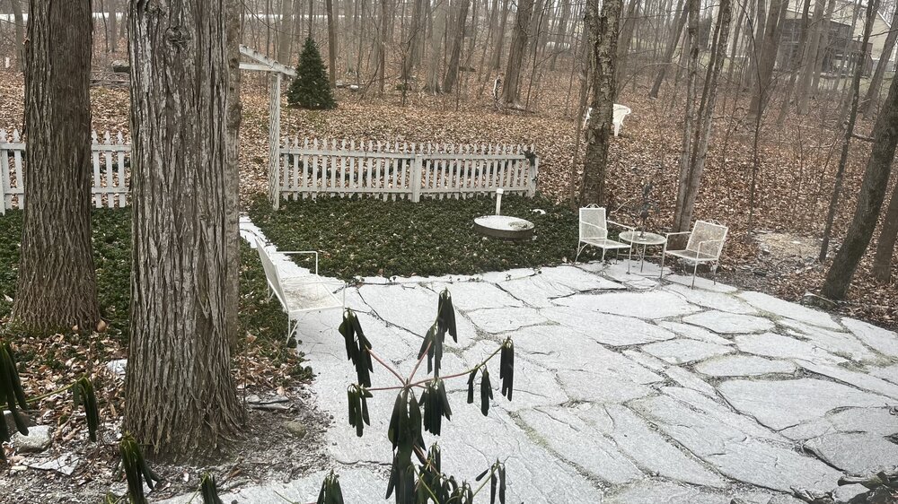
Obs from the house in Clarksburg: 34.8ºF and a RN/IP mix. Mostly rain. Precip started out as SN and maxed out at 0.2" before rain started mixing in. Glad I am up in VT for this storm....
-
2
-
-
56 minutes ago, MillvilleWx said:
Totally understand. A lot is perspective and relative senses. I endured a lot of rainless periods living in West TX and as nice as the days were, seeing everything dead was just awful. I will embrace precip in any form from now on. The pattern will be getting colder mid month moving forward. Hopefully we can track a decent event after it occurs. I still have positive hopes for the season.
I totally get this. Going to school and living in Fresno, CA was miserable. I could not wait to move/work back east.
-
2
-
-
Overrunning Precip has started already way up here in NW VT. Ground is already white.
-
2
-
-
2 hours ago, Torch Tiger said:
wow, speechless

Typically, when you see ops guidance cranking out all-time SLP records at these timeframes, you toss it. But, the ensembles and atmospheric dynamics at play support it.
-
2
-
-
Here comes the reinforcing cold for y’all, moving thru NW VT right now.
-
1
-
-
7 minutes ago, dryslot said:
For the Northern Peeps

I’d guess our 1” of 18:1 fluff will be fully sublimated by the time the deluge on the 10th starts.
-
 1
1
-
-
10 minutes ago, CoastalWx said:
La Nino stole our January.
At least it’s on the right side of the globe this time.
-
2 hours ago, Layman said:
Are there specific characteristics associated with a cutter that allows it to be sniffed out and held onto so far in advance?
Not really. Those on the NW cold side of the cutter on the 10th are fretting and overanalyzing every run of every model, just like this subforum is for this weekend's storm. There's just a whole lot less of them because it's the midwest.
-
I was talking with some friends at BTV earlier in the season, "laughing" that we'd be on the outside looking in in Jan/Feb watching storm after storm run thru the benchmark and leaving us with 1" of cold smoke or, worse, staring at high cirrus. Here we go, I guess.........
-
 1
1
-
-
22 minutes ago, eddygeeme said:
Indeed the last change over event here in Germantown we overperformed I live off exit 16 by Clarksburg and heading up to Damascus. We got 2inches out of what was suppose to be just over a trace. Been living at this location for 8 yrs and it "feels" like one of those situations.
This is indeed the type of setup where Parrs Ridge typically does well.
Edited to add: Those low level ESE and E winds advecting moisture in combined with the upglide can really wring things out on a front end thump like that at Parrs Ridge. Take a look at PSU’s post here. Good rationale there as well.
-
2
-
-
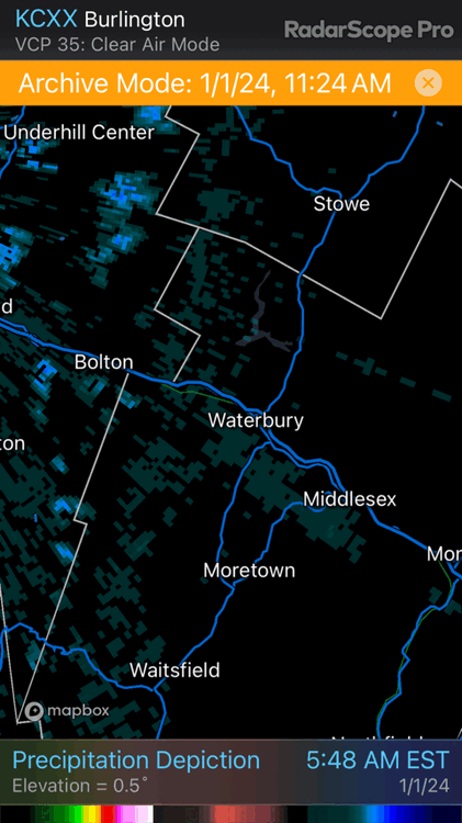
31 minutes ago, powderfreak said:
It was honestly one of the weirdest snowfalls I’ve seen in this area. I know no one cares and there’s other stuff going on, but for an area used to mesoscale differences, this was on another level.
Forge Gym and Country Club of Vermont looked like 4-5” in Waterbury, while Cabot Annex to Cold Hollow Cider to Micheal's went to bare ground with a trace.
The drive to BTV was brown after Waterbury, and the crazy thing was it seemed to snow on just the north side of I-89 in Waterbury. The south facing trees had snow on them, but the north facing ones were bare. Super weird.
4-8” along Mountain Road that you could walk out of. I walk the dog on a 3 mile loop and can essentially punch out of the zone.

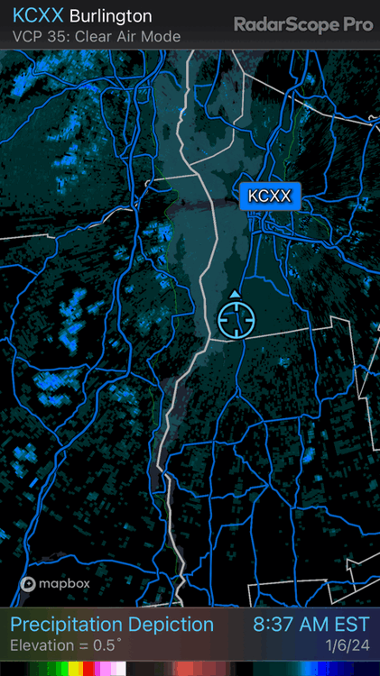
I love microclimate stuff like that. The radar coverage from KCXX is poor there, but it did capture some of the action where it was able to look up the Winooski River Valley. The band had to be less than 10 miles wide and persistent for hours. The highest report I saw was 8 inches. Did you see any higher than that?
-
1
-
-
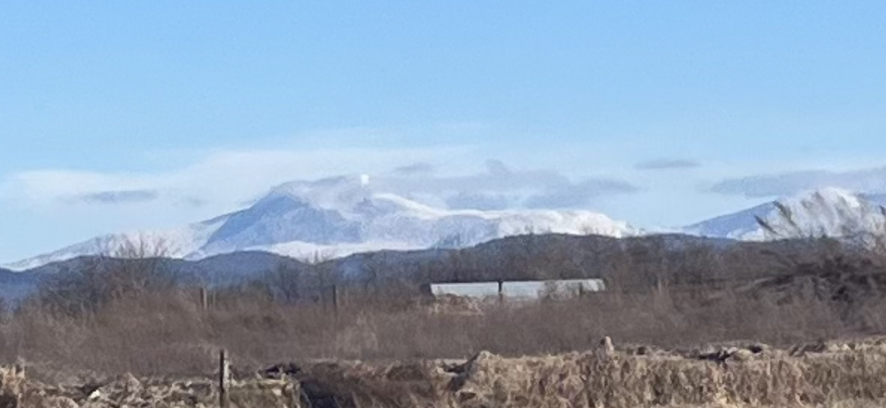
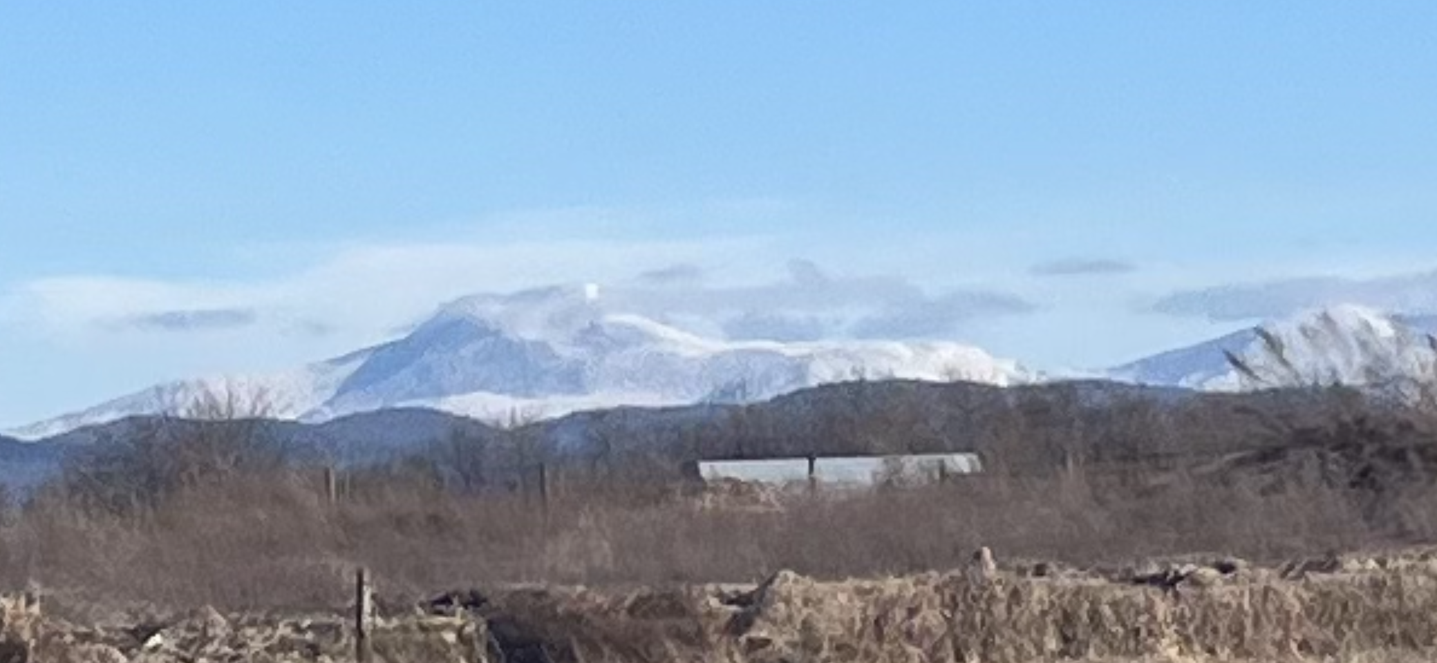
45 minutes ago, powderfreak said:
Saw the sun for the first time since before Christmas up here. Bluebird and fresh snow. Winter wonderland vibes.

I saw it waaaay off in the distance today from the other side:
-
4
-
-
1 hour ago, WxWatcher007 said:
I still think it’s a little too far out to be called a grinch, but obviously if the grid is down through Christmas it’s a grinch lol.
How are things up your way? Did you lose 100%? Just some parking lot piles left around here in the valley. We got skunked last storm here at 284’ with a paltry 0.9”.
-
1 minute ago, nw baltimore wx said:
This should go in banter but it’s great to see @das posting.
It’s been a busy time. Now that I am going back and forth between VT and DC/MD regularly again, I should be mucking around in here again. If y’all will have me.
-
25
-
-
1 hour ago, Stradivarious said:
A volcano just erupted in Iceland. Is there any thought how such an event might influence our weather this winter?
The common understanding has been that short-term volcanic impacts on sensible weather were largely limited to equatorward significant eruptions (like Pinatubo) cooling worldwide weather for a year or two but recent research points to greater duration and impact for significant poleward eruptions. (The current Icelandic eruption is not significant in either ash or sulfur emissions at a global climatological scale). This is an interesting read on the subject if you are so inclined:
-
11
-
 2
2
-
-
On 11/1/2023 at 10:05 PM, Terpeast said:
I put my outlook in a PDF, so I'll put the "tl,dr" here:
There are a lot of mixed signals leading into this winter. But I have seen enough signs to raise my confidence for an interesting winter across the Mid-Atlantic and Southeast U.S. This year is the best chance for a big winter or a top 10 KU since 2015-16 or even 2009-10.
Nice writeup. I am prepared to watch storm after storm cruise by just to my east from my warm(ish), dry perch up here in Vermont. It'll be maddening.
-
1
-
-
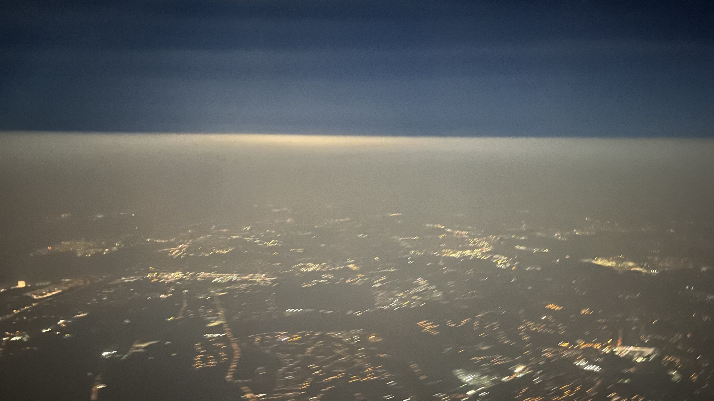
Hi there, mid-Atlantic gang! Flew out of DCA last night at 11pm and took this pic passing thru 10K ft. just north of the Beltway. Pretty cool to see the smoke inversion from above.

-
15
-
1
-
-
1 minute ago, jbenedet said:
Well done. Modelologists making meteorology a farce.
I called the head of the Mission Assurance division at my agency a modelologist a few weeks ago in a meeting. He sat back in his chair with a pleased/satisfied look on his face and then five minutes later said, “Hey!!!”
-
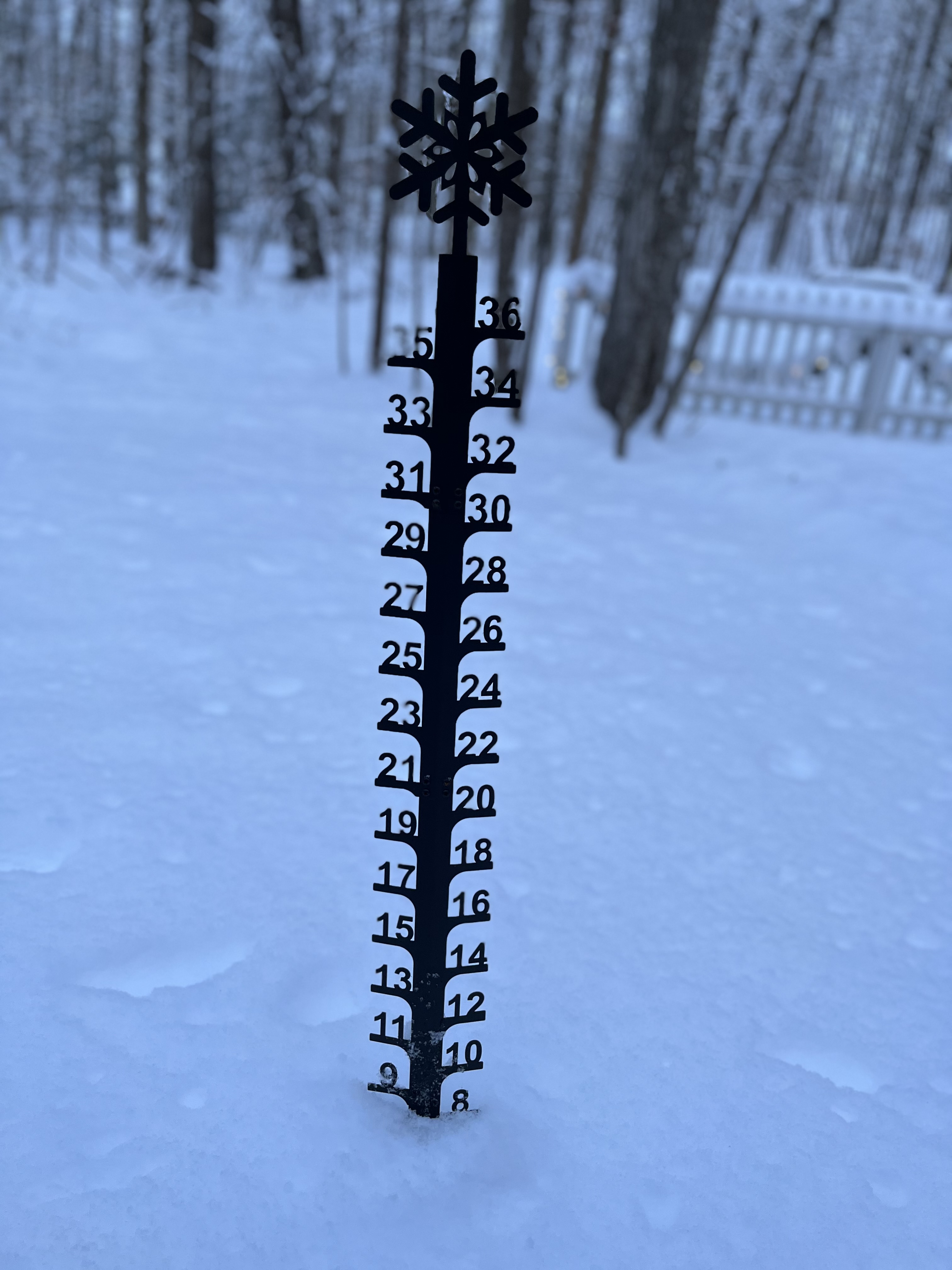
14 hours ago, powderfreak said:
Cold and so much blowing snow in these 30mph gusts in town. The 2” earlier today in the squalls is now getting moved around in a big way. Wind is honking, should be single digits by morning, possibly below zero higher up.
Snow sifting down the roads in the wind, arctic type vibes.
Also, check out this massive “snow devil” a friend caught spinning up near the picnic tables.
IMG_1645.MOV 295.63 kB · 19 downloads
Wow, that's an epic snowdevil. Perfectly placed with the sun behind it.
-
1
-


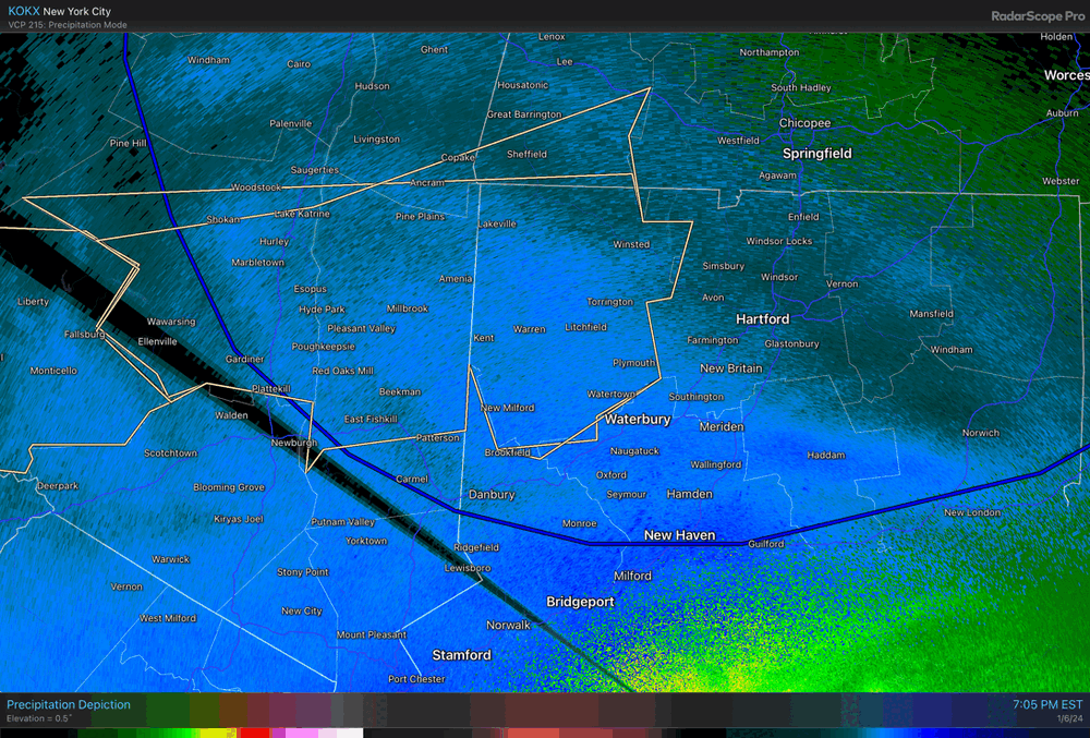
January 6-7, 2024 Winter Storm Obs Thread
in New England
Posted
8.1” here is now 8.5” with the last few hours of highly blocked snow showers. Every dendrite is standing on end on top of each other to get that 0.4 inches. Ha.