jbenedet
-
Posts
7,613 -
Joined
-
Last visited
Content Type
Profiles
Blogs
Forums
American Weather
Media Demo
Store
Gallery
Everything posted by jbenedet
-
We dry slot.
-
The 540 thickness is no where to be found. It's marginal even right under the mid level low...It works because rates are collocated there, but temperature red flags are flying
-
Another classic case where Northeast PA and upstate NY cash in on the snow; Greens/Berks - west. Looks like a cool event there. ZZzzzzzz elsewhere. Longitude >> latitude.
-
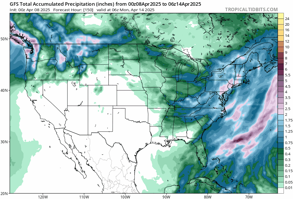
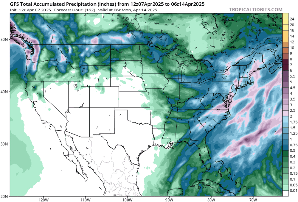
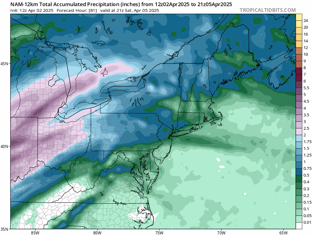
LOL. Total qpf for the "big weekend soaker" down to ~0.25" AWT

-
First half of Decembers have had much better weather than first half Aprils...
-
Zzzzzzz
-
GFS low 30’s 18z Saturday. Unless you have precip rates ripping good luck. Not a snowballs’s chance in hell. Those northeast winds at the surface are advecting from areas 45-50F in NB, by the way….
-
This looks like complete poop on the mesos. Baroclincity ain't there. The surface players are also weak, surface high and low. Temps to our north and west are in the 40's... I don't see the driver for a strong CCB into CNE/NNE. At all. The mid level low occludes over VA and starts spinning itself out... I think we see scattered decaying precip shield as this moves north of the CT coast. Dynamics are absent. 1024 mb high in northeastern NB; 1008 mb low 100 miles SE BM. Synoptic pressure gradient on par with Zzzzzzz sensible weather....
-
37/23 full sun and calm wind. Basically tracking normal after the radiation low.
-
lol GFS clown maps…. yea the precip is real but add 5F to the BL temps. Lots of white rain where the profiles support. Snow confined to the coldest spots, with high elevation.
-
Will be a nice afternoon today. 50’s. Outside of SE MA and islands, the weekend is also trending drier. It’s not done. A lot deamplifying factors for this thing, after it starts spinning out over the mid Atlantic.
-
Nice little pop this hour. 46/14
-
I know all of southern NH is in cahoots according to desk chair critics.
-
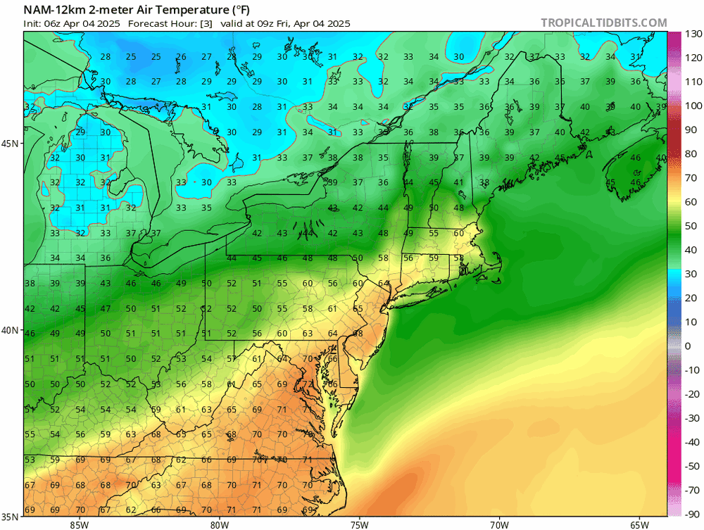
The only thing noteworthy yesterday was the wind. That unequivocally sucked. Otherwise, white rain and mid to upper 30’s is persistence for our early Aprils, lately. Today will top out in upper 40’s in full sun with calm wind. Decent. Sweatshirt, shorts, boots, beer and a beard weather.
-
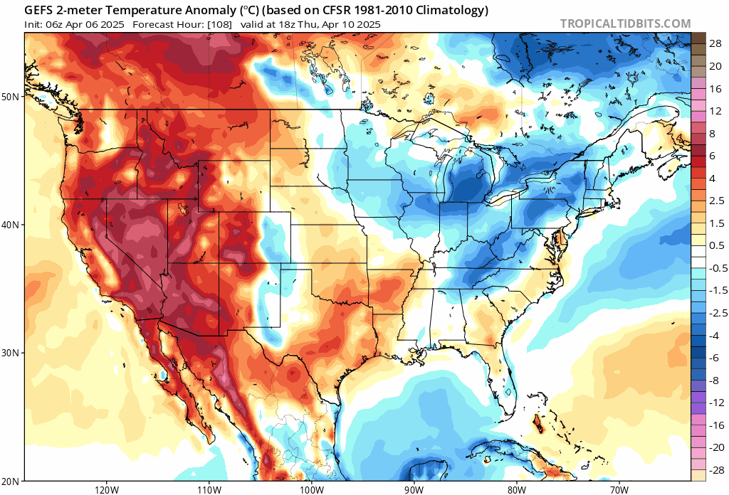
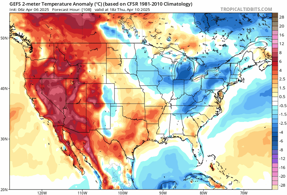
After Wednesday, next 7 days. It’s okay here, given the averages for where most of us live are in the mid 50’s
-
Seems like we get a reprieve this afternoon and then in the shitter again through Wednesday. After Wednesday we break to N to slightly AN which means spring is here and the greening up kicks into high gear.
-
Still looking out for that warm sector that @CoastalWxpromised. Currently in ACY and heading south….
-
62/36 Perfecto.
-
I know you keep saying this while the guidance just keeps getting drier and drier. A real soaker, apparently. Some of us knew.
-
Okay - tell the mid Atlantic that.
-
lol because we are well north of the boundary. It's down to the mid atlantic now...
-
Saturday has evolved to much drier, as expected... Classic... No precip through 21z imby and 2/3 SNE/CNE. I'll take it...
-
Whatever you say...
-
Saturday locked as worst day of the three but trending drier here which is all I can ask for… lucky to hit 40. Still much better than last Saturday… Sunday will be around normal and dry. We take.