

romba
-
Posts
293 -
Joined
-
Last visited
Content Type
Profiles
Blogs
Forums
American Weather
Media Demo
Store
Gallery
Posts posted by romba
-
-
7 minutes ago, Wetbulbs88 said:
18z NAM another improvement. the surface depiction makes almost zero sense so I wouldn’t hang on to that.
Never understood this- why would the model struggle translating what it depicts in the upper atmosphere to the surface?
-
7 minutes ago, WestBabylonWeather said:
been Reading this forum for a very long time
ive definitely seen this movie before. It’s trending better and it’s still 3 days out.
We tend to remember the anomalies that end up crushing, and forget the million others that 'trend' better only to still end up mood flakes versus completely OTS.
That said, I'm hanging on every model run holding out hope we hit the lottery this time
-
2 minutes ago, PB-99 said:
Looks good for upper mid west , not us.
If 93 changed to rain on the coast, what do you think that does displaced 500 miles west ?
50's and t storms baby
-
The models have shown everything and anything at one point with nearly every storm this season and last, so saying 'the models showed a big hit previously and now show nothing, this is where we want to be!' is foolish.
What amazes me is that we are supposedly within the GFS wheelhouse but it still changes so often. At least the Euro has been pretty consistent. It sees what it sees, until some new data causes an adjustment and it changes. The GFS seems to change every 6 hours on a whim. Maybe if it were twice a day this wouldn't seem as big of an issue to me.
-
Just now, forkyfork said:
we've had several day 5 hits this year. you kinda don't want one
Good thing then that GFS didn't show 'a hit'
")
-
 1
1
-
-
Just now, HeadInTheClouds said:
The NAVGEM and ICON, lol.
Add JMA + DeepThunder and we're locked and loaded
-
 2
2
-
-
16 minutes ago, NutleyBlizzard said:
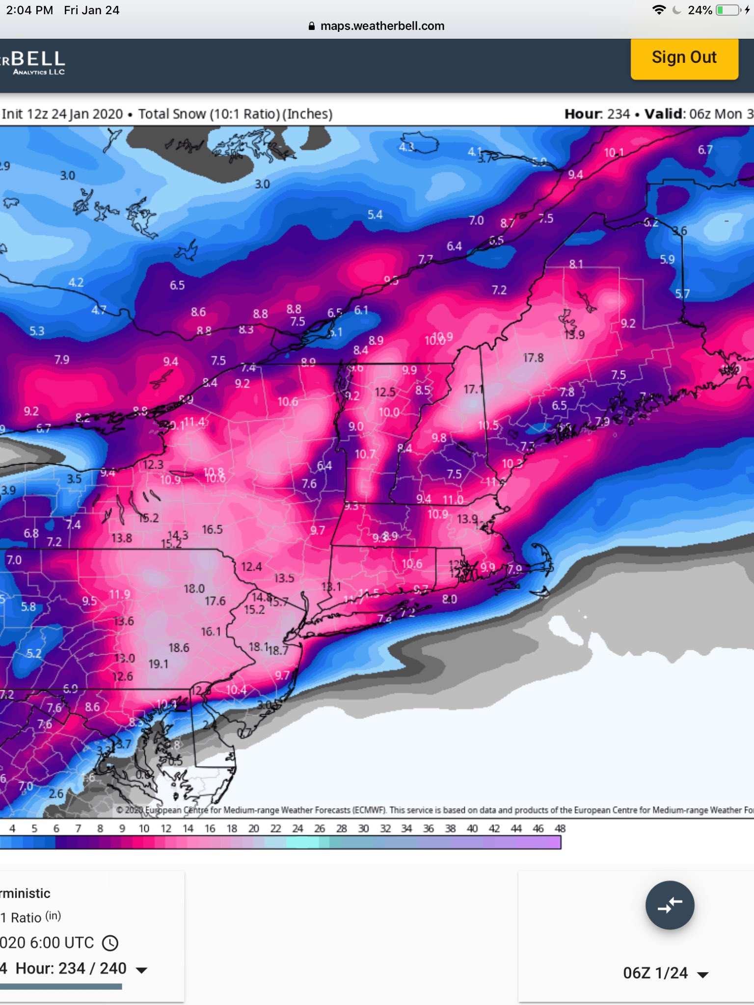
Wowzers. Can I see a clown map so I could at least dream?

Clown Map, as requested
Mid to Long Range Threats
in New York City Metro
Posted
I hope they over-salt your street 4 times in anticipation of this weekends blockbuster