backedgeapproaching
-
Posts
3,816 -
Joined
-
Last visited
Content Type
Profiles
Blogs
Forums
American Weather
Media Demo
Store
Gallery
Everything posted by backedgeapproaching
-
Could be..they actually had a nice band this morning right over them.
-
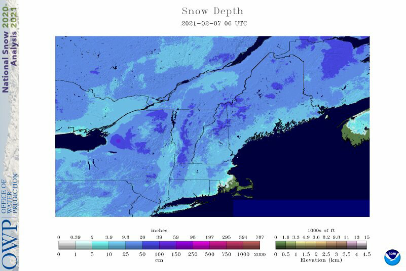
4" give or take was pretty much the number west of the Spine from RUT down through DDH.
-
Slow, steady climb since the Grinch wiped out 30" in the blink of an eye.
-
Yea, some of the mesos were hitting the Berks as a jack, seemed to end up that way
-
Berks
-
Lanesborough had 5".
-
Woodford with a 7" report. Seems questionable again, maybe they got close, don't know. Although radar was interesting today, almost seemed like a blocked SW flow upslope event..echoes seems to struggle to get over towards eastern VT.
-
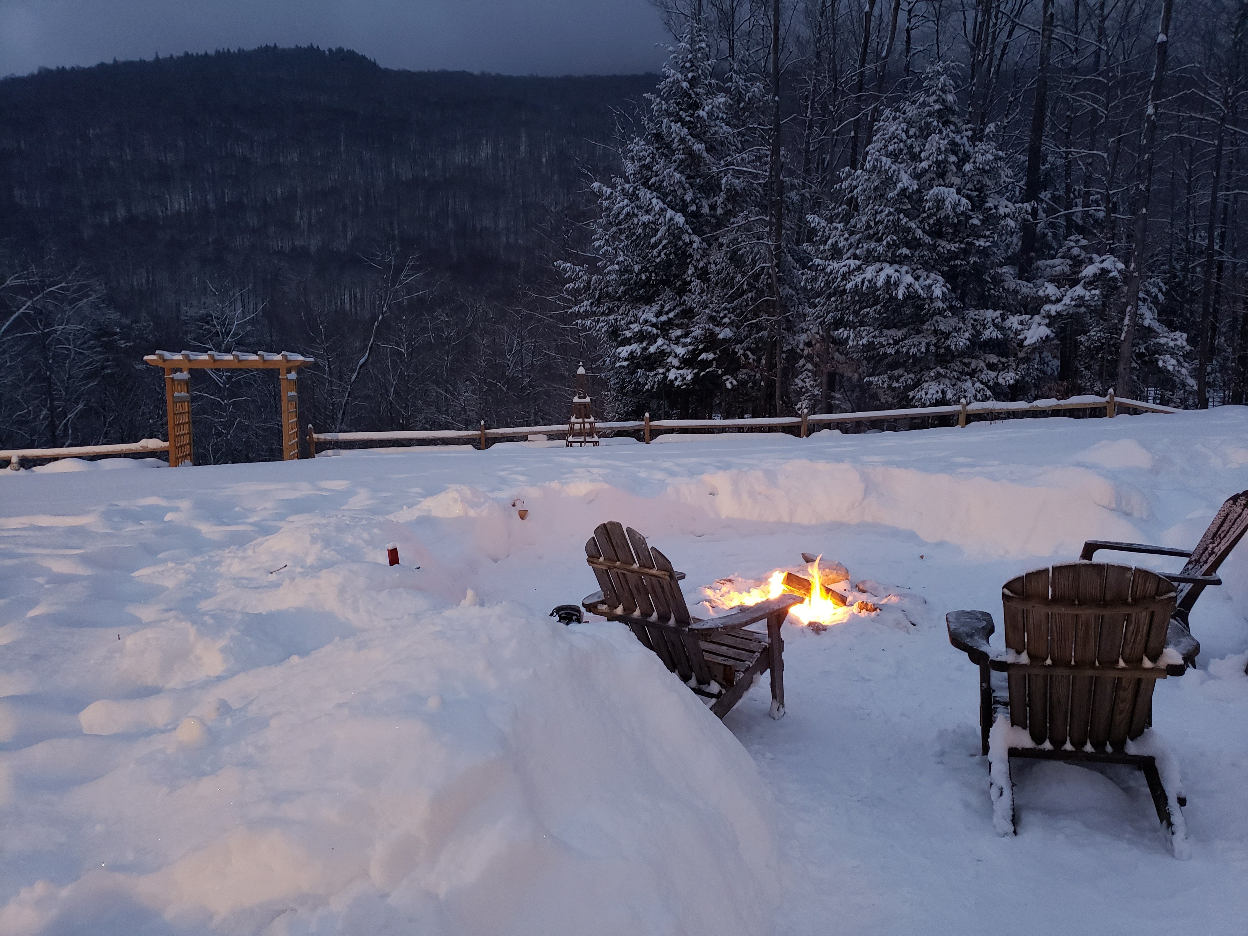
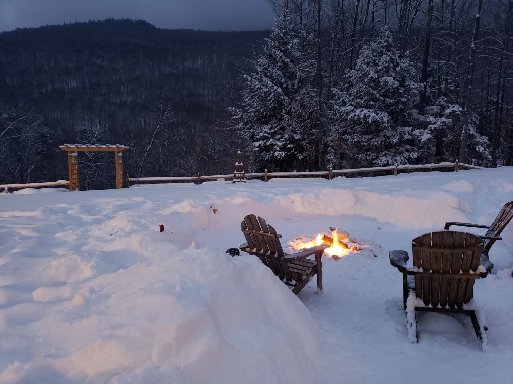
4.2" will do it here. Now little beer and bonfire.
-
https://www.wcvb.com/article/open-houses-cause-traffic-jams-in-crazy-hot-real-estate-market/35451691 Probably added 150K to my house also just from 2018 when we bought. Crazy everywhere-
-
Once this ENY band rotates through W MA snow growth should get better I bet. Best dendrites of the the day right now with this last batch moving through. Been sugar most of the day --certainly hurting accum.
-
Little over 3" here. Been moderate most of the day, with pretty low VIS at times, but snow growth has been pretty bad since early this AM. Nice refresher though.
-
Another totally windless event..love it. Stacking up nicely on everything.
-
Euro isnt too bad for Sunday...not some monster--but could be 6-8" (with ratios) if it pans out like 00Z shows. 12Z GFS lost cutter and more MIller B for Sunday too. ATTM looks pretty good for NNE-still 5 days out though.
-
Snow growth is really good, VIS is still kind of higher than I would think, not crushing rates.
-
Jimmy buried under 2ft on the cape That looks pretty decent for my area- 72-96". Wonder if they are using CO-OP and Cocorahs data? Cocorahs could fill in lots of the gaps that CO-OPs couldn't, so would make sense I think.
-
SNE is getting a little full of themselves right now---like they live in the TUG Hill, every event is a hit..ha. Probably right about Tamarack. Too far removed to get a lot of direct hits from the recent coastal storm baroclinic zone shifting SE a bit over the past 10-15 years, and no bread and butter to rely on. Although I don't really know that area too well and not sure what pattern is best? Guessing 07-08 was good up there?
-
Just did a core of snowpack- 3.37" in 18". Got a little meat to it. Bottom 3-4" is pure ice.
-
Horrific for sure. But that is climo, clunkers and then biggie seasons, lots of variance. Although last year looks like close to an all time rat. Its great for snow weenies like PF said to get a nice run of events going. Ill give them a few more small events, then let's shut it off and shift it north...
-
Just noticed ALY has a map out for Tuesday:
-
Parts of CPV and DDH and RUT area, for sure.
-
Yea, I'm not sure what elevation he was referring to. Any real elevation (2K+) would mostly be near 30" or higher going up in elevation I think like you said. Lower elevation sites throughout VT, yes, that is more comparable and higher in NJ than some of the VT spots.
-
Yea, I mean they just had 3ft. Here is this morning. There is only 1 station that had more than me as of this morning. I guess they added some today? I didn't follow closely down there.
-
Well, coastal was a dud here. Only .7" Have to rely on some bread and butter I guess. Some pre cold front lift producing some huge flakes now.
-
This is the first event in a long while here that has had hideous snow growth.
-
And yes PF, depth isn't outrageous here either(18") but everything is stacked so nicely with with most events being no wind and nice snow growth.