
bwt3650
-
Posts
1,621 -
Joined
-
Last visited
Content Type
Profiles
Blogs
Forums
American Weather
Media Demo
Store
Gallery
Everything posted by bwt3650
-
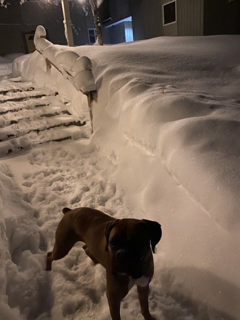
I make the dog hold it for at least a half hour in the morning before he tramples on it. Kind of messed up.
-
Southern vt. and the berks look like they get a decent little thump today compared to up here. Maybe a little upslope thurs into Friday... any thoughts? Certainly, doesn’t look like anything “epic.” Wind did a number on some trails this weekend so could use a little refresh.
-
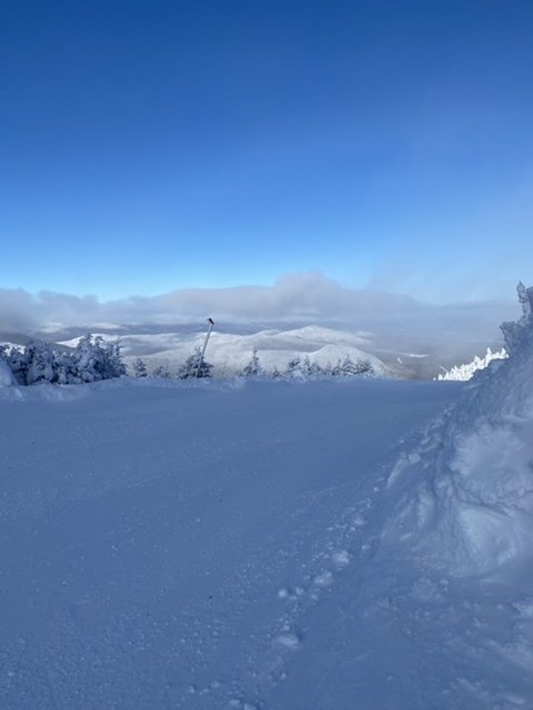
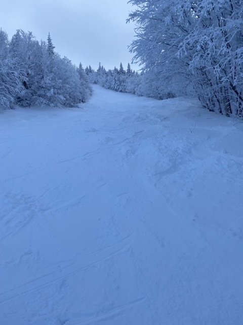
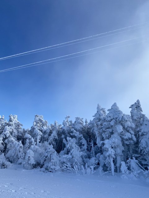
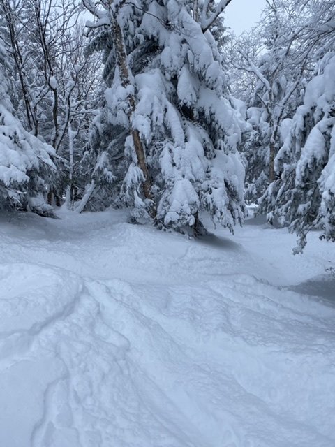
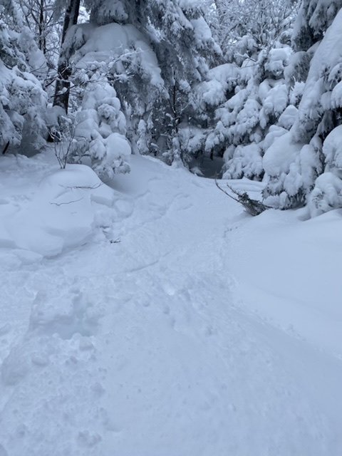
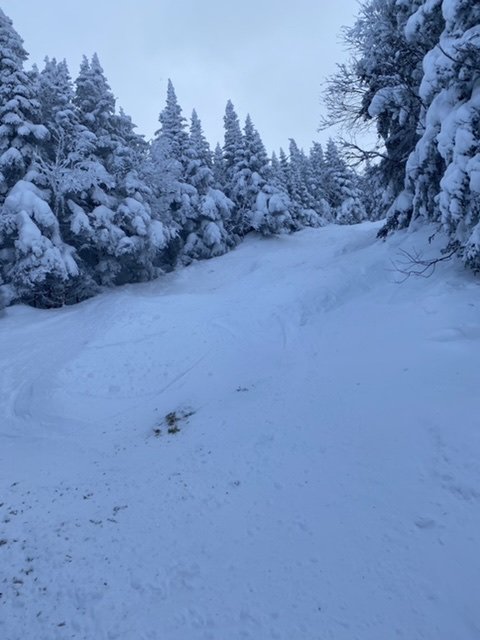
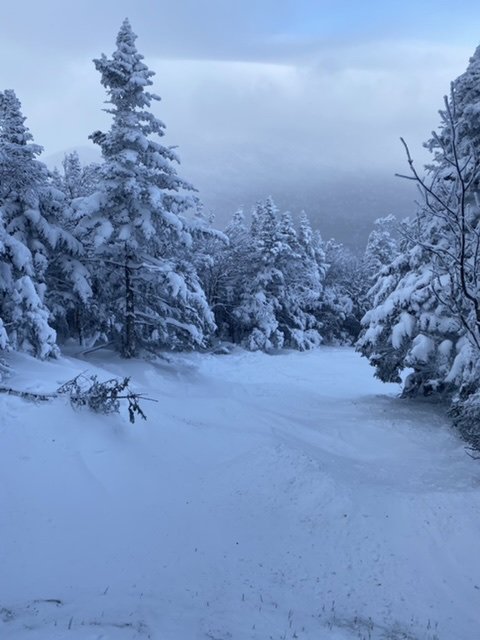
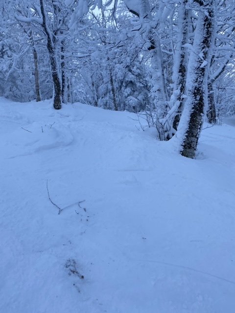
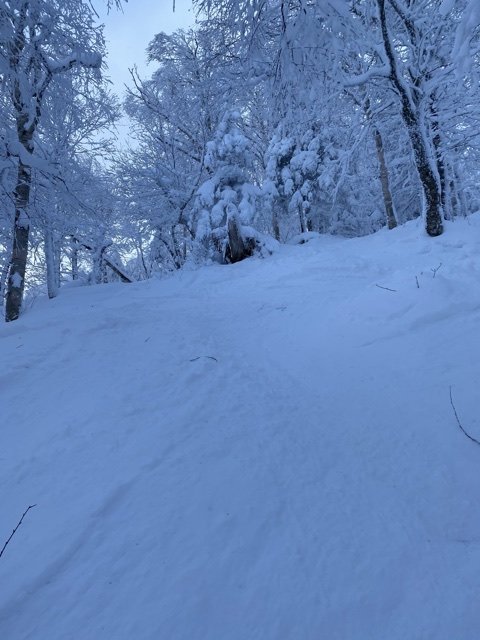
The kind of cold and wind yesterday that made your face covering turn to solid ice from breathing...yeah, it was a true hardcore skiers day yesterday. Coolest thing seeing the wind blow the clouds up over certain parts of the mountain. It was like watching upslope in a science experiment. Obviously, not enough moisture to make snow, but it was like watching the process. Can’t really tell, but in the last picture, the clouds are almost shooting straight up over the peak. The first two are from tram side (jfk) where it was completely empty with the flyer on wind hold. Best bet was to duck in the glades and get out of the wind.
-
All good. I definitely appreciate the data and scientific approach too. It kind of keeps us grounded. I love it up here and even more so, love learning about the micro-climate and the meteorology behind, “wow, it’s snowing again.” I’ll keep the adjectives and pictures coming and you keep the data and science.
-
I stirred quite the conversation with my choice of adjective, ha. To Phins point, it’s probably getting used to periods like this that don’t happen in the mid Atlantic. Over 40” in a week is unheard of there, but clearly pretty standard in mid winter here. While I know what to expect up here and the averages, when you actually see it unfold, I just kind of through the word “epic” out but I get it. You guys don’t like to oversell what is typical mid winter weather.
-
I can see how it can happen when it gets so deep. People (myself included) forget the dangers of the mountains in deep winter sometimes. So much respect for the rescuers and patrol for what they do.
-
I saw a bunch of sleds out last night down near either 105 or 118 (maybe Richford). Not sure the towns around here or the trails, but conditions looked solid. There does trail system in that area along the hi-way, as I see the crossings in a bunch of spots. Looks like tons of fun but I think my wife will leave me if I pick up another hobby.
-
Awesome conditions out there today, but def snot freezing cold! Freezer was on wind hold all day, but if you knew your way around the mountain and didn’t mind walking a little bit, that whole side was empty and untouched. Winds were getting stronger throughout the day, so I called it quits around 3.
-
You would know better what is epic and what is not up here...how about “epic” recovery? Don’t think we go from zero to hero better than we did this week throughout 2020-2021.
-
Valid point...showing I’m a nne rookie...I’ll venture out into the backyard in the morning with snow pants.
-
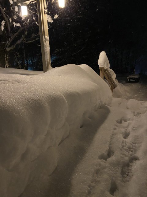
Snowing moderately again..prob another 3”. I think I would classify this week as epic here. Just an amazing amount of snow. Yard stick won’t even touch the ground.
-
Probably a lot of instinct and experience to forecast the whites and greens. I bet it’s an advantage if you grow up in that area and can get a feel for how the mountain behaves under certain conditions.
-
Yeah, it’s fun learning as a kid in the mid Atlantic and Poconos on hills that average 30” a year and freeze/thaw every weekend. It’s all man made ice pellets. But I loved it until I started skiing New England and became a snow snob.
-
Any of you guys not happy with conditions should take the ride to jay this year. Getting dumped on with fifty percent less people than a normal year. I’ll be back out there this weekend and it looks like more powder til Sunday. The woods are incredible right now. I had planned on checking out cannon and wildcat this year (never been) but it really doesn’t make sense to leave jay and Stowe because the conditions are so good right now.
-
My youngest daughter wanted to snowboard instead of ski. It’s def taking longer for her to get comfortable compared to her brothers that wanted to ski. Once kids learn a wedge, they can stop and are good to go and progressively get better. Figuring out a toe edge on a snow board takes more time it seems. I am a skier, who learned to board because my wife did so we could go together. It’s much harder to learn in my opinion.
-
And looking out, there’s really no significant breaks without snow. I’m sure it can change, but maybe a day or two and then it looks like there’s at least some upslope back. The perfect nne winter pattern you guys promised. I guess the difference up here is don’t be scared of red anomalies or cutters that don’t occur around Christmas. Really enjoying being up here so much more this year.
-
To steal a line from sne “you guys tried to tell us”
-
Looks like snow almost everyday between now and the middle of next week on some models with some decent cold...and a substantial pack starting to build...It has turned into the deep winter I think @PhineasC and I envisioned when we decided decided to leave the mid Atlantic dumpster fire and come north this winter. Really looking forward to getting out there and skiing it this weekend and next week.
-
4 seems to be the age where they had the attention span. My 9 year old is obsessed. He memorizes trails throughout New England at all the resorts and collects the trail maps. He will be like “dad, did Stowe open Christie glades yet?” And I’m like, where the f is that.
-
Mine are 5, 7, 9...7 and 9 year olds really starting to get good. My daughter is taking a little longer, but she wanted to snow board instead of ski, which I feel is harder to pick up. We almost had 4 kids..I think after 2 you are outnumbered so why not.
-
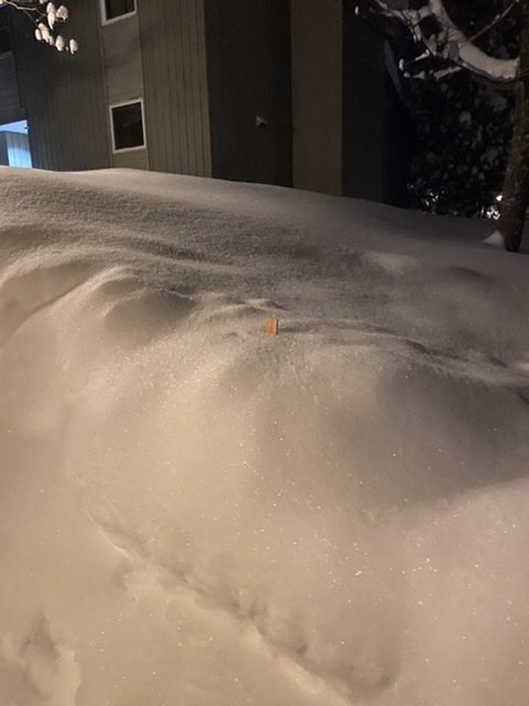
Big fan of that orange dot in northern vt.
-
Pack!!!
-
Another 5-6 last night...really adding up this week. Looks good through Sunday.
-
with all the natural terrain open and no big washouts in the future, conditions should be great all week. Its def lift capacity. You can tell by the way the trails are holding up midweek like last week after 3-4". Normally, by afternoon that is all skied off. I forget who posted it last week but 100 percent on point; this strom and the upslope after was a game changer in the Greens.
-
you have to...skiing, riding, snow and the mountains in general are my stress relief. It should be something that makes you feel excitement and that getting away from all the bs feeling. When it starts causing stress and anxiety, find something else that doesn't. Like 1am Euro runs.


