
Jim Martin
-
Posts
2,469 -
Joined
-
Last visited
Content Type
Profiles
Blogs
Forums
American Weather
Media Demo
Store
Gallery
Everything posted by Jim Martin
-
-
-
Plenty of Fall color here in the Findlay area earlier today.
-
Very pleasant Monday afternoon in FIndlay.
-
Nevada is in Wyandot County, Florida and Texas are in Henry County, Kansas is in northern Seneca County, Oregon is in Lucas County, North Baltimore is in southern Wood County, New Philadelphia is in Tuscarawas County.
-
-
-
For a few in the upper Great Lakes, the Fall color season is just beginning. We are awaitng the start down here in Findlay and Northwest Ohio. This Fall color picture is from November 2017 in Findlay along the Blanchard River.
-
-
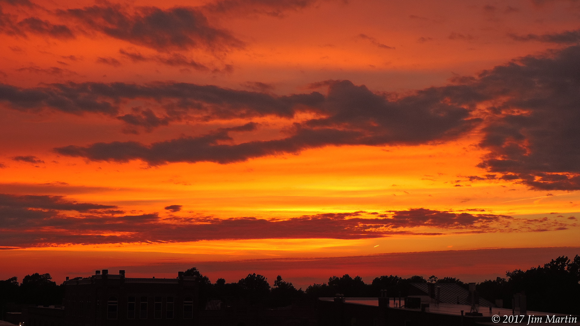
Another great sunset tonight.
- 419 replies
-
- 10
-

-
Golden sunlight this evening.
-
-
Could the risk for severe weather tomorrow be extended a bit further north than previously forecast?
-
Low last night in Findlay was 5 above zero. Currently it is 40 in Findlay. Low last night in Lima was 2 above zero. Currently it is 39 in Lima.
-
-
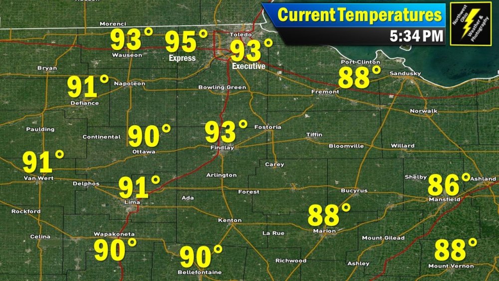
Plenty hot this evening in #NWOhioWx. Toledo in the middle 90s currently.
-

MO/KS/AR/OK 2019-2020 Winter Wonderland Discussion
Jim Martin replied to JoMo's topic in Central/Western States
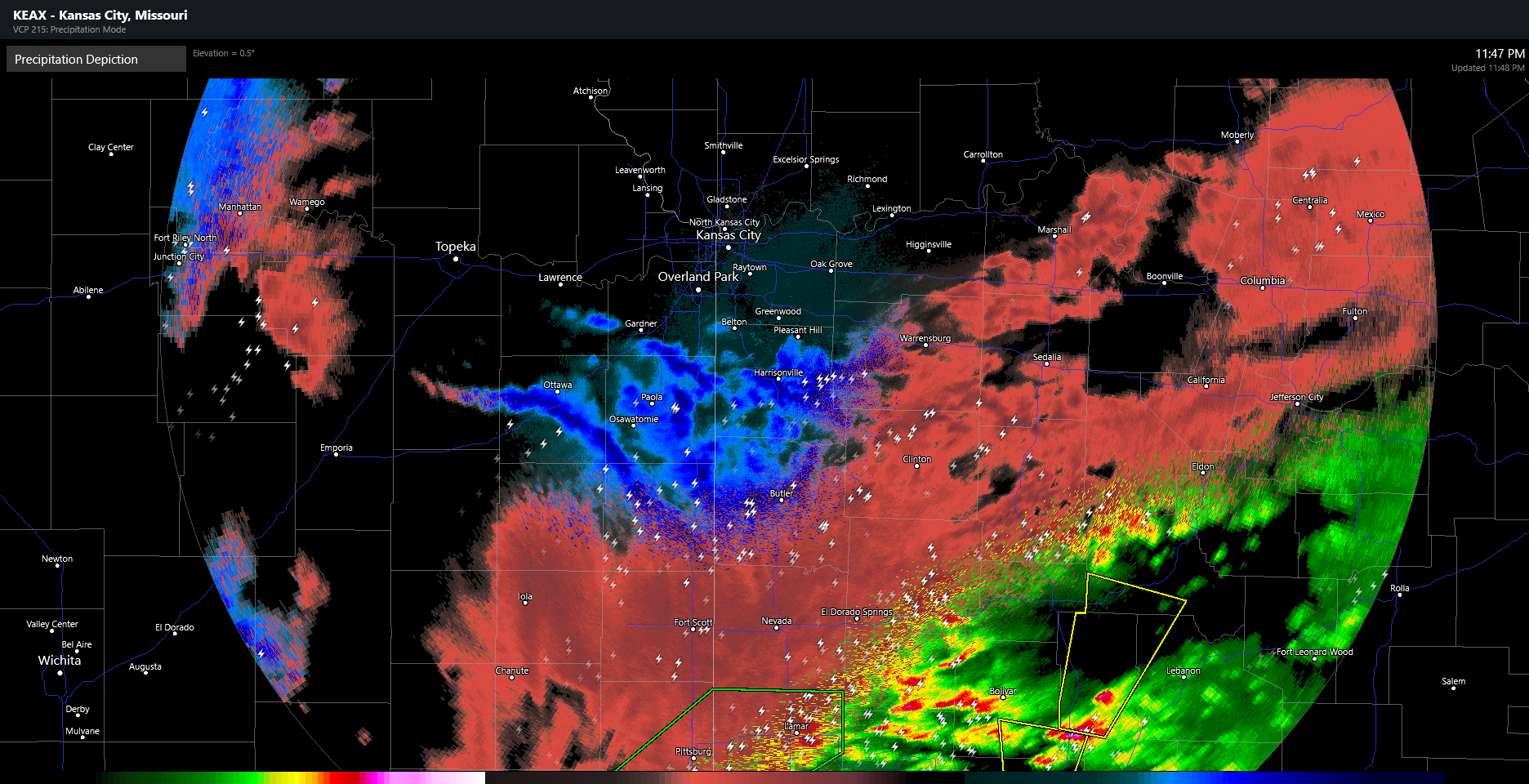
Everything but the kitchen sink tonight from the KC Missouri weather radar.
-
1" of snow here in Findlay as of 445 PM.
-
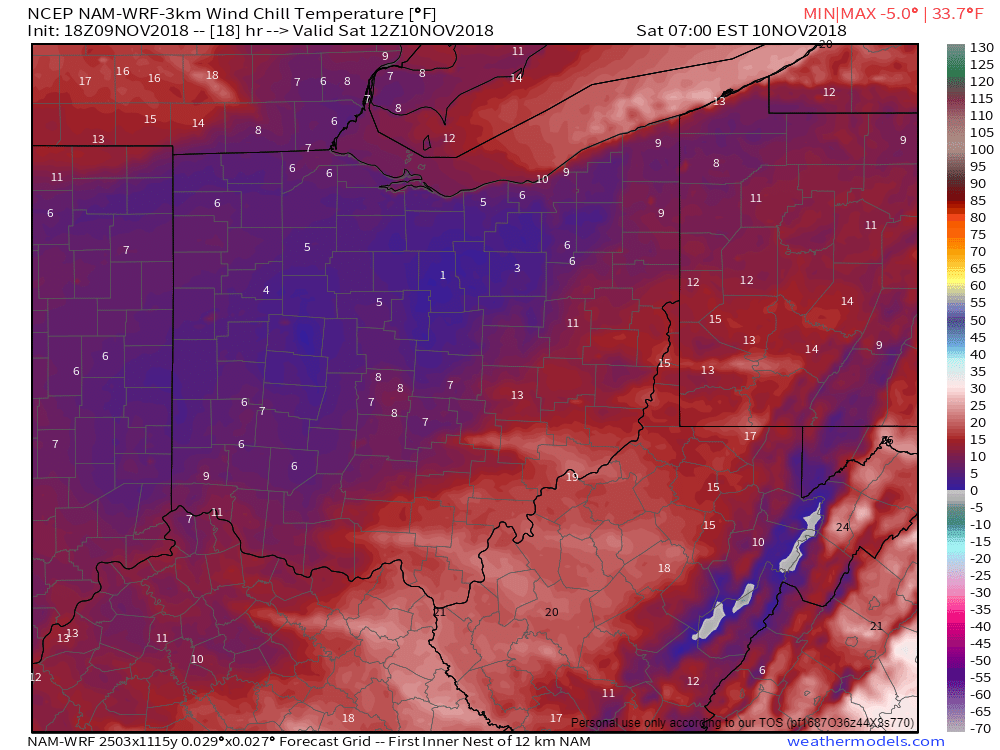
Wind Chill temperatures nearing zero by tomorrow morning across much of northern Ohio.
-
Central/Western Medium-Long Range Discussion
Jim Martin replied to andyhb's topic in Central/Western States
Looking like an active severe weather day possible for Tuesday. The Storm Prediction Center mentioning a fairly good risk for discrete supercells. -
Latest tidbit from SPC on the afternoon Day 2 Outlook... CONCERNING THE SEVERE POTENTIAL, A CORRIDOR OF MODERATE INSTABILITY IS FORECAST TO DEVELOP BY AFTERNOON FROM EASTERN MISSISSIPPI INTO MUCH OF ALABAMA. NAM FORECAST SOUNDINGS AT 21Z IN EASTERN MISSISSIPPI AND NEAR BIRMINGHAM SHOW MLCAPE VALUES REACHING THE 2000 TO 2500 J/KG RANGE. IN ADDITION, THE MID-LEVEL JET WILL CREATE STRONG DEEP-LAYER SHEAR PROFILES ACROSS MOST OF THE REGION. FORECAST SOUNDINGS ACROSS THE SLIGHT RISK AREA BY LATE AFTERNOON SHOW 0-6 KM SHEAR GENERALLY IN THE 60 TO 65 KT RANGE. THIS ENVIRONMENT WILL SUPPORT SEVERE THUNDERSTORM DEVELOPMENT FROM THE MID AFTERNOON THROUGH MUCH OF THE EVENING. THE SHEAR SHOULD BE FAVORABLE FOR SUPERCELL FORMATION ESPECIALLY FROM MIDDLE TENNESSEE SOUTHWARD INTO NORTH-CENTRAL ALABAMA WHERE HAILSTONES OF GREATER THAN 2 INCHES IN DIAMETER, WIND DAMAGE AND A TORNADO THREAT WILL BE POSSIBLE. A STRONG TORNADO MAY OCCUR WITH ANY SUPERCELL THAT CAN BECOME DOMINANT. THE POTENTIAL FOR VERY LARGE HAIL IS ALSO FORECAST SOUTHEASTWARD INTO PARTS OF WESTERN GEORGIA WHERE VIGOROUS CONVECTIVE DEVELOPMENT MAY TAKE PLACE DURING THE EARLY EVENING. THE WIND DAMAGE THREAT MAY INCREASE BY EARLY EVENING ESPECIALLY IF A MESOSCALE CONVECTIVE SYSTEM CAN ORGANIZE.
-
Surprised none of you in here have mentioned the risk for severe weather on Monday...
-
Central/Western Medium-Long Range Discussion
Jim Martin replied to andyhb's topic in Central/Western States
From last night in Southeast Arkansas... 0221 300 PINE BLUFF JEFFERSON AR 3423 9200 MAXIMUM HAIL SIZE MEASURED WAS 3.50 INCHES. (LZK) -
20 years ago next month was the famous Nashville, Tennessee tornado that was captured by WSMV Channel 4 and NewsChannel 5 as it moved through.
-
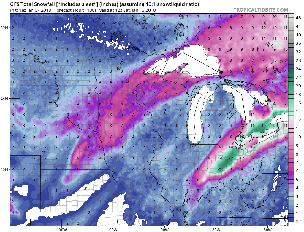
The 18z GFS went absolutely berzerk in Northern Ohio for next weekend. Though some of the precipitation on this run is mixed.