
jjwxman
-
Posts
343 -
Joined
-
Last visited
Content Type
Profiles
Blogs
Forums
American Weather
Media Demo
Store
Gallery
Posts posted by jjwxman
-
-
Tim Buckley (WFMY 2 in GSO) is all in. Finally someone is calling it!
-
 3
3
-
-
Just now, buckeyefan1 said:

That cutoff though... geez.
-
5 minutes ago, SouthWake33 said:
Would you mind posting the prior run for comparison?
12z Euro 24 hour precip. Big shift for sure.
-
3 minutes ago, olafminesaw said:
Kinda embarrassing that RAH still has 20% chance of precip for my location
RAH has always played it conservative. It’s always better to see the snow trending upwards, than retracting a premature statement. We really need the dang Euro to come on board at the 12z. Lol
-
1
-
 1
1
-
-
3 minutes ago, PackGrad05 said:
https://twitter.com/_jwall/status/1229745451144040450?s=206Z Euro (and ensembles) is drier again. This is a trend that it keeps getting drier and drier. NWS and local mets leaning heavily on this model given its record.
The King has spoken... lets see how long it takes for the NAM to sit down and shut up. Or maybe the NAM storms the castle!!
-
-
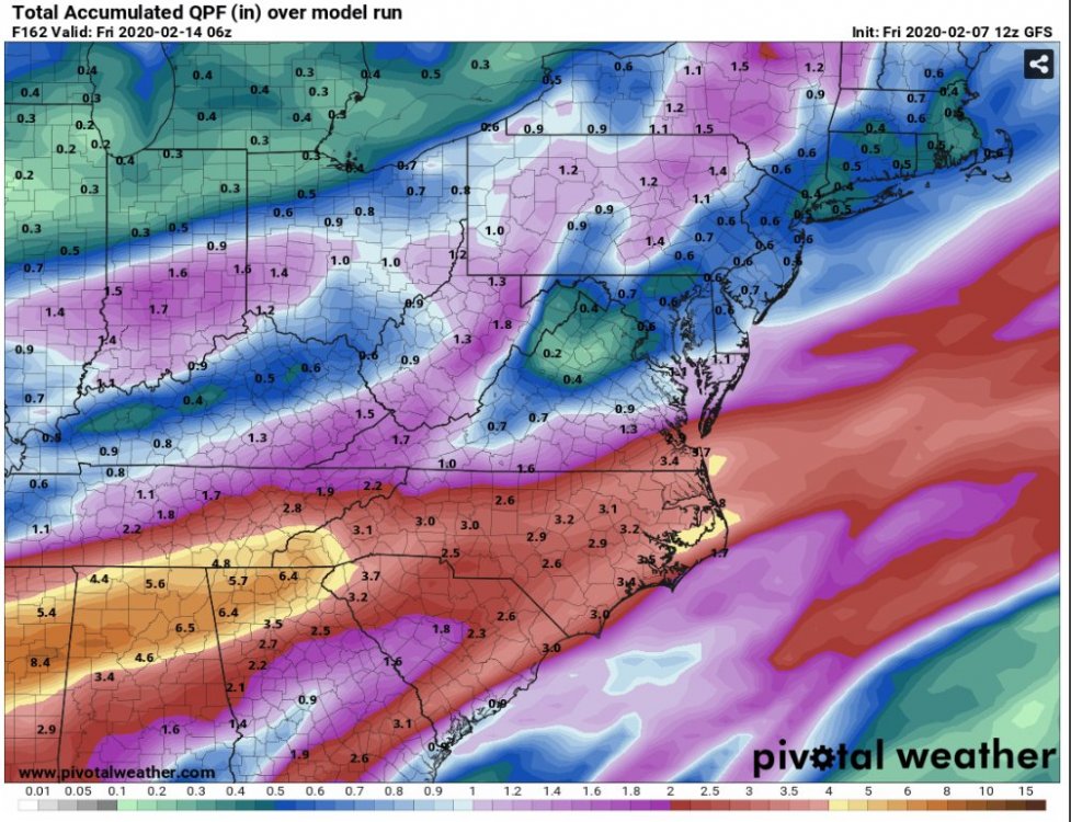
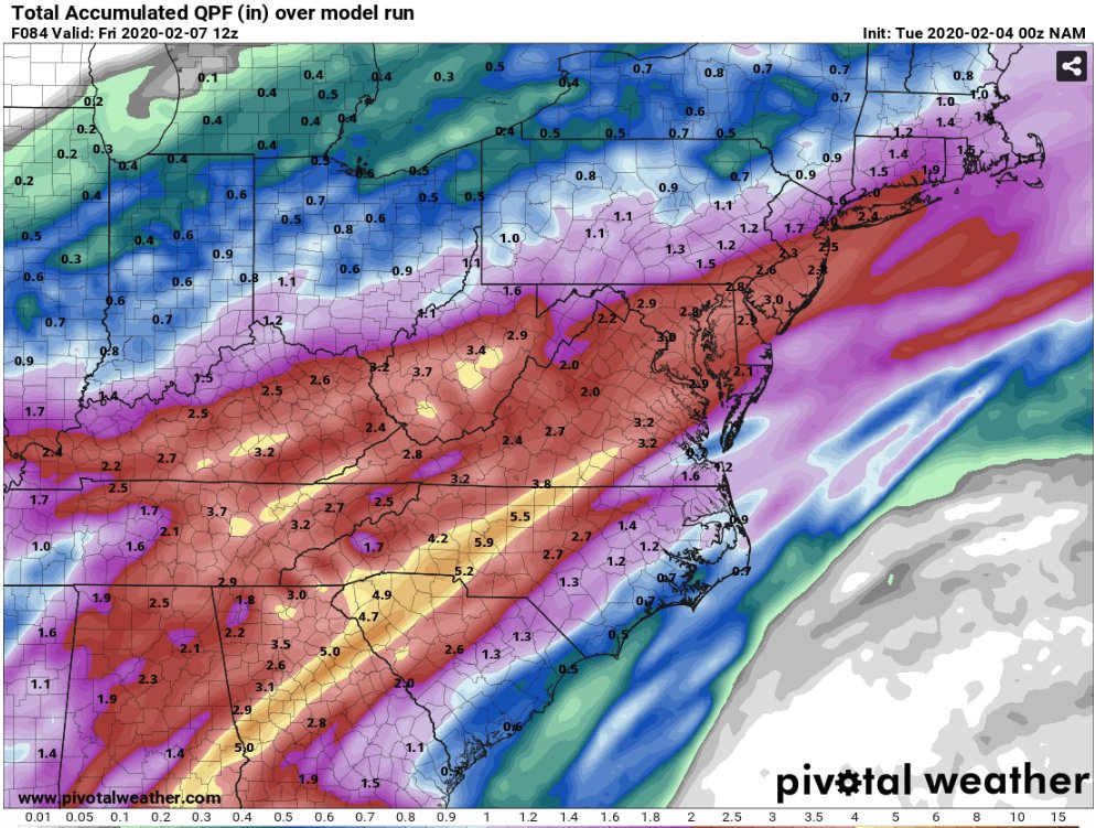
The total QPF on the NAM seems a bit excessive...
-
1
-
 1
1
-
-
Glory hallelujah the European model finally throws us a fantasy bone.
-
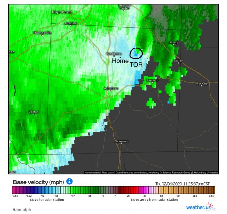
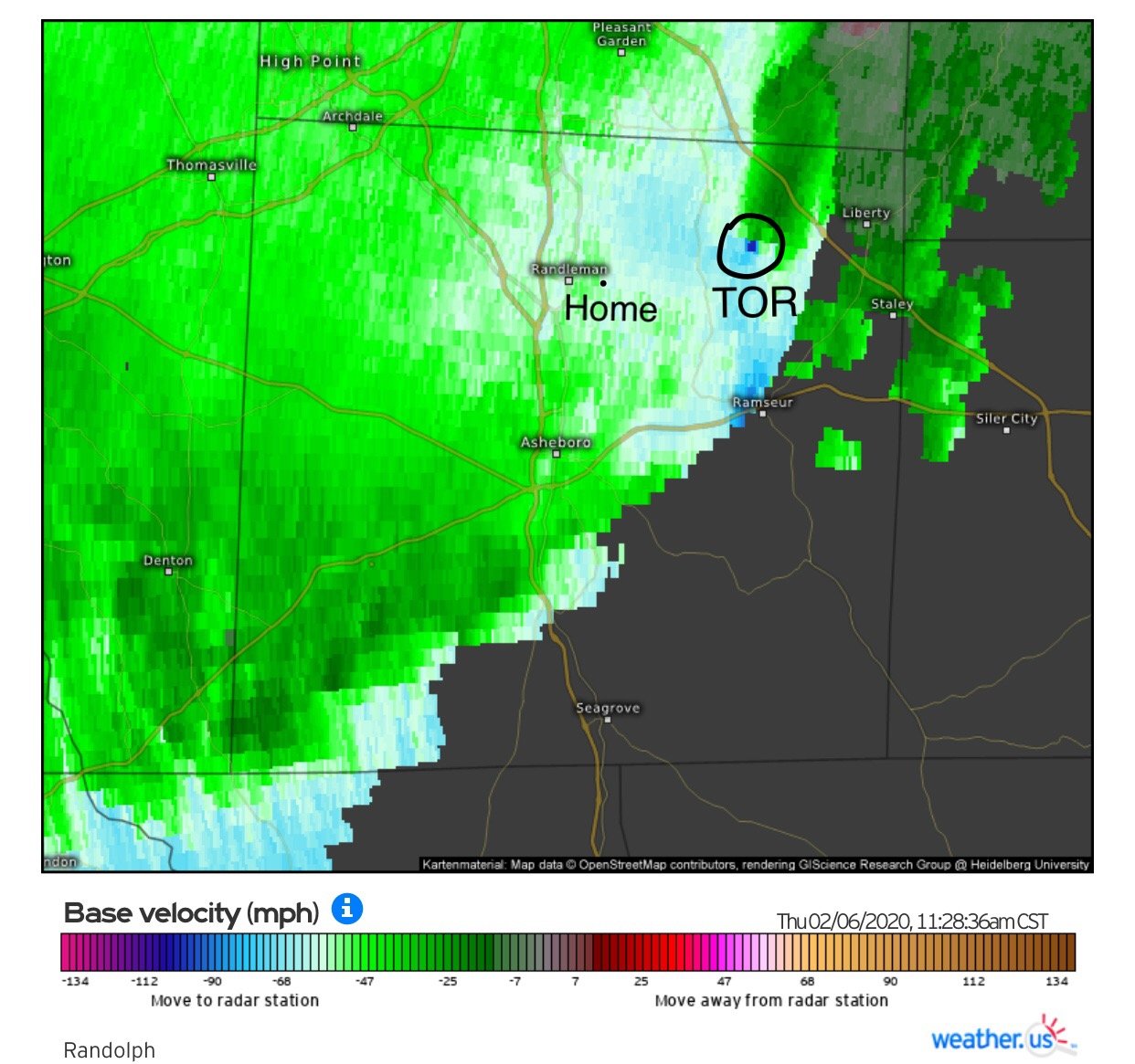
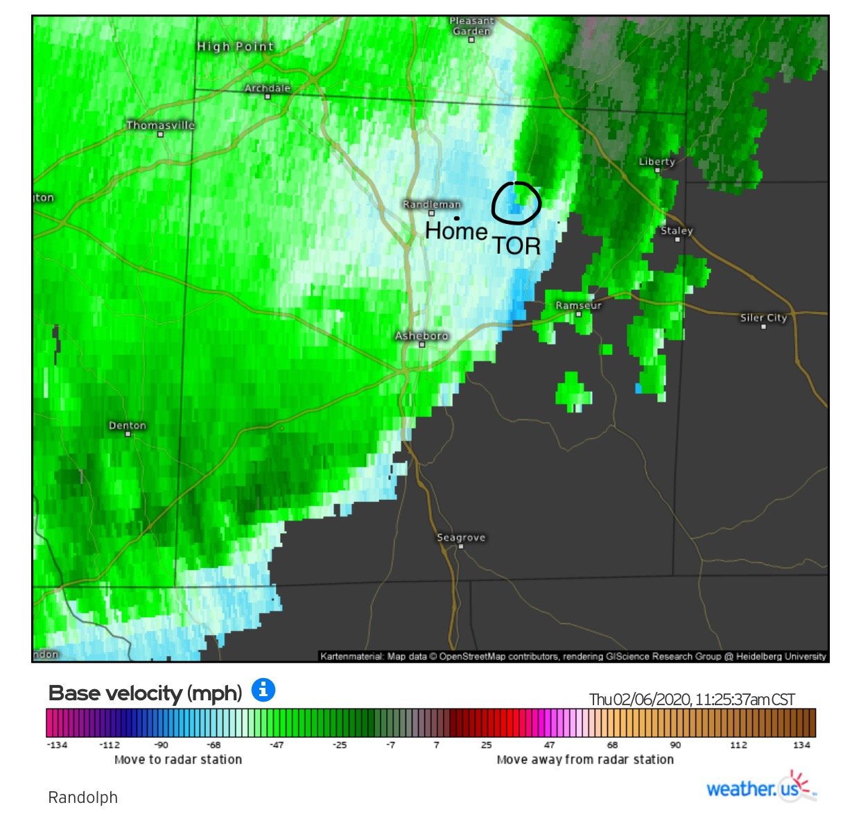
I had a pretty close call with the Randolph County Tornado. We lost our Trampoline and a few trees, thankfully no damage to our house.

-
1
-
-
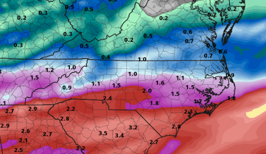
More rain basically all next week...

-
6 minutes ago, olafminesaw said:
Someone's getting blasted, as of now, we're in the cross hairs.


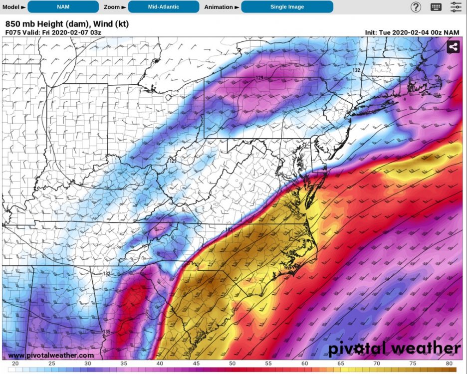
And not mention the severe threat, although probably limited due to the lack of instability, still that’s an absolutely insane boundary for Thursday evening. There will be elevated STP’s along and just south of that boundary. Possible triple point scenario over the I-85 corridor.

-
That’s one heck of a boundary for Thursday evening. Also there will be an elevated STP along the boundary. Absolutely Insane 850mb winds of 75 knots.
-
-
13 minutes ago, BornAgain13 said:
2nd run in a row with a decent snow for southern VA On the CMC
Decent hit for the I-40 / I-85 Corridor.

-
1
-
-
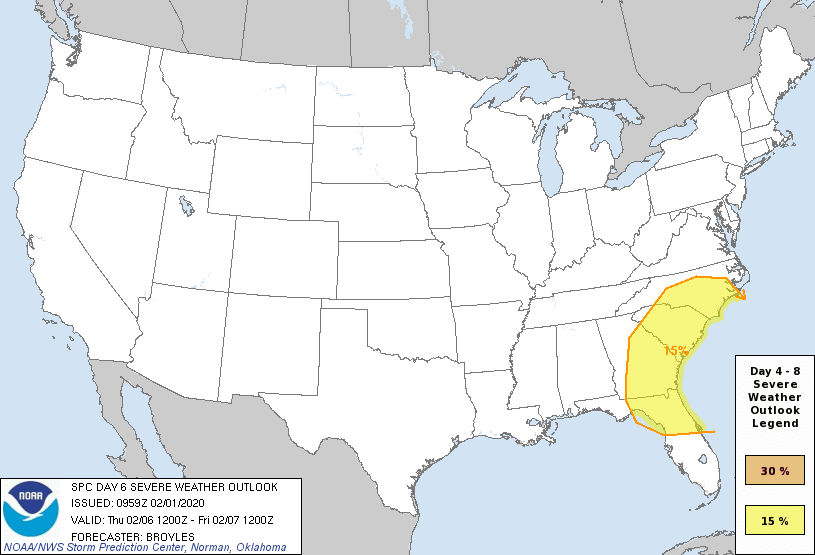
The SPC doesn’t throw out Day 6 outlooks that often. The wind shear parameters are off the charts over the region late next week.

-
Day 6 outlook from the SPC. It’s pretty rare to see the SE in a day 6 outlook, especially in February.
-
Haha... taken verbatim that’s over 2.5” of ice accrual for the I-95 corridor of NC. You guys might have power restored by... let’s say March?
-
5 minutes ago, BornAgain13 said:
If that happened, then who cares what happens or what hadn't happened the rest of the winter lol
It only takes one to forget everything around these parts!!
-
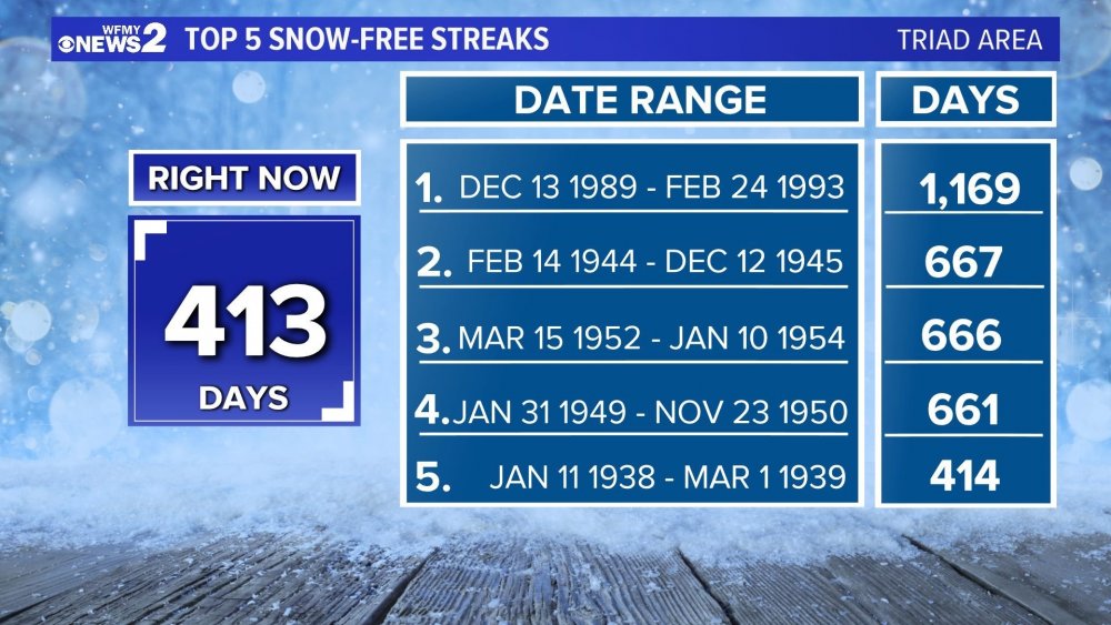
Credit: WFMY 2. This is for the GSO reporting location, we move into 5th place tomorrow. How in the heck did we survive the early 90’s... geez.
-
 1
1
-
-
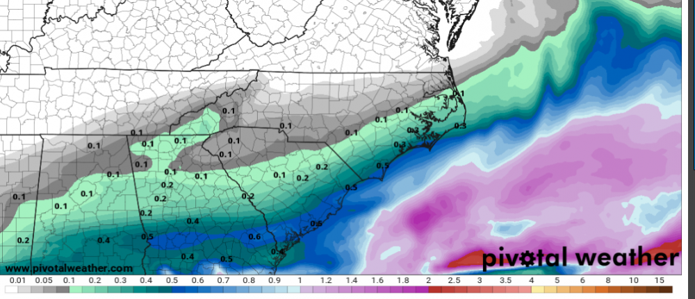
Here's Pivotal Weather's UKmet sounding for Saturday over GSO with total QPF of around 0.4"... so very close. This kills me.

-
Hey btw, Pivotal Weather now has UKmet maps... surface and upper air. I'm sure the free days are numbered... but maybe not?
-
The progression of next weekends storm system on the 00z GFS was very weird. At hr 138 it has the LP center just west of Tampa, FL. Then at 142 it has the LP center over Nashville, TN.

-
 1
1
-
-
3 minutes ago, BornAgain13 said:
The 12z EURO is a 34 degree cold rain in mby , with heavy snow and 32 degrees just to the northwest... still time to hopefully get a little more cold weather.
Both the GFS and Euro were very close to being a big event. I like where we are currently. Lots of time for adjustments... hopefully colder adjustments.
-
2
-
-
The 12z Euro has the storm as well. But it’s slower with the system and the warmest model right now. Lots of time for adjustments. I’m just glad we have a system all the global models are picking up on. Might be the first time this season. Lol


One More Shot: Feb 20-21 Event
in Southeastern States
Posted
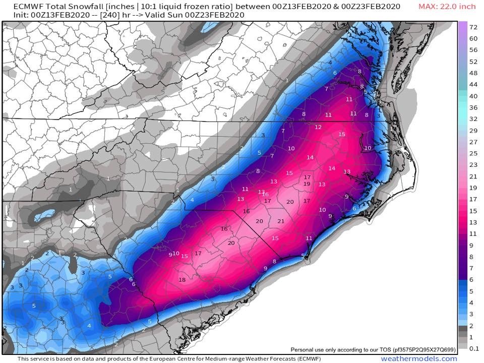
The latest SREF mean snowfall is getting interesting.