
jjwxman
-
Posts
343 -
Joined
-
Last visited
Content Type
Profiles
Blogs
Forums
American Weather
Media Demo
Store
Gallery
Posts posted by jjwxman
-
-
The ice maps for the NAM are assuming everything freezes on contact. That’s simply not going to happen with temps 30-32. Freezing rain as we all know is self limiting anyway. I’m not an ice fan at all, but if for some reason you like no power for two weeks, you would want the surface temps to be on the order of 26-27. In Dec 2002 I measured 0.75 on the tree branches in MBY. We managed to stay 26-28 degrees the entire event.
-
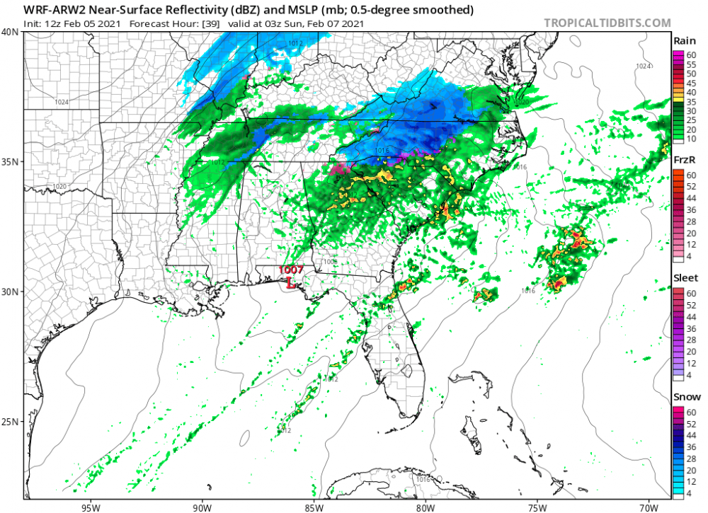
Haha... this thread needs a little of what the WRF-ARW2 is jacked up on! Probably doesn’t belong here at this point, but hey it made me laugh.
-
 1
1
-
 1
1
-
-
Are we really losing another one? Lol Congrats MA/NE. Common theme this year.
-
 1
1
-
-
I expect RAH will issue WWA for their NW counties tomorrow morning. This pretty much looks to be a non-event in regards to impacts in the Triad. But A couple of hours of snow will be nice to see if it happens.
-
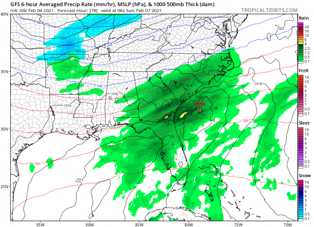
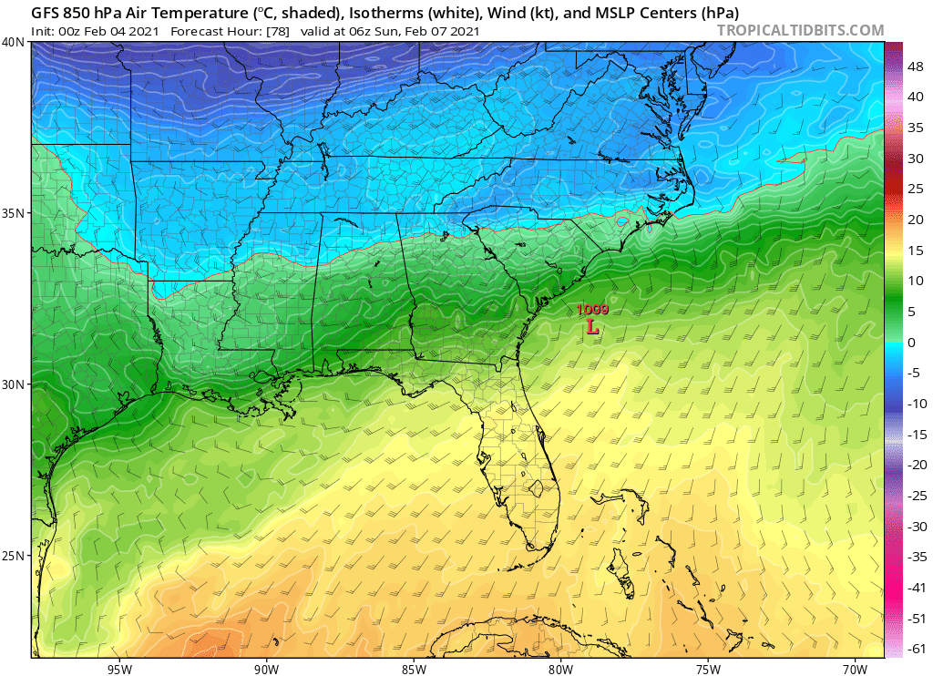
00z GFS Hr 78... Dadgum close.

-
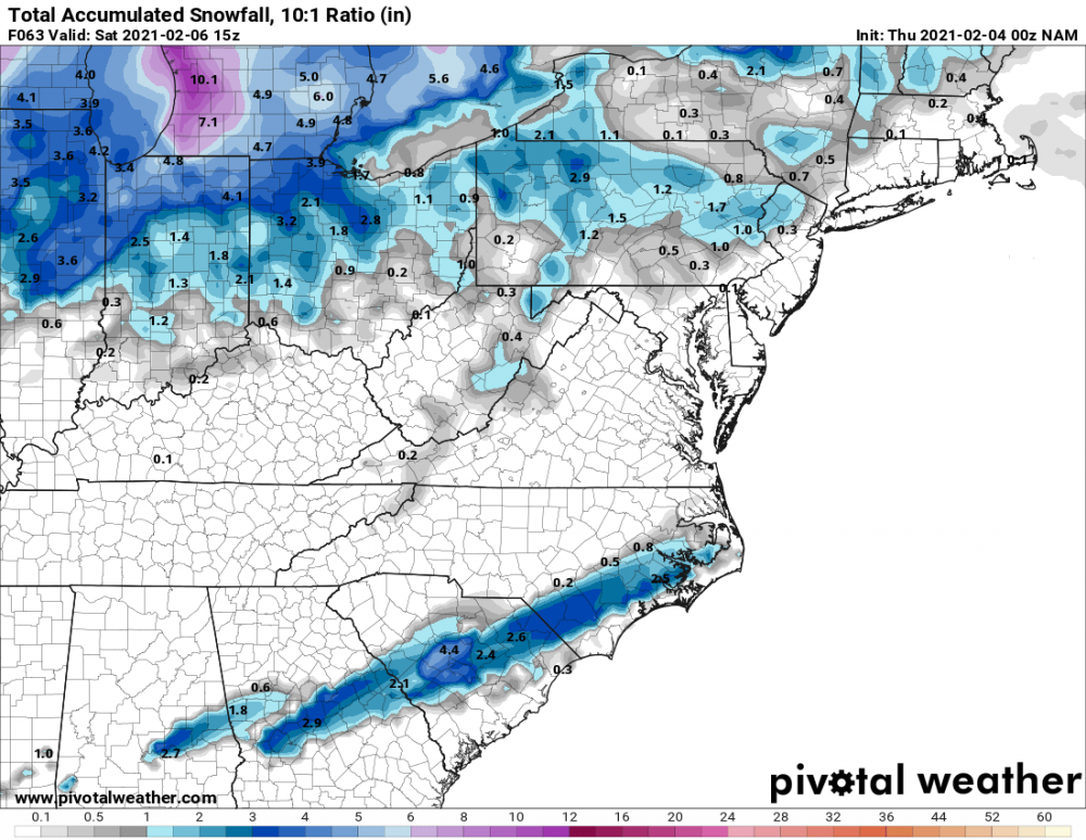
The NAM is trending towards a legitimate marginal overrunning event for this weekend. Not sure how much further NW it will go but it’s definitely trending NW the last three runs.
-
27 minutes ago, NCSNOW said:
Sat/Sunday is where its at boys. No need to wait 10 days.
Nice... So When does the NW trend start? Lol.
-
1
-
-
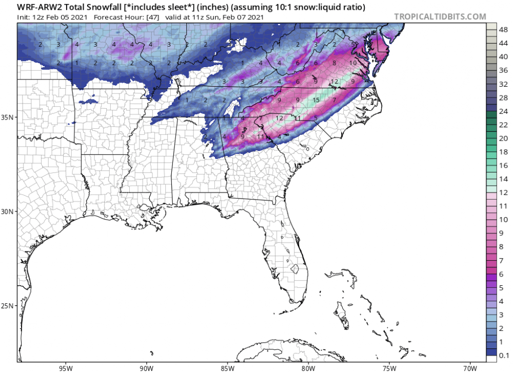
I’m going to frame the 18z GFS weenie apocalypse snow map and put it in my man cave! Lol
-
4
-
2
-
 1
1
-
-
36/27 in Randleman, Northern Randolph County.
Currently Overcast after all sleet with the first band earlier. Womp womp.
-
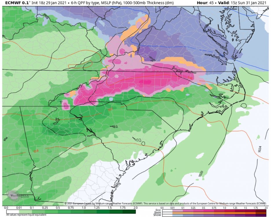
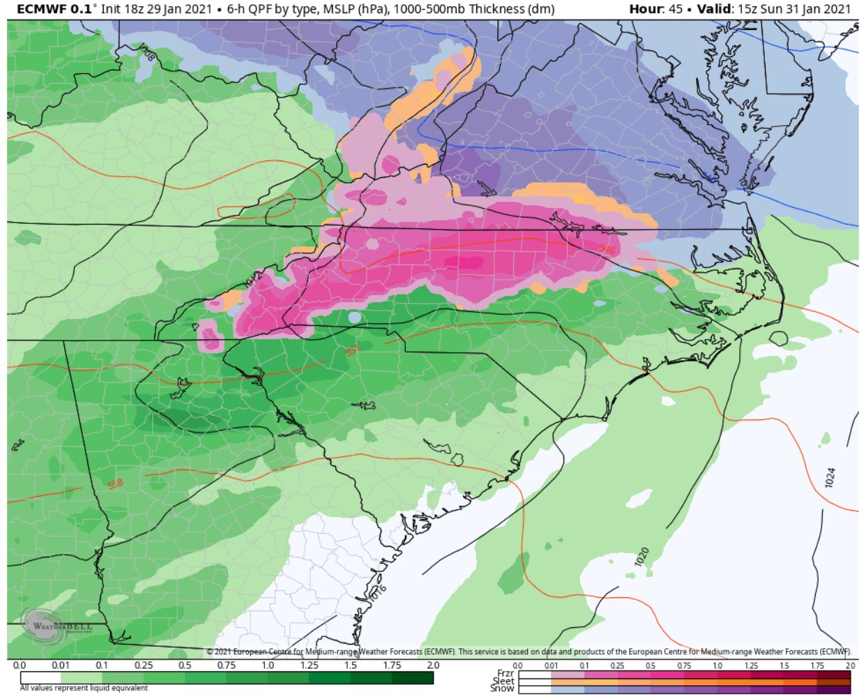
FWIW the 18z Euro, seen below, was 2-3 degrees colder than the 12z run. Kinda out of it’s range at this point, but worth noting.
-
3
-
-
2 minutes ago, BooneWX said:
Weird. Looks a little warmer at the surface but way more ice this run on the 3K. Would love to see it trend towards sleet and a touch of snow, but if my only option is 31 and rain, I’ll pass and take 33 and rain.
Yeah, I agree. I like my power. Haha.
-
1
-
-
I’m expecting 32.5 and rain here in Northern Randolph County. Lol. Any icing will be considered a win.
-
Puts wncsnow and I in some heavy snow there too.
Surface temps at hour 60.
.-
1
-
-
Lights out for me 15 miles south of GSO. Anyone have access to the Euro freezing rain accumulation maps?
-
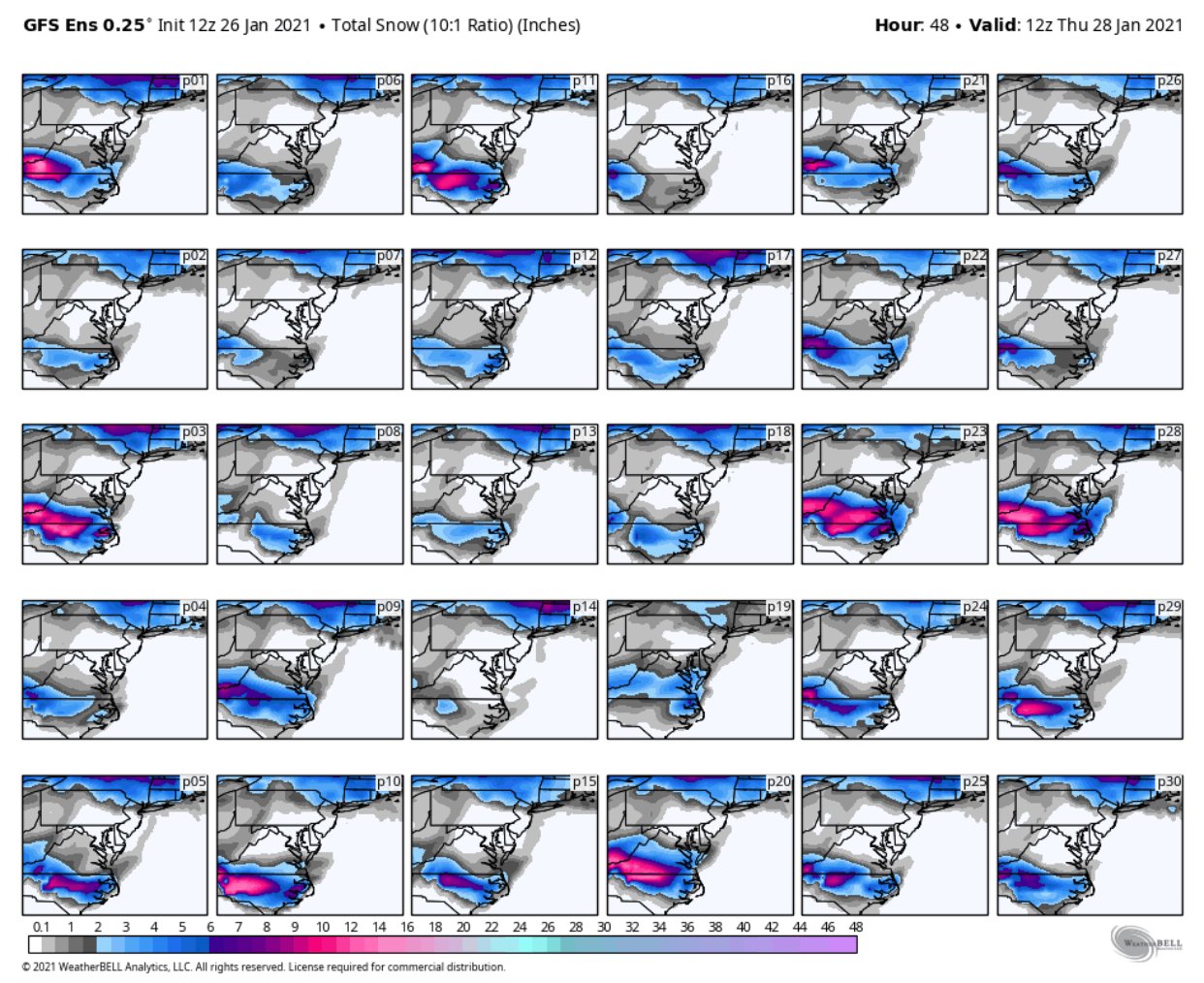
Literally every member of the GEFS...
-
1
-
 1
1
-
-
The suckage is maximized. Snow line stopped advancing east. I give up.

. -
Sleet/Snow mix now at the Coliseum area in Greensboro.
-
37 minutes ago, NCSNOW said:
Switch over is complete here GSO airport. Quater to small cotton ball size flakes
Still rain/sleet near the Coliseum. C'mon!
-
Drizzle and 36/32 in GSO, heavier precip is falling in the form of sleet currently. Hoping that changes to snow soon........
-
Cold rain, some sleet at times 12 miles south of GSO. Temperature steady at 37 degrees.
-
37/31 Randleman, NC. Nothing yet, can actually see some stars.
-
Big changes to my point and click forecast. That's more like it!
-
RAH is likely going with "Warnings for Triad Counties, and also either expand the warning or issue advisories eastward across at least Stanly, Montgomery, Randolph, Alamance and Person counties."
-
Here is the official forecast from RAH for my point and click location 12 miles south of Greensboro... They are just not sold on this thing at all.
-
1
-


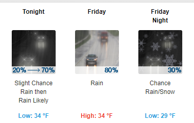
Ice/Snow threat Friday-Sunday
in Southeastern States
Posted
How much ice did you have? That’s definitely the benchmark ice storm for the Triad area.