
jjwxman
-
Posts
343 -
Joined
-
Last visited
Content Type
Profiles
Blogs
Forums
American Weather
Media Demo
Store
Gallery
Posts posted by jjwxman
-
-
Raleigh is considering upgrading portions of the NW Piedmont to a Warning in their afternoon forecast package.
Discussion:
A Winter Weather Advisory is in effect for the Northwest and
Northern Piedmont including the Triad area for 1 to possibly 2
inches of wet snow. A Warning may be needed for portions of the
Northwest Piedmont and the Advisory may need to be extended
eastward with the afternoon forecast package...
-
 1
1
-
-
Thundersnow reported in Jackson, MS earlier.
-
3
-
-
The NWS offices across the deep south/ SE are reporting overachieving occuring.
-
Looks like the classic case of GOM convection blocking moisture transport to me. Nothing can kill a storm system in the SE faster than GOM convection.
-
I was happy with the Euro run. It was a good average between all the 12z data. I personally believe the best case scenario is Allen's first guess map. 1-4" would be a big win anywhere in NC before the Winter Solstice. Perspective, it's not even Winter yet.
-
1
-
-
But, without a CAD the WAA is less noticeable in the soundings even though it is definitely there. This set up is definitely unique to our usual snow set ups. Interesting times ahead!
-
One problem with that idea is there is no HP to the north. Much easier for WAA to invade without it IMO.
-
1
-
-
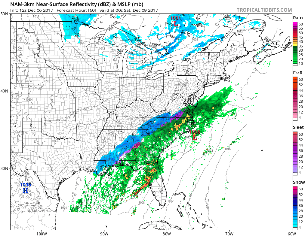
FWIW, the NAM 3km. Hr 60 is dangerous, but Warmer profiles noted.

-
At 54 dewpoints are in the upper 20's in the Triad. Upper 30's surface. Any moderate precip would be snow, per sounding.
-
1
-
-
You've been NAM'd
-
1
-
-
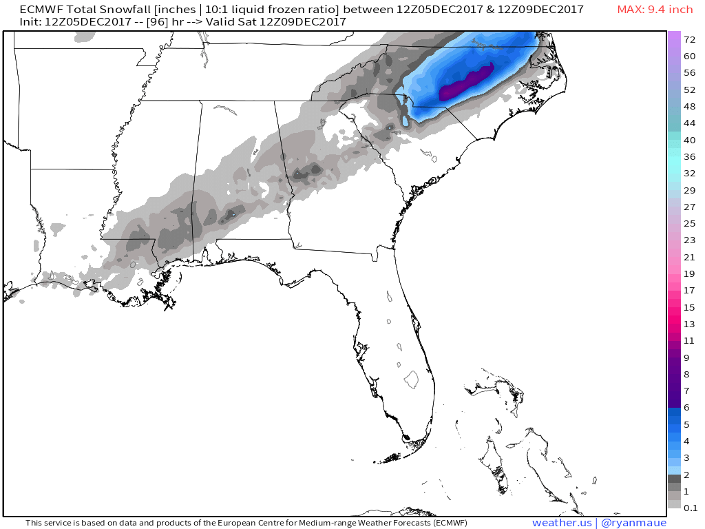
The 12z Euro snow accumulations:

-
1
-
-
Looks good for the Triad/Foothills.

-
2
-
Mid to Long Term Discussion 2018
in Southeastern States
Posted
Well I mean if it's not going to snow... Nothing cleans the salt off the roads like a LCHS spin up. Nice sounding for Jan. over central NC Friday evening.