
CAPE
-
Posts
30,960 -
Joined
-
Last visited
Content Type
Profiles
Blogs
Forums
American Weather
Media Demo
Store
Gallery
Posts posted by CAPE
-
-
6z GFS depicts a significant piece of NS energy dropping southward as the ridge amplifies- that interacts with energy in the flow underneath and induces a strong surface low right at the coast. Very convoluted as this occurs as the initial Miller B transfer to a coastal low is occurring. Ends up with 3 lows.

-
 1
1
-
-
2 minutes ago, nw baltimore wx said:
Any interest in the time around St. Paddy’s Day?
Pretty far out but the ensembles have low pressure tracking well to our northwest.
-
 1
1
-
-
6z GFS snows on us on the 11th. 0z was close.
-
1
-
-
45 minutes ago, Terpeast said:
The biggest irony of this season is we got our best wintry week not from a nino STJ pattern, but more of a nina-like Alaska ridge pattern (-EPO) combined with a short-lived greenland block (-NAO).
If we’re going to play the “everyone zigs, we zag” game, we better hope that two things happen at the same time during next year’s nina - 1) pac ridge nudges poleward into alaska AND 2) we get greenland blocking to hold any cold air down
But my wag is that we don’t get any blocking, and we get 2022-23 without the cold xmas week. I’d pay money to be wrong.
I will roll with a predominant -EPO pattern, and a well timed transient -NAO /+PNA to improve our chances. Provides a mechanism for legit cold to move southward + a wave to track underneath with cold air in place. Lately Ninos are simply too warm to force the thermal boundary southward enough for a favorable storm track at our latitude.
-
1
-
-
2 minutes ago, snowfan said:
Next year is going to suck says the same people that thought this year would be above average for snowfall. They have no fng clue how it’s going to play out. And we’ll be right back here tracking.
No actual idea, but I bet I see more snow in my yard next winter than this one. Just going with recency, Ninos have been fairly lame, while Ninas have overall been better than expected here wrt cold and snow. It just doesn't get cold enough during Ninos since 2010, and/or atmospheric coupling doesn't really happen and it behaves like a shitty Nina or worse(neutral).
-
2
-
1
-
-
9 minutes ago, 09-10 analogy said:
Damn, the Tahoe webcam is down. At least for me.
Some good ones on here.
-
1
-
-
6 minutes ago, 09-10 analogy said:
Damn, the Tahoe webcam is down. At least for me.
Yup.
-
1 minute ago, stormtracker said:
Tenley town liquors. Like 20 mins from my spot.
Awesome.
Three quarters through one here + a little weed. Going to put it aside for now and switch to a Pinot Grigio. About to eat some sushi.
-
1
-
-
2 minutes ago, stormtracker said:

Yeah baby!
Where? I used the DFH finder and couldn't find anything within 10 miles of you.
-
1
-
-
40 minutes ago, stormtracker said:
Apparently total wine and spirits has it in Montgomery county
Found quite a few locations within a few miles of you that supposedly have World Wide Stout. Cant go wrong with that. Nothing for the 120s.
-
1
-
-
1 minute ago, stormtracker said:
OMG..it's on Ubereats and they have it in stock. Tenlytown liquors!! Dude... @CAPE
Do it!
-
2 minutes ago, stormtracker said:
Dammit man. I can't even find one bottle here.
Catch an Uber and head an hour east. The Winery. Good people. They have em' cold. So you can sip on one and get twisted on the return trip
")
-
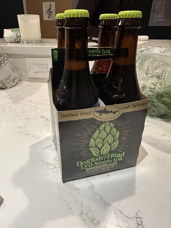
Friday Happy hour- Sipping a 120 while monitoring 4 webcams from the Sierra Nevada, living vicariously.
Picked up a 4 pack in Kent Island for 38 bucks. I been jonesin'.
-
3
-
-
57 minutes ago, paulythegun said:
Extended range models show a rug late March. I think I'll go stand on it, seems stable
EPS has zero snow through mid month. Whips out the weeklies. Hey look, an inch by the beginning of April!
-
1
-
-
2 hours ago, vastateofmind said:
Which begs the question...how do the "wetlands" that make up a significant portion of your "back 40" look at this point, in this particular seasonal transition? Always been interesting in recent years to see how wet it is on the typically wettest portions of your property...and how that compares to other parts of our region on this side of the bay.
The wetland was quite wet several weeks ago(much sooner than last year), but with the relatively dry weather of late is has receded. A few heavy rain events over the coming weeks and it will be back to more typical for Spring- quite expansive and a foot or so deep.
-
2
-
-
3 minutes ago, GATECH said:
Nice shout out @jonjon you have an awesome place with awesome beers. Nice hats too, my current go to which I got in January.
I need one of those.
-
1
-
-
^What I remember most about that storm was the initial waa precip came in earlier, and heavy. There was 6" otg after the first few hours.
-
4
-
-
A couple AFDs from Mount Holly leading up to the Dec 2009 KU. Pretty interesting reads. Seems the Euro sniffed this one out first, as it often did.
AREA FORECAST DISCUSSION
NATIONAL WEATHER SERVICE MOUNT HOLLY NJ
1109 AM EST WED DEC 16 2009

.SYNOPSIS...
STRONG HIGH PRESSURE WILL BUILD IN FROM THE NORTH AND WEST AND
THEN WEAKEN THROUGH THE WORK WEEK. A SYSTEM THAT WILL DEVELOP
NEAR THE GULF OF MEXICO AND MOVE OUT OVER THE ATLANTIC MAY HAVE
SOME EFFECT ON US LATE IN THE WEEKEND.

&&

.NEAR TERM /THROUGH TONIGHT/...
FLURRY ACTIVITY HAS BEEN LIMITED TO THE NORTHWESTERN AREAS OF THE
CWA. A VORT MAX IS EXPECTED TO ROTATE THROUGH THE AREA THIS
AFTERNOON AND AS A RESULT FLURRIES MAY SPREAD SLIGHTLY FARTHER
SOUTH THAN PREVIOUS THINKING. WE HAVE EXTENDED THE CHANCE FOR
FLURRIES INTO THE LEHIGH VALLEY, ALTHOUGH MOST AREAS PROBABLY
WILL NOT SEE TOO MANY FLAKES FALL AS THEY MAY EVAPORATE BEFORE
REACHING THE GROUND. LAKE EFFECT CLOUDS WILL CONTINUE TO STREAM
INTO THE AREA TODAY, AS THE FETCH OFF THE LAKES REMAINS.

WINDS ARE GUSTY AND WILL REMAIN SO THROUGH THE DAY TODAY BEFORE
STARTING TO DECREASE THIS EVENING.

GUIDANCE TEMPERATURES WERE IN PRETTY GOOD AGREEMENT WITH
CONTINUITY AND WERE ACCEPTED.

&&

.SHORT TERM /THURSDAY THROUGH FRIDAY/...
ANOTHER VORT MAX MOVES ACROSS THE AREA TONIGHT WITH SOME
REINFORCING COLD AIR. THE ATMOSPHERE LOOKS TO BE DRIER, SO WE ARE
CONFINING SNOW FLURRIES TO THE NORTHWEST AND GOING MOSTLY CLEAR
ELSEWHERE FOR NOW. WINDS MAY PICK UP SOME AS THE SECONDARY PUSH
OCCURS. GUIDANCE TEMPS AGAIN ARE IN GOOD AGREEMENT WITH CONTINUITY
AND ARE ACCEPTED.

THURSDAY THROUGH FRIDAY LOOKS DRY, ALTHOUGH WARM AIR ADVECTION
ALOFT AND AN UPPER JET MAY BRING SOME MID AND HIGH CLOUDINESS INTO
THE AREA THURSDAY NIGHT INTO FRIDAY. WINDS SHOULD BE DIMINISHING
THROUGH THE PERIOD, AND WERE IT NOT FOR THE POSSIBILITY OF CLOUDS
WE WOULD HAVE UNDERCUT GUIDANCE MINS ON THURSDAY NIGHT WITH
EXCELLENT RADIATING CONDITIONS. AS IT IS, WE CONTINUED TO WALK A
GUIDANCE-CONTINUITY LINE, WHICH HAS WORKED REASONABLY WELL.

&&

.LONG TERM /FRIDAY NIGHT THROUGH TUESDAY/...
THE MODELS CONTINUE TO DIFFER AS TO HOW THEY HANDLE THE ROTATING
UPPER LOW TO OUR NORTH ALONG WITH THE ASSOCIATED SHARPENING TROUGH.
AT THE SURFACE, ALL MODELS DEVELOP A LOW ALONG THE SE COAST AND
HEAD IT NE. MOST OF THE MODELS KEEP IT FAR ENOUGH S AND E OF OUR
AREA SO THAT IT JUST BRUSHES OUR SE SECTIONS. THE OUTLIER AT THIS
TIME IS THE ECMWF WHICH SHARPENS THE TROUGH AND DEVELOPS AN INTENSE
EAST COAST STORM. IT IS ALSO MUCH FASTER THAN THE REST OF THE MODELS
AND WOULD HAVE THE BIGGEST IMPACT LATE SATURDAY AND SATURDAY NIGHT
RATHER THAN LATE SATURDAY NIGHT AND SUNDAY. FOR NOW WE WILL GO WITH
THE MAJORITY AND BRING INCREASING CLOUDINESS IN LATE SATURDAY INTO
SATURDAY NIGHT AND CALL FOR A CHANCE OF SNOW INLAND AND RAIN OR SNOW
ALONG THE COAST LATE SATURDAY NIGHT AND SUNDAY. ONCE THE LOW MOVES
OFF TO THE NE, HIGH PRESSURE WILL BRING ANOTHER BATCH OF COLD AIR
INTO OUR AREA FOR THE BEGINNING OF NEXT WEEK.
AREA FORECAST DISCUSSION
NATIONAL WEATHER SERVICE MOUNT HOLLY NJ
658 PM EST FRI DEC 18 2009

.SYNOPSIS...
HIGH PRESSURE WILL CONTINUE TO MOVE OFF TO THE NORTHEAST THIS
EVENING ALLOWING A MASSIVE LOW PRESSURE SYSTEM TO FILL IN BEHIND
THIS WEEKEND. THIS LOW PRESSURE WILL BE ARRIVING BY EARLY MORNING
SATURDAY AND HEADING TO THE NORTHEAST THROUGHOUT THE DAY. THE LOW
SHOULD PULL FAR ENOUGH TO THE NORTHEAST ON SUNDAY THAT WE WILL SEE A
BRIEF RETURN OF HIGH PRESSURE ON SUNDAY. THE HIGH PRESSURE WILL GIVE
WAY TO ANOTHER LOW PRESSURE SYSTEM MOVING IN FROM THE NORTHWEST ON
MONDAY AND TUESDAY.

&&

.NEAR TERM /UNTIL 6 AM SATURDAY MORNING/...
A 20Z SURFACE ANALYSIS SHOWS AN INTENSE AREA OF LOW PRESSURE OVER
THE SOUTHEASTERN UNITED STATES WHILE HIGH PRESSURE CONTINUES TO SIT
OVER THE NORTHEAST. WINDS WILL REMAIN FAIRLY CALM THIS EVENING BUT
WITH TEMPERATURES WELL BELOW FREEZING WINDS CHILLS WILL BE IN THE
SINGLE DIGITS TO THE TEENS. WHILE FOLLOWING THE STORM SYSTEM DOWN IN
THE SOUTHEAST UNITED STATES WE BROUGHT THE ONSET OF PRECIPITATION IN
WILL START LATE TONIGHT IN THE FAR SOUTHERN ZONES AND PROGRESSIVELY
SPREAD TO THE NORTH DURING THE DAY.

&&

.SHORT TERM /6 AM SATURDAY MORNING THROUGH SUNDAY NIGHT/...
AS IF THINGS COULD NOT GET ANY MORE COMPLICATED WITH THIS MASSIVE
LOW PRESSURE SYSTEM IT APPEARS AS THOUGH THE EARLY MORNING NAM
LEAVES US HIGH AND DRY...HOWEVER 6 HOURS LATER, WE ARE ONCE AGAIN
WET. BOTH THE NAM AND ECMWF HAVE BEEN PRETTY GOOD RECENTLY WITH
THEIR INITIALIZATIONS FIELDS AND OVERALL PERFORMANCE, SO IT IS
REALLY HARD TO DISCREDIT THEIR RECENT SOLUTIONS. WITH THAT BEING
SAID, BELIEVE A BLEND OF THE TWO MODELS WOULD PROVIDE THE BEST
SOLUTION FOR SNOWFALL AMOUNTS ACROSS THE REGION.

UPPER LEVEL DYNAMICS ADD TO THE DEEPENING OF THE LOW PRESSURE SYSTEM
WHILE IT MOVES TO THE NORTHEAST. OUR CWA IS PLACED IN A GREAT REGION
BETWEEN A COUPLED 250H JET STREAK TO SEE AN ENHANCEMENT OF UVM
PROVIDING AN AREA OF MASS DIVERGENCE LEADING TO THE OFFSHORE LOW
DEEPENING. THE INTERACTION WITH THE MID-LEVEL LOW IS A LITTLE MORE
PRECARIOUS RIGHT NOW. BOTH MODELS ARE SHOWING SOME SLIGHT PHASING OF
THE TWO REGIONS LATE SATURDAY WITH THE NAM BEING SLIGHTLY FASTER
THAN THE EURO. THIS PHASING WOULD PROVIDE AN OVERALL SLOWING OF THE
SYSTEM AND POSSIBLE OCCLUSION LEADING TO A GREATER CHANCE OF WRAP
AROUND MOISTURE TO BE SLUNG OVER THE REGION ON SUNDAY. BOTH MODELS
ALSO HINT AT A SLIGHT TROWAL EVENT WITH A DEFORMATION ZONE TO THE
NORTHWEST OF THE PHILADELPHIA METRO AREA ALLOWING ENHANCED
PRECIPITATION TO OCCUR. LOOKS LIKE THE HEAVIEST SNOW WILL BEGIN LATE
SATURDAY EVENING THROUGH EARLY SUNDAY MORNING SOUTH OF I-95 CORRIDOR
WHERE THE BEST OMEGA WILL BE MAINTAINED.

THIS SYSTEMS TRACK HAS BEEN HANDLED FAIRLY WELL WITH PREVIOUS
FORECASTS AND AMOUNT OF QPF. THIS SYSTEM WILL BE THE FIRST
WIDE-SPREAD PLOW-ABLE SNOWFALL EVENT IN THIS EARLY SEASON. RECORDS
SHOW THAT PHILADELPHIA HAS ONLY THREE SEPARATE OCCASIONS IN
DECEMBER WITH DOUBLE DIGIT SNOWFALLS, 12/26/1909, 12/12/1960, AND
12/24/1966, COULD THIS BE THE FOURTH ONE? ACCUMULATIONS LOOK
STAGGERING WITH AT LEAST AN 8 INCH SNOWFALL IN THE METRO AREA WITH
LOCALLY HIGHER AMOUNTS SOUTH AND EAST OF THE CITY WHERE MESOSCALE
BANDING APPEARS TO HAVE THE BEST CHANCE TO FORM.
-
6
-
-
A few webcams to watch for the epic Sierra Nevada blizzard-
https://www.mammothmountain.com/on-the-mountain/mammoth-webcam/woolly-cam
https://www.mammothmountain.com/on-the-mountain/mammoth-webcam/the-village
-
9
-
-
10 minutes ago, nj2va said:
Yay for first day of spring! Bring on the 60s and sun.
Sunday through next week looks to be within a couple degrees of 60. Latter part of the week looks a tad wet though.
-
1
-
-
low of 24.
Haven't really been paying attention so a little surprised.
-
11 hours ago, stormtracker said:
Much like the size of space and the universe, we are at an unfathomable level of suckage.
Given our geographical location, we have always sucked at snow. There are a few anomalous patterns that can shift the thermal boundary far enough south/east for more than a minute to give us a reasonable shot, and lately they are harder to come by.
-
2
-
-
The potential for around the 10th has looked like a Miller B type deal with the primary tracking well NW. Latest ens runs are further south with both the primary and secondary coastal development, but still plenty of spread. This period is probably it for snow chances in the lowlands. Beyond that it looks like a ridge over Hudson again with a trough digging out west. Then we are beyond mid month.

-
10
-
1
-
-
2 minutes ago, Weather Will said:
WB latest EPS control ....seeing a storm at the end of March to our south is a nice sign....

Dude, come on. This is a simulation, and it will be wrong. Way better chance we are 70 on April 1 than NC getting a snowstorm.
-
6
-


Late Feb/March Medium/Long Range Discussion
in Mid Atlantic
Posted
6z GEFS looks similar