nflwxman
-
Posts
1,574 -
Joined
-
Last visited
About nflwxman

Recent Profile Visitors
2,734 profile views


-
A little bit of both. KDIX is right there and it tends to inflate returns given the angle of the radar. That said, that area has been getting crushed. Some reports of over 10" coming out near Howell and Colts Neck.
-
We are about at 7.2" in Brick so that wouldn't surprise me.
-
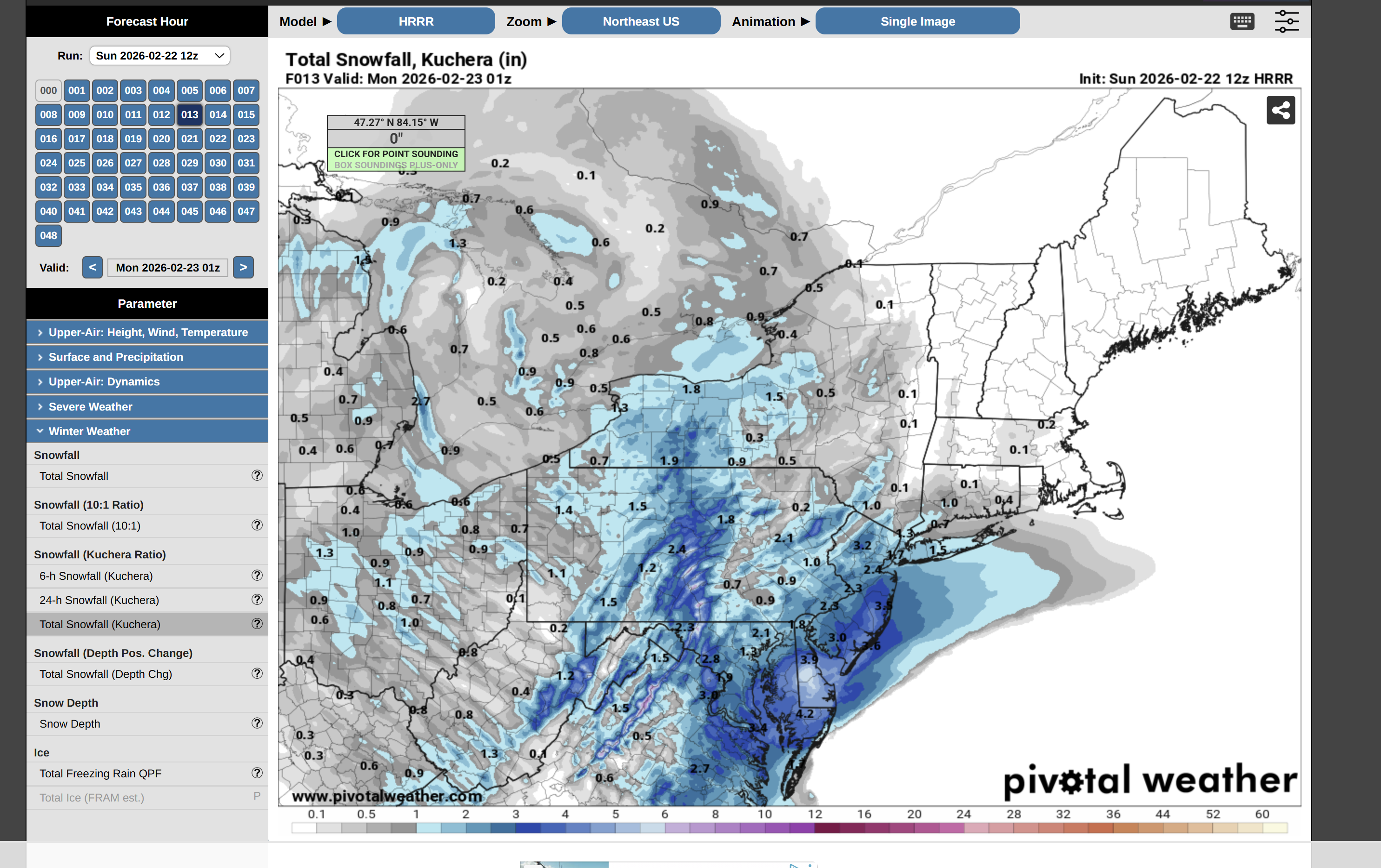
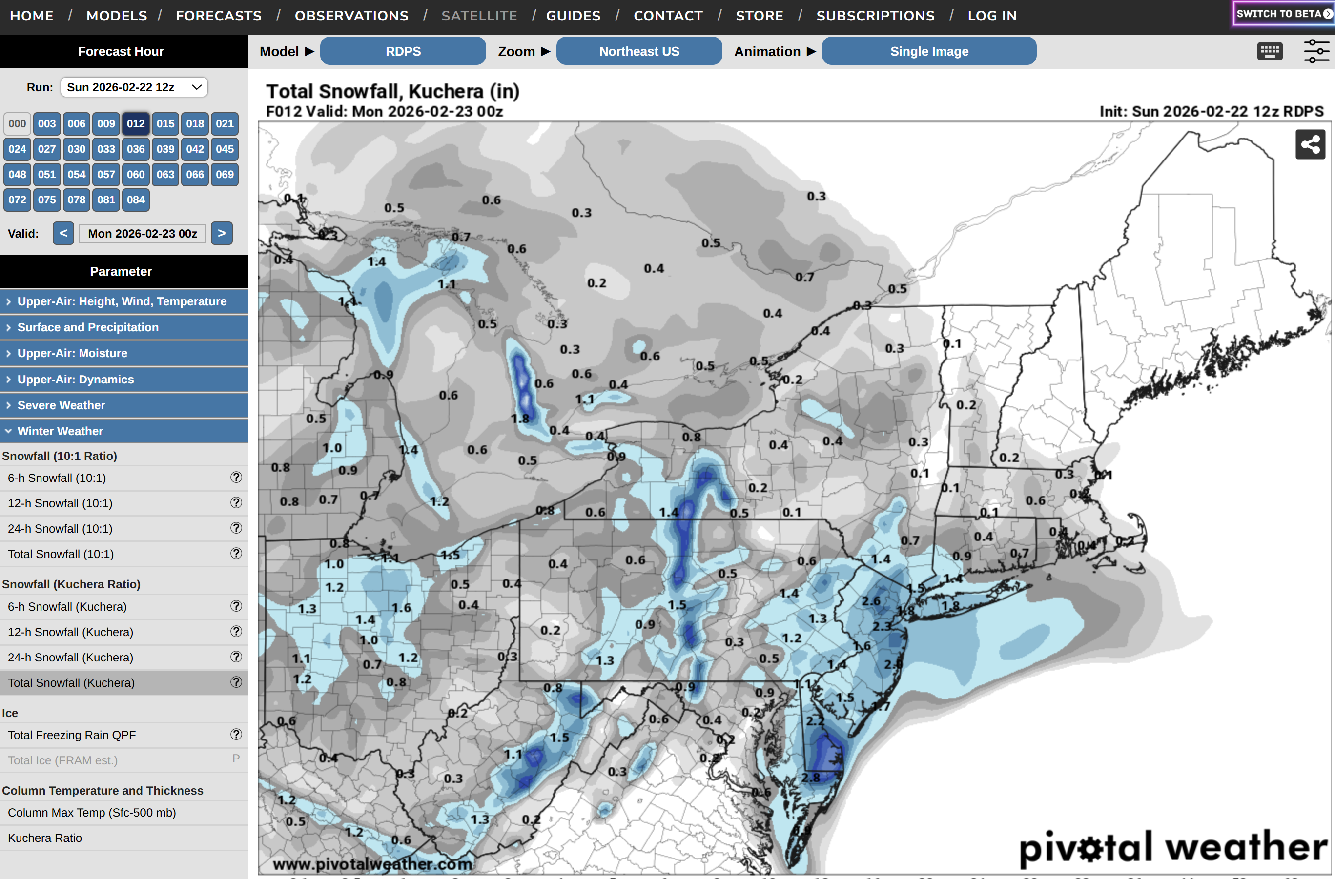
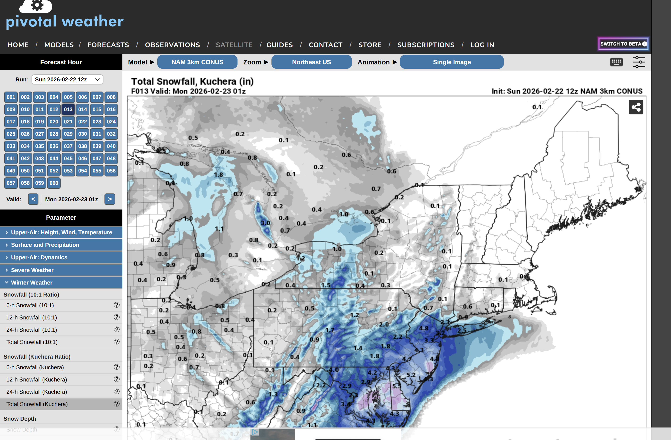
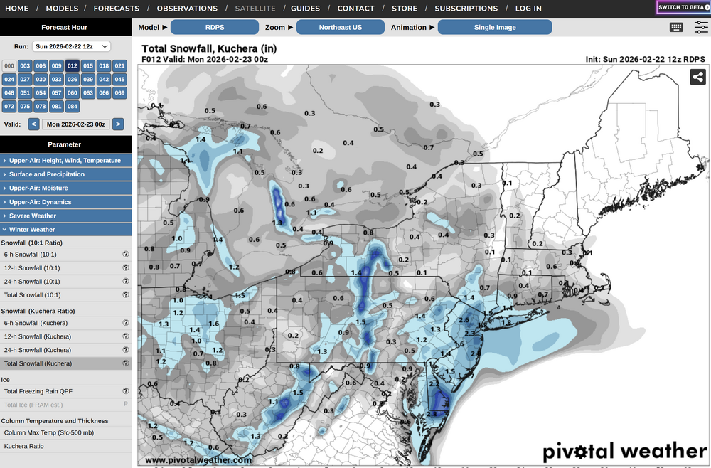
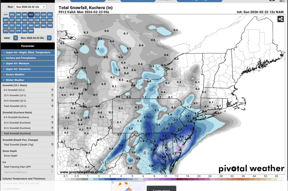
Let's do a quick model performance review of the 12Z clown maps snowfall thus. I can't speak for everyone, but all models were busting low relative to what we have here in Brick, NJ. Demonstrates that even the mesoscales are struggling with the dynamics. 12Z HRRR 12Z RGEM 12Z NAM 3K 12Z 12K NAM


-
Agreed. The fundamentals of this are that the precip shield will be much broader than most globals have. You don't have a <980 low at the BM and have Allentown only at 4". I think the GFS has the right idea in terms of intensity and broadness of the precip shield. I would expect 12+" totals all the way to the LV.
-
Roughly where in the BX are you located?
-
Heavy sleet is relentless. Picked up 0.5" of IP in the last hour.
-
Really hard to measure in the NW Bronx, but we are probably at 13"ish snow + sleet.
-
Looks like 50/50 Snow/IP in NW Bronx.
-
Foot + is a lock here. Expect to hold out on all snow until about 2:30ish.
-
At about 8.5" in the NW Bronx. Expecting another 3-4" before the transition and maybe 1-2" of IP afterwards.
-
Yeah - we will see it slow down, but it really depends on the precip enhancement with the coastal. Gun to head estimate is that it makes it to mid-Westchester with a battle between IP/SN after 2 PM for Manhattan to Tuckahoe.
-
It's largely rate dependent. If you look at those flipping to sleet in SNJ, it's correlated to a lull in precipitation. The coastal needs to get cranking in order to enhance precip to the city north to avoid the WAA taking hold. Really interesting to watch.
-
In NW Bronx now and I think we got hit with an early band that give us a 1-1.5" head start. I feel like I'm crazy compared to other reports in the city but i'm measuring 6.2 - 6.5" in at least 8 flat locations.
-
Yeah - we are getting rocked in Riverdale. Ratios are incredible. I would imagine 1 -2"/hour rates for the next 4-5 hours. 12-14" wouldn't surprise me in the least.
-
Work in renewables and can confirm that this is the case. The 2025 numbers are even more compelling. For example, the average cost of an energy storage system dropped about 27% in the past year due to technology improvements (and a reduction in EV demand, unfortunately). Currently, battery systems are competitive with LNG Peaker plans in MISO (Midwest) where fossils were heavy entrenched incumbents. The reality is that PV + BESS make so much sense. The technology pair has no long-term extraction costs, can be recycled, and of course, no long-term combustion impacts. BESS is also the "swiss army knife" of grid technology and can respond to grid disturbances in milliseconds. Peaker plants, or even nuclear, can't do that. The problem is adoption still isn't happening fast enough. This should have been 10 years ago.