All Activity
- Past hour
-
Not even the strongest quadrant. Absolutely insane
-
-
Definitely Category 5, just need NE quad sampled to confirm
-
There you go, Cat-5.
-
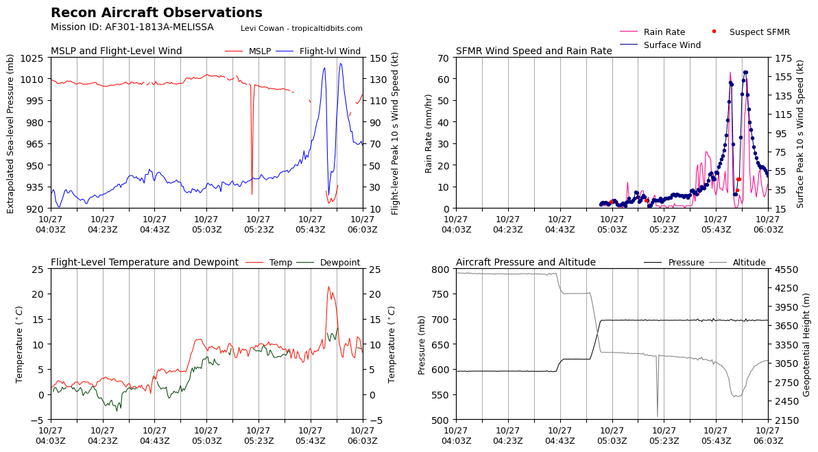
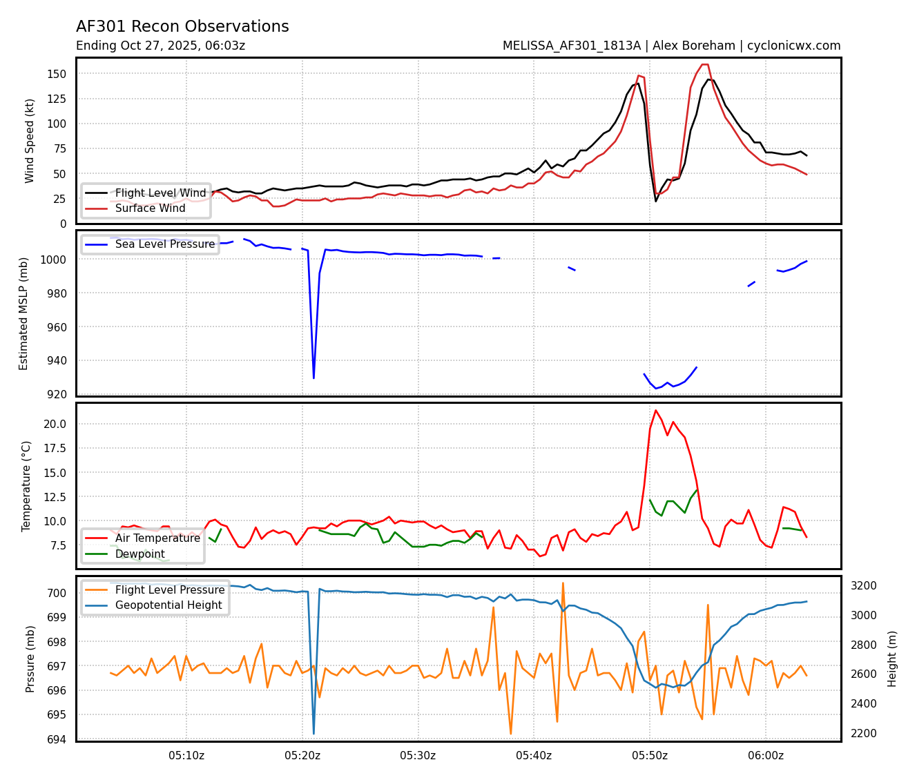
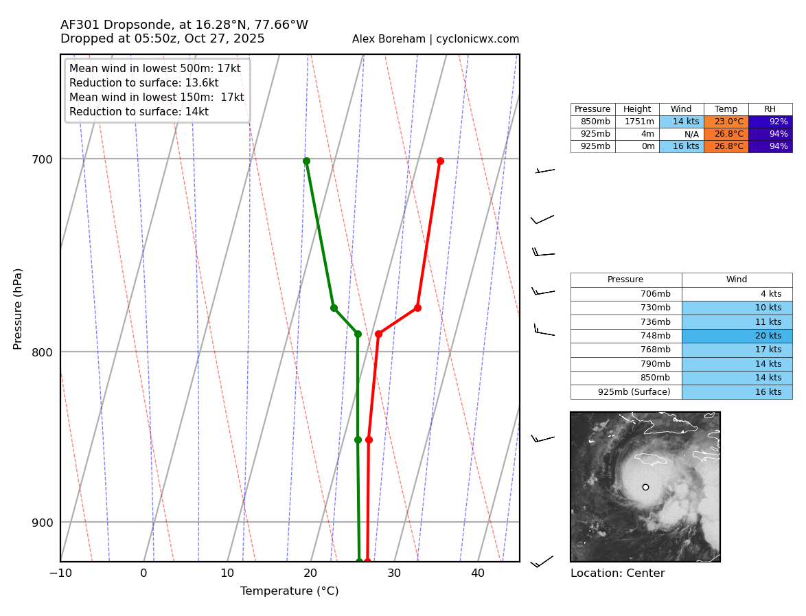
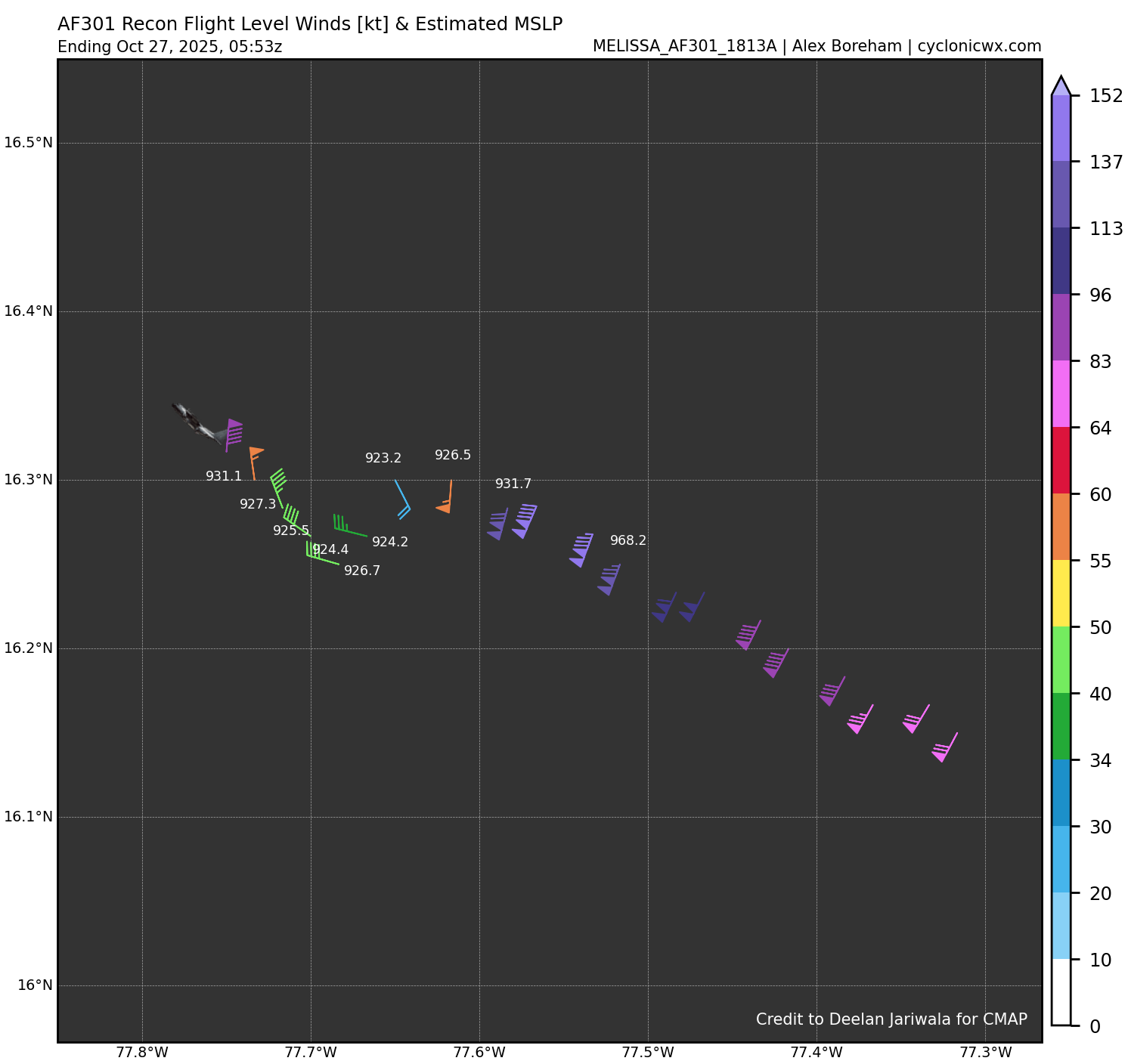
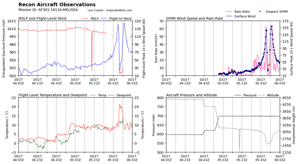
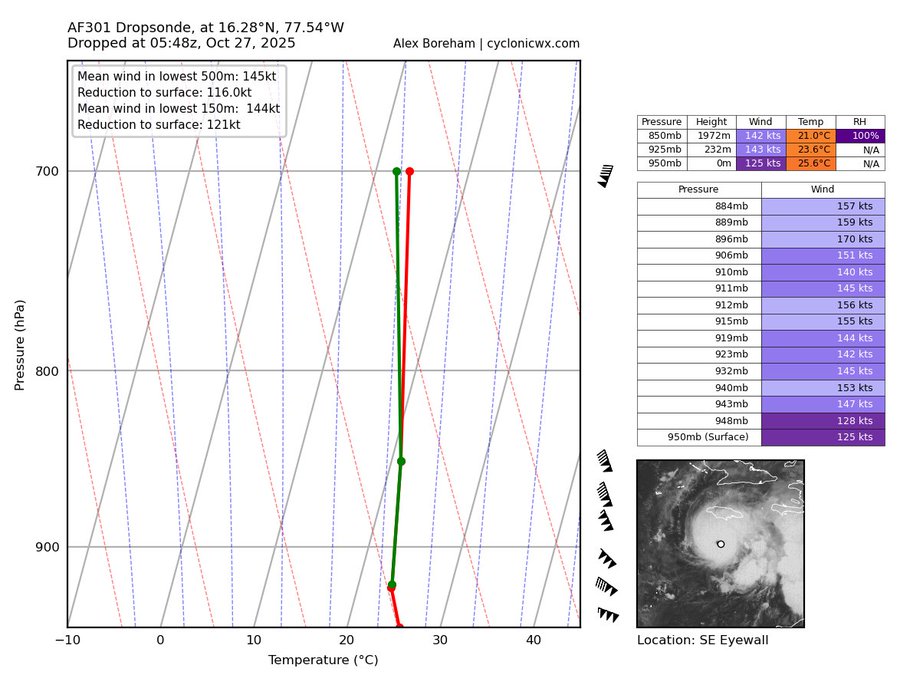
Dropsonde says 924 mb
-
Zero doubt this is a 5 to me. Batch of 143-144 FL and unflagged SFMR of 135, 150, and 159kt.
-
Looks like a cat 5 to me.
-
Definitely eager to see that data and hopefully they get a good pass through the eye
-
Recon just started measuring, give them time. This reading is, again, from the southeast quadrant of the eyewall. The highest winds in a hurricane reside in the northeast quad where the lowest pressure also resides. We are minutes away from finding out what the NE quad measures.
-
Is this the plane that will issue the 5am advisory or will another flight follow this?
-
I don’t think the NHC could pull the trigger on a C5 with that little center data. Recon needs time to confirm imo.
-
I really thought this was going to be a cat 5 now especially given the satellite estimates and what data they're getting now. So confused.
-
I’m thinking this is probably a 5, but recon needs more time to confirm.
-
2:00 AM EDT Mon Oct 27 Location: 16.3°N 77.7°W Moving: W at 5 mph Min pressure: 926 mb Max sustained: 150 mph
-
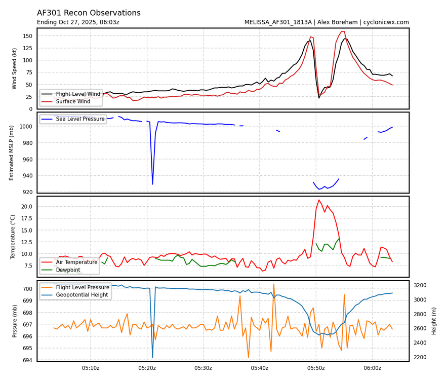
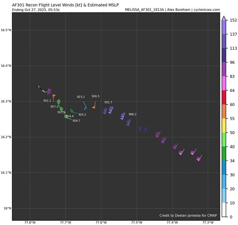
923.2mb extrapolated (might not be dead center) Peak FL of 140kt Peak SFMR of 148 SE to NW pass
-
Um……923mb in the S/SE quad of the eye? Oh boy, this just escalated quickly. Wonder what the NE quad measures.
-
Would make it the strongest ATL basin hurricane on record by max winds…
-
Well we’re about to find out lol
-
Dvorak Technique says “hold my beer”
-
Total guess, 912mb/145kt (165mph)
-
I’m thinking 915mb and 170mph, question is where it’ll fall since 170 is not an advisory strength, so 165/175.
-
Thinking they find pressure in the 910mb-920mb range. Winds in the 170-180mph range. Strictly based on satellite and infrared imagery, also factoring in ADT estimates.
-
165 920-924 range
-
Alright, let’s guess what recon finds, anyone? Pressure/max winds guesses
-
Looks like north turn may be in process of happening now