Bobby Posted January 11, 2011 Share Posted January 11, 2011 My take on it but feel I will be slightly upping the totals for central Suffolk County. Link to comment Share on other sites More sharing options...
Quincy Posted January 11, 2011 Share Posted January 11, 2011 been slaving over this forecast for a while, it's finally here: Link to comment Share on other sites More sharing options...
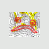
earthlight Posted January 11, 2011 Share Posted January 11, 2011 Looks like a giant fish eating Southern NJ. Link to comment Share on other sites More sharing options...
whiteoutwx1796 Posted January 11, 2011 Share Posted January 11, 2011 Link to comment Share on other sites More sharing options...
B Dawk 20 Posted January 11, 2011 Share Posted January 11, 2011 This is my adjustment and Final Call for the event. Thoughts are, of course, welcome Link to comment Share on other sites More sharing options...
Sock Puppet Posted January 11, 2011 Share Posted January 11, 2011 Looks good. I'm guessing you took all the latest data into account? been slaving over this forecast for a while, it's finally here: Link to comment Share on other sites More sharing options...
snywx Posted January 11, 2011 Share Posted January 11, 2011 Looks good. I'm guessing you took all the latest data into account? Did you see what time he posted that map? lol.. Link to comment Share on other sites More sharing options...
jdt Posted January 11, 2011 Share Posted January 11, 2011 Final Map Follow up to posted map. Storm will be very dynamic which will likely result in a sharp cutoff of accumulations to the west. Indications are this cutoff will, like 12/26, be situated near or over NNJ. Any adjustments in track or intensity of storm may shift this zone east or west thus altering final accumulations in some areas. Map represents the most likely outcome. Further updates will be posted in real time. Link to comment Share on other sites More sharing options...
Grothar Posted January 11, 2011 Share Posted January 11, 2011 AR and Voyager-- watch in the next 2-3 runs of the GFS and NAM- the rookies will be going nuts. I post here in this thread so it cannot be said that I am off my rocker. 6-12 is a good bet for LV- watch the radar rather than the models- there are too many variables working in this storm to rely on just one model Well, have you been looking at the pinned thread? They are going nuts-- people wanting suspensions- trolling issues and calling the storm a bust and it has not even happened yet. The only thing that concerns me is that the primary and high ratios die over the mts too soon. I am still seeing 6-12 for ABE but if the primary dies to soon, we are looking at 2-4. Just keeping reading the pinned thread. real funny Link to comment Share on other sites More sharing options...
nycwx01 Posted January 12, 2011 Share Posted January 12, 2011 Here's my call. I think the storm will get its act together in a hurry east of Long Island, but a bit too late to give NYC (and obviously, areas west) 12+ amounts. As of now, I'm gonna say that NYC gets roughly 8 inches, with the potential for a lot more as you head east (mixing is a threat on the South Fork) and northeast. Link to comment Share on other sites More sharing options...
Grothar Posted January 12, 2011 Share Posted January 12, 2011 Well, have you been looking at the pinned thread? They are going nuts-- people wanting suspensions- trolling issues and calling the storm a bust and it has not even happened yet. The only thing that concerns me is that the primary and high ratios die over the mts too soon. I am still seeing 6-12 for ABE but if the primary dies to soon, we are looking at 2-4. Just keeping reading the pinned thread. real funny Well AR and Voyager, How did I do? I know the storm is not over but I think I was pretty close? The pinned thread last night and this morning was hilarious as they saw the primary taking over and the snowfall rates drop in NJ and the models went to hell in a hand basket. Watch the radar. Thanks Link to comment Share on other sites More sharing options...
Quincy Posted January 12, 2011 Share Posted January 12, 2011 final forecast...high confidence most areas, although I'm a bit cautious about the western gradient between 4-8 and 8-12...radar looks impressive and it looks like the GFS was fairly crappy with its QP forecasts for western areas. Even the 00z NAM might be too low in some areas, but we'll see. Link to comment Share on other sites More sharing options...
ArtRosen Posted January 12, 2011 Share Posted January 12, 2011 Here's my call. I think the storm will get its act together in a hurry east of Long Island, but a bit too late to give NYC (and obviously, areas west) 12+ amounts. As of now, I'm gonna say that NYC gets roughly 8 inches, with the potential for a lot more as you head east (mixing is a threat on the South Fork) and northeast. I think this one is going to verify the most correct. Link to comment Share on other sites More sharing options...
scottynic Posted January 19, 2011 Share Posted January 19, 2011 Bump... lets get this thread going again with upcoming storms... Link to comment Share on other sites More sharing options...
ParanormalWx Posted January 19, 2011 Share Posted January 19, 2011 Here's my guess for Thursday - Friday. Link to comment Share on other sites More sharing options...

Recommended Posts
Archived
This topic is now archived and is closed to further replies.