stormspotterlive Posted May 6, 2012 Share Posted May 6, 2012 I thought it would seam reasonable that I make a thread concerning the front this week as the models are trending slower with it. As of now it seams clear that there will be showers and storms along the front. What seams to be questionable still is weather or now a low pressure system will ride up along it later wed providing a healthy amount of rain to Philly south and east maybe even slightly west or east pending on where the front stalls. 18z GFS just in wants to bring more rain south and east with the front and low pressure system about 1.50-2.00 Philly metro about an inch to 1.25 with a sharp cut off right near I95 between Philly and Allentown it drops off to 0.75 to an inch then has about 1-1.50 for the Poconos. Given the slow moving pattern we are in it does appear there is room for this forecasting period to get interesting but I would suspect the stronger GGEM is overdone. There has been pretty good evidence of the slow pattern with there being a boundary stalled over central pa since yesterday am however it is weak in nature and not providing much in the way of convection. Now as for the euro which once was having the system do circles over us has gone more east and missing most of us completely with the front moving through faster. We shall now wait and see how the models Handel this front as we get closer. Link to comment Share on other sites More sharing options...
phlwx Posted May 7, 2012 Share Posted May 7, 2012 We shall now wait and see how models Handel this front as we are getting closer. type this on an iPad or something with autocorrect? I'm sure Handel won't be able to handle this considering he's been dead for 250 years now. Link to comment Share on other sites More sharing options...
tombo82685 Posted May 7, 2012 Share Posted May 7, 2012 0z euro is going .75-1.75 for the region Link to comment Share on other sites More sharing options...
Allsnow Posted May 7, 2012 Share Posted May 7, 2012 Thanks tombo...wed still look like the rain day? Tuesday dry? Link to comment Share on other sites More sharing options...
tombo82685 Posted May 7, 2012 Share Posted May 7, 2012 Thanks tombo...wed still look like the rain day? Tuesday dry? yup, tuesday most of the precip should be concentrated to the west...as we get towards evening it will creep closer and through the i95 regions then tues night into wed night is the rainy day according to the euro Link to comment Share on other sites More sharing options...
Allsnow Posted May 7, 2012 Share Posted May 7, 2012 Thanks! Link to comment Share on other sites More sharing options...
tombo82685 Posted May 7, 2012 Share Posted May 7, 2012 12z euro, cut back big time for this week in terms of rainfall. Only .25-.5, ..... .5-.75 eastern half of jersey Link to comment Share on other sites More sharing options...
stormspotterlive Posted May 7, 2012 Author Share Posted May 7, 2012 12z euro, cut back big time for this week in terms of rainfall. Only .25-.5, ..... .5-.75 eastern half of jersey I am starting to think the most anyone sees in our region is about an inch though out in central and western pa looking like they will get over an inch. Models are really starting to lose the organized low they had passing through the area or just to the east of us. Just a side note currently 59.9 degrees and light rain here in Northeast Philadelphia with the warm front. Link to comment Share on other sites More sharing options...
phlwx Posted May 7, 2012 Share Posted May 7, 2012 18z NAM, for what it's worth, is east/offshore with the heavy rain axis on Wednesday night. Link to comment Share on other sites More sharing options...
tombo82685 Posted May 8, 2012 Share Posted May 8, 2012 Only model with the big rains is the ggem, which loves to blow storms up. It looks like as the models have it now, we are caught in between 2 storms. The one pulling to the north of us which will dump good rain on western and central pa and the stalled front which looks to be off shore. Though still looks like a .25-.5 ordeal of rain for the region. Link to comment Share on other sites More sharing options...
hazwoper Posted May 8, 2012 Share Posted May 8, 2012 Looks like we might get some decent rains out of this first batch today. Link to comment Share on other sites More sharing options...
stormspotterlive Posted May 8, 2012 Author Share Posted May 8, 2012 If the spc 4km and NMM is right steady rain makes it into Philly even with round 2. Should be interesting to see how it unfolds coastal areas of jersey and Delaware could come close on the heavy rain aspect. Looks like the 12z euro has moderate rain fall east of PA not sure the total amounts though. As for a side note looks like the rain fall wants to hit Philly area about 5pm the peak of rush hour. Remember wipers on headlights on. Link to comment Share on other sites More sharing options...
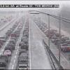
am19psu Posted May 8, 2012 Share Posted May 8, 2012 As for a side note looks like the rain fall wants to hit Philly area about 5pm the peak of rush hour. Remember wipers on headlights on. Driving to the stadium via the Schuylkill is going to be murder. Link to comment Share on other sites More sharing options...
NaoPos Posted May 8, 2012 Share Posted May 8, 2012 Driving to the stadium via the Schuylkill is going to be murder. No different than any Other time! Link to comment Share on other sites More sharing options...
am19psu Posted May 8, 2012 Share Posted May 8, 2012 No different than any Other time! Looking forward to passing under the sign at 202/76 that says TRAVEL TO I-676 12 MI 45 MIN Link to comment Share on other sites More sharing options...
stormspotterlive Posted May 8, 2012 Author Share Posted May 8, 2012 Driving to the stadium via the Schuylkill is going to be murder. Good luck 2 sports events + Rush hour+ rain will be like a Friday on I76 already looks crowded. Link to comment Share on other sites More sharing options...
tombo82685 Posted May 8, 2012 Share Posted May 8, 2012 Looking forward to passing under the sign at 202/76 that says TRAVEL TO I-676 12 MI 45 MIN huge lol Link to comment Share on other sites More sharing options...
tombo82685 Posted May 8, 2012 Share Posted May 8, 2012 If the spc 4km and NMM is right steady rain makes it into Philly even with round 2. Should be interesting to see how it unfolds coastal areas of jersey and Delaware could come close on the heavy rain aspect. Looks like the 12z euro has moderate rain fall east of PA not sure the total amounts though. As for a side note looks like the rain fall wants to hit Philly area about 5pm the peak of rush hour. Remember wipers on headlights on. .1-.25 for rd 2 for philly metro Link to comment Share on other sites More sharing options...
NaoPos Posted May 8, 2012 Share Posted May 8, 2012 Looking forward to passing under the sign at 202/76 that says TRAVEL TO I-676 12 MI 45 MIN Thinking positive I see? :-) dont feel bad, I have a feeling our inaugural night of my golf league will be cancelled... Link to comment Share on other sites More sharing options...
tombo82685 Posted May 8, 2012 Share Posted May 8, 2012 12z gfs ens are pretty bullish for rd 2 for phl metro on south and east Link to comment Share on other sites More sharing options...
stormspotterlive Posted May 8, 2012 Author Share Posted May 8, 2012 .1-.25 for rd 2 for philly metro Thanks Tom. nice gentle rain for the grass would be nice. Link to comment Share on other sites More sharing options...
johnc Posted May 8, 2012 Share Posted May 8, 2012 low dewpoint ftl Link to comment Share on other sites More sharing options...
tombo82685 Posted May 8, 2012 Share Posted May 8, 2012 ooo that silly 18z gfs Link to comment Share on other sites More sharing options...
johnc Posted May 8, 2012 Share Posted May 8, 2012 ooo that silly 18z gfs tornadoes or snow storm? ahhh... ninja edit you sneak you road trip to cape may Link to comment Share on other sites More sharing options...
stormspotterlive Posted May 8, 2012 Author Share Posted May 8, 2012 18z nam also went wetter and the wrf is now west. Models had this far out then lost it I doubt it is safe to say it is wrong or right Overdone on qpf maybe. Any how with every model having a different solution nowcasting is going to be interesting. Link to comment Share on other sites More sharing options...
tombo82685 Posted May 8, 2012 Share Posted May 8, 2012 18z nam also went wetter and the wrf is now way west. Models had this far out then lost it I doubt it is safe to say it is wrong or right Overdone on qpf maybe. Any how with every model having a different solution nowcasting is going to be interesting. Even though the nam came west a little its no where near what the gfs has. Its on its own honestly, no other model has what it is showing. Can you link me to the wrf? Link to comment Share on other sites More sharing options...
stormspotterlive Posted May 8, 2012 Author Share Posted May 8, 2012 Even though the nam came west a little its no where near what the gfs has. Its on its own honestly, no other model has what it is showing. Can you link me to the wrf? The earlier run that I saw was quite a bit east of the latest run but is not like the GFS yet. we do get some rain at different intensities but nothing major. verry interested to see the 18z GFS ensembles. really need multiple models to support the GFS to fully believe it. http://hp5.wright-we...-loop_1hour.gif Link to comment Share on other sites More sharing options...
tombo82685 Posted May 8, 2012 Share Posted May 8, 2012 18z gfs ens agree with the op....brings .75-2.25 to the drought stricken region.. .75 in the lehigh valley... 1.25-1.75 philly metro and 2 inches to jersey shore Link to comment Share on other sites More sharing options...
stormspotterlive Posted May 8, 2012 Author Share Posted May 8, 2012 For what it is worth the old ruc is pretty high on amounts just southeast of philly prior to the coastal the GFS has. Sets up a heavy band just east of the city that does briefly sneak west but puts down 1 inch + for some just east of I95. Take this with a grain of salt for now. Additionally sim radar at the end is rather west again take this with a grain of salt as well. Link to comment Share on other sites More sharing options...
stormspotterlive Posted May 9, 2012 Author Share Posted May 9, 2012 Very interesting right now to see PW values stalled noticeably more west and exploding. Also interesting to note that the Potential precipitation placement is stalling and setting up noticeably more west as well. Link to comment Share on other sites More sharing options...

Recommended Posts
Archived
This topic is now archived and is closed to further replies.