

brooklynwx99
-
Posts
4,596 -
Joined
-
Last visited
Content Type
Profiles
Blogs
Forums
American Weather
Media Demo
Store
Gallery
Posts posted by brooklynwx99
-
-
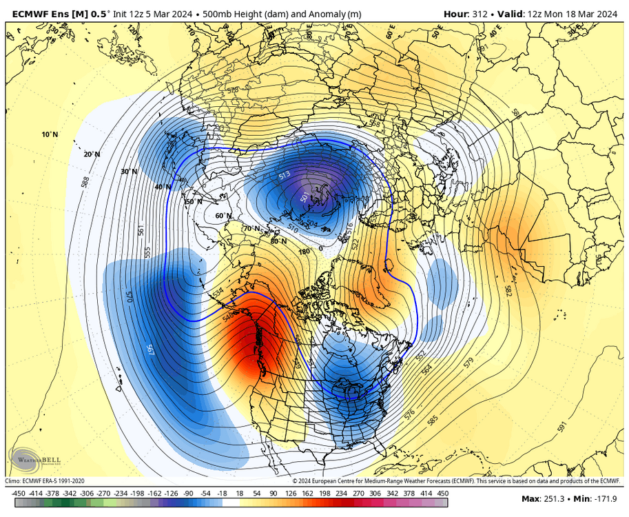
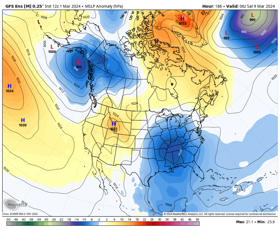
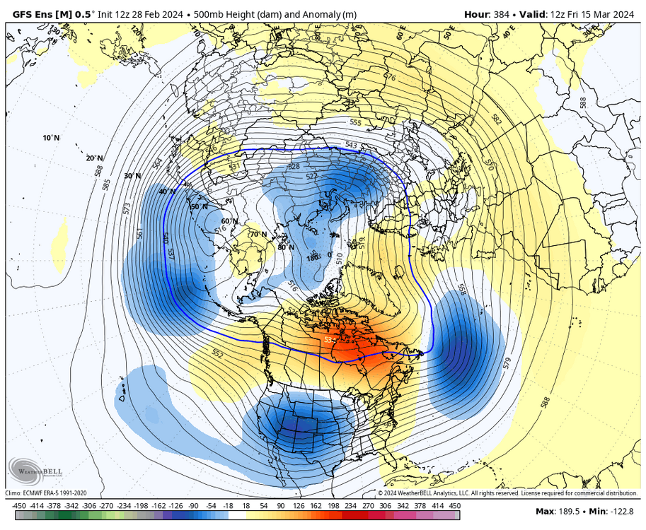
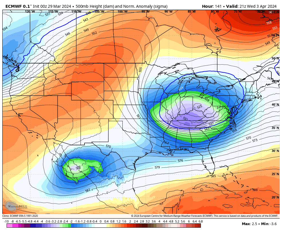
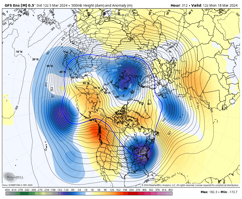
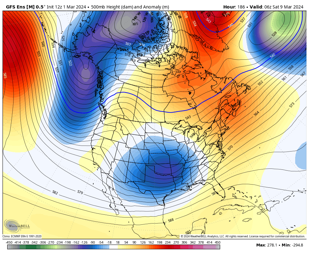
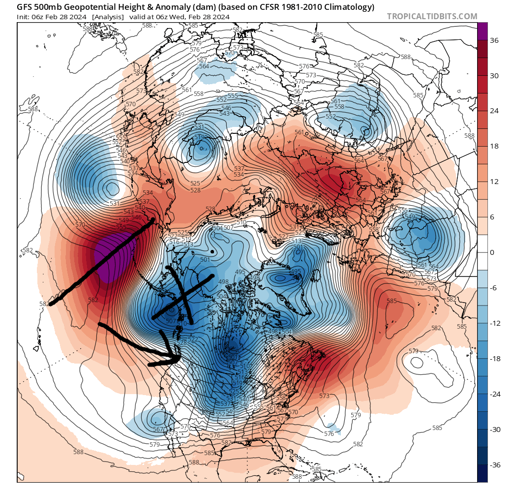
you have an anomalous -NAO breaking down over the Davis Strait and a 50/50 in place, it’s a really good pattern for a significant storm. and the trough is showing up as low as -3 to -4 sigma on OP runs. climo starts to mean less when you’re dealing with that level of deviation from the mean
someone is going to get crushed. I would feel a lot better if I was in Boston

-
 3
3
-
 1
1
-
-
also, lol
-
1
-
-
and the trough is showing up as low as -3 to -4 sigma on OP runs. climo starts to mean less when you’re dealing with that level of deviation from the mean

-
3
-
-
you have an anomalous -NAO breaking down over the Davis Strait and a 50/50 in place, it’s a really good pattern for a significant storm
-
4
-
-
1 minute ago, 40/70 Benchmark said:
Unless all of the cold remains in Eruasia...
verbatim, some pretty stout cross polar flow develops. again, I would like to see it get closer, but it would work

-
1
-
-
18 minutes ago, Brian5671 said:
That was preceded by an arctic outbreak with temps near freezing for 4-5 days prior. Temps like that are unlikely this year
IF the TPV gets displaced like some of the OP runs have shown, I'll buy it. big if for now, but with the ongoing SSW and Pacific wave breaking, it is a possibility. would be silly to totally dismiss it
-
 1
1
-
-
8 minutes ago, 40/70 Benchmark said:
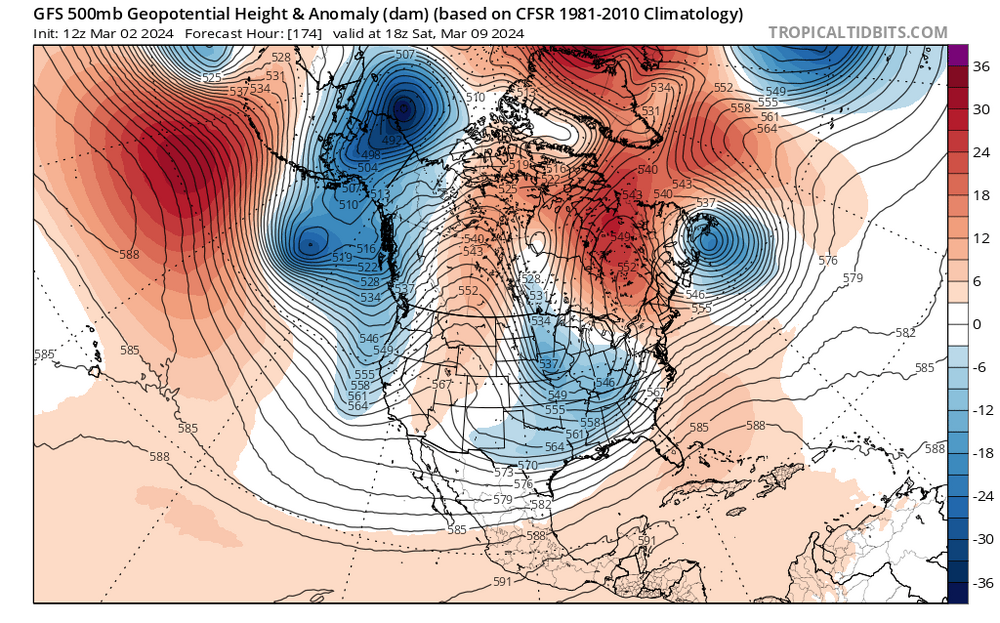
March 1973 also had a late cool down and a touch of snow, which is by far the best analog this month IMO.
hell, even 1998 had a late season event followed by a week of 80s. it was NYC's only snow of the winter
-
1
-
-
IF there were to be a weird late season event, this would be the pattern needed to get it done

-
1
-
-
1 minute ago, psuhoffman said:
There are hints that perhaps there could be more arctic air involved in the pattern after March 20 or so...but so much would have to go perfectly at that point for it to matter. There is a reason there are VERY few examples of significant snow that late in the DC Baltimore area. For places with higher elevations, you know who you are, there are somewhat better chances late March and early April.
IF there were to be a weird late season event, this would be the pattern needed to get it done


-
1
-
-
lol. if there was to be a dumb late season event, this would be the pattern you’d need to pull it off


-
 1
1
-
-
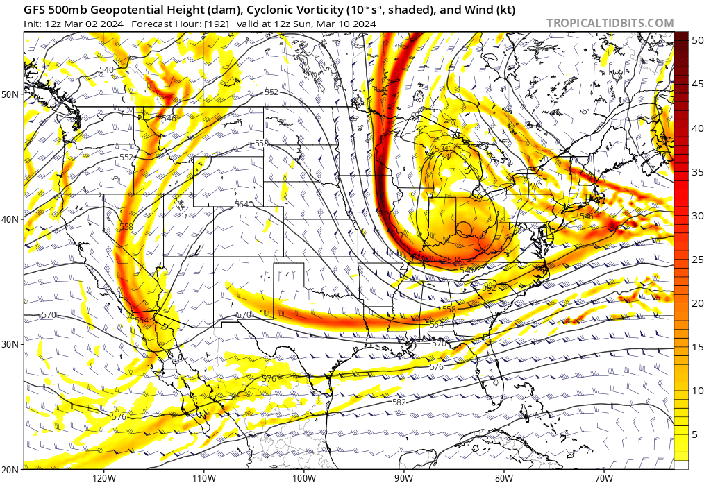
this ain’t bad… blocked flow to the north, a 50/50 in place, and strong HP to the north to allow colder air to drain in. again, something to keep an eye on, especially away from the immediate coast

-
3
-
 1
1
-
-
2 minutes ago, RUNNAWAYICEBERG said:
He’s not though. It’s a fair assessment imo. One thing is for sure though, we're taking ditty to the woodshed and spanking his bare fanny with empty beer bottles.
if this was Jan, i’d probably can the risk, but March is stupid and this could easily just cut off and dump
-
1
-
-
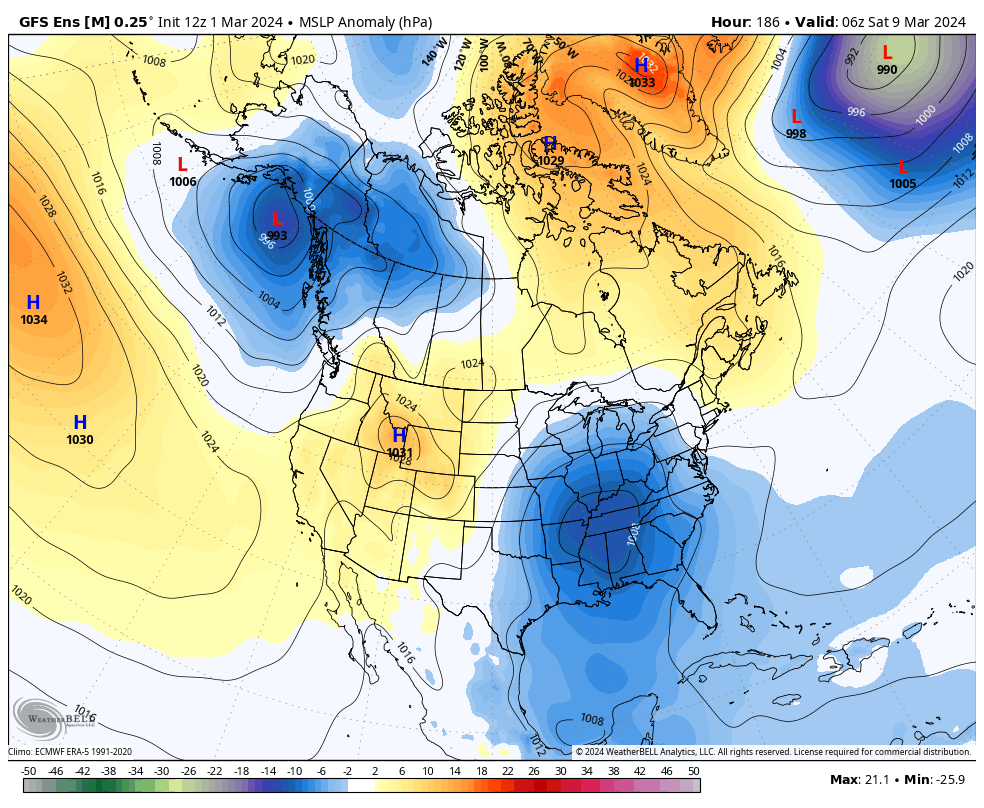
i would like to see more of a cutoff signature, as AN heights over Nova Scotia usually aren’t the best for late season storms. however, teleconnections aren’t quite as useful as they are in mid-Jan due to shorter wavelengths. there’s also some nice HP to the north. something to watch, but I would lower expectations given a lack of ample cold air

-
3
-
-
i would like to see more of a cutoff signature, as AN heights over Nova Scotia usually aren’t the best for late season storms. however, teleconnections aren’t quite as useful as they are in mid-Jan due to shorter wavelengths. there’s also some nice HP to the north. something to watch, but I would lower expectations given a lack of ample cold air

-
2
-
-
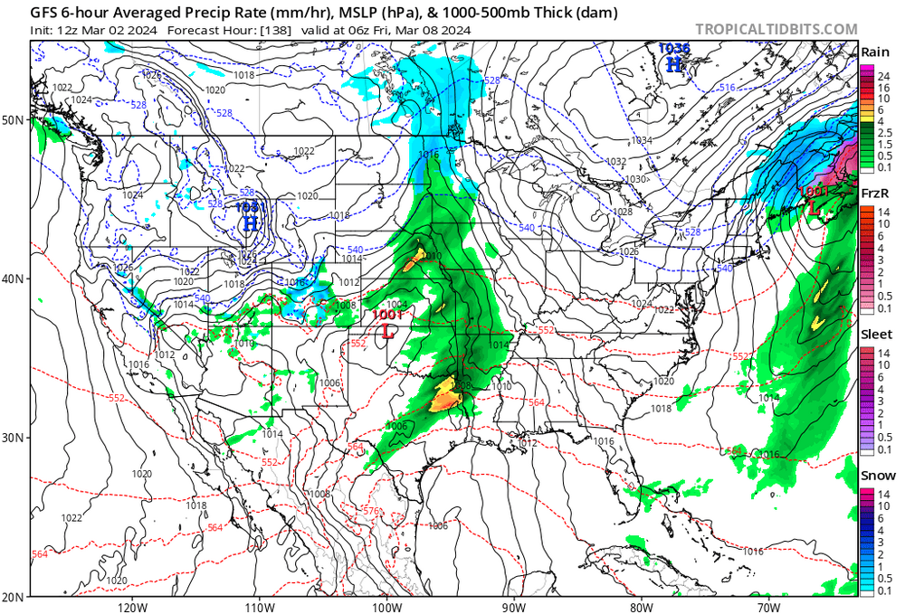
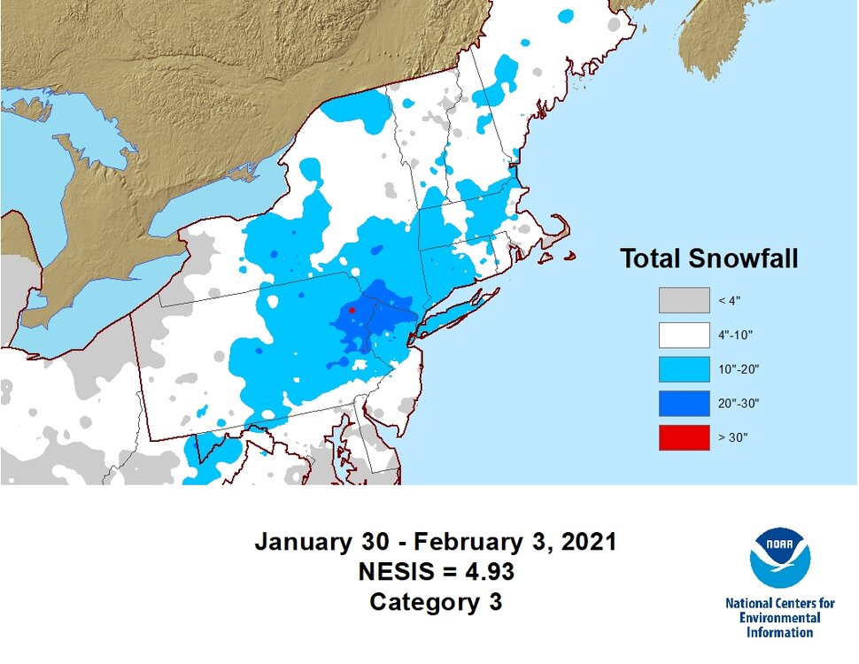
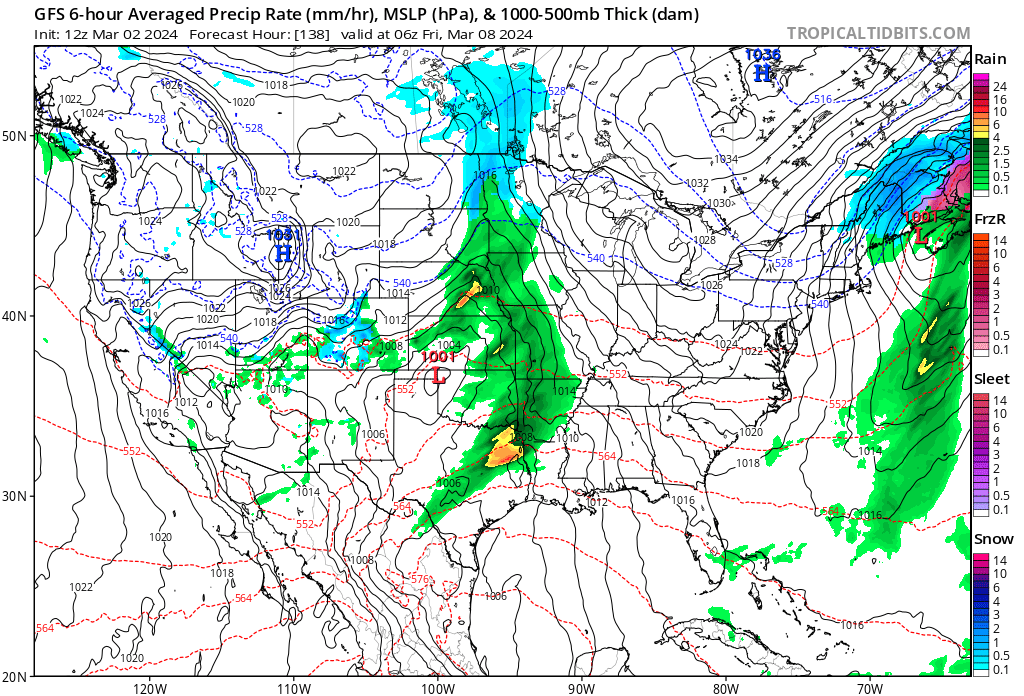
for reference, this MECS occurred four days afterwards. lmao
-
1
-
-
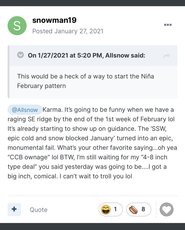
3 hours ago, snowman19 said:
You are unbelievably arrogant and pompous. I would expect no less
oh yeah? this you?
@Allsnow must have been nice digging out from 18” and then 6” over the next two weeks
-
1
-
1
-
-
i don't really see the point in posting about a warm ass pattern, either. hence why I come off as cold biased... i only really post about things that look conducive for winter weather. i don't see any interesting about 7-10 days of AN with this pattern. most posters are like this
like what is there to say about this other than warm and boring? lmao
-
2
-
1
-
-
@snowman19 also, I am aware that the advertised pattern fell through. it's annoying, but there were also a lot of other meteorologists that were excited at the possibilities, and rightfully so. you should find some respected mets on Twitter or even on this forum and shit on them too, while you're at it. sometimes the models just do a really bad job. hell, they couldn't even figure out the Feb 15th storm a day in advance
you have also had your fair share of complete fails (as does every other person that forecasts the weather for an extended period of time), but you don't see me ready to pounce on you for it. i also don't put words in your mouth either, but you're just here in bad faith, so i can't expect anything less
-
2
-
1
-
-
3 minutes ago, snowman19 said:
Oh you’re back again, I figured you couldn’t be far after this morning’s GFS run. You must be getting ready to hype how wonderful, great and epic mid-late March looks. Textbook KU pattern and major blocking and cold is coming right? Stand down. After all your bombastic cold and snow hype busts this winter and last winter you should take some time to work on humility
you okay dude? I think @40/70 Benchmark is a therapist. you should have a chat with him! god bless
-
5
-
1
-
-
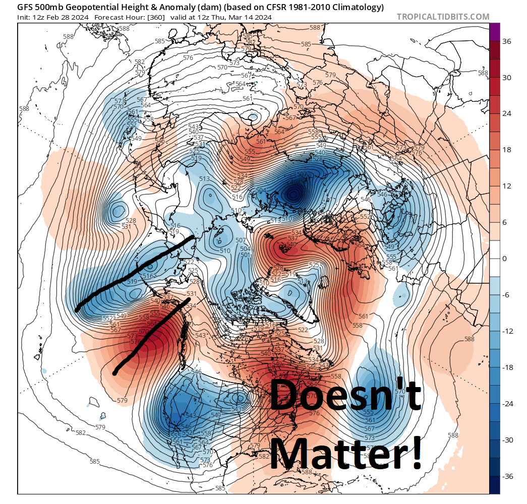
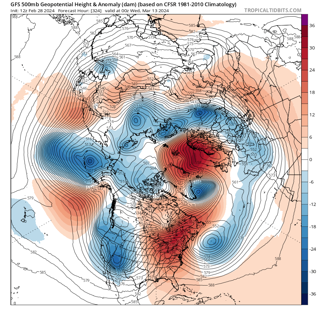
also yeah it's going to torch until the 10th or so but things likely moderate with some typical late-season wintry chances for the interior afterwards. i don't see anything that advertises prolonged anomalous warmth into mid-month
-
4 minutes ago, snowman19 said:
The GFS is better huh? You mean the model that kept showing the phantom anafront snow run after run? I’m sure you remember it well because you hyped it all last weekend and kept posting the GFS runs. Yea, it’s a great model, absolutely superb. How much anafront snow did you get today? I haven’t had a chance to check yet….
you mean at like 144 hours out? who cares
sometimes you complain that people don't like you because you're such a "realist" but this is more grating to read than whatever Tony posted lmao
-
1
-
-
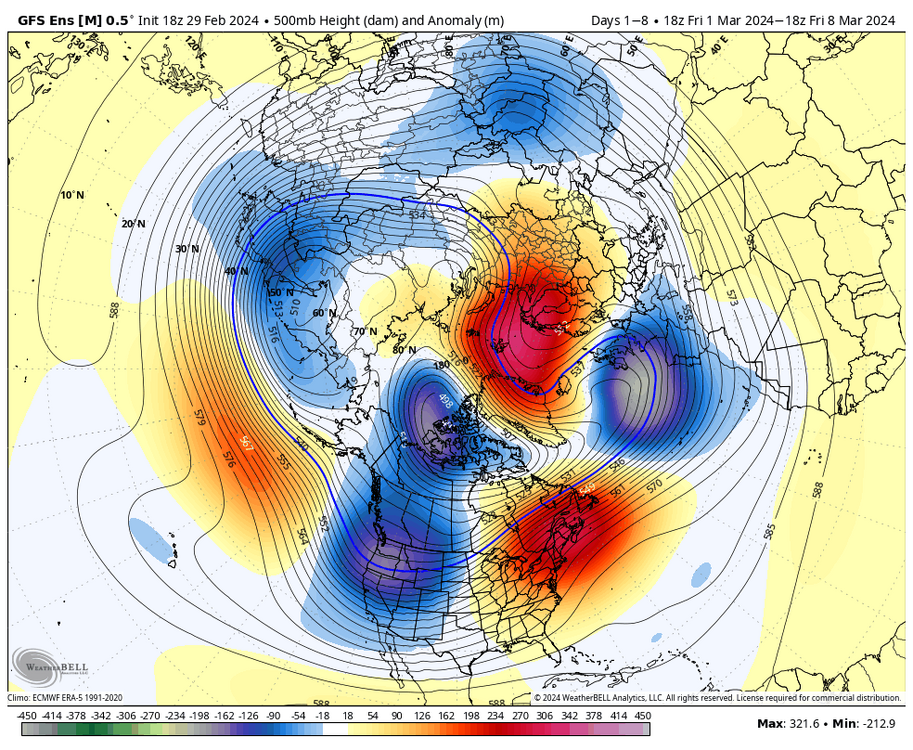
8 minutes ago, psuhoffman said:
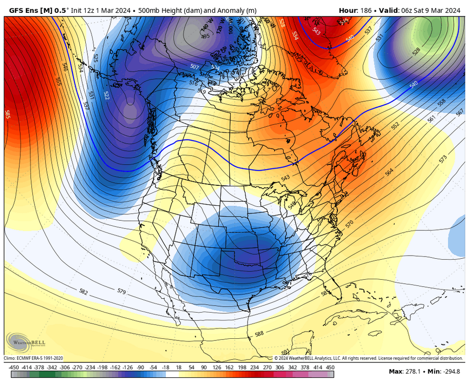
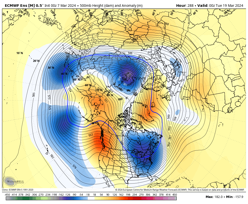
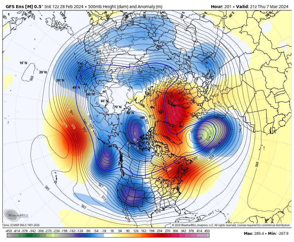
@brooklynwx99 this is a better example. Look at the pac. Totally opposite pattern there. But the same trough ridge configuration over the US! The wavelengths just adjust.

the thing is that is looks like this a couple days before the frame you posted. of course there's going to be a residual ridge with a full latitude trough stretching from Siberia to Baja CA. give the GEFS a couple of days to push the colder air east. looking at this stuff without context doesn't do much good

-
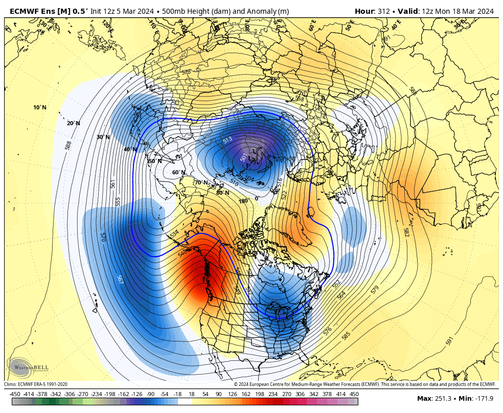
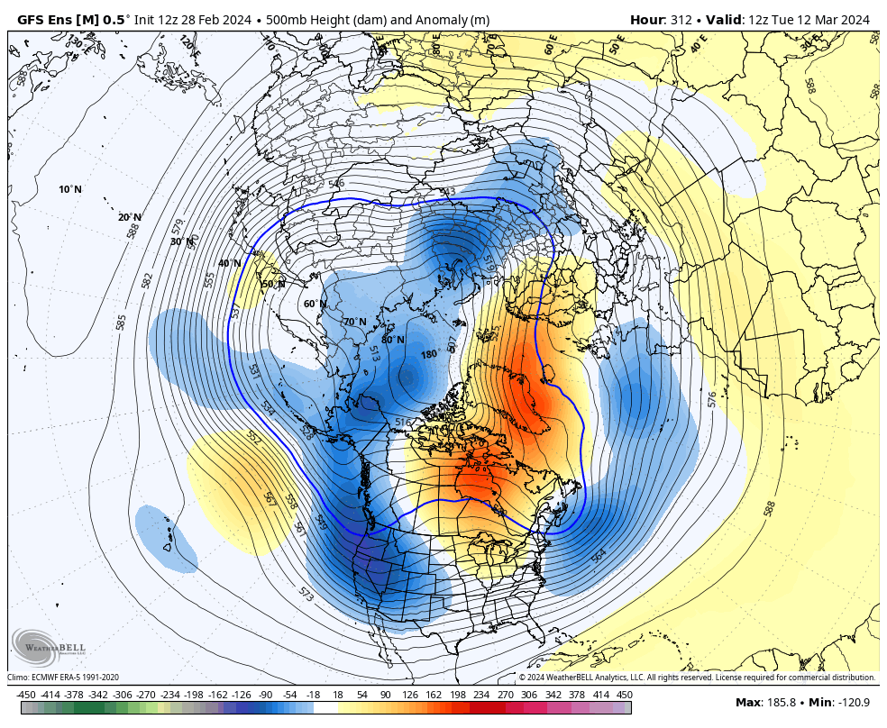
35 minutes ago, psuhoffman said:
I've pointed this out before...
This first example its obvious why we are warm... This pacific configuration is a train wreck, we should be warm with this crap pacific longwave setup
But then look at this...its the complete opposite pacific longwave pattern, and we still have a massive full latitude eastern N American ridge

I've shown this several times over the last few years...that at times it doesn't matter what the jet configuration is over the pacific it leads to the same pattern over the CONUS regardless. Am I 100% sure the PDO is totally to blame for this...ehh. I hope so.
well, yeah, you have to look at the pattern beforehand as well. there's a trough in the west and in AK. it's not really a surprise that it's warm in the east a day or so later. again, you have a case with most of this stuff, but this is not a good application at all. that ridge later on isn't even centered over the West Coast

-
1
-
-
IMO, there are only two things that CC has done that are pretty much indisputable:
- winters have become warmer, and there is a lower chance of seeing a BN three-month stretch
- snowfall variance has increased (more boom/bust winters)
that's about it. anything else is speculative at best
-
7


April 2024
in New York City Metro
Posted
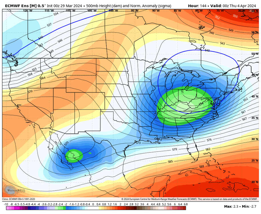
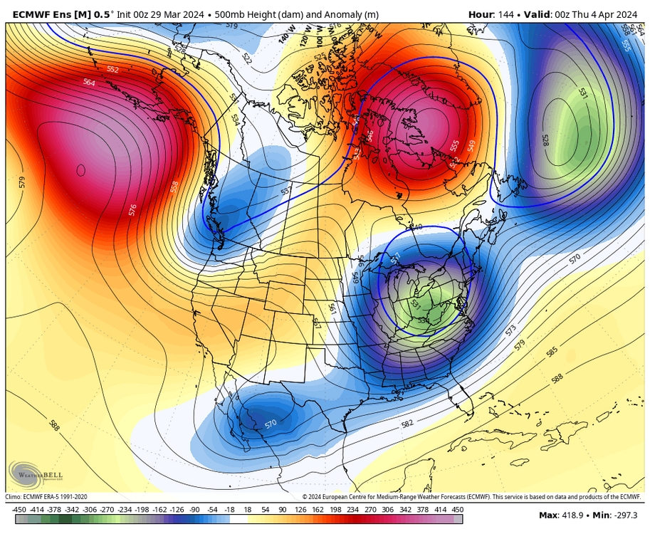
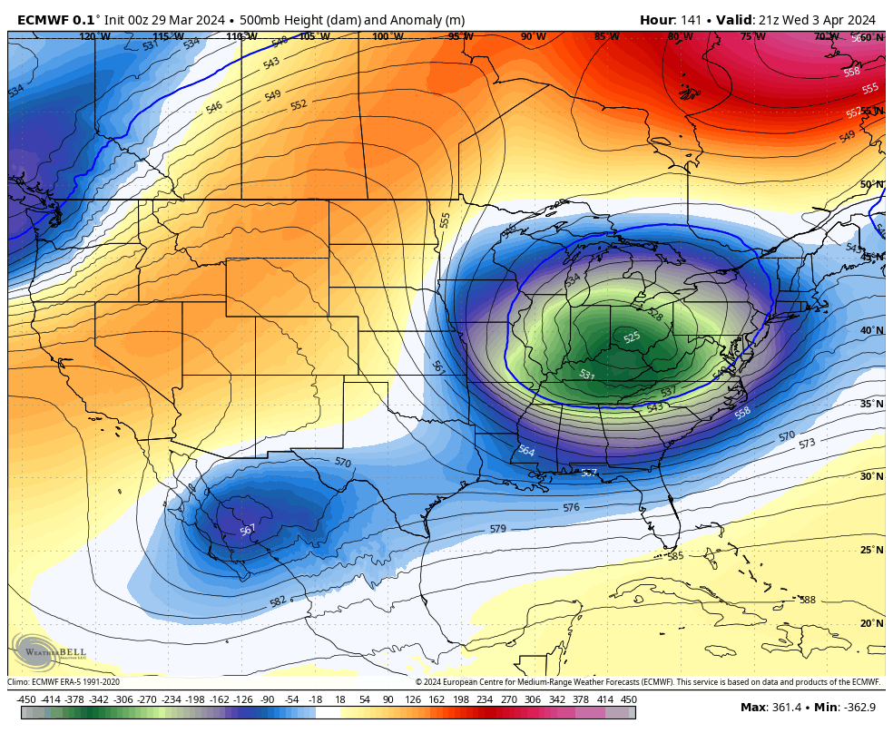
trough on the EPS is deeper with stronger blocking