

brooklynwx99
-
Posts
6,224 -
Joined
-
Last visited
Content Type
Profiles
Blogs
Forums
American Weather
Media Demo
Store
Gallery
Posts posted by brooklynwx99
-
-
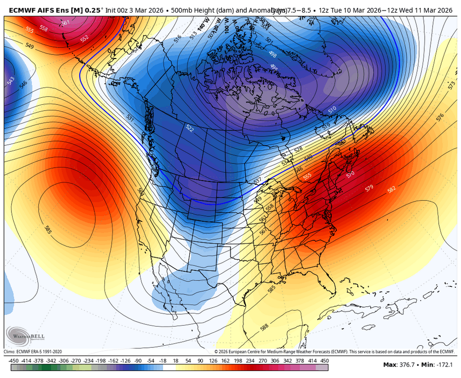
mario ramirez super nino
-
 1
1
-
-
1 hour ago, 40/70 Benchmark said:
It will also be interesting to see how the burgeoning warm ENSO interacts with the apparent north Pacific phase change, as we have clearly shifted to more of a -WPO base-state. If El Nino does grow as powerful as some suspect, it may be more like a 1982-1983 type of deal, where as the north Pacific was a bit more favorable.
if we go the super route, I actually like 1982-83 quite a bit
-
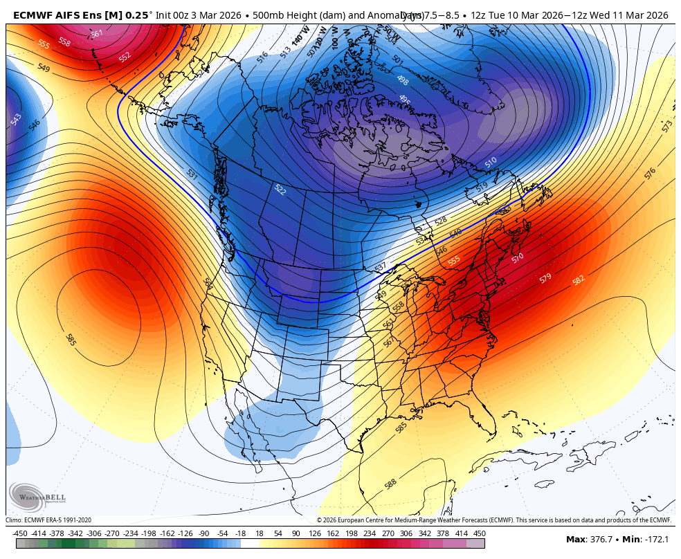
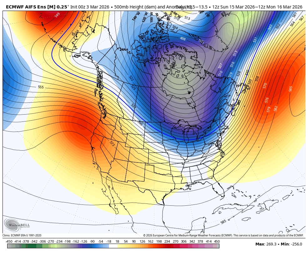
for the record, this should be a strong Nino per ONI and even RONI, but taking those +2.5C euro forecasts in early April to heart is silly. wait a couple of months and see if it sticks. the euro has overdone many a Nino in the past
-
 3
3
-
 1
1
-
-
gotta pass the spring barrier. this is like a 10 day EPS forecast but for ENSO at this point in the year
-
4
-
 1
1
-
-
hey, give me a loaded STJ and temps that aren't an abject torch and I'd like to see what happens now that we're in a paradigm of blockier winters. 2023-24 was cursed and I think people are scared about an outcome like that. I find it unlikely, there are much better analogs
-
1
-
-
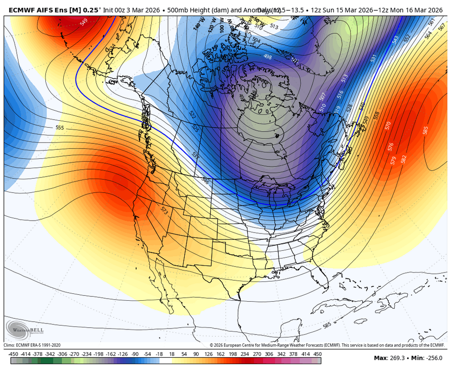
paul roundy super Nino part 2?
-
1
-
 1
1
-
-
every model has the signal mid-month, worth watching for sure with the ridge rising out west. airmass is better than you'd think with the PV nearby
-
1
-
 1
1
-
1
-
-
classic spring swing here
-
1 hour ago, Typhoon Tip said:
This winter's been just morally repulsively enabling to CC deniers in this region of the world. HAHA
the snow blitzes this winter are just as much a part of CC as the warm bursts IMO
-
2
-
-
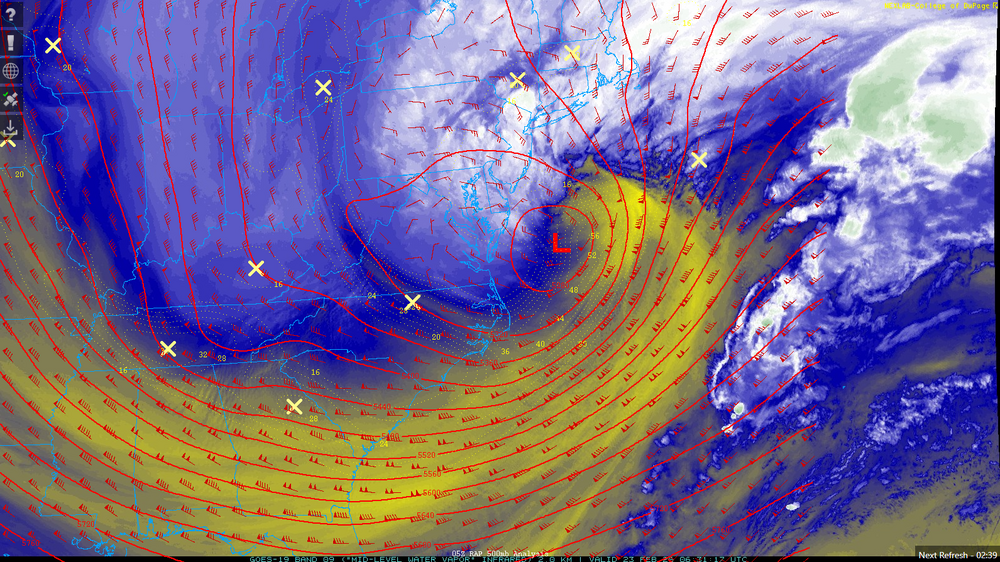
incredible storm, about 13.5" here
-
6
-
-
9" and some of the heaviest snow i have ever seen
-
1
-
-
hang it in the Lourve. absolutely sick
-
6
-
1
-
1
-
-
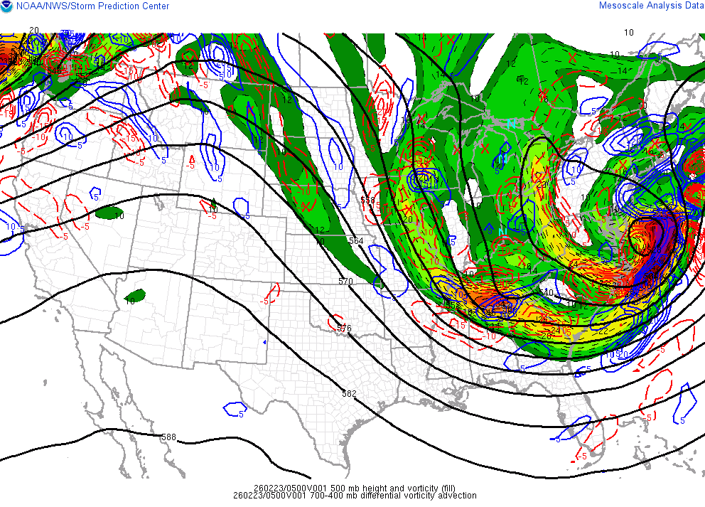
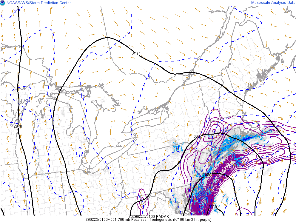
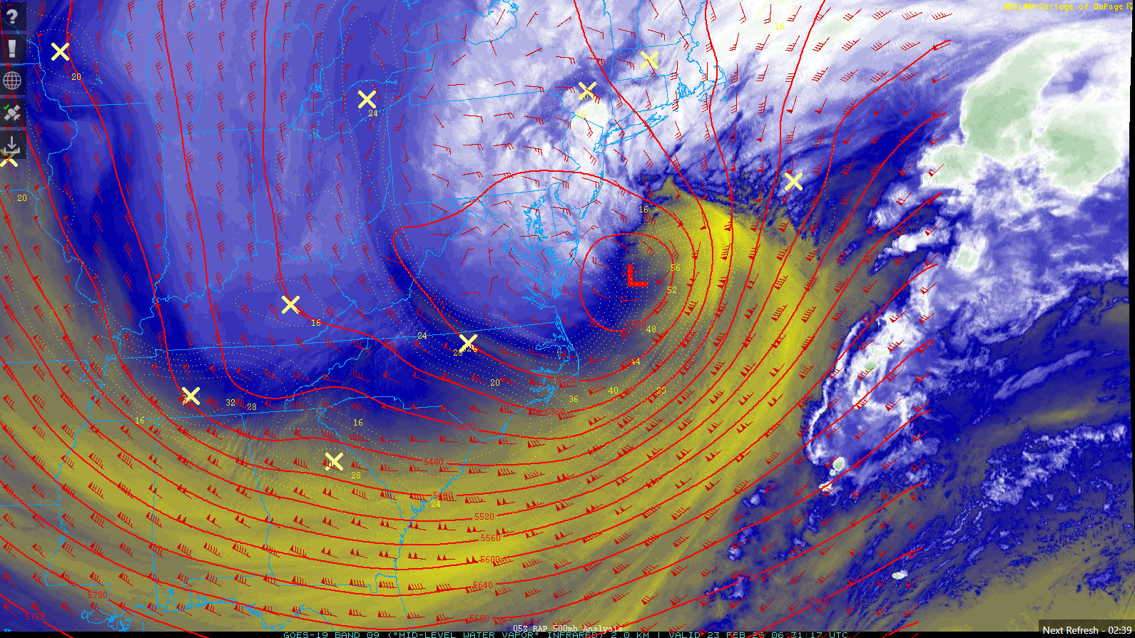
really incredible stuff. the low is just getting started
-
7
-
 1
1
-
 2
2
-
-
absolute cinema. this will be special for the area
-
16
-
-
rippage about to occur over the next hour
-
8
-
1
-
-
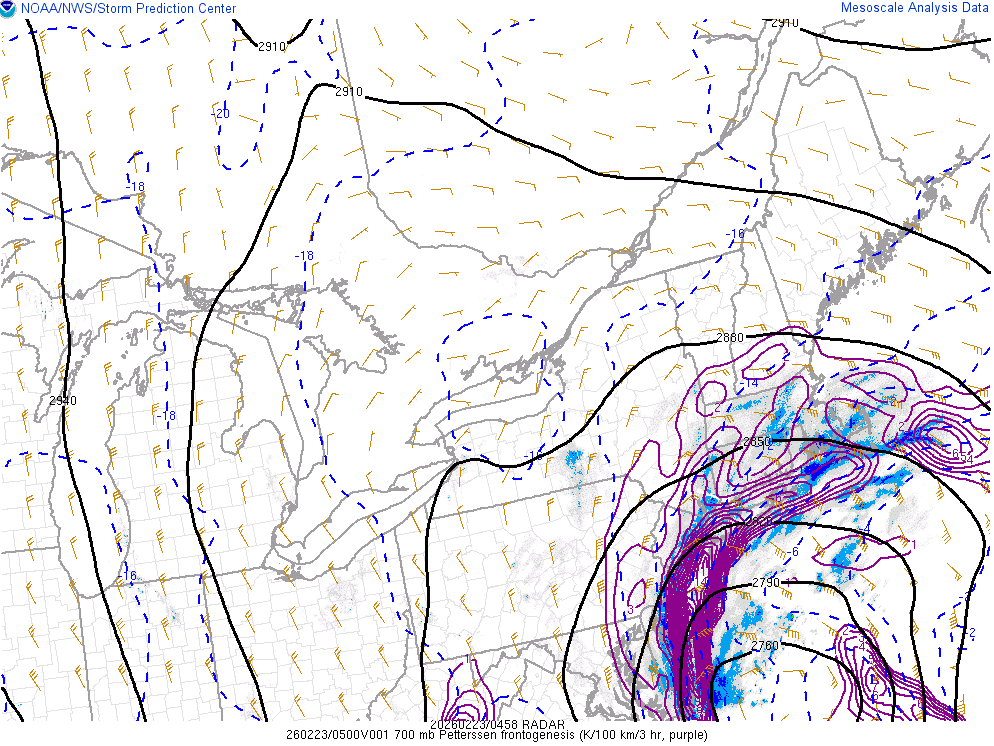
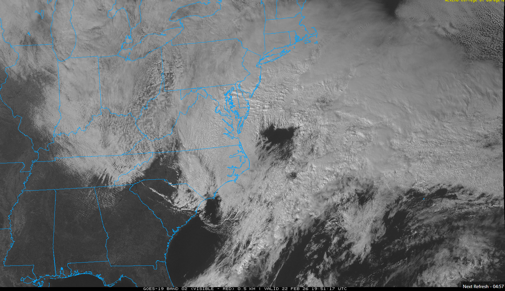
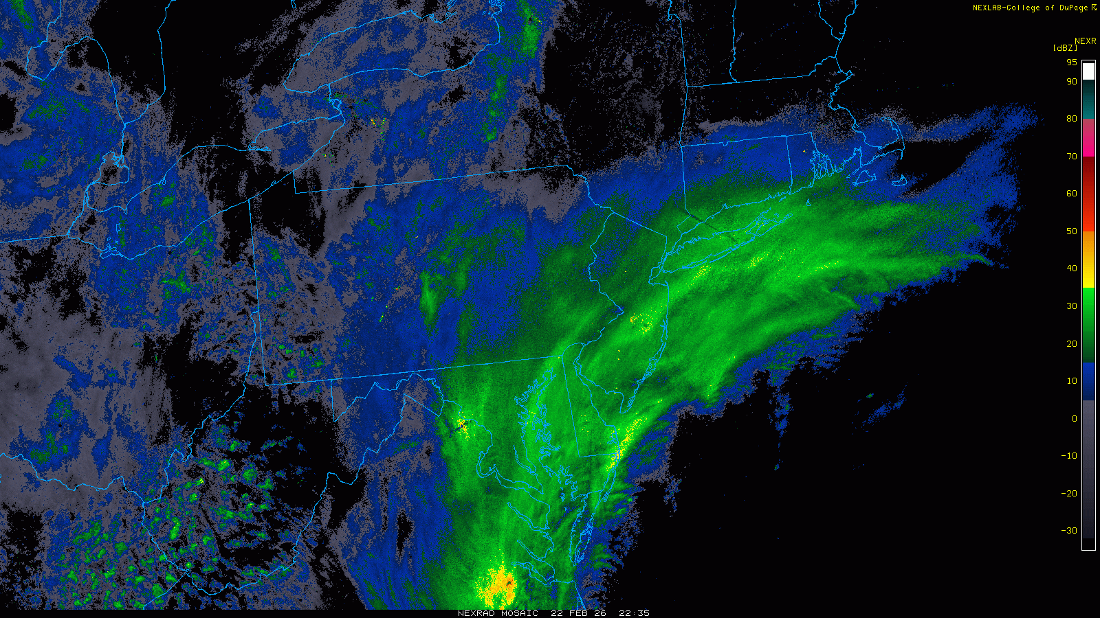
radar looks great
can see that outer banding popping up over SE PA

-
10
-
-
steady light snow, covering colder surfaces up now
-
1
-
-
this thing is locked and loaded, be sure to enjoy it
-
2
-
-
be sure to soak this one in, guys

-
13
-
-
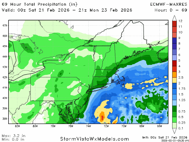
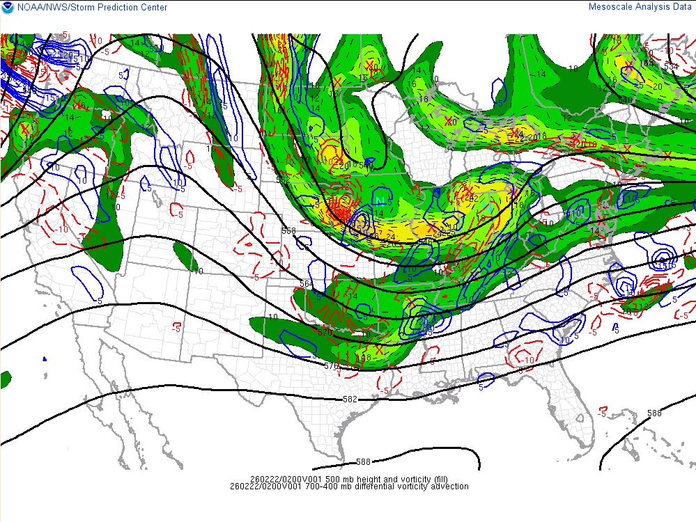
SPC is forecasting a thundersnow risk!
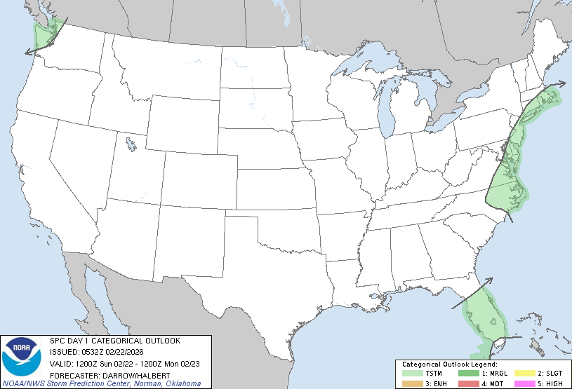
 ...Discussion...

   Strong short-wave trough is digging southeast toward the OH Valley
   late this evening. This feature will phase with the southern stream
   and induce a surface low off the NC coast early in the period.
   Intense deepening is expected with this offshore cyclone which will
   lift north-northeast during the overnight hours.

   Isolated thunderstorms may develop along the trailing cold front as
   it surges south across the FL Peninsula during the day, but poor
   lapse rates and weak buoyancy suggest the risk for robust convection
   is not particularly high.

   Intense low-level warm advection will aid the potential for
   lightning discharge in midlevel convection along the middle Atlantic
   coast and southern New England. Forecast soundings suggest the
   majority of this activity will be within heavier snow bands along
   the northwest-north side of the cyclone.

   Across the Pacific northwest, significant midlevel cooling and
   steepening lapse rates are expected along the WA coast by early
   afternoon. Weak SBCAPE is expected to develop across this region and
   some risk for lightning is possible with convection that develops
   within this warm-advection regime.
-
6
-
-
NYC 18.6
LGA 19.2
ISP 21.1
JFK 20.3
EWR 18.1
-
1
-
-
it has never been more happening in the history of happenings
-
11
-
1
-
-
1 minute ago, Rjay said:
I'm usually not one to do this but just an awful performance by the Euro.
lol
-
3
-
1
-
1
-
-
thing of beauty already
-
8
-
2026-2027 Strong/Super El Nino
in Weather Forecasting and Discussion
Posted
just messing. i agree that we're probably getting a super Nino this year