.JPG.b4e83aadd99c39a6a799f453c94452e8.JPG)
J.C.
-
Posts
761 -
Joined
-
Last visited
About J.C.

- Birthday 03/22/1981
Recent Profile Visitors
2,613 profile views


-
If you haven't noticed, this is a Raleigh heavy subforum. Atlanta posters should probably spend as much time reading the Tennessee Valley su forum. Raleigh not getting any snow is the reason for this thread.
-
At least there is football...
-
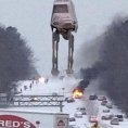
I stole the second pic.

-
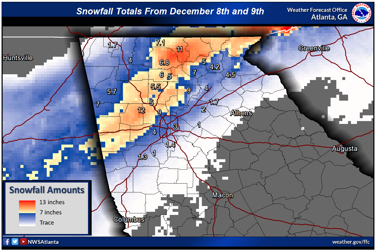
We had 10" The NWS map had a foot on the Cobb/Paulding line over a good chunk of area.
-
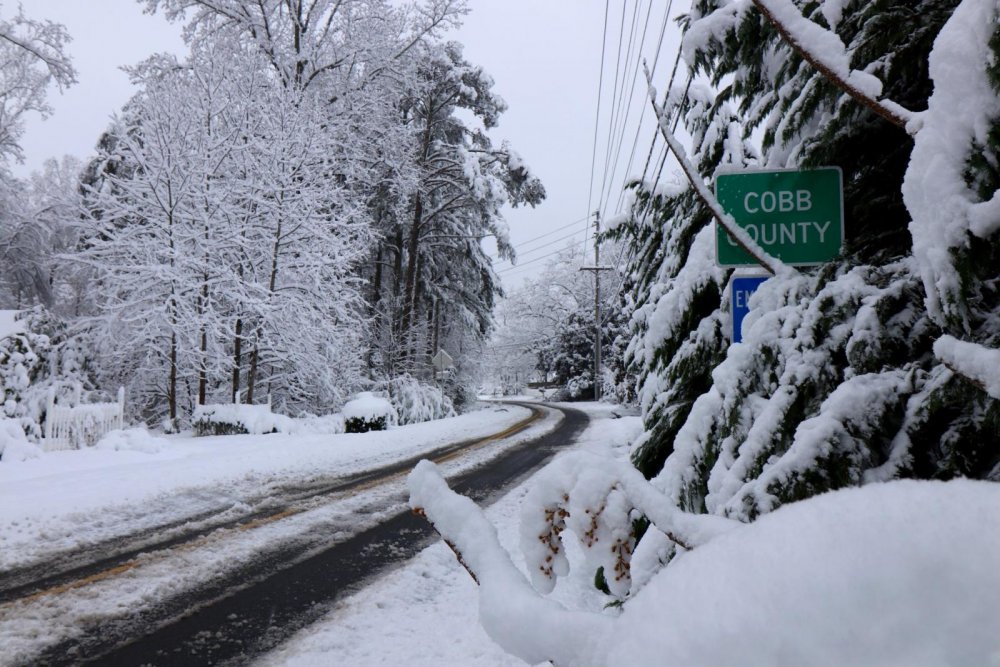
Mountain City, GA -18" Cobb County GA-12" Just two of many places around here.
-
It really does have to be a perfect set up. You need a parent high in the northeast and the storm a good ways off the coast for anything. Columbia only has one wind direction that can bring in cooler air and that is northeast. North and northwest are downsloping winds.
-
.thumb.JPG.31210124b742ef17be141b392a43be90.JPG)
The December to Remember 7th-8th blue turd winter threat thread.
J.C. replied to lilj4425's topic in Southeastern States
I can't believe the models are showing a deformation band for tonight, crazy. -
The December to Remember 7th-8th blue turd winter threat thread.
J.C. replied to lilj4425's topic in Southeastern States
Winter Storm warnings now from the western suburbs of Atlanta northeast to the mountains, I guess the models finally triggered it. -
The December to Remember 7th-8th blue turd winter threat thread.
J.C. replied to lilj4425's topic in Southeastern States
There is the cold front draped across the south right now just north of Atlanta, I'm sure as the storm moves east it will pull some drier/cooler air in from the north. -
The December to Remember 7th-8th blue turd winter threat thread.
J.C. replied to lilj4425's topic in Southeastern States
There isn't a map, just points on the map of major airports. http://www.spc.noaa.gov/exper/sref/srefplumes/ -
The December to Remember 7th-8th blue turd winter threat thread.
J.C. replied to lilj4425's topic in Southeastern States
SREF mean for ATL is 1.88" GVL 2.75" GSP 3.72" -
The December to Remember 7th-8th blue turd winter threat thread.
J.C. replied to lilj4425's topic in Southeastern States
Mine too! -
The December to Remember 7th-8th blue turd winter threat thread.
J.C. replied to lilj4425's topic in Southeastern States
RGEM 18z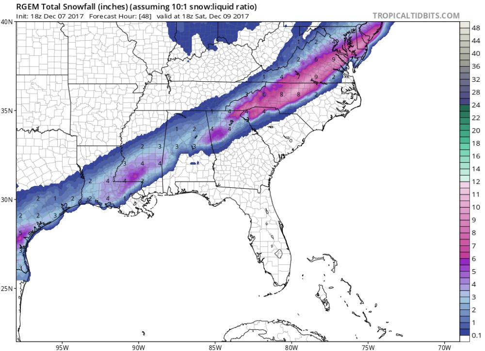
-
The December to Remember 7th-8th blue turd winter threat thread.
J.C. replied to lilj4425's topic in Southeastern States
Very interesting. Models must be picking up on some increased precipitation bursts. Thanks for sharing. -
The December to Remember 7th-8th blue turd winter threat thread.
J.C. replied to lilj4425's topic in Southeastern States
I didn't realize there was a second front that the low was going to ride from Texas, that front is currently stretched from San Antonio to Pittsburgh. Once that low passes to the south, the cold air will be brought in, to what extent is always a guess.