Siberian-Snowcover-Myth
-
Posts
291 -
Joined
-
Last visited
Content Type
Profiles
Blogs
Forums
American Weather
Media Demo
Store
Gallery
Everything posted by Siberian-Snowcover-Myth
-
Richmond Metro/Hampton Roads Area Discussion
Siberian-Snowcover-Myth replied to RIC Airport's topic in Mid Atlantic
18z gave RIC 6.3” juicier -
Richmond Metro/Hampton Roads Area Discussion
Siberian-Snowcover-Myth replied to RIC Airport's topic in Mid Atlantic
Icon gives RIC 6.7”….. 18z icon gave RIC 4.2” Juicier… -
Richmond Metro/Hampton Roads Area Discussion
Siberian-Snowcover-Myth replied to RIC Airport's topic in Mid Atlantic
Short Pump got 18” from that storm. -
Richmond Metro/Hampton Roads Area Discussion
Siberian-Snowcover-Myth replied to RIC Airport's topic in Mid Atlantic
I live 2 miles from RIC, Dec 2018 I measured 16”…. Jan 2016 I measured 18” -
Richmond Metro/Hampton Roads Area Discussion
Siberian-Snowcover-Myth replied to RIC Airport's topic in Mid Atlantic
00z NAM showing it as well. -
Richmond Metro/Hampton Roads Area Discussion
Siberian-Snowcover-Myth replied to RIC Airport's topic in Mid Atlantic

-
Richmond Metro/Hampton Roads Area Discussion
Siberian-Snowcover-Myth replied to RIC Airport's topic in Mid Atlantic
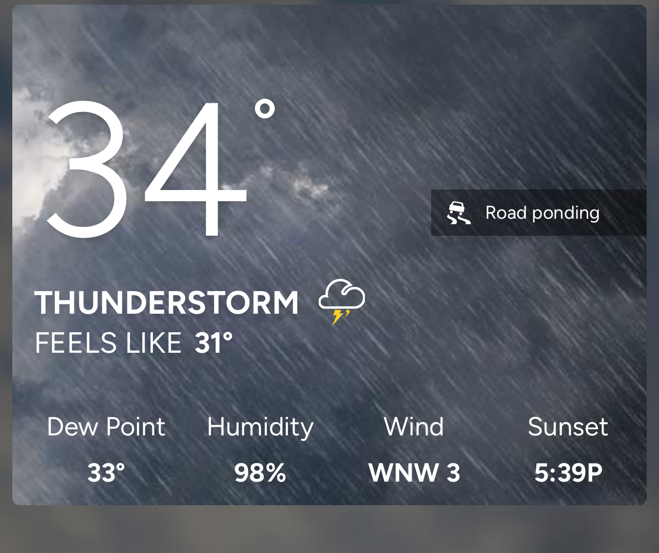
Thunderstorm in Richmond, currently 34 degrees. -
Currently, Thunderstorm in Richmond….34 degrees
-
February Medium/Long Range Thread
Siberian-Snowcover-Myth replied to stormtracker's topic in Mid Atlantic
I went from 29” of snow, to thunderstorms , in 3 GFS runs. The SER is dominant. The Barney Avacado was a pipe dream. -
February Medium/Long Range Thread
Siberian-Snowcover-Myth replied to stormtracker's topic in Mid Atlantic
Where is all the Barney cold that was supposedly going to set records?? -
Richmond Metro/Hampton Roads Area Discussion
Siberian-Snowcover-Myth replied to RIC Airport's topic in Mid Atlantic
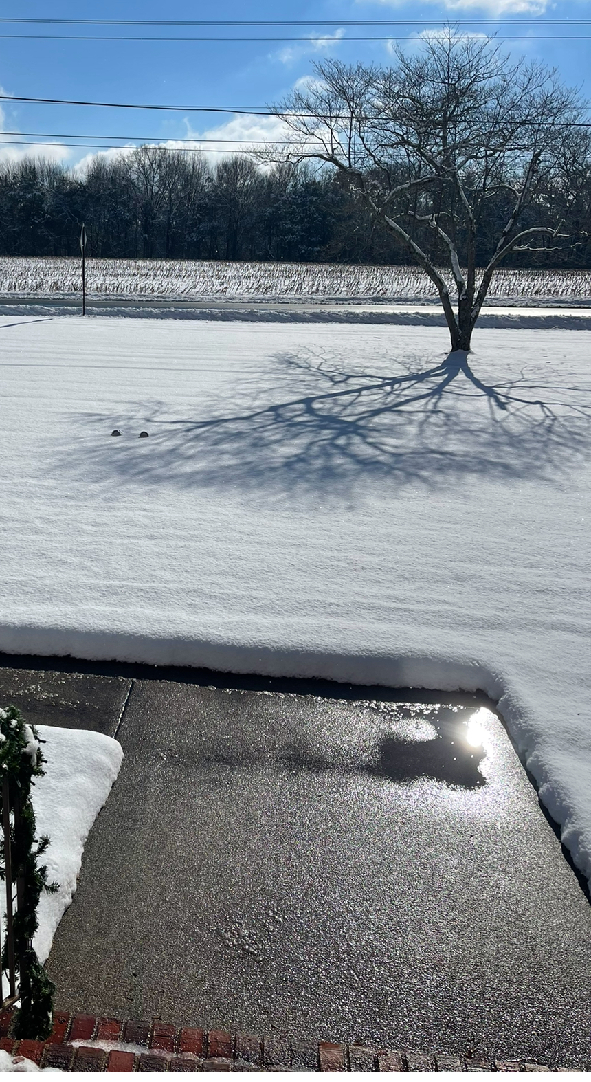
Roads are bad in eastern Henrico. Caved immediately…. The county didn’t have any plows on call tonight either.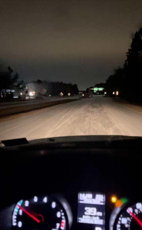
-
Richmond Metro/Hampton Roads Area Discussion
Siberian-Snowcover-Myth replied to RIC Airport's topic in Mid Atlantic
Over performing in Eastern Henrico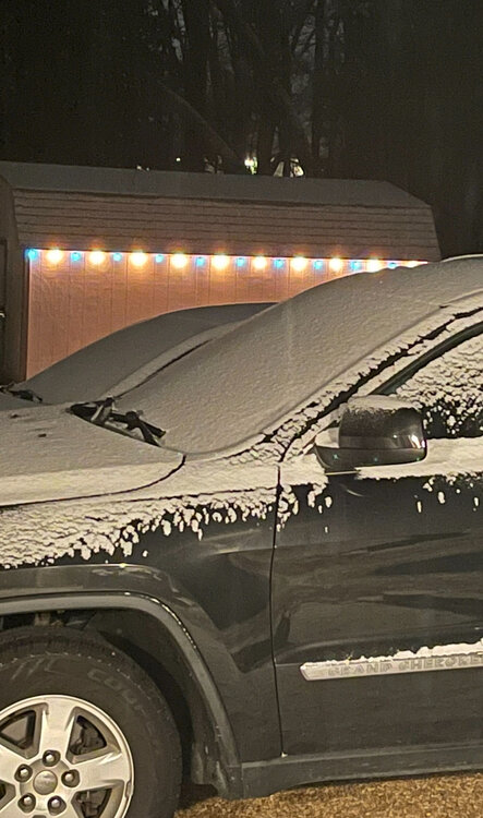
-
Richmond Metro/Hampton Roads Area Discussion
Siberian-Snowcover-Myth replied to RIC Airport's topic in Mid Atlantic
Yes. I’d like to see a more southern shift by about 100 miles. I still think the models are having a hard time with the strength of that arctic high. -
Richmond Metro/Hampton Roads Area Discussion
Siberian-Snowcover-Myth replied to RIC Airport's topic in Mid Atlantic
06z Gfs shows a stronger, more southern low developing Sun/mon. It’s been consistent on the development for several runs now. Whether it’s correct or not in its placement is a different matter.
-
January Medium/Long Range: A snowy January ahead?
Siberian-Snowcover-Myth replied to mappy's topic in Mid Atlantic
Went from, clear and 25 degrees for the high Wednesday, to Rain and 42, in 1 run. They’re all over the place I think. They aren’t handling the cold push correctly. -
Richmond Metro/Hampton Roads Area Discussion
Siberian-Snowcover-Myth replied to RIC Airport's topic in Mid Atlantic
P03, and P23 look like a snow apocalypse -
Richmond Metro/Hampton Roads Area Discussion
Siberian-Snowcover-Myth replied to RIC Airport's topic in Mid Atlantic
Definitely several chances at winter weather from Jan 20-31st. -
Richmond Metro/Hampton Roads Area Discussion
Siberian-Snowcover-Myth replied to RIC Airport's topic in Mid Atlantic
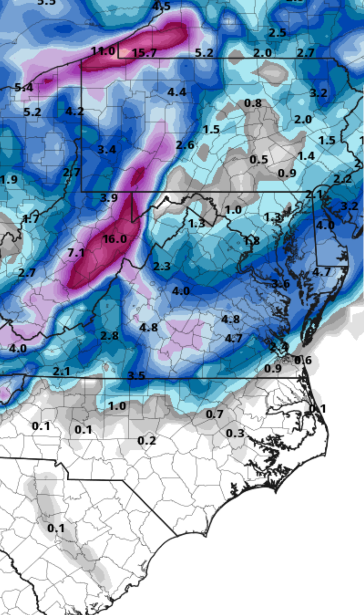
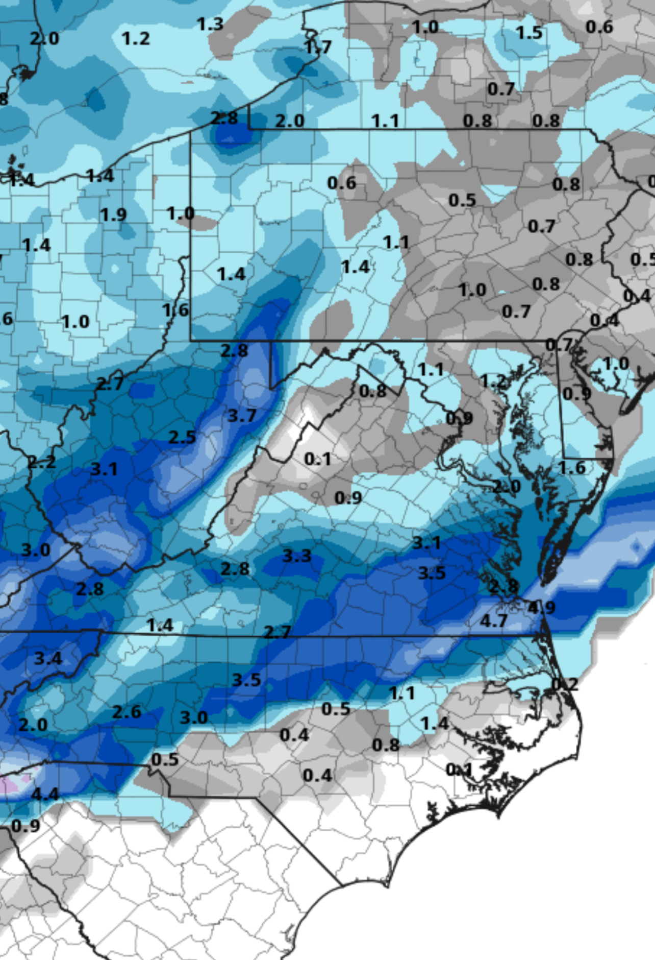
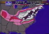
Ended with 4.2” in Varina. (5 miles SE of RIC) 7.2” so far to date, (almost at climo).
-
Richmond Metro/Hampton Roads Area Discussion
Siberian-Snowcover-Myth replied to RIC Airport's topic in Mid Atlantic
Lard in Varina. Pretreated sidewalks starting to cave.
-
Richmond Metro/Hampton Roads Area Discussion
Siberian-Snowcover-Myth replied to RIC Airport's topic in Mid Atlantic
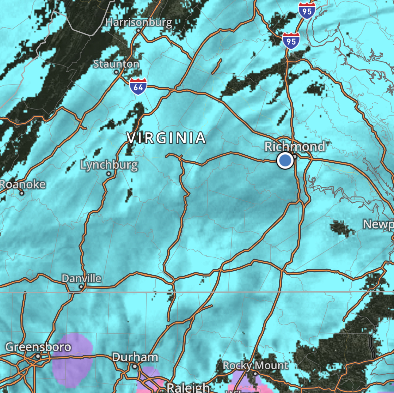
Looks like to my untrained eyes, RIC to Petersburg could be setting up in heavy bands shortly.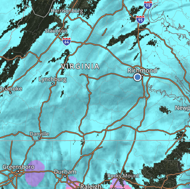
-
Richmond Metro/Hampton Roads Area Discussion
Siberian-Snowcover-Myth replied to RIC Airport's topic in Mid Atlantic
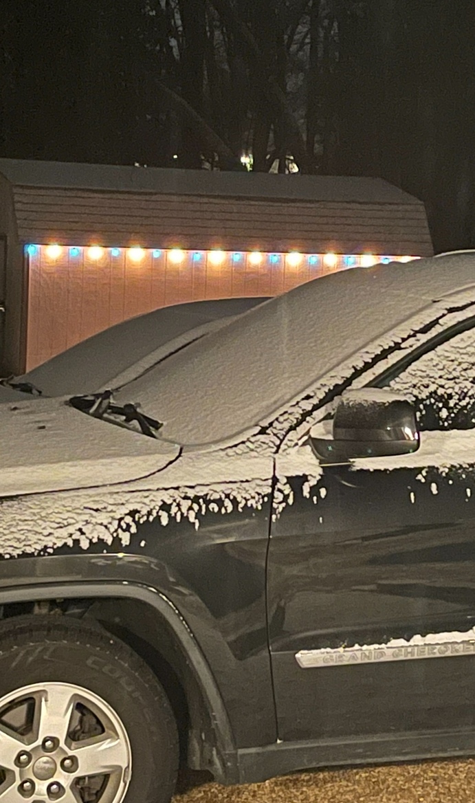
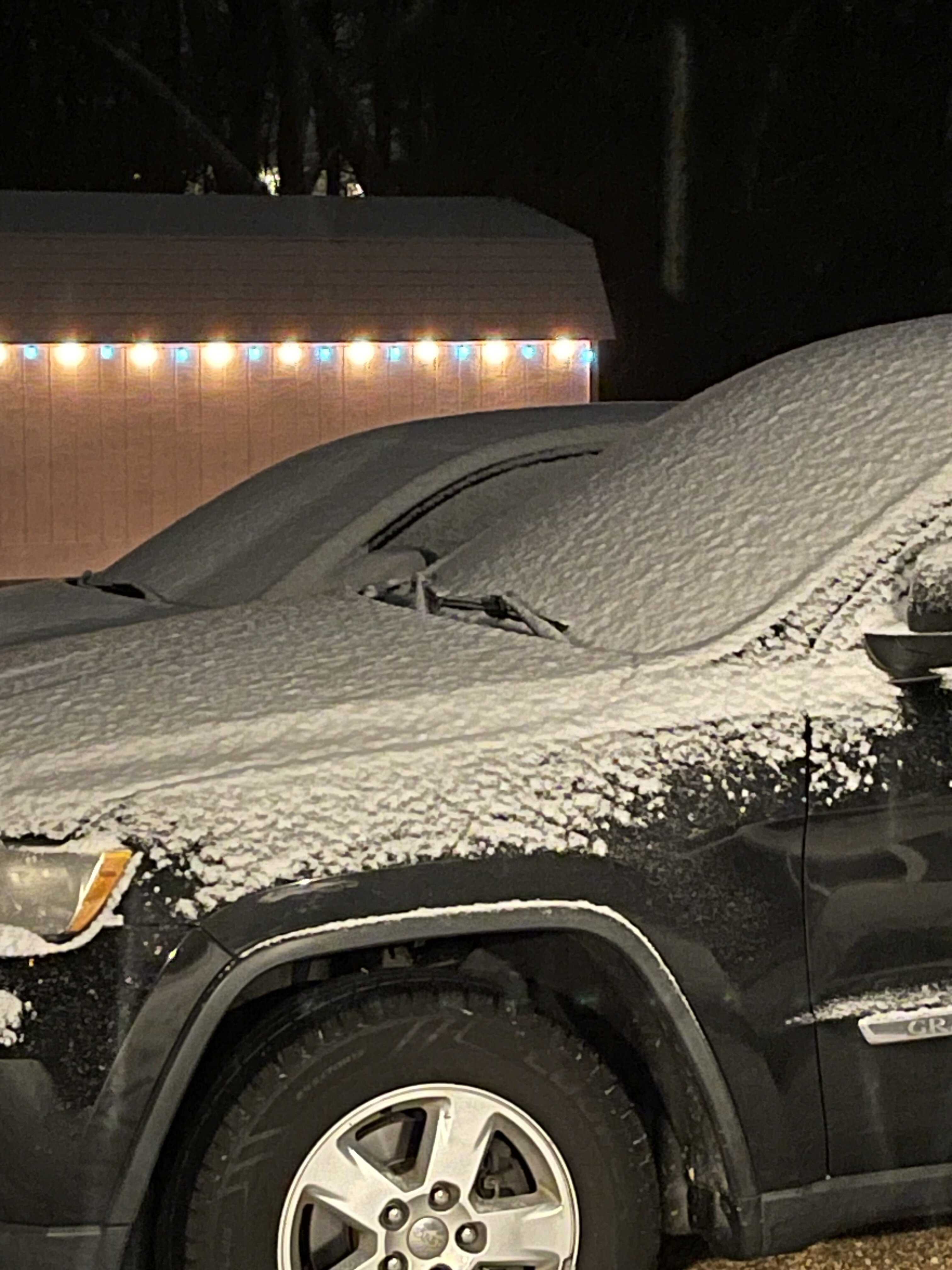
Car topper in Varina… moderate snow.
-
1/11/25: The little weekend thing.
Siberian-Snowcover-Myth replied to dailylurker's topic in Mid Atlantic
Car topper east of RIC.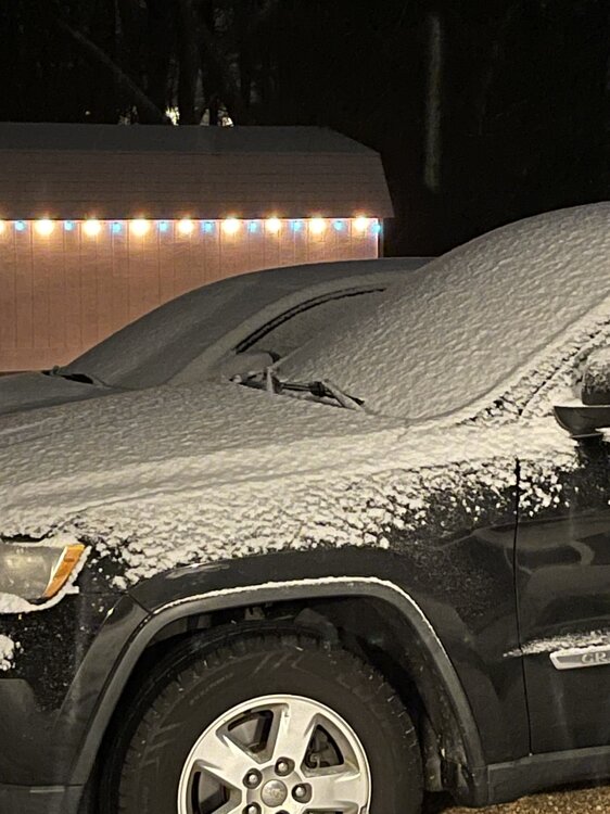
-
Richmond Metro/Hampton Roads Area Discussion
Siberian-Snowcover-Myth replied to RIC Airport's topic in Mid Atlantic
Cars covered here in Varina. Moderate/heavy snow. -
Richmond Metro/Hampton Roads Area Discussion
Siberian-Snowcover-Myth replied to RIC Airport's topic in Mid Atlantic
18z gfs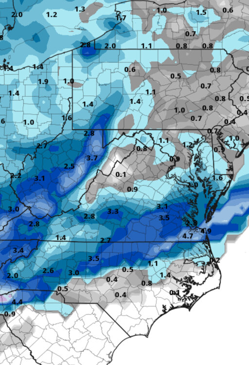
-
Richmond Metro/Hampton Roads Area Discussion
Siberian-Snowcover-Myth replied to RIC Airport's topic in Mid Atlantic
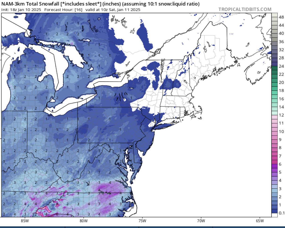
18z NAM 3k