
NycStormChaser
-
Posts
2,374 -
Joined
-
Last visited
Content Type
Profiles
Blogs
Forums
American Weather
Media Demo
Store
Gallery
Posts posted by NycStormChaser
-
-
First time I've seen a clap of thunder set off car alarms

-
42 minutes ago, LongBeachSurfFreak said:
A stunningly huge bust. This shows how far we still have to go with forecasting. The equivalent of 12-18” of snow and getting a dusting.
And another squeeze play today with rains to our north and south
Yeah I would not call it a bust to be honest. If the models DID NOT correct themselves leading up to yesterday then it would be a bust in my opinion. As others said the euro picked up on this. The NAM and the HRRR also picked up on it monday night as well. By yesterday morning the writing was on the wall before the event even started. The models are only tools.
-
Baby storm heading for the city with some lightning.

-
We may actually have more storms tomorrow morning than we did today.
-
 1
1
-
-
You should have seen may 20th when I was chasing in Oklahoma. It was a high risk day by the spc. We saw a tornado but the high risk did not come close to verifying.It’s amazing that an event can be so incredibly poorly forecast. If this were a winter storm this thread would be 50 pages of weenie suicides-
1
-
 1
1
-
-
Agreed. It should be canceled at this point. The models handled this setup poorly. Unfortunately it happens from time to time.I doubt that even happens at this point but still possible. I am surprised that Mt.Holly held onto the Flash Flood Watch for some of their counties including mine but the watch area was reduced from yesterday. I think the watch will be canceled when the afternoon update comes out IMO. -
Thunderstorms and flash flooding aren't out of the question today for our area. Wait until the event is over before calling a bust.
-
2
-
-
What do you mean? They did cut back on the northern extent of the slight and marginal. The writing was on the wall yesterdayLooks like we were both wrong.-
 1
1
-
-
I think they tighten up the northern extent of the marginal and slightI am curious to see what the SPC will do in the new day 1 outlook in a couple of hours. I think they will hold serve.-
1
-
-
I'm likely heading to SEPA for the chance of tornadoes. Might be a bit further south but it's definitely on the table IMOtomorrow's threat looks dead to me. lots of debris and the low has been trending weaker and weaker -
Certainly not something you see often in the Northeast.
Tornado: 5% - Slight
Wind: 30% - Enhanced
Hail: 15% - Slight -
All modes of severe weather are possible Tuesday including tornadoes. I think the Philly area will be the center point and the slight risk may shift north. Wouldnt be surprised to see an enhanced risk Tuesday either if the forecast models hold its current course.
-
1
-
-
Tuesday looks like our next chance for severe weather. Does not look like a bad setup either.
-
1
-
-
Last evenings Aurora Borealis from the Adirondacks. Violet colored pillars filled the night sky as a weak geometric solar storm affected Earth. This was a new photography spot and dealing with the light pollution was very challenging.

-
8
-
1
-
-
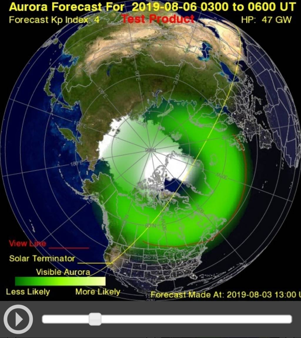
Keep your eyes to the sky tonight if you live in some of our dark northern suburbs. The Aurora Borealis may make an appearance. It's only forecasted to be a KP5 but it does surprise us sometimes. I will be photographing it from the Adirondacks if it makes an appearance
-
6
-
-
11 minutes ago, Animal said:
Last night I got caught in some of the heaviest rain I have seen in nnj in years.
flash flooding was ridiculous. Town sewer holes had water shooting up in the air like a fountain. Towns streets were rivers in certain areas with cars stranded.
weather today is too nice out to produce a repeat.
We will see. Both the HRRR and 3kNAM have storms across the NYC Metro today. 3k NAM is more aggressive. Storms already firing up with some hail in the Hudson Valley.

-
Most of areas that saw storms last night should see them storms again this evening.
-
1
-
-
My latest time lapse video from the Ashokan Reservoir in the Catskill Mountains last evening. Mother Nature gave me some thunderstorms and a beautiful sunset.
https://www.youtube.com/watch?v=NVBiVCS-h8o -
-
I wrote up a quick recap with some of my footage and photographs of the past 6 days around here. 3 days of severe weather and a 3 day heatwave.
http://www.nicholasisabella.com/a-wild-week-of-weather
-
1
-
-
7 minutes ago, TriPol said:
Around what time was this photograph taken?
8:30 PM on the dot
-
This was the closest I got but it quickly dissipated.


-
3
-
-
Nws confirmed multiple sightings of cold air funnels the last hour. Found this on Twitter too. Im photographing a storm over Staten Island and it's trying hard to produce one.
-
1
-
-
Based off the damage I saw on Twitter id say an Ef2Radar indicated tornado with widespread damage as that cell crossed Cape Cod.https://mobile.twitter.com/ericfisher
https://mobile.twitter.com/WeatherMatrix/status/1153702676707860481
https://mobile.twitter.com/ReedTimmerAccu/status/1153701965580259328


August 2019 General Discussions & Observations Thread
in New York City Metro
Posted