

hudsonvalley21
-
Posts
3,870 -
Joined
-
Last visited
Content Type
Profiles
Blogs
Forums
American Weather
Media Demo
Store
Gallery
Posts posted by hudsonvalley21
-
-
1 minute ago, North and West said:
Amazing that in the decade and a half that I’ve had this sump pump in the new part of my basement (I added a French drain in conjunction with it), it ran the longest it ever has right before Christmas. Didn’t run for Isiais, Ida, or Irene. (We love our Is)
.With the QPF amounts we’ve had for the last month plus vegetation dormant, everything is totally saturated. What would help would be the ground surface to freeze. That would help some but be worse for the folks living near the waterways. Definitely a tough time for many.

-
 2
2
-
-
15 minutes ago, North and West said:
Backup sump pump battery is arriving Friday!
I’m on a hill as well; it’s the high water table people are going to be wrestling with if there’s rain + snowmelt.
.The QPF for the 2nd event is around 1”-2”. Hopefully we won’t have many issues. Fingers crossed.
-
1
-
-
Thank you Rodger for all the time and diligence you put into this contest. It is greatly appreciated.

-
2
-
 2
2
-
-
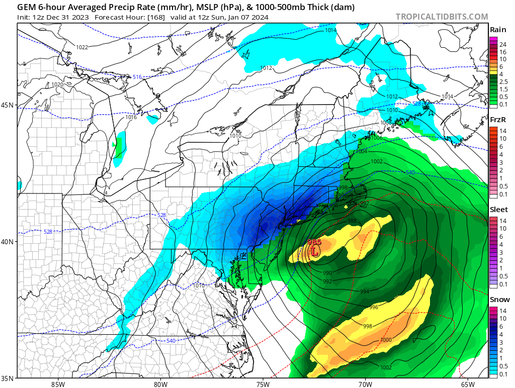
4 hours ago, IrishRob17 said:
I'm with you on that, the 12z GFS flips the bird to folks wanting snow around here. The Canadian looks a bit different than the GFS. One run with lots to go but clearly nothing should be locked up in either direction six days out.
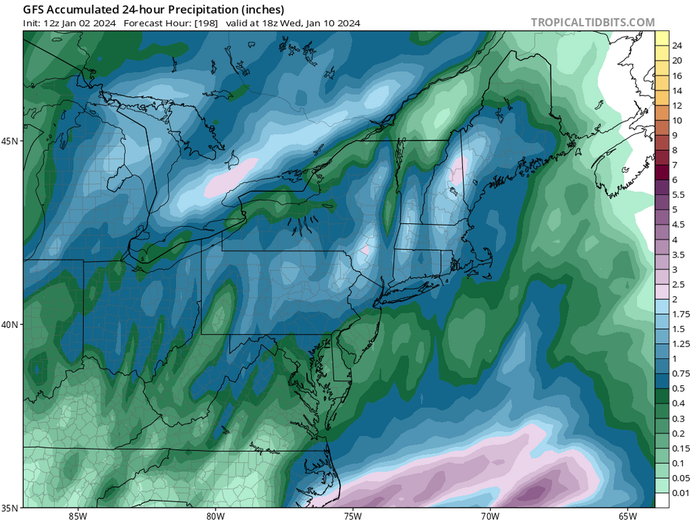
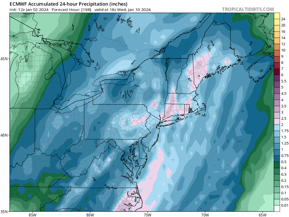
I think the flooding potential might be more impactful vs.the snowfall. Especially if we get a good amount of QPF from both events.
Happy New Years to all.

-
1 minute ago, Wxoutlooksblog said:
I'm leaning towards taking the suppression solutions off the table. We are in what would normally be the time-frame where suppressive solutions would dominate. Only the GFS and last night's Euro to an extent have shown significant suppression. I think a major event of some kind is likely here. Exactly what, we wait another few runs to know for sure.
WX/PT
And as Walt Drag just mentioned, there is another system on its heels to contend with.
-
1
-
-
1 minute ago, MJO812 said:
Need the 50 50 to hold
Talking about a different 50. 50 miles of a shift in any direction would make a huge difference in what this run shows. I hate being in the bullseye this far out. That 50 50 low is key.
-
1 hour ago, gravitylover said:
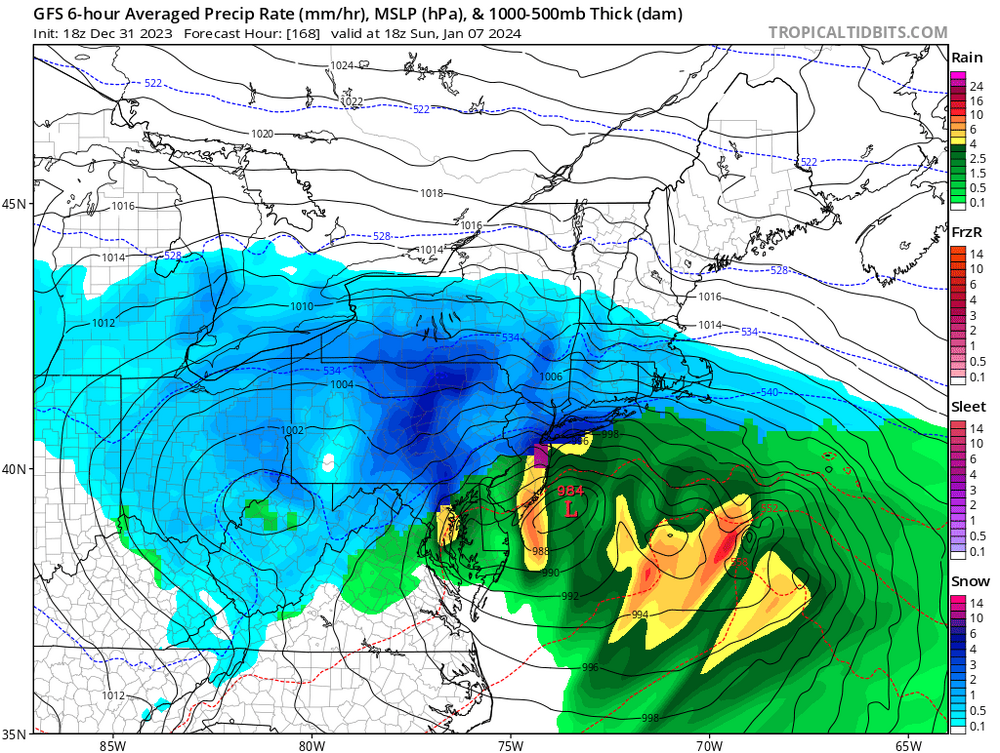
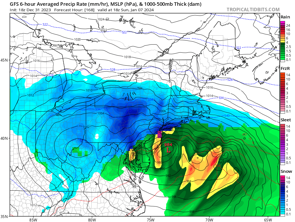
Tree branches with wounds have soaked up water and are soggy, a little freeze and a little breeze and they're coming down. Will they fall on your house or the cars in your driveway? Better go take a look and do something about it before next weekend. Driving around this afternoon I saw a bunch of water still coming out of hillsides and storm drains at the bottom of valleys so it's obvious that we're saturated. That's gonna be a lot of ice as the new moisture runs off so if your driveway is like mine be prepared, go get some sand. The couple of dry days coming up won't do squat to help especially if the surface freezes at night. Hoping for not too cold and not too windy.
Agree with you. The aftermath from these events could be equally as bad as the duration of the events. Sand, salt, sump pumps, and chainsaws may be needed. Especially if we get some snowpaste and winds. Being prepared is key. The 18z GFS is showing a 24 hour event for the Sunday show.
-
48 minutes ago, IrishRob17 said:
Agreed. People are so focused on the lack of snow I think many are missing the flood potential that Walt also mentioned in the thread title. With each storm the Wallkill drops just a bit less than before. It may not seem like a big deal but that combined with the saturated soil that still has plenty of fresh ponds/puddles that last longer and longer...not a good combo. I was kinda surprised at the amount of standing water still out there around town this morning.
Not a good situation at all. With the runoff still going on and the next events on the horizon possibly being wintery, the roads will be hazardous in spots for some time.
-
1
-
-
11 minutes ago, wdrag said:
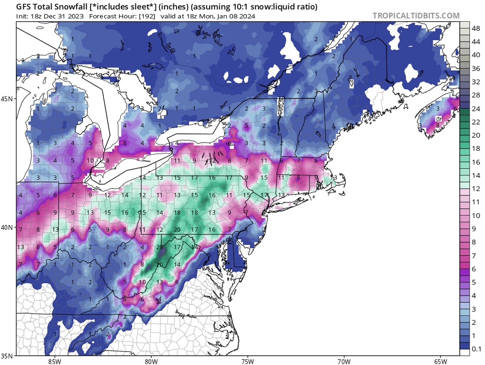
Modeling: It's getting better if we can talk generalities a week in advance and be reasonably accurate. Still... two big storms within 3-4 days... not common around here, especially if snow. My caution is stick with ensembles. AND... please if you can... don't use 10-1 snowfall unless we're within 48 hours and you think it ill be all snow. We're better off using conservative numbers for our area (positive snow depth c change via Tropical Tidbits and Pivotal()...especially since so close to the r/s line. Warm thickness for the first storm has me worried about a narrow band of 6+ inch 32-33F wet snow - clinging to wires with power outages inland of I95 somewhere. just dont know where, if at all in our subforum. SST's are near normal today but warming along the coast from Wallops to Boston.
So... it's at least a temporary enthusiastic opportunity, especially our I84 folks and maybe we can get some snow in the city.
Thanks Walt, and as you mentioned earlier, the QPF amounts are also critical with the flooding potential.
-
1
-
-
10 minutes ago, It's Always Sunny said:
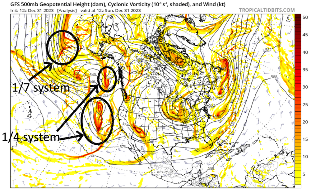
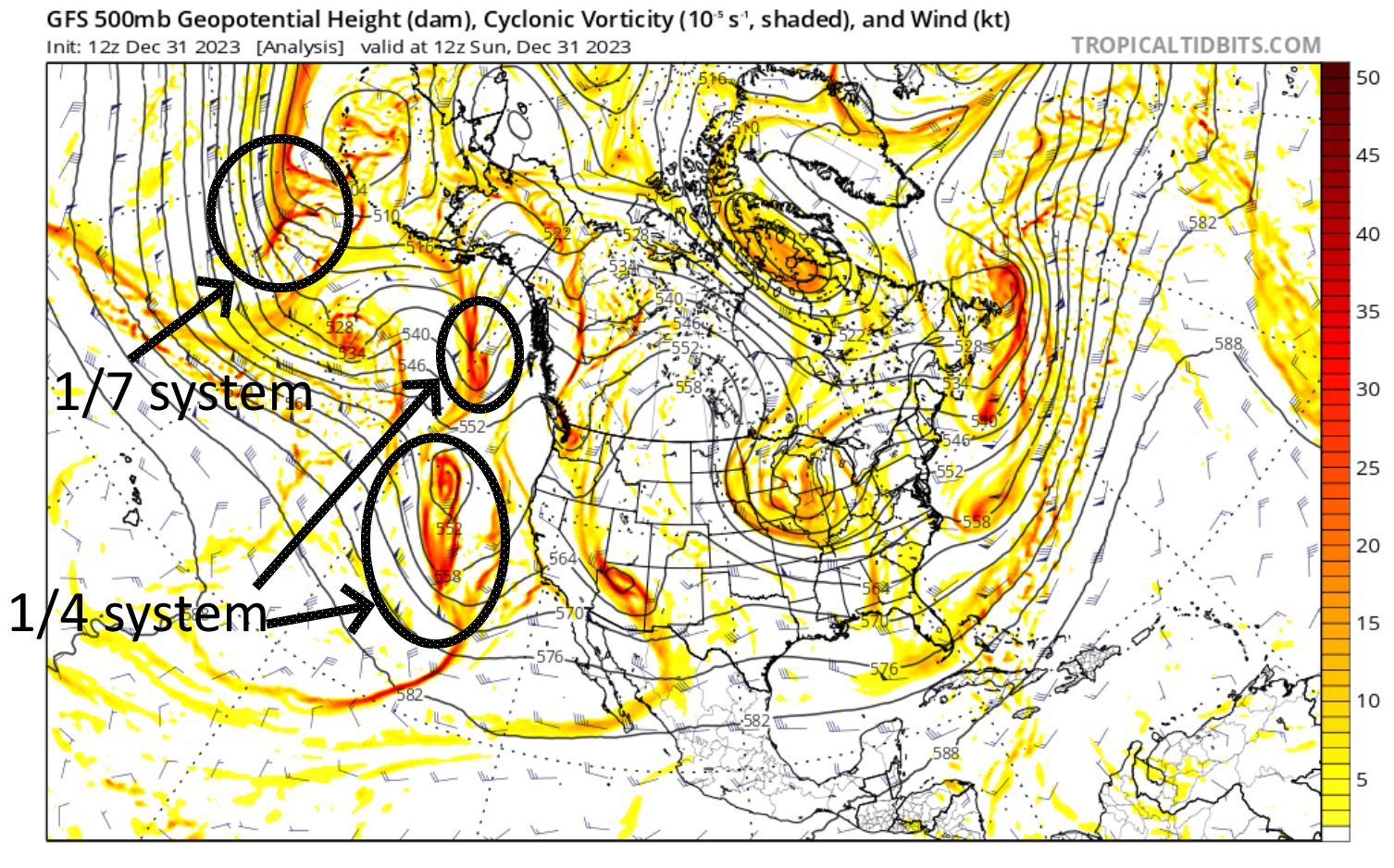
50/50 low is irrelevant to this storm's track in my opinion. What's important is where this storm develops. It's all about the timing/location of jet stream phasing. 12Z ECMWF similar to what GFS has been showing past couple runs:


I believe the phase would be better if it happens east of the Mississippi River.
-
2 minutes ago, MJO812 said:
Another huge storm
7th and 10th storm are huge on the euro
Well the models are all showing activity. Nice to see that agreement this far out. Clown maps are just weather porn for now. Hopefully there isn’t too much of an impact on flooding issues.
-
1 minute ago, cardinalland said:
traced the storms back to the present/hour 0 and they are still quite far away at present. don't know enough to determine how this impacts prediction, but wanted to share anyways
When the systems hit the west coast, there will be better sampling. Wait and see for a couple of days.
-
3
-
-
4 minutes ago, MJO812 said:
Cmc is a crush job for our area
Nice too see if we were only a couple of days out.

-
1
-
-
Just now, NEG NAO said:
how about the mid/late week event too ? Not sure how that is going to play out yet
Fire up one thread, maybe Walt Drag will start another.
-
2
-
-
2 minutes ago, MJO812 said:
The 4th wave becomes the 50 50 to lock in the cold air.

-
2
-
-
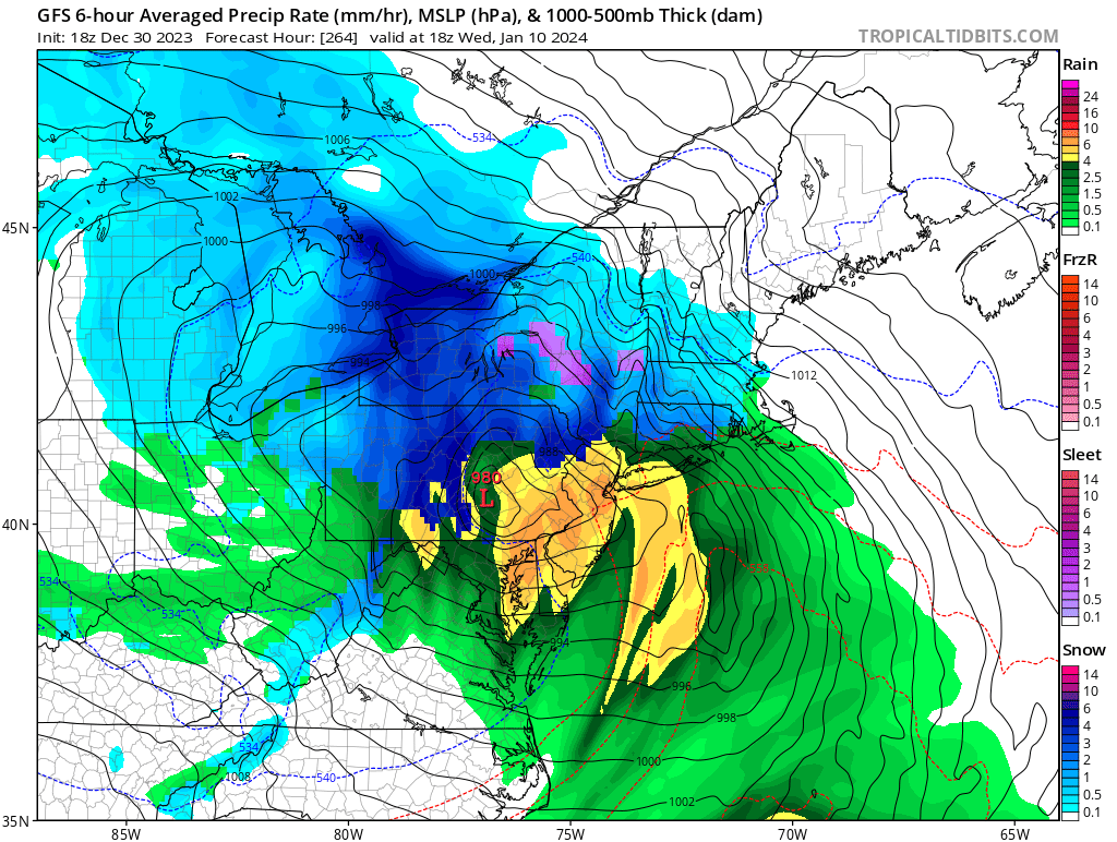
4 minutes ago, MJO812 said:
Went from a strong cutter to this
And as we know, this will flip flop like a fish out of water run to run.
-
1
-
-
3 minutes ago, MJO812 said:
Went from a strong cutter to this
Subject to change of course

-
-
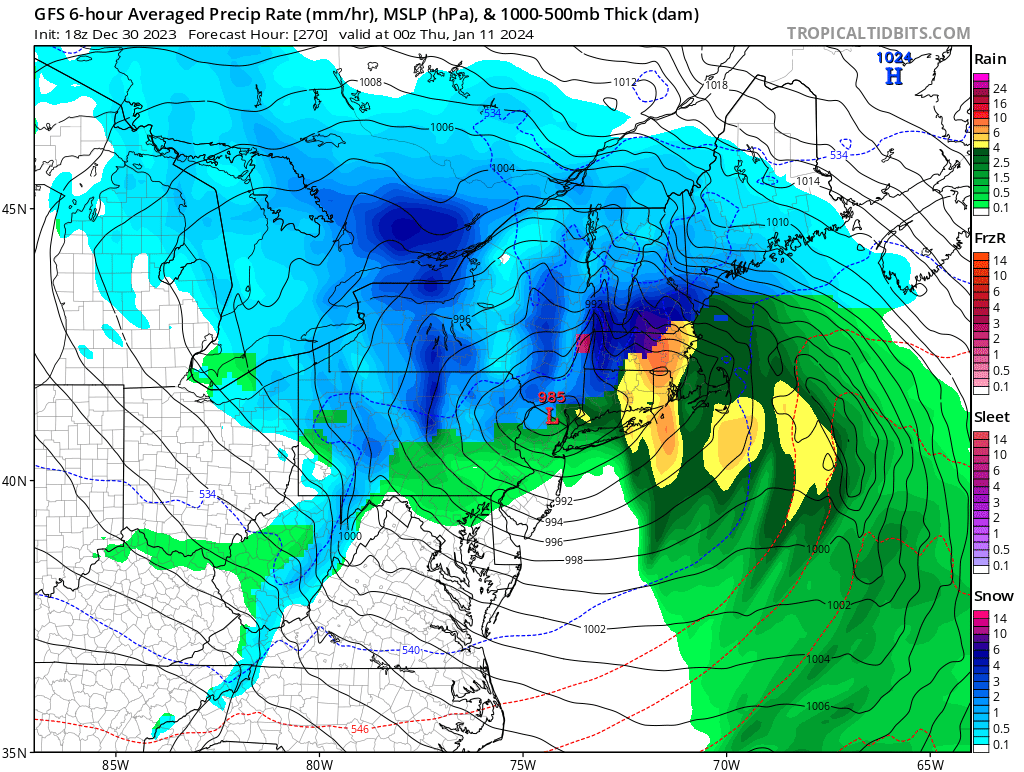
4 minutes ago, MJO812 said:
And now the gfs redeveloped the cutter because of the 50 50 low in place.
Maybe a front end thump before a changeover on the 10th.
-
DCA _ NYC _ BOS __ ORD _ ATL _ IAH __ DEN _ PHX _ SEA
1.5 1.2 1.4 0.4 0.6 1.1 1.3 2.0 -0.8
-
-
1 hour ago, Stormlover74 said:
Nam unfortunately jackpots the same areas that got hit hardest last week. 3knam is further south and east
.thumb.png.8bb2c56202a310bae8fec4cd471015db.png)
-
35 minutes ago, wdrag said:
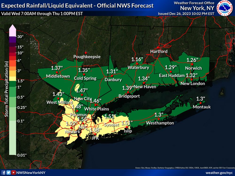
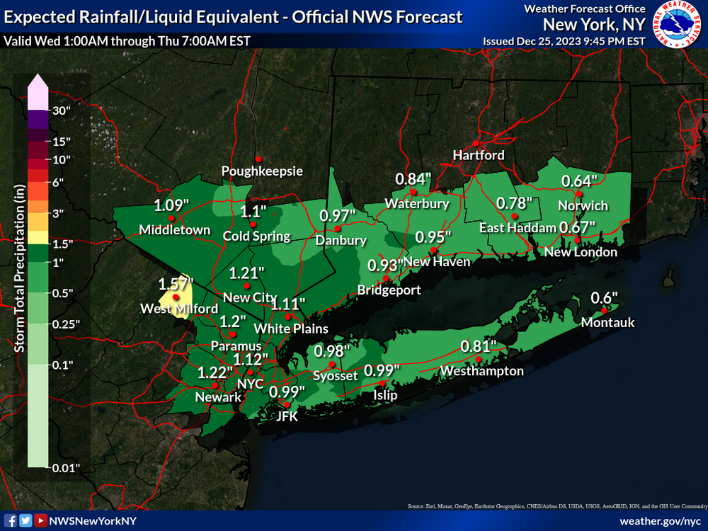
Monitoring for a headline thread of flooding again for Wed-Thu 27-28, maybe topping off I84 with some snow late Friday-Sat.
Still thinking 0.75-2" entire area by the time it quits for a while late Thursday. Of interest to me is potential for 4+" of rain portions of western NC by Wednesday morning which may translate newd. Probably not as serious as a week ago but am pretty sure a few rivers including a couple mainstems in NJ will go back into minor flood, if not moderate flood This event, seems to favor interior NJ/NY/e PA and along and west of I95. Small wet snow accumulation late Friday-early Sat for MA/NCT?
All needing further consideration before wasting anyones time.
Wish there were more wintry to focus upon. I guess patience is my best approach.
Thanks for the heads up Walt, it won’t take much to raise the water levels. We’ll see what the next few runs show. Merry Christmas to you and yours.
-
25 minutes ago, rclab said:
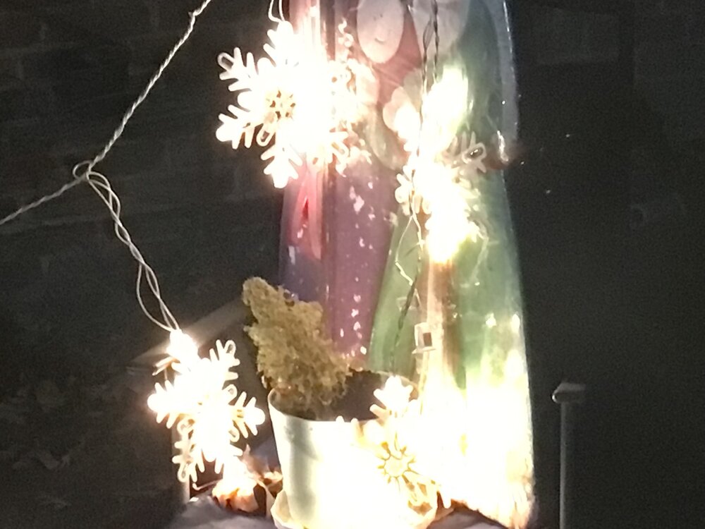
Thank you Julian. Late last night I walked out into the postage stamp, no jacket, just to feel the chill but not very cold Christmas Eve night. I was alone, as I’ve been for the last six years but then I felt I wasn’t. I listened to the unusual quiet of this inner city Sunday night. In the silence I found all I was looking for. The lights of a celebrating neighbor, my four very special snowflakes that regardless of the boundary layer …. never melt and finally looking up I saw through the overcast the light that has never left me. Happy Christmas and blessed New Year to you and all our forum members.
As always …
Rclab, sounds like you have found the Christmas sprit. Have a blessed Christmas!
 Merry Christmas to all !
-
2
-


.png.e56ef70694dc3ed5c13555f1ae1c89a3.png)


Interior NW & NE Burbs 2024
in New York City Metro
Posted
Definitely has my attention especially up this way. The flooding/power loss potential I hope doesn’t come to fruition. After the first system comes thru will see what the models show for the 2nd one. Who knows, we could get a good front end thump of snow with #2. That could help with some rain absorption with this weekends snow.