
Torchageddon
-
Posts
1,327 -
Joined
-
Last visited
Content Type
Profiles
Blogs
Forums
American Weather
Media Demo
Store
Gallery
Posts posted by Torchageddon
-
-
Just about every possible conceivable parameter to make today a rotten one was in place: very windy, rainy, dark, cold at 6C feeling like 3 after the near hot temps we had 5 days ago. Its a classic near the lakes getting this lake effect rain in Oct. 53 mm/2" since the start 4 days ago.
-
 1
1
-
 1
1
-
-
My low was 18C, that is insanity for Oct 5! Higher than my avg low in the middle of summer. Had a line of storms in the aft with some thunder, the rank trash has arrived

-
This last stretch of Sep has been magnificent, 8 days at least of great weather, one day where it was mainly cloudy but no rain. Looking back at my typically awful 7 day for accuracy, it did very well correctly predicting most of this week within a few degrees. Remarkably stable pattern my highs and lows (around 9C-10C every day) are the same in a transitional period with this climo. One of the best last 3rd of Sep ever.
-
 1
1
-
-
This has been an impressive streak of great wx for Sep standards, mainly sunny for 6-7 days straight and pleasant temps. Its now been a full year since the blocking patterns started giving long streaks of crap or fantastic conditions. We had a wretched 6 days of overcast I think in late Aug, now the inverse but I'm fortunate that the cloud shield of Ophelia remained east in Niagara/Toronto this weekend. I liked this Sep better than Aug.
-
2
-
1
-
-
It was torrid at 1030am when I went out, but then in the early aft it was actually nice (sun still out). There was a increase in winds I guess. Storms just 45 mins away to my SW.
-
I was still at 24C at 12:30 am with a humidex of 32! Did not expect these kind of numbers this late, probably one of the most humid Sep nights recorded. Driving after dark I saw a massive opossum on a rural road right in the center.
-
1
-
-
9am obs had 100% RH, 21C/20C. Hourlies have me at peak temp by 11am nearly 31C/ Humidex 41.
-
Amazing day, a relief after the drab last 3 or more weeks. I was out quite a bit and realized how I missed this gorgeous stuff - Comfy and sunny right from the start! When I woke up I felt so much better than usual and motivated. Not coincidentally, the last time I felt this peak was around the first week of July which *drumroll* was the last time we hit 30C/86F!!
 The correlation has no cracks.
TWN still has me at 30C/ Humidex 37 which is uncommonly higher than my station showing 29C. Ideal day to be out from dawn to dusk.
-
1
-
-
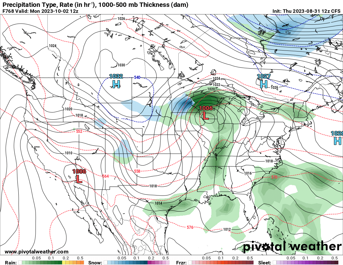
9 hours ago, mhou said:
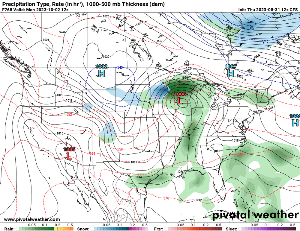
Just a little teaser from the lovely CFS model lol
I was getting worried for a sec until I saw the "F768" lol.
I'm sitting at 13C still and hourlies show 21C by 11am, being reduced a tad. Skies mellowed out by some smoke
-
 1
1
-
-
Very rare blue skies day, no clouds at all anywhere in SON. Maybe haven't had this since first half of July. Soaking it in.
-
1
-
1
-
-
I'm down to 6.8C/44F this morning, by far the coldest of the summer. Clear blue skies.
-
1
-
-
Today was the 4th day of overcast crap that I've been dreading to see make itself again. TWN forecast completely flopped showing partly cloudy, early this morning it was dark with thicc canopy. Got this blast of rain coming from the north at noon that also sucked. The last 4 days my forecast was completely wrong and its been awful. The sun came out at 5pm today so got something.
-
3
-
-
Michigan's no EF4+ streak is safe!
-
Got my 9th t-storm first thing this morning, 13mm of rain with even a little hail briefly. Good rumbles of thud on the first. Lowest light of 170 lux around 9am. More cells rolled through so now up to 24mm just for this morning. Thursday this year is the day of the week I'm getting all my storms, even before today I noticed
.
There is a potent cell heading for northern Waterloo currently that is svr warned for toonie sized hail. Looks like a strong hail core:

-
Had my first bad storm in years, it was borderline svr but not officially. What I noticed is the rare direction it was coming in from: NNW. My best LES bands also come from that vector. 580 lightning strikes in less than a hour, 90 during 5 min intervals at peak (9pm). There was actual structure as it approached with defined shelf features and inflow. The lightning was all cc but very bright and flicker-like. The ambiance was amazing as that fat cell came in, haven't felt excited for a storm in so long. I could hear pingers as I got large pea-sized hail for a min. Largest hail here so far this decade, I got larger Mar 2012. Wind was decent but nothing crazy. I got nearly an inch within mins. There were stronger hail cores not far from me just like Sep 7 2021. Best storm of 2023 beating Apr 5 overnight.
-
5
-
1
-
-
6 hours ago, bowtie` said:
To be fair, August and September are supposed to be the smokey months. That June smoke was the out-of-box stuff. Very understandable why everyone is sick of it already though.
The worst of the smoke here was in May. Didn't have any today.
-
I didn't get any storm (again) overnight but 15 strikes distantly. I overachieved on rain getting 27mm or 1 inch in the morning. I was suppose to clear up by 10am with a chance of shower til 5pm but its been overcast just til now. TWN hourlies were abysmal.
-
2 hours ago, A-L-E-K said:
Lol
I'm going to have to book a flight to Phoenix
-
1
-
-
1 hour ago, Powerball said:
Just thinking is it the caliber of storm where its the only news story covered at 5pm and they have people calling in with those slideshows of big trees toppled. Judging by that I'd say it was.
-
2
-
-
I knew when it was overcast for most of the aft and the temp was dropping hours before the storms arrived that my energy would be squandered. I surprisingly got some minor power flickers a hour ago but its basically just a gentle thunder shower
 . Very slow onset, no dark skies, dead calm. Yesterday's forecast output may not have been glue-sniffed after all. I'm not complaining.
-
3 hours ago, SolidIcewx said:
Latest HRRR model this morning.
If that verified it would be the most severe storm I'd have in years. I'm watching this setup closely, I'm clear aside from smoke all morning and its sultry unlike any summer day so far. I was laughing when my forecast for later today yesterday showed just "rain at times heavy" instead of chance of storms lmao. That algorithm is so damn bad it hurts, its obvious that was bs! The SPC had me under a Slight when that turd was presented.
-
1
-
-
Getting some loud cracks of thunder, a quick 4mm of rain. The cells didn't form to my east for once, they're forming a line though after passing. I haven't had a mid-day quickie with sun mins later, enjoy them!
-
1
-
-
On 7/20/2023 at 5:27 PM, Torchageddon said:
This is hilarious, there is a dry gap in this mega squall with record winds in far sw on and then in Georgian Bay area they typically get these large cells that are tornado warned like this afternoon...guess which of those 3 zones I'm in?
Every time, the cells form just to my east!
If I had a nickel for the number of times this has happened in 2023!


Twice within a few hours today!! Never fails, just ludicrous.
-
Last few days have been perfect, Friday was uncommonly windy for mid-summer with great clouds in the morning, yesterday was nearly clear all day with comfy temps.
Amazing stretch coming up, stormy and humid! A heatwave begins Weds and my low for Thurs shows 24C, a once in 2-3 year occurrence. A bunch of days where my low doesn't drop below 20C.
-
1
-
 1
1
-
October 2023 General Discussion
in Lakes/Ohio Valley
Posted
Neat fall day, the winds were coming from the NE so I got all these low clouds coming from Georgian Bay, extreme wind shear was visibly apparent.