
.png.5608f5bab30d37cac5ee5443be92fc2f.png)
HIPPYVALLEY
-
Posts
29,538 -
Joined
-
Last visited
Content Type
Profiles
Blogs
Forums
American Weather
Media Demo
Store
Gallery
Posts posted by HIPPYVALLEY
-
-
Freezing rain overnight, cars etc are coated.
-
 1
1
-
-
27 minutes ago, AstronomyEnjoyer said:
This will fill in some dry lake beds.

I doubt it will work out that way but if LA can pull off 12” of rain, that would be pretty historic.
-
50 minutes ago, Torch Tiger said:
it's wild!!
It's


I'm just gonna' step away for a bit and see ya'll when sanity is on the radar.
-
 2
2
-
-
Stuck at 21” for the foreseeable future here. Falling behind YTD average now.
-
56 minutes ago, RUNNAWAYICEBERG said:
At least we are dry for the next 10 days until the next Rainer comes.
.A rainer will only be fun if it’s brutally cold and dry after.
-
1
-
-
I will admit, the lack of sun has been kind of brutal. I think we have had one sunny day in the past 10.
-
2
-
-
3 hours ago, 40/70 Benchmark said:
Here are the final snowfall amounts from the storm that began on Sunday and ended early this morning.
Versus the Eastern Mass Weather Final Call:
The forecast across the elevated far interior was fairly accurate, however, the snowfall was significantly over forecast across the densely coastal plane of the eastern and souther portions of the region. More specifically, 1-3" fell where 2-5" was forecast along the immediate coast of eastern Mass. And 4-7" was forecast instead of the 2-5" that fell across interior Eastern Mass, throughout the route 128 and 495 belts. The gradient was also sharper than forecast across southern Connecticut, Rhode Island, the cape islands., where little to no snowfall accumulated rather than the 1-3" forecast. The primary reason for the forecasting failure is that the precipitation never grew heavy enough to overcome very marginal temperatures. This was an issue that was flagged on much of guidance prior to the event, as evidenced by fairly weak lift that was not colocated within the favored snow growth region in the mid levels of the atmosphere, which is between approximately 12 and -18C. As it turned out this bette lift did in fact materialize, but it further north across central New Hampshire, where several inches did fall last night.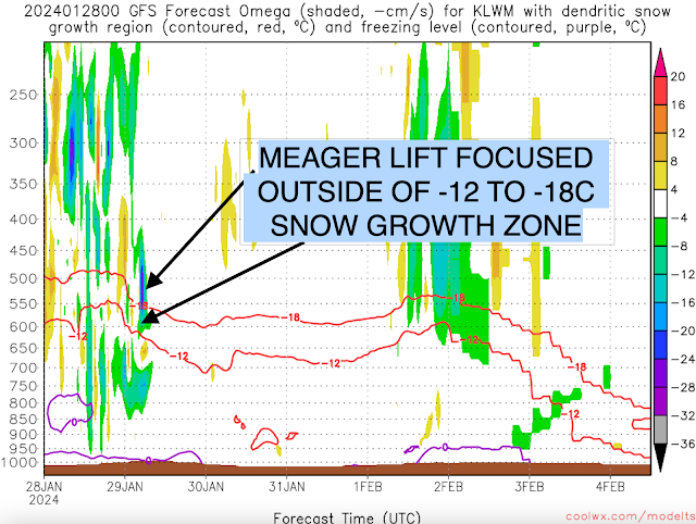
Final Grade: D
Outside of the elevations above 600' or so, those W MA totals are too high on the NWS BOX map. I drove all over the valley today and the I-91/CTRV corridor barely had more than an inch otg between Brattleboro and Springfield. Not at all giving you shit for busting because I liked your maps and I like your forecasts in general. I'm just saying that the NWS forecasts and the totals they are posting, for this storm, are a bit overdone for the lower elevations.
-
1
-
-
9 minutes ago, TauntonBlizzard2013 said:
Looks like a wintry weekend upcoming in NNE for my trip. Models have snow in the air Thursday and Friday
Not sure how much they picked up this past storm but we are heading up to N Conway the weekend after. It will definitely be wintery no matter what. Cutters with rains to Maine seem to be off the table for a bit.
-
2
-
-
Relative to normal, most ensembles, are pretty much a continent wide, semi-furnace thru mid month. It's going to take some needle threading to get measurable snow for SNE the next 2 weeks. It's what we've got going on, so may as well settle in to that vibe. Hopefully we get something to pop next week.
-
26 minutes ago, CoastalWx said:
I haven't felt this taxed and defeated in a long time. Just an all around shit feeling. Enjoy the snow...those that got it. I probably would take the day off and just walk around in the snow, should that day ever come this year.
I know. We had a fair January here but nothing special and now we are in the heart of winter with barely any snow on the ground.
Greenfield winter carnival is this weekend so I’m sure they will have to cancel most of the events. I will say this, every year it’s the first weekend in February and more than half of them have not worked out, so maybe time to move it further into the month.
-
2
-
-
Just now, STILL N OF PIKE said:
Stein February?
I’d prefer Stein April but yeah, looks boring.
-
11 minutes ago, Torch Tiger said:
Looks
 for a while
Mildish and dry.
-
2
-
-
6 minutes ago, CoastalWx said:
That might be the first time a storm with that track totally effed me over.
Same.
-
11 minutes ago, Torch Tiger said:
what happened to the days n days with this one? Remember snower right through Monday/Tues AM?
I think there was also some talk of an arctic blast this week that seems to have moderated.
-
1
-
 1
1
-
-
12 minutes ago, HoarfrostHubb said:
8.8” in New Ipswich, NH. 8.1 in Ashby
Elevation
Judging by the hilltops around here you needed at least 600’
-
1
-
-
1 minute ago, Damage In Tolland said:
Picked up 1” of sleet and snow overnight into this morning . Snowing lightly. Took like 45 minutes to clean off 4 cars. Caked and iced and wet snow
I’m a little shocked you didn’t do better with your elevation when S Worcester Co at lower elevations is reporting 2-3”
-
31 minutes ago, 40/70 Benchmark said:
2.5"
You must have caught better banding, the Valley was pretty much a shutout.
-
59 minutes ago, CoastalWx said:
Pretty much nothing here.
Ditto in Greenfield. .25” of icy slush.
-
 2
2
-
-
2 minutes ago, jbenedet said:
Kinda wild hearing the melting as the rates drop to light, and temps bump up a degree or two.
One of my least favorite winter sounds. Hearing snow turning to water.
-
The number of posts shows how well this is going for most of SNE.
-
2
-
2
-
-
2 minutes ago, codfishsnowman said:
Been back to some sort of mix...just continuing to waste precip. I mean when is the column going to finally cool enough?? Such a dumpster of an event. Gross.
This has looked rough for those under 800’ for days. Trash antecedent air mass.
-
1
-
-
13 minutes ago, HoarfrostHubb said:
3.5” new. Hubb-town

You’ll be MA jackpot. Maybe Savoy but I think your area got/gets the better qpf and lift.
-
-
Terrible here. Shredded radar and back to light rain. Heavy coating only so far.


It was a Flop... February 2024 Disco. Thread
in New England
Posted
I would leave the board until memorial day if that verified.