
David-LI
-
Posts
1,248 -
Joined
-
Last visited
Content Type
Profiles
Blogs
Forums
American Weather
Media Demo
Store
Gallery
Posts posted by David-LI
-
-
Our next best chance for a storm according to 12z euro seems to be around the 14th-15th.
-
 1
1
-
-
Just now, Snow88 said:
Storm chance next weekend on every model
We just have to hope the cold air stays because it's going to get cold after the cutter.
GFS and euro look completely different for next week. Definitely rain for Mon-Tue on both, followed by a possible storm for the weekend.
-
1 minute ago, SI Mailman said:
flakes here as well. 5th straight day of snow falling from the sky.
Wait a second, 5th straight day? Yesterday was sunny and clear. You saw snow yesterday?
-
Mood flakes here in Great Neck, north Nassau County
-
When was the last time we had a HECS? 2016?
-
1
-
-
54 minutes ago, uncle W said:
nothing beats the winter of 1960-61 especially the period from Jan. 15th to February 12th...
Go on....
-
1
-
-
7 minutes ago, bluewave said:
The NEPAC warm blob associated with these extreme -EPO blocks is running at very warm levels. There is also record low sea ice extent around Alaska. An experimental forecast for the NEPAC SST’s gets close to the 2015 warmth record. So that Arctic high that the Euro generates is very impressive for this time of year. It could be one of the stronger Arctic outbreaks for mid-December. Could also be SWFE potential as the Arctic high slides east.
Current +NPM warm blob

Experimental forecast with full forecast in the link
https://www.dropbox.com/s/xxuft0mmb3qzvzb/DiLorenzo-heatwave-prediction-2020.pdf?dl=0
What does this all mean for snow in the northeast?
-
24 minutes ago, SnoSki14 said:
Could be a massive arctic outbreak if trends continue followed by a possible SWFE.
Euro even has some -NAO ridging.
Euro looks interesting around the 13th
-
1
-
-
1 hour ago, Sanman 06 said:
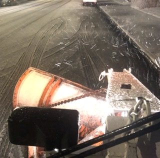
It’s been snowing at a good clip Here in Staten Island for the past hour and streets are finally getting snow covered !!
Good luck out there dude. Pulling an all nighter?
-
6 minutes ago, Ericjcrash said:
What's going to cause this "blossoming"?
The weenie gods
-
2
-
-
Back to drizzle here in North Nassau County. Oh well.
-
Snow/sleet/rain mix in north Nassau County
-
Just now, Stormlover74 said:
What are these totals in NYC? I'm colorblind
-
 1
1
-
-
Radar seems to be filling in and colder air slowly moving east. I'd bet by noon the city is all snow.
-
1
-
 1
1
-
-
What’s current low pressure ?
-
Dry slot over the city metro
-
-
Any word on the 18z euro?
-
Euro looks a bit stronger at hr 54 compared to last run.
-
1
-
-
Where do you see clown maps on tidbits? I can't find the link.
-
Not sure how reliable NAM 3k is but at hr 60 it looks like a 988 low under Long Island about to get real
-
Nam looks nice with that CCB. looks like a foot for NYC , not much for Long Island. Anyone got clown maps?
-
How’s surface temperature looking Monday afternoon on the NAM?
I’m wondering if snow will stick. I have to drive from Astoria to Suffolk County Monday at 4pm. Knowing it’s Monday after thanksgiving and snow might stick, I can see the hell I’ll go through.
-
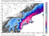
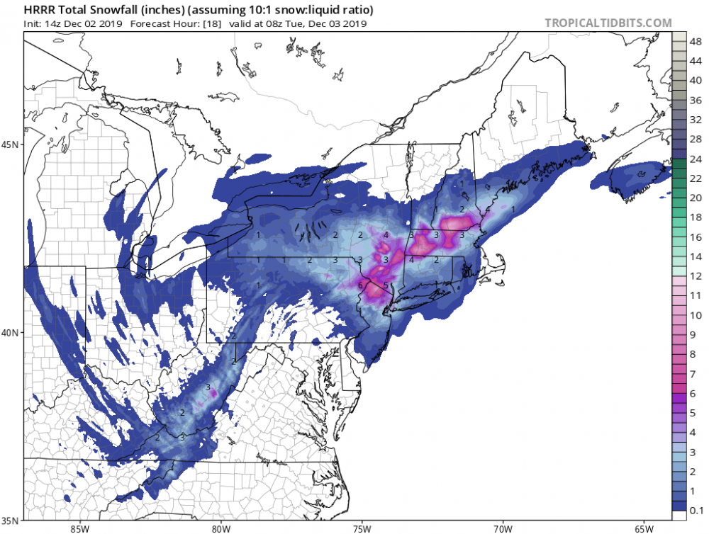
Light to Moderate snow from Monday afternoon well into Tuesday morning on the 12k NAM.

December 2019
in New York City Metro
Posted
Has there been winters where NYC metro got more snow than Albany for example, or Buffalo?