stormtracker
-
Posts
64,391 -
Joined
-
Last visited
Content Type
Profiles
Blogs
Forums
American Weather
Media Demo
Store
Gallery
Everything posted by stormtracker
-

The Jan 31 Potential: Stormtracker Failure or 'Tracker Trouncing
stormtracker replied to stormtracker's topic in Mid Atlantic
RGEM now is noticeable further west -
The Jan 31 Potential: Stormtracker Failure or 'Tracker Trouncing
stormtracker replied to stormtracker's topic in Mid Atlantic
God, I hope not -
The Jan 31 Potential: Stormtracker Failure or 'Tracker Trouncing
stormtracker replied to stormtracker's topic in Mid Atlantic
Yes, but nothing crazy -
The Jan 31 Potential: Stormtracker Failure or 'Tracker Trouncing
stormtracker replied to stormtracker's topic in Mid Atlantic
RGEM western lobe is a bit further west so far -
The Jan 31 Potential: Stormtracker Failure or 'Tracker Trouncing
stormtracker replied to stormtracker's topic in Mid Atlantic
Not even sure how you saw a bomb when it was clearly east of 18z. -
The Jan 31 Potential: Stormtracker Failure or 'Tracker Trouncing
stormtracker replied to stormtracker's topic in Mid Atlantic
Yeah, ICON is far worse than 18z -
The Jan 31 Potential: Stormtracker Failure or 'Tracker Trouncing
stormtracker replied to stormtracker's topic in Mid Atlantic
Yeah, not sure why we're analyzing a weather model here. Let's delve into the potential new flavors of Coca Cola. -
The Jan 31 Potential: Stormtracker Failure or 'Tracker Trouncing
stormtracker replied to stormtracker's topic in Mid Atlantic
Hey, I could be wrong. I hope I am. -
The Jan 31 Potential: Stormtracker Failure or 'Tracker Trouncing
stormtracker replied to stormtracker's topic in Mid Atlantic
Not super promising so far...may even be backsliding -
The Jan 31 Potential: Stormtracker Failure or 'Tracker Trouncing
stormtracker replied to stormtracker's topic in Mid Atlantic
Yeah, posted a while back. Maybe this is helping things. What if the GFS scored a coup. That'd be hilarious -
The Jan 31 Potential: Stormtracker Failure or 'Tracker Trouncing
stormtracker replied to stormtracker's topic in Mid Atlantic
Well. 1 for 5 so far -
The Jan 31 Potential: Stormtracker Failure or 'Tracker Trouncing
stormtracker replied to stormtracker's topic in Mid Atlantic
I believe the NAM would come close or do it. The differences are crazy -
The Jan 31 Potential: Stormtracker Failure or 'Tracker Trouncing
stormtracker replied to stormtracker's topic in Mid Atlantic
18z0z
-
The Jan 31 Potential: Stormtracker Failure or 'Tracker Trouncing
stormtracker replied to stormtracker's topic in Mid Atlantic
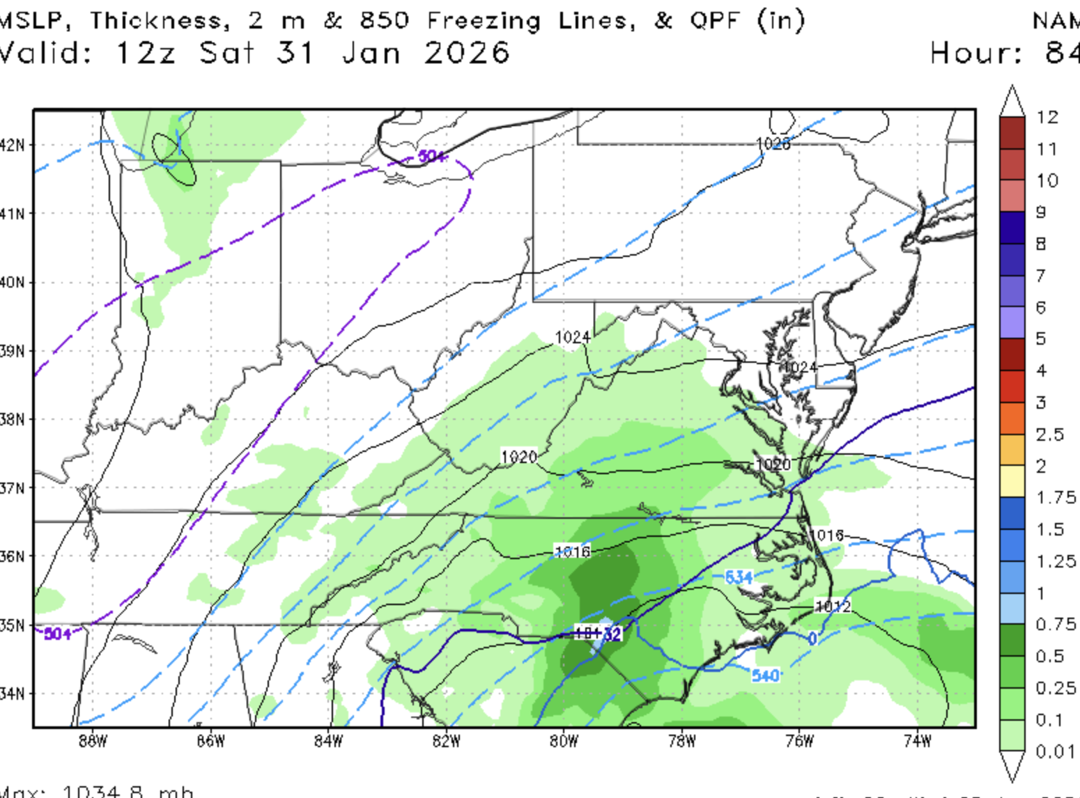
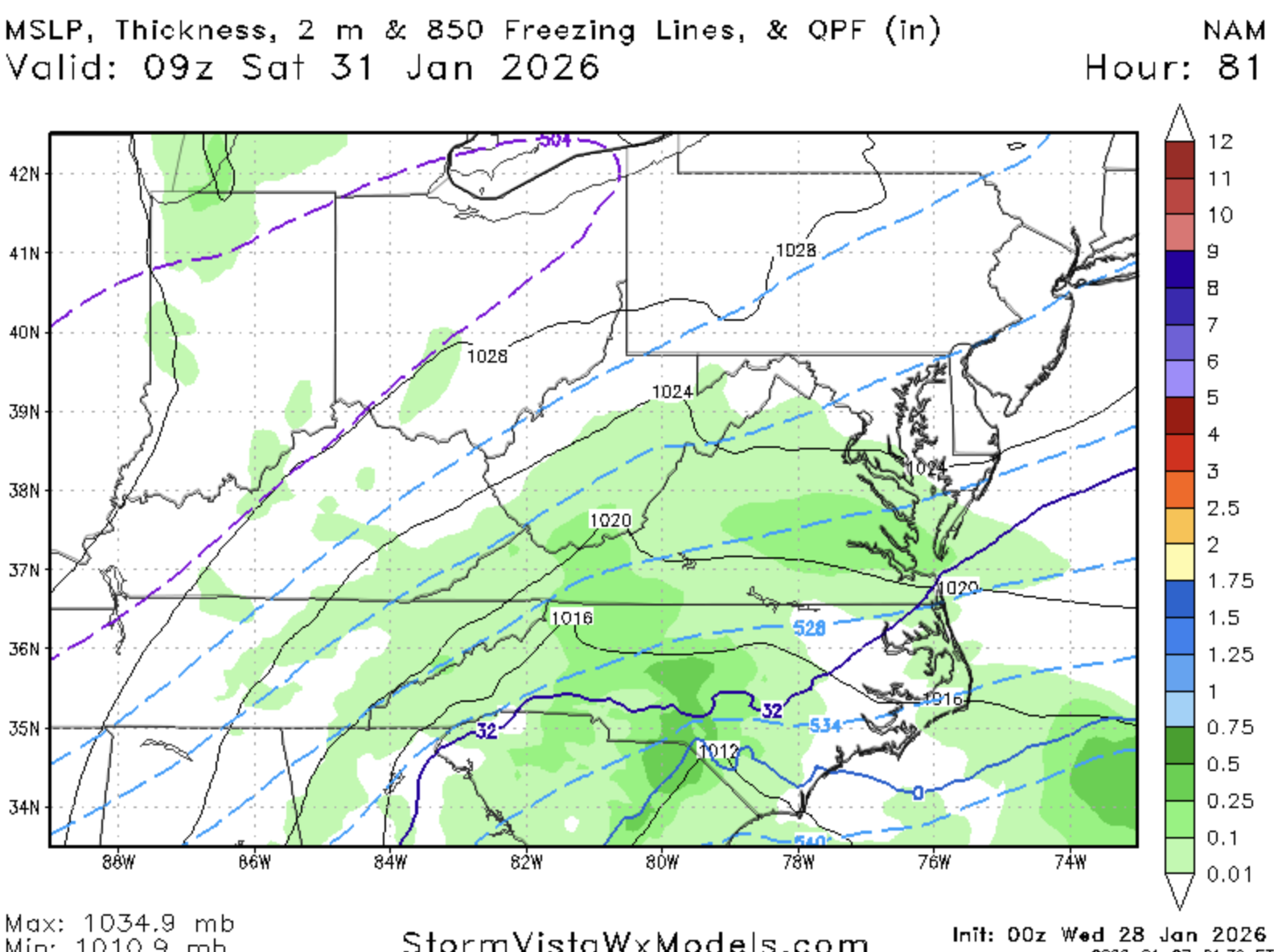
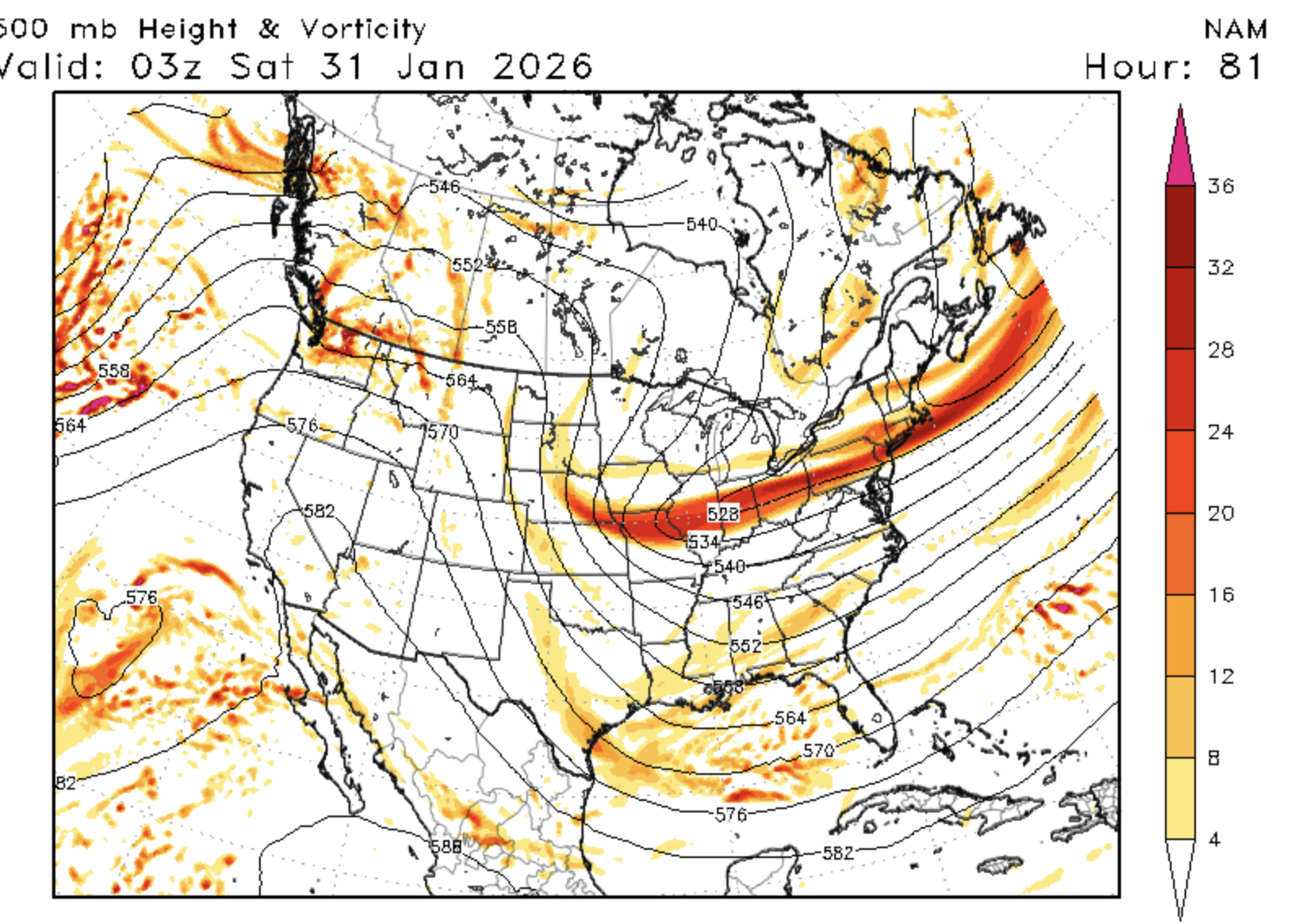
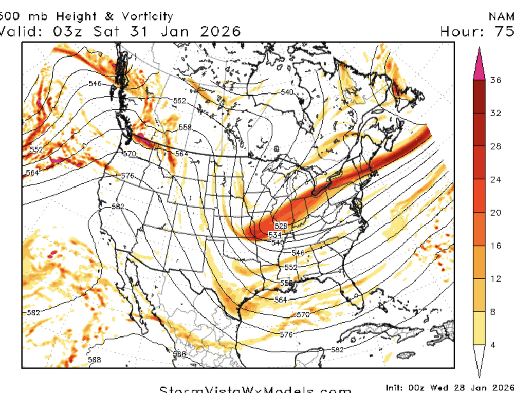
NAM is vastly better -
The Jan 31 Potential: Stormtracker Failure or 'Tracker Trouncing
stormtracker replied to stormtracker's topic in Mid Atlantic
Its a big step in the positive direction so far. Let's see if it translates -
The Jan 31 Potential: Stormtracker Failure or 'Tracker Trouncing
stormtracker replied to stormtracker's topic in Mid Atlantic
So there's no doubt NAM changed for the better. So far, seems like baby steps, but again...it's early -
The Jan 31 Potential: Stormtracker Failure or 'Tracker Trouncing
stormtracker replied to stormtracker's topic in Mid Atlantic
I couldn't tell anything at that hour. 42 lobe is def a bit west of 18z. But obv we aren't at the money panels yet. -
The Jan 31 Potential: Stormtracker Failure or 'Tracker Trouncing
stormtracker replied to stormtracker's topic in Mid Atlantic
Looks good, but tempering my excitement based on what @high risk said about it lagging behind -
The Jan 31 Potential: Stormtracker Failure or 'Tracker Trouncing
stormtracker replied to stormtracker's topic in Mid Atlantic
We gonna eat good. I'm for sure getting the most expensive things on the menu. Surf and Turf, twin lobster tails and a bone-in Ribeye. Old Fashione(S) to dringk. This man got money yall. -
The Jan 31 Potential: Stormtracker Failure or 'Tracker Trouncing
stormtracker replied to stormtracker's topic in Mid Atlantic
Man, you really don't like being here. -
The Jan 31 Potential: Stormtracker Failure or 'Tracker Trouncing
stormtracker replied to stormtracker's topic in Mid Atlantic
What the hell is this wxnext model?? -
It is what it is.
-
Blame me if it fails. Give me glory if it succeeds. I'll take all the smoke.