

stormtracker
-
Posts
64,391 -
Joined
-
Last visited
Content Type
Profiles
Blogs
Forums
American Weather
Media Demo
Store
Gallery
Everything posted by stormtracker
-

The Weekend Rule? Saturday 2/17 - The Icon Storm
stormtracker replied to DDweatherman's topic in Mid Atlantic
Wait, you found some? So hard to find here -
Late Feb/March Medium/Long Range Discussion
stormtracker replied to WinterWxLuvr's topic in Mid Atlantic
SV sucks so bad. It’s counting sleet as snow. -
Late Feb/March Medium/Long Range Discussion
stormtracker replied to WinterWxLuvr's topic in Mid Atlantic
lol. Sleet fest i was asking for the clown maps so i could see that hilarious gradient -
Late Feb/March Medium/Long Range Discussion
stormtracker replied to WinterWxLuvr's topic in Mid Atlantic
Nobody got the pretty clown maps? -
Late Feb/March Medium/Long Range Discussion
stormtracker replied to WinterWxLuvr's topic in Mid Atlantic
Nah. I’m not vesting into this one until other models start showing it. Euro can be drunk sometimes -
Late Feb/March Medium/Long Range Discussion
stormtracker replied to WinterWxLuvr's topic in Mid Atlantic
Euro has been pretty insistent with this one -
Late Feb/March Medium/Long Range Discussion
stormtracker replied to WinterWxLuvr's topic in Mid Atlantic
The gradient is ridiculous. I’d get 12 -18 and zwyts gets like 4. I mean it’s not gonna play out like that but it’s funny. Probably worse on the clown maps. Would love to see them -
Late Feb/March Medium/Long Range Discussion
stormtracker replied to WinterWxLuvr's topic in Mid Atlantic
Look at that gradient. Lol.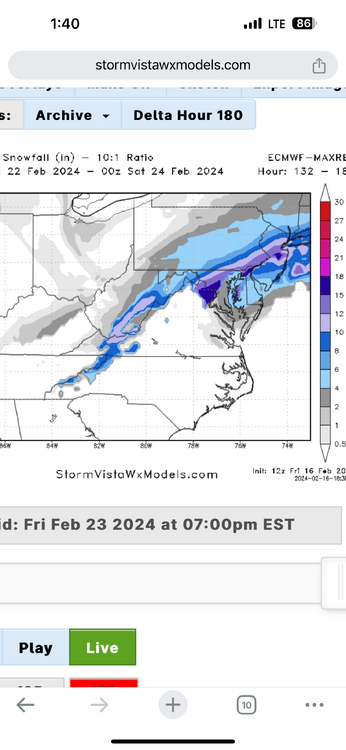
-
Late Feb/March Medium/Long Range Discussion
stormtracker replied to WinterWxLuvr's topic in Mid Atlantic
850s collapse and dumps a huge amount of qpf on us. Problem is the surface. -
The Weekend Rule? Saturday 2/17 - The Icon Storm
stormtracker replied to DDweatherman's topic in Mid Atlantic
In all seriousness. That’s probably how i would have gone. I’m gonna waste some qpf and heaviest precip to my north. They must have used the GFS for toilet paper. -
The Weekend Rule? Saturday 2/17 - The Icon Storm
stormtracker replied to DDweatherman's topic in Mid Atlantic
Lwx hates me actually that’s a pretty good map if i were forecasting. -
The Weekend Rule? Saturday 2/17 - The Icon Storm
stormtracker replied to DDweatherman's topic in Mid Atlantic
Agreed -
The Weekend Rule? Saturday 2/17 - The Icon Storm
stormtracker replied to DDweatherman's topic in Mid Atlantic
Hey. Mt Cleveland Park is 300+ -
The Weekend Rule? Saturday 2/17 - The Icon Storm
stormtracker replied to DDweatherman's topic in Mid Atlantic
If I could find another 120.... -
The Weekend Rule? Saturday 2/17 - The Icon Storm
stormtracker replied to DDweatherman's topic in Mid Atlantic
The perils of being an urban dweller -
The Weekend Rule? Saturday 2/17 - The Icon Storm
stormtracker replied to DDweatherman's topic in Mid Atlantic
It's in the back of my mind...but I can't say I'm alarmed -
The Weekend Rule? Saturday 2/17 - The Icon Storm
stormtracker replied to DDweatherman's topic in Mid Atlantic
All things considered...average out all these models...I'm fine with going 3 for us -
The Weekend Rule? Saturday 2/17 - The Icon Storm
stormtracker replied to DDweatherman's topic in Mid Atlantic
SV maps, Thanks for your shitty service -
The Weekend Rule? Saturday 2/17 - The Icon Storm
stormtracker replied to DDweatherman's topic in Mid Atlantic
Nah, it's Hartford County S and E. I mean up in Mappy and PSU land the previous maps were still 2 to 4...but for us and the immediate burbs up to Bmore it got drier -
The Weekend Rule? Saturday 2/17 - The Icon Storm
stormtracker replied to DDweatherman's topic in Mid Atlantic
So yeah, a bit drier...last run some spots were 4-6 -
The Weekend Rule? Saturday 2/17 - The Icon Storm
stormtracker replied to DDweatherman's topic in Mid Atlantic
From Charles County MD North, widespread 2-4 -
The Weekend Rule? Saturday 2/17 - The Icon Storm
stormtracker replied to DDweatherman's topic in Mid Atlantic
21, it's in on us...heaviest trimmed off at the south...gonna be a tiny bit drier for East and SOuth of Hartford County -
The Weekend Rule? Saturday 2/17 - The Icon Storm
stormtracker replied to DDweatherman's topic in Mid Atlantic
Pretty much the same so far through 12hr -
The Weekend Rule? Saturday 2/17 - The Icon Storm
stormtracker replied to DDweatherman's topic in Mid Atlantic
Euro time! -
The Weekend Rule? Saturday 2/17 - The Icon Storm
stormtracker replied to DDweatherman's topic in Mid Atlantic
Kuchera is more realistic. I'll take it.


