

Iceagewhereartthou
-
Posts
1,906 -
Joined
-
Last visited
Content Type
Profiles
Blogs
Forums
American Weather
Media Demo
Store
Gallery
Posts posted by Iceagewhereartthou
-
-
Meh, not impressed for my area. Not enough precip and not enough cold. Hard to snow with those ingredients. Burrel's posts give me some hope but I feel this is one of those "coastal low resulting in moisture skip for the upstate with it being to warm with initial light precip" events. If we are able to get anything it'll be a novelty with northern and eastern NC getting the goods. This past decade Greenville NC has done way better than Greenvile SC.
-
 1
1
-
-
1 hour ago, buckeyefan1 said:
I don’t believe I’m saying this........If the upstate could just get some moisture


-
50 minutes ago, ILMRoss said:
The reason for the change is an eastward trend in the shortwave that drops in to help create lift. Compare:

The 24 hour change in the gfs shows a 500 mile shift East. Because of this, the shortwave has a more positive tilt and produces less moisture transport. Still a very potent setup and I don’t think it would take too many tweaks to show snow again, but this is a setback.
Good post. And am I correct in saying that this eastward jump (and resultant change in the angle of the trough) is also responsible for some warming of the western areas?
-
16 minutes ago, burrel2 said:
Every sounding ive looked at is saturated up to 250mb Thursday morning. Growing dendrites shouldn’t be a problem.
I haven't looked at maps much yet, what is the timeframe looking like? As much as I like to see snow fall in the day we really do better with night snowfall.
-
4 minutes ago, mackerel_sky said:
2 words: NW trend!
Nice to see the GFS pick up on the Euros rain event!
This is still fantasy land at this point, but as always, especially south of the boarder, borderline cold looks to be a huge issue here. Gotta get the cold in to have any shot.
-
3 hours ago, burrel2 said:
The biggest snow I've ever seen in my backyard is 5.75 inches, 2nd biggest is 4 inches. That's over a 30 year period. Please feel free to name another city in the Southeast outside of Florida who hasn't gotten a bigger storm than that over the past 30 years.
Big difference just between you and me in Easley. I don't do as well as many, but got 5.5 in 2016 and 8 from 2011. Still have a lot more mixing than TR, Greer, etc. Grew up in Dacusville and that was generally a good spot. 16 from 88, at least 12 from 87, around 10 from 93, 6 from 96. My parents there got 9 in 2016. Amazing how much 10 or 20 miles makes. I was in Taylor's for March 93 but never got more than 4.5 due to ground temps being stuck at 34. Western upstate completely missed on others like Jan 2000 and Feb 04.
-
31 minutes ago, mackerel_sky said:
Burrell already jackpotted, he deserves rain!
Aw, come on now. Actually that would be sleet for MBY. Verbatim, the run we saw of the Euro has Feb 15 or Dec 18 written all over it; all slept and zr here, snow bury for NC.
-
40 minutes ago, WarmNose said:
@mackerel_sky this one is toast. Time to roll out the Zoysia


Notice the rain in Oconee and Pickens.

-
 1
1
-
 3
3
-
-
Already 9.97 in for the month and 19.63 for the year.
-
40 minutes ago, Icy Hot said:
Just browsing this forum but wow! When is the last time South Carolina had anything like this verify?
Probably Feb 73 would be the closest. Personally I would pass, it brings basically nothing for me. Need an I85 special. I think these Euro clown maps are just as useless as the GFS ones, so this is entertainment only anyway.
-
4 hours ago, palmettoweather said:

Something under 240 for a lot of the board on the GFS. There have been several runs hinting at something in this timeframe. Interested to see what ECMWF thinks.


-
1
-
-
With the sun this afternoon temps have soared into the low 70s. Crazy weather continues!
-
48 minutes ago, magpiemaniac said:
My winter 2020-2021 outlook: bitter cold, below-average temperatures and bone dry from Thanksgiving to St. Patrick’s Day. In other words, the exact opposite of 2019-2020.
Sign me up!
-
10 hours ago, NEGa said:
Me too lol. I would rather have any amount of rain over another drought.
I'll pass, bring on the dry and dusty please!
-
1
-
-
Well officially over an inch today with, no telling how much, more coming over the next couple of days. After my flooding last week I'm completely dreading this.
-
3 hours ago, magpiemaniac said:
Venn diagram of winter 2019-2020...

That's awesome. Just need to make the cold circle very tiny!
-
Wow, check out the radar guys. This is the feed we needed Sat morning when we had the cold. Epic!
-
Hmmm, GSP has the forecast low for Pickens County airport as 35 tonight, but its already down to 31 with "mist and fog" reported. I'm down to 32 and there are still wet roads in the neighborhood. Gotta think black ice could be a significant issue in the morning, especially for some back roads in parts of Oconee and Pickens, and much of NGA, WNC. No advisories?
-
Sun has finally come out over the past hour. While I hate to see it melt the few remaining specks of snow, I really need it to dry out stuff just a little before the next monsoon. Was in the mid 30s all day, now already up to 41.
-
Here is the seasonal snowfall map through yesterday/today, from NOAA. If accurate, there has been more snowfall than I expected, especially in the Northeast and Great lakes region. I didn't think they had done nearly that well this year. In any case, it looks pretty accurate for the SE region.

BTW Poor CAE! (Especially 17/18 and 15/16)


-
1
-
 1
1
-
-
Got somewhere b/w 2 and 2.5 here. Had some melting this afternoon but still probably about 1.5 left. High today was just 34. Never had any road problems, I think most fell with temps just above 32. Timing of clouds this morning made all the difference.
-
Awesome, glad you had a fun day. I got to play and sled with my kids; can't put a price on that!
-
1
-
1
-
-
28 minutes ago, buckeyefan1 said:
I’ve had enough of the whining and trolling

How much did you see today Buckeye?
-
Forget the rain. I WANT MORE SNOW! GIVE ME THE BIG DOG AND THEN I'LL BE SATISFIED!
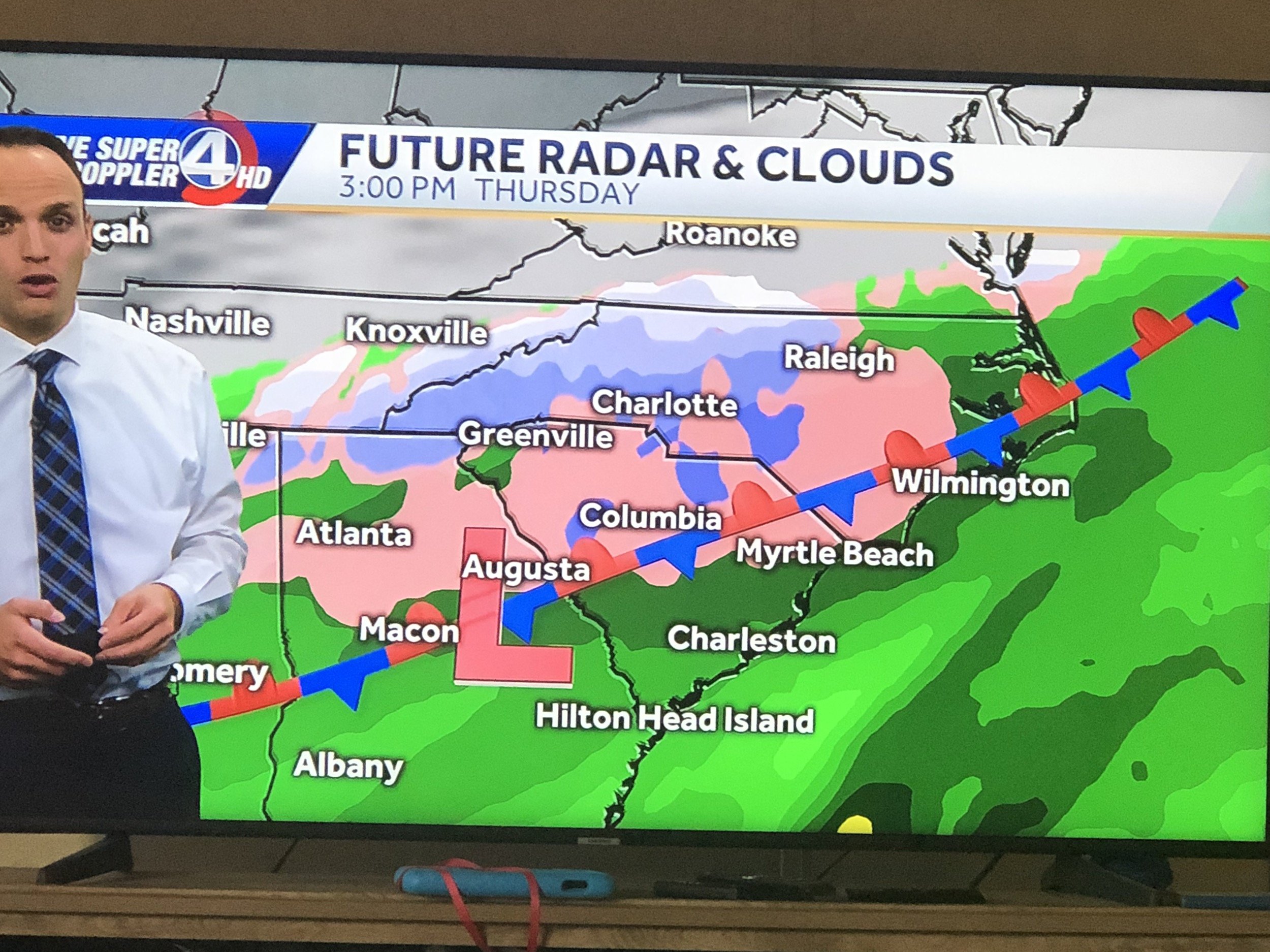

One More Shot: Feb 20-21 Event
in Southeastern States
Posted
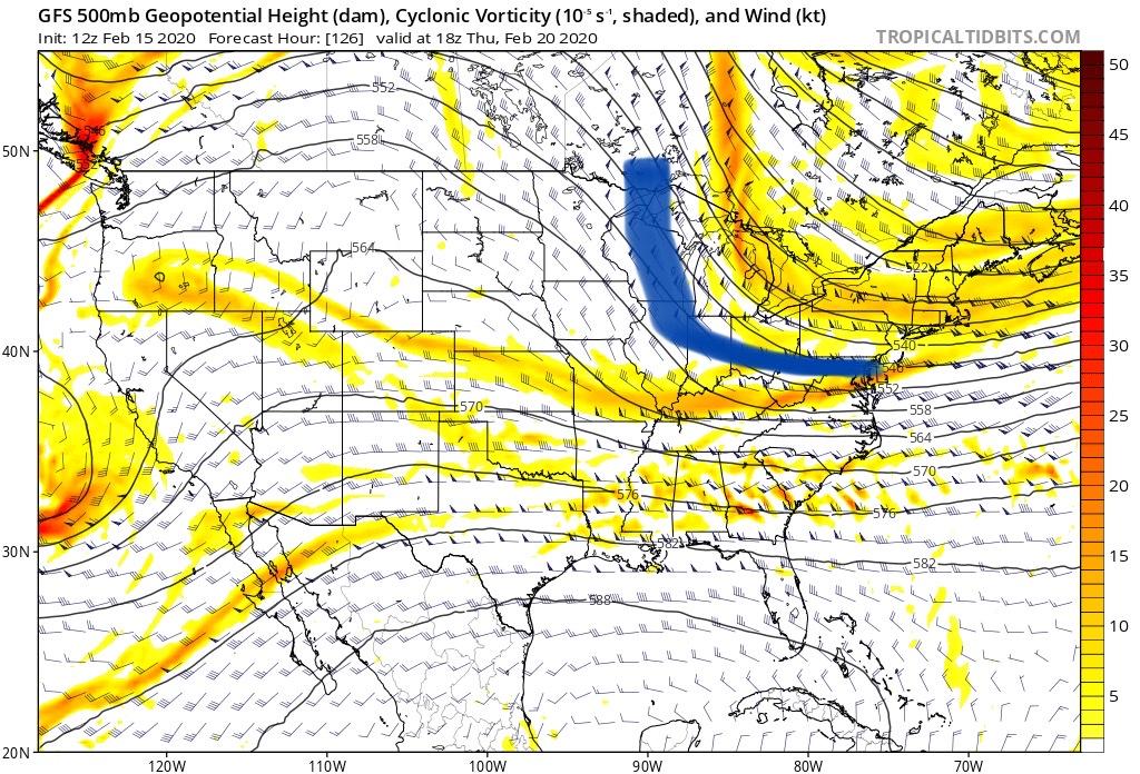
In past years the NAM had a tendency to underestimate the warm nose resulting in much of it's snow being sleet, especially on the SW fringes. Dec 18 is a perfect example. It has done very well this year and with it pulling the frozen precipitation line north that is not a good sign for areas south. Certainly could come back south over the next 48 hours though. Profile readings not matching it's precip output though. Profile suggests snow much further South, but output removes virtually all snow from SC.